
Putgarten
| coat of arms | Germany map | |
|---|---|---|

|
Coordinates: 54 ° 40 ′ N , 13 ° 25 ′ E |
|
| Basic data | ||
| State : | Mecklenburg-Western Pomerania | |
| County : | Western Pomerania-Ruegen | |
| Office : | North Ruegen | |
| Height : | 21 m above sea level NHN | |
| Area : | 12.62 km 2 | |
| Residents: | 180 (Dec. 31, 2019) | |
| Population density : | 14 inhabitants per km 2 | |
| Postal code : | 18556 | |
| Area code : | 038391 | |
| License plate : | VR, GMN, NVP, RDG, RÜG | |
| Community key : | 13 0 73 071 | |
| Office administration address: | Ernst-Thälmann- Strasse 37 18551 Sagard |
|
| Mayoress : | Iris Möbius ( CDU ) | |
| Location of the municipality Putgarten in the district of Vorpommern-Rügen | ||
  |
||

Putgarten is a municipality in the district of Vorpommern-Rügen on the island of Rügen on the Wittow peninsula in Mecklenburg-Western Pomerania ( Germany ).
The municipality is administered by the North Rügen Office with its seat in the municipality of Sagard . Putgarten is the northernmost municipality in Mecklenburg-Western Pomerania.
Geography and traffic
.JPG)
Putgarten is located in the northeastern part of the Wittow peninsula on the island of Rügen between the Tromper Wiek in the east and the open Baltic Sea in the north. Except for the coastal forests in the north and east, the slightly hilly municipal area is almost free of forests and is largely used for agriculture. The highest heights are at Cape Arkona and reach a little over 40 meters above sea level . From there the cliff coast drops steeply to the Baltic Sea.
At Vitt there is an erosion channel, geologically called Liete , which was cut into the cliff by a small stream. The village of Vitt, which is a listed building as a whole, was built into this. Only the chapel is located above the Liete.
The sights are an attraction for a large number of tourists who arrive daily, especially by bus and car. Putgarten and the visiting destinations are therefore closed to private car and bus traffic, with the exception of residents. There is therefore a large parking lot on the southern edge of Putgarten, from which visitors can hike or cycle to the Arkona area. There is the possibility to get to the village Putgarten, Vitt or Cape Arkona by shuttle service.
Districts
The districts belong to the municipality:
- Arkona
- Fernlüttkevitz
- Goor
- Nobbin
- Putgarten
- Vitt
- Varnkevitz
- Wollin
history
- Putgarten
Putgarten was a Ranen settlement from the 6th to the 12th century . The name Putgarten means under the castle . This refers to the Jaromarsburg . Putgarten belonged to the Svantovite sanctuary there until it was destroyed.
The place was part of the Principality of Rügen until 1326 and then the Duchy of Pomerania . With the Peace of Westphalia of 1648, Rügen and thus also the Putgarten area became part of Swedish Pomerania . In 1815 Putgarten came to the Prussian province of Pomerania as part of New Western Pomerania .
Since 1818 Putgarten belonged to the district of Rügen . Only in the years from 1952 to 1955 was it part of the Bergen district. The community then belonged to the Rügen district in the Rostock district until 1990 and became part of the state of Mecklenburg-Western Pomerania in the same year. The district of Rügen, which has been called this again since 1990, was merged in 2011 in the district of Vorpommern-Rügen.

The former NVA facility west of Putgarten in the district of Varnkevitz is now a Bundeswehr RRP 117 radar station . In addition, a Neolithic cattle burial was found in Varnkevitz .
- Nobbin
- Arkona
- Vitt
Coat of arms, flag, official seal
The municipality has no officially approved national emblem, neither a coat of arms nor a flag . The official seal is the small state seal with the coat of arms of the region of Western Pomerania . It shows an upright griffin with a raised tail and the inscription "GEMEINDE PUTGARTEN * LANDKREIS VORPOMMERN-RÜGEN".
Attractions
- Fishing village Vitt and Vitter chapel above the village
- Cape Arkona with the two lighthouses , the bearing tower and the Jaromarsburg
- Gut Putgarten - "Rügenhof Arkona"
- The nature reserve Nordufer Wittow with Hohen Dielen
- The foundling Siebenschneiderstein
photos

Putgarten - town center

Putgarten - manor house

Stallspeicher Gut Putgarten - now a craft market
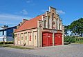
Fire station in Putgarten

Helene-Weigel-Haus, temporary residence of Bertolt Brecht


Web links
- Literature about Putgarten in the state bibliography MV
- http://www.amt-nord-ruegen.de/gemeinden/putgarten/
Individual evidence
- ↑ Statistisches Amt MV - population status of the districts, offices and municipalities 2019 (XLS file) (official population figures in the update of the 2011 census) ( help ).
- ↑ Main statute § 2 (PDF).
- ↑ Main Statute, Section 1, Paragraph 1 (PDF).

Ahrenshagen-Daskow | Ahrenshoop | Altefähr | Altenkirchen | Altenpleen | Baabe | Bad Sülze | Barth | Mountains on Rügen | Binz | Born a. Darß | Breege | Buschvitz | Dettmannsdorf | Deyelsdorf | Dierhagen | Divitz-Spoldershagen | Dranske | Drechow | Dreschvitz | Eixen | Elmenhorst | Franzburg | Fuhlendorf | Garz / Rügen | Went | Glewitz | Glowe | Goehren | Grammendorf | Gransgebieth | Gremersdorf-Buchholz | Grim | Groß Kordshagen | Gross Mohrdorf | Gustow | Hugoldsdorf | Hiddensee Island | Jakobsdorf | Karnin | Kenz-Küstrow | Klausdorf | Kluis | Kramerhof | Lancken-Granitz | Lietzow | Lime wood | Löbnitz | Lohme | Lüdershagen | Lüssow | Marlow | Millienhagen-Oebelitz | Mönchgut | Neuenkirchen | Niepars | Pantelitz | Papenhagen | Parchtitz | Patzig | Poseritz | Preetz | Prerow | Prohn | Pruchten | Putbus | Putgarten | Ralswiek | Rambin | Rappin | Ribnitz-Damgarten | Richtenberg | Hall | Sagard | Velvet | Sassnitz | Schaprode | Schlemmin | Sehlen | Sellin | Semlow | Splietsdorf | Steinhagen | Stralsund | Süderholz | Sundhagen | Trent | Tribsees | Trinwillershagen | Ummanz | Velgast | Weitenhagen | Wendisch Baggendorf | Wendorf | Wieck a. Darß | Wiek | Wittenhagen | Wustrow | Zarrendorf | Zingst | Zirkow