
Elmenhorst (Western Pomerania)
| coat of arms | Germany map | |
|---|---|---|

|
Coordinates: 54 ° 13 ' N , 13 ° 4' E |
|
| Basic data | ||
| State : | Mecklenburg-Western Pomerania | |
| County : | Western Pomerania-Ruegen | |
| Office : | Miltzow | |
| Height : | 10 m above sea level NHN | |
| Area : | 22.48 km 2 | |
| Residents: | 689 (Dec. 31, 2019) | |
| Population density : | 31 inhabitants per km 2 | |
| Postal code : | 18510 | |
| Area code : | 038327 | |
| License plate : | VR, GMN, NVP, RDG, RÜG | |
| Community key : | 13 0 73 023 | |
| Office administration address: | Bahnhofsallee 8a 18519 Miltzow |
|
| Website : | ||
| Mayor : | Rudi Wendorf ( CDU ) | |
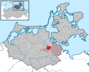
| Location of the municipality Elmenhorst in the district of Vorpommern-Rügen | ||
  |
||

Elmenhorst is a municipality south of Stralsund in the Vorpommern-Rügen district . It is administered by the Miltzow Office based in the Miltzow district of Sundhagen . The community belonged to the Kronskamp office until January 1, 2004 .
geography
Geographical location
Elmenhorst is about ten kilometers south of the city of Stralsund and about 15 kilometers north of Grimmen . Larger parts of the municipality are forested, for example in the northwest of the Krummhagen forest . The southern border of the municipality is the Barthegraben .
Community structure
- Districts
- Bookhagen
- Elmenhorst
- Living spaces
- Neu-Elmenhorst
- Groß-Elmenhorst
history
Bookhagen had 18 residents on December 31, 2015.
Elmenhorst was first mentioned in a document in 1273. Elmenhorst could mean something like higher-lying terrain made up of elms .
Until the Reformation (1534), the village was owned by the Neuenkamp monastery , then owned by the Duke of Pomerania. From the Thirty Years War until 1815 Elmenhorst was Swedish , after which it became Prussian . The municipalities of Groß-Elmenhorst , Elmenhorst Dorf and Neu Elmenhorst and the Bookhagen manor district were merged to form the municipality of Elmenhorst in 1921.
The community was part of the Grimmen district until 1952 and then belonged to the Grimmen district in the Rostock district until 1994 (until 1990).
The place has had a railway connection since 1900 and an electricity connection since 1922. In the 1960s, the VEB Erdöl-Erdgas Grimmen was drilling for crude oil and natural gas in the municipality .
Elmenhorst had 711 inhabitants on December 31, 2015.
Coat of arms, flag, official seal
The municipality has no officially approved national emblem, neither a coat of arms nor a flag . The official seal is the small state seal with the coat of arms of the region of Western Pomerania . It shows an upright griffin with a raised tail and the inscription "GEMEINDE ELMENHORST - LANDKREIS VORPOMMERN-RÜGEN".
Attractions
- Gothic church Elmenhorst from the 13th century
- Home parlor
- Elmenhorst horse show
- Old school
- Marketplace
- railway station
- Brick houses

Church from the northeast

Church from the southeast

Memorial to those who died in World War II
.JPG)
.JPG)
.JPG)
Economy and Infrastructure
traffic
Federal highway 194 runs west of the municipality and federal highway 96 to the east . The Stralsund– Berlin line ( Berliner Nordbahn ) runs through the municipality and has a train station in Elmenhorst.
Web links
Individual evidence
- ↑ Statistisches Amt MV - population status of the districts, offices and municipalities 2019 (XLS file) (official population figures in the update of the 2011 census) ( help ).
- ↑ a b https://www.amt-miltzow.de/seite/280029/statistik.html
- ↑ Dorfchronik Elmenhorst ( Memento of the original dated February 7, 2017 in the Internet Archive ) Info: The archive link was inserted automatically and has not yet been checked. Please check the original and archive link according to the instructions and then remove this notice.
- ↑ Main Statute, Section 1, Paragraph 4 (PDF).

Ahrenshagen-Daskow | Ahrenshoop | Altefähr | Altenkirchen | Altenpleen | Baabe | Bad Sülze | Barth | Mountains on Rügen | Binz | Born a. Darß | Breege | Buschvitz | Dettmannsdorf | Deyelsdorf | Dierhagen | Divitz-Spoldershagen | Dranske | Drechow | Dreschvitz | Eixen | Elmenhorst | Franzburg | Fuhlendorf | Garz / Rügen | Went | Glewitz | Glowe | Goehren | Grammendorf | Gransgebieth | Gremersdorf-Buchholz | Grim | Groß Kordshagen | Gross Mohrdorf | Gustow | Hugoldsdorf | Hiddensee Island | Jakobsdorf | Karnin | Kenz-Küstrow | Klausdorf | Kluis | Kramerhof | Lancken-Granitz | Lietzow | Lime wood | Löbnitz | Lohme | Lüdershagen | Lüssow | Marlow | Millienhagen-Oebelitz | Mönchgut | Neuenkirchen | Niepars | Pantelitz | Papenhagen | Parchtitz | Patzig | Poseritz | Preetz | Prerow | Prohn | Pruchten | Putbus | Putgarten | Ralswiek | Rambin | Rappin | Ribnitz-Damgarten | Richtenberg | Hall | Sagard | Velvet | Sassnitz | Schaprode | Schlemmin | Sehlen | Sellin | Semlow | Splietsdorf | Steinhagen | Stralsund | Süderholz | Sundhagen | Trent | Tribsees | Trinwillershagen | Ummanz | Velgast | Weitenhagen | Wendisch Baggendorf | Wendorf | Wieck a. Darß | Wiek | Wittenhagen | Wustrow | Zarrendorf | Zingst | Zirkow