
Gross Mohrdorf
| coat of arms | Germany map | |
|---|---|---|

|
Coordinates: 54 ° 23 ' N , 12 ° 57' E |
|
| Basic data | ||
| State : | Mecklenburg-Western Pomerania | |
| County : | Western Pomerania-Ruegen | |
| Office : | Altenpleen | |
| Height : | 14 m above sea level NHN | |
| Area : | 41.76 km 2 | |
| Residents: | 745 (Dec. 31, 2019) | |
| Population density : | 18 inhabitants per km 2 | |
| Postal code : | 18445 | |
| Area code : | 038323 | |
| License plate : | VR, GMN, NVP, RDG, RÜG | |
| Community key : | 13 0 73 037 | |
| Office administration address: | Parkstrasse 2 18445 Altenpleen |
|
| Website : | ||
| Mayor : | Bernd Kopmann | |
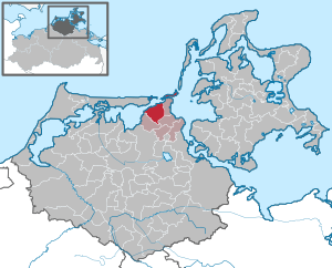
| Location of the community Groß Mohrdorf in the district of Vorpommern-Rügen | ||
  |
||

Groß Mohrdorf is a municipality northwest of Stralsund in the German district of Vorpommern-Rügen . The municipality is administered by the Altenpleen office based in the Altenpleen municipality.
Geography and traffic
Groß Mohrdorf is located in the northernmost corner of the mainland of Mecklenburg-Western Pomerania and is about 15 km northwest of Stralsund and about 20 km east of Barth . The community has an area of 4156 ha. The community area includes the island of Bock , the island group of Kleine Werder and the peninsula of Großer Werder . The district of Nisdorf is located on Grabow , part of the Barther Bodden . The northeastern part of the municipality is located in the Vorpommersche Boddenlandschaft National Park . The highest point in the municipality is over 22 m above sea level. NHN . Larger forest areas of the otherwise agriculturally dominated municipality are located near Kinnbackenhagen and on the island of Bock.
State road 213 Buschenhagen - Stralsund leads through Groß Mohrdorf. The neighboring towns are Günz (4 km west) and Hohendorf (2 km east). The distance to the nearest junction, Grimmen-West, on federal motorway 20 is around 43 kilometers. The next rail connection is in Stralsund with connections to Berlin , Rostock and Saßnitz .
West of Groß Mohrdorf there is a disused airfield. A radio beacon from this former airfield has been converted into the DGPS reference station in Groß Mohrdorf .
Districts
|
|
history
The first unsecured mention of Groß Mohrdorf was in 1278 as Merdherpe in the Stralsund city register. From 1314 other old place names such as Murdorp or Mordorp are mentioned. Construction of the brick church began at the end of the 13th century. After belonging to the Principality of Rügen , Mohrdorf fell to the Duchy of Pomerania in 1326 . At the beginning of the 14th century, Hermanus de Turri sold the Mohrdorf estate to the Öbelitz family. In the centuries that followed, many Stralsund councilor families followed, until the von Braun family came into existence in 1626. Nikolaus von Braun separated the estate into large and small Mohrdorf at the end of the 17th century, when the property was divided between the four sons. In 1733 Baron Johan Reinhold von Trautvetter acquired the Groß Mohrdorf estate and built a new manor house there. The von Trautvetter family owned the estate until 1945.
After the Thirty Years' War until 1815, the area belonged to Swedish Pomerania and then to the Prussian province of Pomerania . After the Prussian regional administration reform, Groß Mohrdorf was incorporated into the Franzburg district in 1818, which was renamed the Franzburg-Barth district in 1928 . With the formation of administrative districts in Prussia , Groß Mohrdorf was assigned to the office of Niepar in 1874 . In 1939 the designation district was introduced. Initially, the administrative district of Stralsund was the supraregional administrative authority. This was incorporated into the administrative district of Stettin in 1932 . In 1895 Groß Mohrdorf had a connection to the small railway line of the Franzburger Kreisbahnen , which led from Stralsund to Barth. After the previously administratively independent manor districts were dissolved, the Batevitz and Klein Mohrdorf estates were incorporated into Groß Mohrdorf in 1929. This increased the number of inhabitants, in 1933 Groß Mohrburg had its largest population for the time being with 873 inhabitants.
At the end of the Second World War , Soviet troops reached the region at the beginning of May 1945 , and Groß Mohrdorf fell into the area of the Soviet occupation zone , from which the GDR emerged in 1949 . In 1945 the trauvettersche estate was expropriated and relocated in the course of the land reform . Due to the settlement of bombed-out Stralsunders and refugees from the German eastern areas , the population of Groß Mohrdorf had increased to 1580 in 1946. The district administration was moved to Stralsund in 1946 and 1952 as part of the East German administrative reform in the district of Stralsund renamed. At the same time, it was incorporated into the GDR district of Rostock . In 1965 the operation of the small railway line was stopped. At that time, Groß Mohrdorf had 1,028 inhabitants.
At the time of German reunification in 1990, the population of Groß Mohrdorf had fallen to 687. After the GDR's economic system was abolished, several new agricultural and handicraft businesses emerged and the number of inhabitants initially rose again. In 2004, 890 people lived in Groß Mohrdorf, after which the number of inhabitants fell again and was only 743 in 2013. After the dissolution of the GDR district of Rostock, Groß Mohrdorf belonged to the newly founded state of Mecklenburg-Western Pomerania from 1990 and was administratively assigned to the Altenpleen office. Through the district reform in 1994, the place became part of the district of North Western Pomerania , which was added to the district of Western Pomerania-Rügen through another district reform in 2011 . In 1996 the Naturschutzbund Deutschland and the WWF set up the only crane information center in Germany at that time in Groß Mohrdorf . The former manor house was converted into the "Rainbow" daycare center in 2009.
.JPG)

Coat of arms, flag, official seal
The municipality has no officially approved national emblem, neither a coat of arms nor a flag . The official seal is the small state seal with the coat of arms of the region of Western Pomerania . It shows an upright griffin with a raised tail and the inscription "GEMEINDE GROß MOHRDORF * LANDKREIS VORPOMMERN-RÜGEN".
Attractions
- Groß Mohrdorf village church , built at the end of the 13th century
- Crane information center, the only one of its kind in Germany
- Hohendorf Castle , mansion with park: two-storey, 10/11-axis plastered building in the classicistic , Gothic style from 1854 for Ernst Malte Freiherr von Klot-Trautvetter
- Groß Mohrdorf manor: Originally built in 1733 by the von Klot-Trautvetter family, rebuilt after fire in 1841, only small parts of the manor house have been preserved, since 2009 a children's facility.
Web links
- Groß Mohrdorf at altenpleen.de
- Groß Mohrdorf crane information center
- Vorpommersche Boddenlandschaft National Park
Individual evidence
- ↑ Statistisches Amt MV - population status of the districts, offices and municipalities 2019 (XLS file) (official population figures in the update of the 2011 census) ( help ).
- ↑ Main Statute, Section 2, Section 1 (PDF).

Ahrenshagen-Daskow | Ahrenshoop | Altefähr | Altenkirchen | Altenpleen | Baabe | Bad Sülze | Barth | Mountains on Rügen | Binz | Born a. Darß | Breege | Buschvitz | Dettmannsdorf | Deyelsdorf | Dierhagen | Divitz-Spoldershagen | Dranske | Drechow | Dreschvitz | Eixen | Elmenhorst | Franzburg | Fuhlendorf | Garz / Rügen | Went | Glewitz | Glowe | Goehren | Grammendorf | Gransgebieth | Gremersdorf-Buchholz | Grim | Groß Kordshagen | Gross Mohrdorf | Gustow | Hugoldsdorf | Hiddensee Island | Jakobsdorf | Karnin | Kenz-Küstrow | Klausdorf | Kluis | Kramerhof | Lancken-Granitz | Lietzow | Lime wood | Löbnitz | Lohme | Lüdershagen | Lüssow | Marlow | Millienhagen-Oebelitz | Mönchgut | Neuenkirchen | Niepars | Pantelitz | Papenhagen | Parchtitz | Patzig | Poseritz | Preetz | Prerow | Prohn | Pruchten | Putbus | Putgarten | Ralswiek | Rambin | Rappin | Ribnitz-Damgarten | Richtenberg | Hall | Sagard | Velvet | Sassnitz | Schaprode | Schlemmin | Sehlen | Sellin | Semlow | Splietsdorf | Steinhagen | Stralsund | Süderholz | Sundhagen | Trent | Tribsees | Trinwillershagen | Ummanz | Velgast | Weitenhagen | Wendisch Baggendorf | Wendorf | Wieck a. Darß | Wiek | Wittenhagen | Wustrow | Zarrendorf | Zingst | Zirkow