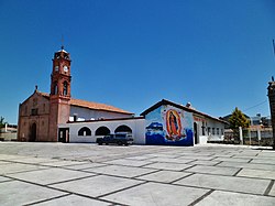
Municipio Atlacomulco
| Atlacomulco | ||
|---|---|---|

|
||
| Symbols | ||
|
||
| Basic data | ||
| Country | Mexico | |
| State | México | |
| Seat | Atlacomulco de Fabela | |
| surface | 258.6 km² | |
| Residents | 93,718 (2010) | |
| density | 362.3 inhabitants per km² | |
| founding | 4th August 1824 | |
| Website | atlacomulco.gob.mx/ | |
| INEGI no. | 15014 | |
| politics | ||
| Presidente municipal | Arturo Nemecio Vélez Escamilla | |
Coordinates: 19 ° 48 ′ N , 99 ° 52 ′ W
Atlacomulco is a municipality in the Mexican state of México . The seat of the municipality is Atlacomulco de Fabela . The community had 93,718 inhabitants in 2010, its area is 258.6 km² .
The name Atlacomulco comes from Nahuatl - atlacomolli 'fountain' and -co 'place, place' - and roughly means "place of the fountain".
geography
The municipality borders on the Municipios Temascalcingo , Acambay , Timilpan , Morelos and Jocotitlán .
Biggest places
| place | population |
| Municipio | 93,718 |
| Atlacomulco de Fabela | 22,774 |
| San Lorenzo Tlacotepec | 7,566 |
| Santiago Acutzilapan | 5,866 |
| San Antonio Enchisi | 4,870 |
| San Pedro del Rosal | 4,277 |
Sons and daughters
- Isidro Fabela (1882–1964), lawyer, politician and writer
- Arturo Vélez Martínez (1904–1989), Catholic clergyman, Bishop of Toluca
- Enrique Peña Nieto (* 1966), politician, President of Mexico since 2012
- Octavio "El Tavo" Valdez (* 1973), football player, born in Santiago Acutzilapan
Web links
Commons : Atlacomulco Municipality - Collection of images, videos and audio files
- Enciclopedia de los Municipios y Delegaciones de México: Municipio Atlacomulco (Spanish)
- INEGI : Datos Geográficos: Municipio Atlacomulco (Spanish; PDF)


