Auerbach (Bensheim)
|
Auerbach
City of Bensheim
|
|
|---|---|
| Coordinates: 49 ° 42 ′ 8 ″ N , 8 ° 37 ′ 9 ″ E | |
| Height : | 108 m |
| Residents : | 9585 (Jun. 30, 2019) |
| Incorporation : | April 1, 1939 |
| Postal code : | 64625 |
| Area code : | 06251 |
|
Map of Bensheim
with the Auerbach district |
|

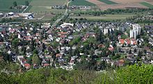
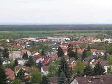
Auerbach is with about 10,000 inhabitants, is the largest district of the city of Bensheim on the Bergstraße in southern Hesse Bergstraße district . Auerbach (formerly Urbach ) was an independent municipality for centuries and was not incorporated into Bensheim until 1939. The name is derived from the river Auer , which flows from the Odenwald over the Winkelbach to the Rhine . The place was known for the Auerbach marble .
geography
location
Auerbach extends from the eastern edge of the Upper Rhine Plain to the slopes of the western Odenwald and lies at the foot of the Melibokus ( 517.4 m above sea level ) and on its southern foothills, the Schlossberg Auerberg ( 345.9 m above sea level ) the Auerbach Castle .
In the north is Zwingenberg , on the route to Darmstadt are Alsbach Castle and Frankenstein Castle . To the south the route leads via Bensheim and Heppenheim into Baden to Heidelberg or Mannheim . To the east it goes over Hochstädten and Balkhausen into the Odenwald . Behind Balkhausen you reach the Kuralpe and the Felsberg with the Felsenmeer . In the west, in the Hessian Ried , are the Bensheim districts Schwanheim and Fehlheim , as well as Rodau , district of Zwingenberg, via which it goes to Gernsheim on the Rhine .
climate
The place is located in the Bergstrasse region, which is one of the warmest regions in Germany and is also known as the German Riviera . It stretches from Nussloch or Wiesloch ( Baden-Württemberg ) to Darmstadt . The mild climate favors viticulture. The Bergstrasse is a blooming garden at the beginning of spring, when cherry, peach and almond trees usually wake up from hibernation two to three weeks earlier than in the rest of Germany.
history
middle Ages
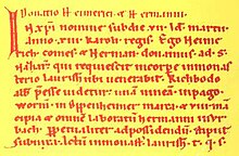
In 781, but more likely in 786, Auerbach was first mentioned as Urbach in the 1539 document in the Lorsch Codex . The first Auerbacher known by name is a "Hermann in Urbach" who had to do his work for the Lorsch Abbey .
In 773, Charlemagne donated the Mark Heppenheim to Lorsch Abbey . In connection with this donation, border disputes developed between the Lorsch monastery and the diocese of Worms , which led to the convening of an arbitration tribunal in 795. As a result of this court of arbitration, a new boundary description was established, which now also named the most important places within the boundaries of the Mark Heppenheim, namely Furte (Fürth), Rintbach (Rimbach), Morlenbach (Mörlenbach), Birkenowa (Birkenau), Winenheim (Weinheim), Hepenheim (Heppenheim), Besinsheim (Bensheim), Urbach (Auerbach), Lauresham (Lorsch) and Bisestat (Bürstadt).
There are no reliable findings about the centuries that followed. Through the marriage of Hildegard von Henneberg , parts of the Bergstrasse came to Heinrich II. Von Katzenelnbogen around 1135, who was given over by King Konrad III in 1138. was raised to count. Auerbach now belonged to the County of Katzenelnbogen with the main town of Katzenelnbogen . The County of Katzenelnbogen was divided into a Lower County , located on the Rhine around St. Goar , and an Upper County , located in southern Hesse.
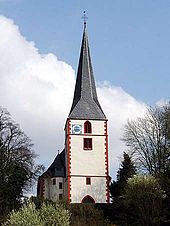
In the 13th century, the counts expanded the hermitage to the Einsiedeln on the Auerberg into a chapel. The mountain church in Auerbach also has its origins in the 13th century. A smaller church had already stood on this site in Romanesque times and was built by the County of Katzenelnbogen. As the community grew, the church building had to be expanded repeatedly. In the late Gothic the church received its west tower with a pointed helmet. The year 1479 is carved over the portal that leads into the nave. The entrance door between the tower and the nave is the oldest and most important element of the church in terms of art history. The two-wing door with iron ornamentation has been preserved from the previous Romanesque building.
Probably from 1222 onwards, the Auerbach Castle was built on the Auerberg (Urberg) by Count Diether IV. Von Katzenelnbogen. The first documented mention of the castle on the Urberg dates from 1247 and the first document that was made on the Urberg from 1257.
In 1260 the brothers Diether V. (founder of the older line) and Eberhard I (founder of the younger line) divided the County of Katzenelnbogen. Whereby Eberhard I. had more property in the Upper County, with Auerbach and Auerbach Castle. Zwingenberg, however, fell to Diether V, who had more property in the Lower Counties.
In 1318 Berthold III. (Bertolf) and his nephew Eberhard II, both from the younger line, their property in the Upper County, whereby Auerbach and Auerbach Castle were divided between Bertolf and Eberhard von Katzenelnbogen.
In 1402 the two lines were merged again through the marriage of Johann IV. Von Katzenelnbogen (younger line) and Anna von Katzenelnbogen (older line) in 1383.
In 1479 Auerbach and castle fell through the death of the last Count Philipp I - the elder - von Katzenelnbogen to his son-in-law, Landgrave Heinrich III. of Hessen . As a result, the state border between the Landgraviate of Hesse and the Principality of Kurmainz was between Auerbach and Bensheim . In the south-east, near Schönberg, the county of Erbach and Schönberg Castle joined.
Landgrave Philip I of Hesse introduced the Reformation in 1526 . According to the principle of cuius regio, eius religio , the subjects had to adopt the religion of the respective sovereign. In 1528 the first Protestant pastor was introduced. The Catholic community of Auerbach ceased to exist and the mountain church dedicated to St. Nicholas (1479) became a Protestant parish church. Thus there was also a denominational boundary between Auerbach ( Protestant ) and Bensheim ( Catholic ) .
In 1567 Auerbach was inherited by the new Landgraviate of Hessen-Darmstadt .
Thirty Years' War
The Thirty Years War (1618–1648) also devastated the country on the Bergstrasse, desecrated people and animals, and the plague and other diseases wiped out the population. A chronicle says: This is how Count Mansfeld is said to have moved through Auerbach in 1622. The already rampant Mansfeld war peoples were now followed by looters and murderers who were joined by a dozen Bensheimers and other malevolent neighbors from the Palatinate region. The church was broken into and devastated, almost all houses suffered damage, people were mistreated and the animals were taken away. The mills burned up the valley and Hochstädten experienced the same affliction. The physical participation of the people from Bensheim had a long lasting effect. And further: At the Auerberg house (Auerbach Castle) nothing is left, but everything was burned and taken away by the soldiers in 1634.
Modern times
In the period after that until 1693, mainly French troops moved to and through the mountain road, under Henri de Latour d'Auvergne, Vicomte de Turenne and General Lorges. The devastation was so severe that the Auerbach Castle was left in the state of ruin as it is today. The castle was left abandoned. Anything that wasn't nailed down was used in the village and taken from the castle.
In 1766, the previously known mineral-rich spring in the Roßbachtal was opened up again. The rotunda-shaped fountain, which has been preserved to this day, was built in 1767 and in 1768 two residential pavilions were built and the first avenues laid out. In 1790 the Landgraviate began to develop the prince camp into a summer residence. In 1772 the Landgrave Ludwig IX built. the observation tower on the Melibokus.
The late 18th and early 19th centuries brought far-reaching changes to Europe. As a result of the Revolutionary Wars , the “ Left Bank of the Rhine ” and thus the left bank of the Rhine from Kurmainz was annexed by France as early as 1797 . In its last session in February 1803, the Perpetual Reichstag in Regensburg passed the Reichsdeputationshauptschluss , which implemented the provisions of the Peace of Luneville and reorganized the territorial relations in the Holy Roman Empire (German Nation) . The Landgraviate of Hessen-Darmstadt was awarded parts of the dissolved principalities of Kurmainz and Electoral Palatinate and the diocese of Worms as compensation for lost areas on the left bank of the Rhine .
End of the Old Kingdom
In the Landgraviate of Hesse-Darmstadt, the judicial system was reorganized in an executive order of December 9, 1803. The “Hofgericht Darmstadt” was set up as a court of second instance for the Principality of Starkenburg . The jurisdiction of the first instance was carried out by the offices or the landlords . The court court was the second instance court for normal civil disputes, and the first instance for civil family law cases and criminal cases. The superior court of appeal in Darmstadt was superordinate .
Under pressure from Napoleon , the Rhine Confederation was founded in 1806 , this happened when the member territories left the empire at the same time. This led to the laying down of the imperial crown on August 6, 1806, with which the old empire ceased to exist. On August 14, 1806, the Landgraviate of Hesse-Darmstadt was raised by Napoleon to the Grand Duchy of France against high military contingents and membership of the Rhine Confederation , otherwise he was threatened with invasion.
In 1814 serfdom was lifted in the Grand Duchy. After Napoléon's final defeat, the Congress of Vienna in 1814/15 also regulated the territorial situation for Hesse and confirmed the boundaries of the Principality of Starkenburg. In addition, Article 47 assigned other areas to the Grand Duchy of Hesse, including Worms , Alzey , Bingen and Mainz , an area known as Rheinhessen . In 1815 the Grand Duchy joined the German Confederation .
In 1816 provinces were formed in the Grand Duchy and the area previously known as the "Principality of Starkenburg", which consisted of the old Hessian territories south of the Main and the territories on the right bank of the Rhine that were added from 1803, was renamed "Province of Starkenburg" . On December 17, 1820, with the introduction of the " Constitution of the Grand Duchy of Hesse ", the Grand Duchy became a constitutional monarchy , in which the Grand Duke still had great powers. The remaining civil rights magnificent as Low jurisdiction , tithes, ground rents and other slope but remained composed until 1848.
The statistical-topographical-historical description of the Grand Duchy of Hesse reports on Auerbach in 1829:
»Auerbach (L. Bez. Bensheim) Lutheran parish village; lies in the mountain road leading to the Darmstadt Bensheim Chausses, from the former site 5 and the other 1 / 2 M. distant, and contracts with the larger part on either side of a stream in a narrow valley side up. There are 202 houses and 1574 inhabitants, except for 6 Catholics and 4 Reform. and 79 Jews, all of whom are Lutheran. The church is a bit high. The place is engaged in viticulture; good pendulum clocks are also made here. The prince camp and the ruins of Auerbach Castle are nearby. The district contains 8 mills, a type of marble, excellent limestone and mineral springs. Auerbach is a seaside resort that is visited very often by notables in the area during the spa months. The source only became well known in 1739 and was surrounded by a border in 1777. The water is partly drunk and partly used for bathing. In the first case it serves against chronic evils, hypochondria, and rashes; on the other hand, in diseases which result from weakness in the more solid parts. It contains particularly iron, volatile mineral acid, combined with alkaline, calcareous earths and a fire-resistant alkaline salt. The fountain springs 1 / 4 St. from places in Roßbacher Thale, and 1 / 8 St. Auerbach, in Hochstädter Thale, are two sources of the same content. The water does not hold up to seduce you into more distant areas. - Auerbach was owned by the Frankish kings at Lorsch, and from there it came to Mainz, and the village of Urbach is named in documents from 773 and 775. Mainz enfeoffed Count Johann von Katzenellenbogen with the village in 1420, which was, however, katzenellenbogic long before. With the county of Katzenellenbogen, the place came to Hesse. Originally the place was a branch of Bensheim, but had its own chapel in front of the place, named for God's grace, which was demolished during the Reformation. Around the middle of the 15th century Auerbach had its own parish church in the village, which was completely independent of Bensheim. - There was a silver mine nearby, loaned in 1517; gold is said to have been panned in the brook earlier, so that some also want to derive the name Auerbach from aurum . "
After the industrial age slowly announced itself for Auerbach at the end of the 19th century , great advances in infrastructure were achieved with the commissioning of the Langen (Hessen) - Darmstadt - Heppenheim section of the Main-Neckar Railway on June 22, 1846. With the final commissioning of the line on October 9, 1846, three German states at that time, namely Prussia with Frankfurt am Main , the Grand Duchy of Hesse and the Grand Duchy of Baden , were connected by rail. The station building of the train station in Auerbach, which still exists today, was inaugurated in 1850. November 1st, 1896 was a great day for the development of Auerbach, because the first electric light burned in the region at the parish fair, which was supplied by the electricity company that had recently been built in Auerbach . The E-Werk was built by the German-American Beck and supplied electricity to both private households and street lighting. In 1914 the direct current plant was transferred to the "Gruppengaswerk Bergstrasse AG", with which the "Gruppen-Gas- und Elektrizitätswerk Bergstrasse AG" was created. The plant operated until 1920 before it was shut down.
In the Grand Duchy of Hesse, the administrative units changed several times. Until 1821 Auerbach belonged to the office of Zwingenberg and then came to the district of Bensheim . In 1832 the administration was changed again and Auerbach was incorporated into the Bensheim district. As a result of the March Revolution of 1848, with the "Law on the Relationships of the Classes and Noble Court Lords" of April 15, 1848, the special rights of the class were finally repealed. In addition, in the provinces, the districts and the administrative districts of the Grand Duchy were abolished on July 31, 1848 and the two districts of Bensheim and Heppenheim merged to form the administrative district of Heppenheim . This administrative reform only lasted four years, because in May 1852 the merger was lifted and Auerbach came back to the Bensheim district. The structure created at that time lasted for more than eight decades.
In 1870, the Prussian Prime Minister Otto von Bismarck provoked the Franco-German War with the so-called Emser Depesche in which the Grand Duchy of Hesse took part as a member of the North German Confederation on the side of Prussia . Before its official end on May 10, 1871, the southern German states joined the North German Confederation, and on January 1, 1871 its new constitution came into force, with which it was now called the German Empire . On the German side, this war claimed around 41,000 deaths. With the Reich Coin Act , Germany only had one currency, the mark with 100 pfennigs as a sub-unit.
Time of world wars
On August 1, 1914, the First World War broke out, which put an end to the positive economic development throughout the German Empire . When the armistice was signed after the German defeat on November 11, 1918, Auerbach had 87 casualties to mourn, while the war cost a total of around 17 million human lives. The end of the German Empire was thus sealed, and the troubled times of the Weimar Republic followed, in which between 1921 and 1930 around 566,000 emigrants tried to escape the difficult conditions in Germany.
In 1918 the Grand Duke was deposed and the Grand Duchy of Hesse became the People's State of Hesse .
On April 28, 1928, the Bergstrasse was hit by a catastrophic storm, nobody in the affected area could remember anything similar. "Bensheim, Auerbach, Zell, the Ried and above all Zwingenberg offered a picture of devastation". Thunderstorms and hail destroyed the hope of a harvest and masses of water rolled from the slopes of the mountain road into the affected places. The mountain climber Anzeiger wrote: “Dam breaks near Auerbach led to the destruction of the fields, vineyards looked like battlefields. The Darmstädter Straße between Auerbach and Bensheim was practically impassable, the Bachgasse was completely buried so that the curious could not get through. The Bachgasse is an impassable heap of rubble, stones, wood and mud ”.
On January 30, 1933, Adolf Hitler became Chancellor, which marked the end of the Weimar Republic and the beginning of the National Socialist dictatorship. After the dissolution of the provincial and district assembly in what was now the People's State of Hesse in 1936 and the dissolution of the Starkenburg province in 1937, the year 1938 brought a review of the district boundaries, which resulted in the merging of the Bensheim and Heppenheim districts into the Bergstrasse district with the district town of Heppenheim .
The competent jurisdiction was during the affiliation to Hesse, from 1821 to 1879 the regional court Zwingenberg and from 1879 to 1934 the resulting district court Zwingenberg . From 1934 the district court area of Zwingenberg was abolished and added to the district court Bensheim , which is responsible to this day.
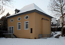
The November pogroms of 1938 passed the Auerbach synagogue , as it had already been abandoned at that time and no longer served as a place of worship. From 1984 the synagogue was restored and used as a cultural facility. After 1933, part of the 31-person Jewish community at that time had moved away or emigrated as a result of increasing reprisals. In 1937 the Jewish community dissolved. Of the Jewish citizens who were born in Auerbach or who had lived there for a long time, 15 were killed by the Nazi regime.
Auerbach has been a district of Bensheim since April 1, 1939.
On September 1, 1939, when German troops marched into Poland, the Second World War began , the effects of which were even more dramatic than the First World War and the number of victims estimated at 60 to 70 million people. In the final phase of the Second World War in Europe, the American units reached the Rhine between Mainz and Mannheim in mid-March 1945. On March 22nd, the 3rd US Army crossed the Rhine near Oppenheim and occupied Darmstadt on March 25th. In the first hours of March 26, 1945, American units crossed the Rhine near Hamm and south of Worms, from where they advanced on a broad front towards the Bergstrasse. On March 27, the American troops were in Lorsch, Bensheim and Heppenheim and a day later Aschaffenburg am Main and the western and northern parts of the Odenwald were occupied. The war in Europe ended with the unconditional surrender of all German troops, which came into effect on May 8, 1945 at 11:01 p.m. Central European Time.
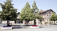
Outside the Auerbach cemetery, next to the northeast exit, are the graves of 22 Nazi victims. They come from the armaments company Ing.Hans Heymann, which was moved to the marble mine near Hochstädten after the bombing of Darmstadt. Due to his good relations with the head of the SS-Wirtschafts-Verwaltungshauptamt Oswald Pohl , he was able to procure concentration camp prisoners from Buchenwald , who were housed in a camp set up according to concentration camp regulations above today's tennis court on Weiherweg. The camp was assigned to the Natzweiler-Struthof concentration camp (Alsace) as a satellite camp . In addition, the entrepreneur was assigned a group of 130 Greek slave laborers who were arrested in a bloody raid on August 17, 1944 in a district of Athens and taken to Auerbach. They were housed in the former fruit market hall at the train station in Auerbach and had to march from there to the marble mine every morning, where they had to build the “Dom” or “Heymann Hall” in an underground hall for the planned armaments production. The fact that in the few months from September 1944 to the end of March 1945 more than 10 of the young men who were then buried outside the Auerbach cemetery wall - together with murdered concentration camp prisoners - was the result of the brutal treatment by their overseers, who Totally inadequate nutrition, clothing, medical care and housing, and inhumane working conditions. A project group has been able to establish contact with some of the survivors since 1990 and the city of Bensheim invited them six times for a few days. A number of interviews were also made that illustrate the full extent of the terrible experience.
Post-war and present
In 1945 after the end of the Second World War , the area of today's Hesse was in the American zone of occupation and by order of the military government, Greater Hesse was created , from which the state of Hesse emerged in its current borders and to which Bensheim-Auerbach now also belonged. The population rose sharply due to the influx of many refugees and displaced persons from the former German eastern regions.
In 1955, Bensheim-Auerbach became the only state-approved climatic health resort on the Hessian Bergstrasse.
At the beginning of the 1960s, numerous orchards and vineyards to the left and right of the B 3 (Darmstädter Straße, formerly Heidelberger Straße) were given up and declared as building land. Since that time there has been a steady influx of new citizens and a rapid increase in the population, which will continue into the 21st century.
Territorial history and administration
The following list gives an overview of the territories in which Auerbach was located and the administrative units to which it was subordinate:
- before 1479: Holy Roman Empire , County of Katzenelnbogen , Upper County of Katzenelnbogen
- from 1479: Holy Roman Empire, Landgraviate of Hesse , Upper County of Katzenelnbogen, Office of Zwingenberg and Jägersburg
- from 1567: Holy Roman Empire, Landgraviate of Hessen-Darmstadt , Upper County of Katzenelnbogen, Office of Zwingenberg and Jägersburg
- from 1803: Holy Roman Empire, Landgraviate of Hessen-Darmstadt , Principality of Starkenburg , Zwingenberg Office
- from 1806: Confederation of the Rhine , Grand Duchy of Hesse , Principality of Starkenburg, Zwingenberg Office
- from 1815: German Confederation , Grand Duchy of Hesse, Province of Starkenburg , Zwingenberg Office
- from 1821: German Confederation, Grand Duchy of Hesse, Starkenburg Province, Bensheim District District (separation between the judiciary ( Zwingenberg District Court ) and administration)
- from 1832: German Confederation, Grand Duchy of Hesse, Starkenburg Province, Bensheim district
- from 1848: German Confederation, Grand Duchy of Hesse, administrative district of Heppenheim
- from 1852: German Confederation, Grand Duchy of Hesse, Province of Starkenburg, District of Bensheim
- from 1867: North German Confederation , Grand Duchy of Hesse, Starkenburg Province, Bensheim district
- from 1871: German Empire , Grand Duchy of Hesse, Province of Starkenburg, Bensheim district
- from 1918: German Empire, People's State of Hesse , Starkenburg Province, Bensheim district
- from 1938: German Empire, People's State of Hesse , Bergstrasse district (In the course of the regional reform in 1938 , the three Hessian provinces of Starkenburg, Rheinhessen and Upper Hesse were dissolved.)
- on April 1, 1939 Auerbach was incorporated into the city of Bensheim
Population development
Source: City of Bensheim
| • 1629: | 127 house seats |
| • 1791: | 876 inhabitants |
| • 1800: | 998 inhabitants |
| • 1806: | 1111 inhabitants, 154 houses |
| • 1829: | 1574 inhabitants, 202 houses |
| • 1867: | 1481 inhabitants, 230 houses |
| • 2007: | 8981 inhabitants |
| • 2011: | 8931 inhabitants ( 2011 census ) |
| • 2018: | 9594 inhabitants |
| • 2032: | 8700 inhabitants (forecast) |
| Auerbach: Population from 1791 to 1925 | ||||
|---|---|---|---|---|
| year | Residents | |||
| 1791 | 876 | |||
| 1800 | 998 | |||
| 1806 | 1,111 | |||
| 1829 | 1,574 | |||
| 1834 | 1,494 | |||
| 1840 | 1,531 | |||
| 1846 | 1,334 | |||
| 1852 | 1,556 | |||
| 1858 | 1,570 | |||
| 1864 | 1,451 | |||
| 1871 | 1,469 | |||
| 1875 | 1,542 | |||
| 1885 | 1,811 | |||
| 1895 | 1,960 | |||
| 1905 | 2,358 | |||
| 1910 | 2,559 | |||
| 1925 | 3.138 | |||
| Data source: Historical municipality register for Hesse: The population of the municipalities from 1834 to 1967. Wiesbaden: Hessisches Statistisches Landesamt, 1968. Other sources: | ||||
dishes
The competent jurisdiction of the first instance was:
- from 1803: Office Zwingenberg
- from 1821: District Court of Zwingenberg
- from 1879: District court Zwingenberg
- from 1934: Bensheim District Court
politics
Local advisory board
The local elections since 2006 have produced the following results:
| Parties and constituencies |
% 2016 |
Seats 2016 |
% 2011 |
Seats 2011 |
% 2006 |
Seats 2006 |
|
| CDU | Christian Democratic Union of Germany | 37.7 | 4th | 36.8 | 4th | 39.1 | 4th |
| SPD | Social Democratic Party of Germany | 18.6 | 2 | 22.6 | 2 | 32.2 | 4th |
| FDP | Free Democratic Party | 9.4 | 1 | 5.3 | 1 | 6.7 | 1 |
| GLB | Green List Bensheim | 15.6 | 2 | 25.9 | 3 | 13.9 | 1 |
| FWG | Free voter community Bensheim | 7.0 | 1 | 9.5 | 1 | 8.1 | 1 |
| Citizen | Citizens for Bensheim | 11.5 | - | - | - | - | - |
| total | 100.0 | 11 | 100.0 | 11 | 100.0 | 11 | |
| Voter turnout in% | ? | 45.2 | 40.5 | ||||
The chairmen of the local council are:
- Mayor : Robert Schlappner (CDU)
- Deputy : Christoph von Fumetti
- Deputy : Rolf Schepp`
The non-party mayor Karl Wilfried Hamel († April 5, 2015), who was in office from 1993 to 2011, was appointed honorary mayor.
coat of arms
The coat of arms of Auerbach shows the lion of the Counts von Katzenelnbogen above and below the three golden coins (or gold nuggets) for the legend of St. Nicholas of Myra . The Katzenelnbogen lion can also be seen in the coats of arms of Darmstadt , Zwingenberg , Pfungstadt , Katzenelnbogen and St. Goar .
Sights and culture
Bachgasse
A local attraction is the Bachgasse with some old half-timbered houses. The Auerbacher Bergkirche is located above the alley through which the small Auer stream flows.
The Bachgasse leads in a north-easterly direction over the Mühltal to Hochstädten, one of the nine districts of Bensheim. The Mühltal takes its name from the seven mills that stood from Auerbach to Hochstädten, one after the other up the valley on the Auer. The village mill in the town center is now a wine bar, the Ranzenbergermühle is today the location of the Wiesengrund retirement and nursing home , the Gagelsmühle studio and home of an artist based in Auerbach, the Kadels, Wiemers, Mößingers and Jungmühle are used as residential buildings.
A few hundred meters before the end of the village, Bachgasse leads to the right to the Fürstenlager State Park , with the manor, the prince's and the women's building.
The Burgweg, the former entrance to the castle, leads through the Weidgasse, past a war memorial, to the Auerbach Castle .
Mountain church
The church, consecrated to St. Nicholas, probably built around 1260/70 on a hill that can be seen from afar, became a Protestant parish church as early as 1528. It contains late Romanesque elements and was expanded in 1479, rebuilt in 1901 and 1964.
Princely camp
The prince's camp was built around 1790 as the summer residence of the landgraves and grand dukes of Hessen-Darmstadt at a fountain (Goethe fountain) , the water of which was thought to have healing properties. It lies in a side valley parallel to the Rhine plain. In the 46 hectare park with many exotic trees, laid out in the style of an English garden , there are a number of courtyard buildings arranged as in a grown village. A special feature was the public manner of the court at that time.
Auerbach Castle with Scots pine
Among the sights of the castle ruins of a large stronghold from the 13th century in the County of Katzenelnbogen are the gnarled, only seven meters high bonsai Scots pine ( Pinus sylvestris ), which has been on the battlements of the shield wall below the observation tower of the ruins for over 300 years grows. The sharp needles of the tree catch droplets of mist, which then run off over the wax layer and drip to the ground - exactly in the area of the battlements cut out by the battlements. Botanists call this crown eaves . In addition, pines have what is known as a taproot with high root energy. This means that the roots use brute force to push themselves into the smallest cracks and crevices in order to get to the coveted nutrients. The Auerbacher pine is one of Germany's natural wonders.
On the road to Auerbacher Schloss, from Darmstädter Straße (B3) following the Ernst-Ludwig-Promenade, shortly before the pass between Melibokus and Auerberg you come to the chapel Zur Not Gottes , on the pass you will find the junction to the right leads to Auerbach Castle and left to Melibokus. The road downhill leads to the Mühltal and via Bachgasse back to Auerbach.
Pilgrimage site "In need of God"
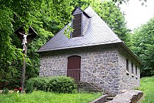
The pilgrimage site “ Zur Not Gottes ” outside Auerbach goes back to a medieval chapel, the remains of which were excavated in 1891/92. In the Middle Ages there was a hermitage and a spring sanctuary near the chapel. The current chapel was built in 1960.
Churches
- Evangelical parish of Auerbach and Hochstädten, Bergkirche Auerbach
- Catholic parish Heilig Kreuz Auerbach and Hochstädten, Heilig Kreuz Church
- Evangelical Chrischona Community Auerbach
- Christ Church: Evangelical Free Church Community of Bensheim-Auerbach
- Auerbach Adventist Church
Regular events
- Auerbach Synagogue Association, citizens from Bensheim-Auerbach and from the immediate and wider area of Auerbach recognized an intellectual and cultural mission in the former Auerbach synagogue. On March 29, 1984, the Auerbach Synagogue Association was founded on the initiative of the Protestant and Catholic parishes in Bensheim-Auerbach. The city of Bensheim entrusted this association to work on the interior design and sensible use of the former synagogue in Auerbach.
- City district documentation Bensheim-Auerbach, with numerous exhibitions, mainly with old photographs, drawings and other documents, the past times are brought closer to the population.
- KUNST IM FÜRSTENLAGER, the buildings of the Fürstenlager are regularly used for arts and crafts exhibitions.
- International Summer Festival Bensheim-Auerbach, the prince's camp , the former landgrave's health resort and summer residence of the House of Hessen-Darmstadt - embedded in a landscape park with historical buildings, exotic flora and Mediterranean flair - is considered a cultural monument of importance in Hessen.
- Vineyard hike (May 1st) since 1988. The path begins in Alsbach and leads through the vineyards above and partly through the towns touched by the Weinlageweg to the Hessian-Baden border near Heppenheim . Up to 40,000 participants take part in the event.
- The Auerbacher Bachgasse Festival has been held in July since 1987 .
Non-profit associations
- The beautification and health resort association Auerbach in Hesse , founded in 1866, is now the Kur- und Verkehrsverein Auerbach 1866 e. V. and thus one of the oldest clubs in Auerbach. He maintains the curb (parish fair) and artist departments in the royal camp.
- The Auerbach volunteer fire brigade, founded in 1890 . V. 1890 is the largest district fire brigade in Bensheim and maintains the emergency department, youth fire brigade , marching band and honorary department.
- The Melibokusturmverein looks after the observation tower on the Melibokus, which is located on Auerbach.
- The non-profit association NITYA SEVA e. V. looks after former street, slum and train platform children as well as orphans and sick children in its two children's homes in Bhopal / India.
- The Auerbach district documentation organizes annual exhibitions on the history of the district and maintains an extensive archive of images on Auerbach.
sports clubs
- HSG Bensheim / Auerbach , handball, home games are in the Weststadthalle held
- TSV Rot-Weiß 1881 Auerbach e. V., the largest association in Auerbach with over 3000 members. In 1977 the women's handball team was in the final of the German championship, but it was lost 7:12.
- PSG-Auerbach 1570 e. V., shooting club with approx. 220 members. Shooting disciplines: air rifle and air pistol, small bore sport rifle, handguns (small and large caliber); Schützenhaus on Schönberger Höhe with shooting ranges (10 m, 25 m, 50 m and 100 m).
- Minigolf-Sport-Club Bensheim-Auerbach e. V .; Teams in the 1st Bundesliga: 1st women's team, teams in the regional league: 1st men's team.
Economy and Infrastructure
Auerbach is characterized by medium-sized companies. Retailers, craft businesses, restaurants, doctors and medical companies as well as freelancers determine the townscape.
In the industrial area west, located on the railway line Berlin ring, many businesses have settled.
In the early 1960s, the farms were moved from the village to the so-called Aussiedlerhöfe , in front of the gates of Auerbach, in the Hessian Ried. The Rothweiler, Seitz and Steinmüller wineries are still in the village today .
The grounds of horticultural companies were abandoned and houses were built on.
Viticulture
Auerbach is located in the wine-growing region Hessian mountain road , in the wine field Starkenburg region , with the famous Great location Auerbacher Rott . Since the vineyards on Bergstrasse are not very large, only two individual layers have been identified in Auerbach: the Auerbacher Höllberg and the Auerbacher Fürstenlager . The Alsbacher Schöntal , Zwingenberger Steingeröll and Zwingenberger Alte Burg sites also belong to the large Auerbacher Rott site .
The vineyards are located on the slopes of the Melibokus and the Auerberg, stretch across the Fürstenlager to the Altarberg and reach Schönberg and Bensheim with their own vineyards.
In Auerbach, Riesling , Müller-Thurgau and Silvaner were traditionally grown. Over the years (since around 1980) more and more grape varieties have been added and even red wines are grown, which is not exactly typical for the Hessian Bergstrasse.
Some wineries in Auerbach and the surrounding area, as well as Bergsträßer Winzer eG in Heppenheim, take care of the expansion of Auerbach wine, which is mostly consumed in the region. The winemakers are now also dedicated to the production of sparkling wine and secco as well as pomace and fruit brandies.
The Katzenelnbogen family already grew wine in Auerbach; in 1258 the Grafenweinberg vineyard below the castle, in 1318 the Reuchte vineyard and in 1410 the Urbergen Wyne grape variety is named. In 1732 Wingerten was first mentioned in the so-called Roth zu Auerbach. The hillside behind the manor house in the royal camp was planted as a vineyard by the Darmstadt county. The Auerbach prince camp still bears witness to this historic prince camp wine.
gastronomy
The gastronomic side of Auerbach is just as diverse as the place itself, although there is no gastronomic center, the restaurants are spread over the whole place.
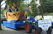
The Auerbacher Bachgasse Festival takes place every second weekend in July . Residents of Bachgasse and clubs open the courtyards, put benches and tables on the alley and celebrate until the last guests have left. This event has up to 20,000 visitors. Since 2005, the soap box race has been taking place every Sunday, which has drawn many visitors under its spell.
History: In
1849 the poet Joseph Victor von Scheffel lived as a refugee from the Baden Revolution in the Parkhotel Krone , the oldest house on the square, founded in 1655 as an inn: Princely Herberge zur Güldenen Krone. The Scheffelsaal in this house is named after him.
In 1859 the W. Schweikert brewery was built on Darmstädter Strasse. After a few changes of ownership; Heinrich Böttinger Brewery, Jean Gehring Brewery, Böttinger Jean Gehring Brewery; it was closed in 1920. The Deutsche Lichtspiele cinema , or DELI for short, was located in the brewery hall until 1965 . From the brewery you can still see the Zum Holzwurm restaurant with the beer garden.
Transport links
The federal highway 3 runs through Auerbach from north to south along the Bergstrasse . Auerbach can be reached by motor vehicle via the motorways 5 (Bensheim and Zwingenberg exits) and 67 (Lorsch and Gernsheim exit). The place is located on the Frankfurt am Main - Heidelberg railway line and has its own train station where regional trains stop. Numerous shuttle buses ( shuttle buses ) connect Auerbach with the Frankfurt Airport .
schools
- Schloßbergschule, elementary school
- Schillerschule, elementary, secondary and secondary school
Personalities
- Nicolai Borger (* 1974), writer and director; born and raised in Auerbach
- Joseph Victor von Scheffel (1826–1886), writer and poet, lived in Auerbach in 1849 as a refugee from the Baden Revolution. The Scheffelsaal in the Parkhotel Krone and the Scheffelplatz in the Wolfsschlucht are named after him.
- Heinrich Metzendorf (1866–1923), the builder of Bergstrasse , also left his mark on numerous Metzendorf villas in Auerbach .
- Johann Georg Brückmann (1896–1973), born in Auerbacher; was mayor of Bensheim and Hessian state parliament member for the NSDAP
- Heinrich Winter (1898–1964), local history researcher; died in Auerbach
- Karl Wilfried Hamel (1942–2015), long-time mayor, chairman of the health resort and tourist association and local researcher
- Werner Buggisch (1943–2019), geologist; was born in Auerbach
literature
- Karl Wilfried Hamel: Auerbacher Schloß - Feste Urberg - the most important castle complex in the Upper County of Katzenelnbogen, AAA-Verlag, Bensheim-Auerbach 1997, ISBN 3-9803139-0-5
- Ernst Pasqué: There is a tree in the Odenwald: a story about the Bergstrasse , ISBN 3-9808869-0-5
- Ernst Pasqué: The mountain road: from Jugenheim to Auerbach , ISBN 3-9808869-2-1
- Kur- und Verkehrsverein Auerbach: Auerbacher Leben, monthly bulletin with reports from Bensheim-Auerbach
- Bernd Philipp Schröder: Auerbach an der Bergstrasse history through twelve centuries , published by the city of Bensheim 1984
- Johannes Schröder: Village and Castle Auerbach on the Bergstrasse. A historical attempt. At the same time guide through the castle ruins , 1905
- Ernst Schad: Auerbach as it was. A chronicle , Verlag Auerbacher Leben, Bensheim-Auerbach 1975
- Wilhelm Busch: Bensheim-Auerbach, Evangelical mountain church. Small art guides; No 2436 , Schnell and Steiner, Regensburg 2002, ISBN 3-7954-6210-X
- Karl E. Demandt: Regesten der Grafen von Katzenelnbogen , 4 volumes 1953–1957, 800 pages; 896 p .; 668 p .; 572 pp., ISBN 3-922244-10-6 , ISBN 3-922244-11-4 , ISBN 3-922244-12-2 , ISBN 3-922244-13-0
- Rainer Metzendorf: Georg Metzendorf, 1874–1934. Settlements and buildings . Sources and research on Hessian history 96. Darmstadt / Marburg 1994, ISBN 3-88443-185-4
- Literature on Auerbach in the Hessian Bibliography
Web links
- District Auerbach In: Website of the city of Bensheim.
- Auerbach, Bergstrasse district. Historical local dictionary for Hessen. In: Landesgeschichtliches Informationssystem Hessen (LAGIS).
- Circular hiking trail: Castle, Prince's Camp, Goethe Fountain From Echo-Online from June 18, 2009
- Hike on the adventure hiking trail in Bensheim-Auerbach (PDF; 2.9 MB) Hiking tip from the Odenwaldclub
Individual evidence
- ↑ Bensheim in numbers (only residents with main residence). In: website. City of Bensheim, accessed July 2019 .
- ^ Minst, Karl Josef [trans.]: Lorscher Codex (Volume 3), document 1539, March 9, 785? - Reg. 2846. In: Heidelberg historical holdings - digital. Heidelberg University Library, p. 250 , accessed on March 11, 2016 .
- ↑ Further mentions can be found in documents 3810, 3811 and 3835, cf. List of places for the Lorsch Codex, Bensheim-Auerbach , Archivum Laureshamense - digital, Heidelberg University Library.
- ^ Map of the County of Katzenelnbogen. Accessed December 2019.
- ^ Heinrich Tischner: Katzenelnbogen division contract of August 26, 1318. In: www.heinrich-tischner.de. Private website, accessed December 2019 .
- ↑ Bernd Phillip Schröder: Auerbach an der Bergstrasse history through twelve centuries , 1984
- ^ A b Georg Wilhelm Justin Wagner : Statistical-topographical-historical description of the Grand Duchy of Hesse: Province of Starkenburg . tape 1 . Carl Wilhelm Leske, Darmstadt October 1829, OCLC 312528080 , p. 6 ( online at google books ). )
- ^ The German railway lines in their development 1835-1935. Berlin 1935 = manual of the German railway lines. ND Mainz 1984, p. 19f (No. 7).
- ↑ Headlines from Bensheim on the 175th anniversary of the “Bergsträßer Anzeiger” 2007. (PDF 8.6 MB) “Main-Neckar-Bahn brings progress” and “Electricity works founded in Auerbach”. P. 3 , archived from the original on October 5, 2016 ; accessed on December 28, 2014 .
- ↑ Law on the Conditions of the Class Lords and Noble Court Lords of August 7, 1848 . In: Grand Duke of Hesse (ed.): Grand Ducal Hessian Government Gazette. 1848 no. 40 , p. 237–241 ( online at the information system of the Hessian state parliament [PDF; 42,9 MB ]).
- ^ Ordinance on the division of the Grand Duchy into circles of May 12, 1852 . In: Grand Ducal Hessian Ministry of the Interior (ed.): Grand Ducal Hessian Government Gazette 1852 No. 30 . S. 224–229 ( online at the Bavarian State Library digital [PDF]).
- ^ Lists of casualties of the German army in the campaign 1870/71. In: Online project fallen memorials. Archived from the original on May 6, 2015 ; accessed on May 10, 2018 .
- ^ Auerbach, World War I. In: Online project fallen memorials. Accessed December 2019 .
- ↑ Headlines from Bensheim on the 175th anniversary of the "Bergsträßer Anzeiger" 2007: "Die Bergstrasse - ein Trümmerfeld", p. 64
- ↑ Headlines from Bensheim on the 175th anniversary of the "Bergstrasse Indicator" 2007: The "Origin of the Bergstrasse District". P. 109
- ↑ a b c d e Auerbach, Bergstrasse district. Historical local lexicon for Hesse (as of February 9, 2018). In: Landesgeschichtliches Informationssystem Hessen (LAGIS). Hessian State Office for Historical Cultural Studies (HLGL)
- ^ Auerbach (Bergstrasse district) - Jewish history / synagogue. In: Alemannia Judaica. Accessed December 2019 .
- ^ Incorporation of the communities Auerbach, Schönberg and Zell into the city of Bensheim on February 22, 1939 . In: Reichsstatthalter in Hessen (Hrsg.): Hessisches Regierungsblatt. 1939 no. 5 , p. 25 , no. 2368 / L / 38 ( online at the information system of the Hessian state parliament [PDF; 10.9 MB ]).
- ↑ Cf. “Because what we suffered, that was every minute” Greek forced laborers in an armaments factory at the end of the Second World War, in: Dorn, Fred / Heuer, Klaus (ed.): “I was always good to my Russian woman” On the structure and the practice of the forced labor system in World War II in the South Hesse region, Pfaffenweiler, 1991, pp. 137–152. Furthermore: History workshop "Jakob Kindinger" Bensheim, Ed .: Johannes Krämer: ". And that we pay attention to the next generation". History of the Greek slave laborers in Bensheim-Auerbach, in interviews, archive documents and newspaper articles. Bensheim 2008
- ↑ a b Kur- und Verkehrsverein Auerbach 1866 e. V. Website. Accessed December 2019 .
- ^ Michael Rademacher: German administrative history from the unification of the empire in 1871 to the reunification in 1990. State of Hesse. (Online material for the dissertation, Osnabrück 2006).
- ^ Grand Ducal Central Office for State Statistics (ed.): Contributions to the statistics of the Grand Duchy of Hesse . tape 1 . Großherzoglicher Staatsverlag, Darmstadt 1862, DNB 013163434 , OCLC 894925483 , p. 43 ff . ( Online at google books ).
- ↑ a b List of offices, places, houses, population. (1806) HStAD inventory E 8 A No. 352/4. In: Archive Information System Hessen (Arcinsys Hessen), as of February 6, 1806.
- ^ District monitoring. (PDF; 280 kB) Key figures Auerbach. City of Bensheim, p. 13 , accessed July 2019 .
- ↑ Hessen-Darmstadt state and address calendar 1791 . In the publishing house of the Invaliden-Anstalt, Darmstadt 1791, p. 129 ( online in the HathiTrust digital library ).
- ↑ Hessen-Darmstadt state and address calendar 1800 . In the publishing house of the Invaliden-Anstalt, Darmstadt 1800, p. 134 ( online in the HathiTrust digital library ).
- ^ Ph. AF Walther : Alphabetical index of the residential places in the Grand Duchy of Hesse . G. Jonghaus, Darmstadt 1869, OCLC 162355422 , p. 4 ( online at google books ).
- ↑ Selected data on population and households on May 9, 2011 in the Hessian municipalities and parts of the municipality. In: 2011 census . Hessian State Statistical Office
- ↑ Local Advisory Council 2016 - distribution of seats. In: website. City of Bensheim, accessed December 2019 .
- ↑ Local Advisory Board 2016. In: Website. City of Bensheim, accessed December 2019 .
- ↑ City district documentation Bensheim-Auerbach
- ↑ Auerbach Synagogue Association. Website. Accessed December 2019 .
- ↑ Handicrafts in the royal camp. Website. Accessed December 2019 .
- ^ New exhibition in the royal camp. In: Morgenweb. Mannheimer Morgen, June 9, 2016, accessed December 2019 .
- ^ Bensheim-Auerbach International Summer Festival. Website. Accessed December 2019 .
- ↑ Auerbach volunteer fire brigade. Website. Accessed December 2019 .
- ↑ 125 years of the fire brigade: then and now. In: Blog of the city district documentation Auerbach. Accessed December 2019 .
- ↑ NITYA SEVA. Website. Accessed December 2019 .
- ↑ Blog of the district documentation Auerbach. Accessed December 2019 .
- ↑ Headlines from Bensheim on the 175th anniversary of the "Bergsträßer Anzeiger" 2007: "German vice title for TSV Auerbach", p. 6
- ↑ KE Demandt Regesten der Count von Katzenelnbogen 1953
- ↑ Hannelore Volk: From the Böttinger brewery to the wood worm, in: Mitteilungen des Museumsverein Bensheim e. V. No. 59, 2009, pp. 34-41; also in Bensheim-Auerbach (blog on the history of the district)


