
Dachsbach
| coat of arms | Germany map | |
|---|---|---|

|
Coordinates: 49 ° 38 ' N , 10 ° 42' E |
|
| Basic data | ||
| State : | Bavaria | |
| Administrative region : | Middle Franconia | |
| County : | Neustadt an der Aisch-Bad Windsheim | |
| Management Community : | Uehlfeld | |
| Height : | 280 m above sea level NHN | |
| Area : | 20.58 km 2 | |
| Residents: | 1809 (Dec. 31, 2019) | |
| Population density : | 88 inhabitants per km 2 | |
| Postal code : | 91462 | |
| Area code : | 09163 | |
| License plate : | NEA, SEF, UFF | |
| Community key : | 09 5 75 117 | |
| LOCODE : | DE DSH | |
| Market structure: | 7 parts of the community | |
Market administration address : |
Schulstrasse 11 91462 Dachsbach |
|
| Website : | ||
| First Mayor : | Peter Kaltenhäuser ( Unity and Justice Rauschenberg ) | |
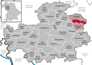
| Location of the Dachsbach market in the Neustadt an der Aisch-Bad Windsheim district | ||
  |
||


Dachsbach is a market in the Middle Franconian district of Neustadt an der Aisch-Bad Windsheim and a member of the Uehlfeld administrative community .
geography
Geographical location
The market is located in the Aisch Valley , the Rauschenberg district with a brick hut in the southern Steigerwald .
Neighboring communities
Neighboring communities are (starting from the north clockwise): Uehlfeld , Weisendorf , Gerhardshofen and Gutenstetten .
Community structure
The municipality has seven officially named municipality parts (the type of settlement is given in brackets ):
- Arnshoechstädt ( village )
- Dachsbach (main town)
- Göttelbrunn ( wasteland )
- Oberhöchstädt ( parish village )
- Rauschenberg (village)
- Traishöchstädt (village)
- Brick hut (wasteland)
history
Until the end of the Holy Roman Empire of the German Nation (1806)
The Dachsbach market is documented for the first time in 1129 - a knight Heinrich von Dahspach sold one of his goods to the St. Michael monastery in Bamberg for 80 silver marks . The place name is derived from a water body of the same name, the defining word of which is perhaps dahs ( mhd. For badger ). Accordingly, it could have been used to designate a brook where badgers occur. The local coat of arms also refers to this meaning.
During the time of the tribal duchies , Dachsbach was in the Duchy of Franconia . In 1132 a knight Albrecht von Dachsbach witnessed the founding of the Heilsbronn monastery . On April 14, 1280, Ludwig von Oettingen , the owner of Dachsbach Castle at the time, had to pledge it with all rights and affiliations to the burgraviate of Nuremberg . The burgraves made it an official residence and built it as a bastion against the bishopric of Bamberg . From 1298 to 1347 was a bailiff and knight Konrad Heider von Dachsbach († August 3, 1347), successor to the bailiff of Neustadt, Konrad, monastery governor in Münchsteinach .
After Neustädter Jews fell victim to the so-called Rintfleisch pogrom in 1298 , Jews from the region preferred to settle in Dachsbach. A Jew who had a business relationship with the sovereign, called "Grozze Moisse", and all other Jews were ordered in February 1343 by the Emperor Ludwig to cancel his debts to the Burgrave Johann , an order that King Charles IV repeated in 1347 . Moisse later moved to Neustadt, where there is evidence that he lived in 1386 and 1390.
In the land register of 1464 Dachsbach is recorded as an independent office under Albrecht Achilles .
Aristocratic families recorded in Dachsbach in 1486 were the “Auracher” (see Urach , Truchseß and Haller on Burggut ). This official seat remained in Dachsbach until 1797. At that time Neustadt an der Aisch became the central office in the Aisch valley. Until then, the blood jurisdiction for up to 41 places in the area was located in the Dachsbacher Amtshaus. The place of execution on Galgenberg was dismantled in 1814.
Various wars have left their mark on Dachsbach. In the First (1449–1450) and Second Margrave War (1552–1555) it was the Nuremberg people, in the Peasants' War (May 9, 1525), the rebellious peasants who took the place and plundered it. On November 12th, 1553, Albrecht Alcibiades burned down the castle, which belonged to him himself, to “teach the Nuremberg pepper sacks to burn”. After the Reformation , Erasmus Hirschberger, who worked as a chaplain in Neustadt in 1528, is evidently the first evangelical clergyman of Dachsbach. During the Thirty Years' War Dachsbach was looted twice in 1631 (also set on fire in November of that year) and almost completely destroyed on August 10, 1634. Forchheim troops left only the church, the tithe barn and six houses standing. At the beginning of the Thirty Years' War, in the days of the Kipper and Wipper , the margravial mint in Dachsbach operated by the Kastner Wolfgang Hanfelder and the court attorney Joh. Derrer in 1622 minted 120 kreuzers among other things "bad thalers" (called "guilders"), which were the size of full-value thalers, but consisted of a smaller silver alloy with a high copper content (also a 48 Kreuzer piece, a "gulden", which was only worth half a "good silver gulden", was minted in Dachsbach around 1622) . After the end of the war, Protestant religious expellees from Austria settled there, who made a significant contribution to the reconstruction of their new homeland.
At the end of the 18th century there were 56 properties in Dachsbach. The high court and the village and community rule exercised the Brandenburg-Bayreuth caste and jurisdiction office Dachsbach . The landlords were the Dachsbach caste and jurisdiction office (51 properties: castle, church, office building, parsonage, bath room, 1 mill, 1 tavern, 2 breweries and taverns, 1 forge, 2 courtyards, 7 estates, 10 estates, 11 Sölde , 7 Tropfgütlein , 4 houses), the parish of Oberhöchstädt (1 inn, 1 estate), Barnos Joseph Löw and Abraham Cohn (2 estates) and the State Office of Almoses of the Imperial City of Nuremberg (1 estate). In the 18th century the small bailiwick of Liebenau was merged with Dachsbach.
The end of the term of office in Dachsbach was in 1797. At that time the Dachsbach bailiff was called Herrgott, to whom both the saying “live like God in Dachsbach” and the term “Herrgottsköpf” for the Dachsbacher go back. In August 1798, by questioning an inmate, he succeeded in breaking up the so-called Great Franconian Thieves and Robber Gang . The end of Herrgott was not particularly "Herrgöttlich", as he was imprisoned in Bayreuth in 1806 because of official misconduct. Since then, Dachsbach has led a rather contemplative existence and can only prove its regional importance through its architectural monuments.
Under the Kingdom of Bavaria
In 1810 Dachsbach came to the new Kingdom of Bavaria . As part of the municipal edict , the Dachsbach tax district was formed in 1811 , to which the places Birnbaum , Demantsfürth , Emelsdorf , Forst , Gerhardshofen , Kästel , Kleehof , Linden , Rohrmühle , Vahlenmühle , Wiesenmühle , Willmersbach and Ziegelhütte belonged. In 1813 the tax district was split up into:
- Dachsbach tax district with Demantsfürth, Forst, Gerhardshofen, Rohrmühle and Vahlenmühle;
- Tax district Birnbaum with Emelsdorf, Kästel, Kleehof, Linden, Wiesenmühle, Willmersbach and Ziegelhütte.
At the same time the rural community Dachsbach was formed, to which Demantsfürth and Rohrmühle belonged. With the second community edict (1818) Demantsfürth became its own rural community. The rural community of Dachsbach was subordinate to the regional court Neustadt an der Aisch in administration and jurisdiction and in the financial administration to the Rentamt Neustadt an der Aisch (renamed in 1920 to Finanzamt Neustadt an der Aisch ). From 1862 Dachsbach was administered by the Neustadt an der Aisch district office (renamed the Neustadt an der Aisch district in 1938 ). The jurisdiction remained with the district court Neustadt an der Aisch until 1879, from 1880 district court Neustadt an der Aisch . The community originally had an area of 4,755 km².
1923 to 1933
Warnings against the National Socialist policy of the newly formed NSDAP were formulated by Karl Lechner on June 24, 1923 at an event organized by the Republican Reich Federation in the Zur Goldenen Traube inn. From March 1925 events of the paramilitary association Reichsflagge took place in Dachsbach , in which on May 21, 1925 its founder Adolf Heiss also took part in the cellar of the Hieronymus inn . The Reichsflaggenkapelle Nürnberg, which performed there, was already musically active in January 1924 in Dachsbach as part of a celebration of the founding of the Reich. At an event of the Reichsflagge district group Dachsbach on April 4, 1925, the teacher Hümmer, head of the Aischgrund section of the Reichsflagge, appeared. In the time of National Socialism a local Nazi group was founded in Dachsbach for which the Nuremberg politician Karl Holz at the inn bulk gave a lecture on 5 November 1927th In May 1931, an SA storm led by the veterinarian Adolf Hausmann arose in Dachsbach. By the time it was banned in April 1932, the group, which was initially subject to the Ansbach standard and later to the Neustadt standard 8, had grown to 125 members. After the prohibition period, Dachsbacher SA was led by law student Fritz Friedrich from Oberhöchstädt. A newly built rural youth home was named "Otto Roth" after the Neustadt district manager who died in 1932.
Incorporations
On January 1, 1972, the previously independent communities Rauschenberg and Traishöchstädt were incorporated. Oberhöchstädt was added on January 1, 1978.
Population development
In the period from 1988 to 2018, the population increased from 1,410 to 1,757 by 347 inhabitants or 24.6%.
Dachsbach community
| year | 1987 | 2007 | 2008 | 2009 | 2010 | 2011 | 2012 | 2013 | 2014 | 2015 | 2016 |
|---|---|---|---|---|---|---|---|---|---|---|---|
| Residents | 1398 | 1777 | 1796 | 1783 | 1787 | 1703 | 1714 | 1711 | 1697 | 1705 | 1698 |
| Houses | 408 | 545 | 547 | 553 | 553 | ||||||
| source |
Dachsbach municipality (= Dachsbach municipality until the regional reform)
| year | 1818 | 1840 | 1852 | 1855 | 1861 | 1867 | 1871 | 1875 | 1880 | 1885 | 1890 | 1895 | 1900 | 1905 | 1910 | 1919 | 1925 | 1933 | 1939 | 1946 | 1950 | 1952 | 1961 | 1970 | 1987 |
|---|---|---|---|---|---|---|---|---|---|---|---|---|---|---|---|---|---|---|---|---|---|---|---|---|---|
| Residents | 473 | 545 | 484 | 481 | 487 | 492 | 480 | 501 | 524 | 509 | 439 | 456 | 411 | 471 | 487 | 481 | 449 | 473 | 458 | 773 | 701 | 671 | 662 | 673 | 645 |
| Houses | 92 | 72 | 78 | 82 | 78 | 88 | 101 | 123 | 182 | ||||||||||||||||
| source |
politics
Peter Kaltenhäuser has been the mayor since 2020. He replaced the previous mayor Hans-Jürgen Regus with a lead of 4.86% of the valid votes in the first ballot.
| Proposal password | Share of votes | vs. 2014 | Seats | vs. 2014 |
|---|---|---|---|---|
| Civic bloc | 28.43% | + 0.10% p | 3 | −1 |
| Rauschenberg | 24.72% | −0.36% p | 3 | ± 0 |
| Oberhöchstädt | 23.46% | −0.53% p | 3 | ± 0 |
| Active women | 12.70% | +1.67% p | 2 | +1 |
| JW Dachsbach | 10.69% | −0.81% p | 1 | ± 0 |
| total | 100% | - | 12 | - |
Status: Local election March 15, 2020
badges and flags
Dachsbach has had a coat of arms since the 17th century.
|
|
Blazon : “In red over silver waves a striding, black armored silver badger; a little silver and black plaque floating above it. "
Black-white-red municipal flag |
| Justification for the coat of arms: A seal dated 1682 shows two small shields on top of each other with the badger speaking for the place name and the wavy bar as well as the Zollern shield as an indication of the sovereignty of the Margraves of Brandenburg-Bayreuth. The same picture is handed down in a coat of arms illustration from 1767. The colors have been fixed since 1965. |
Education and culture
church
- Evangelical parish in Dachsbach
- Dachsbach church choir
- Dachsbach trombone choir
- Evangelical rural youth Dachsbach
- Evangelical parish of Oberhöchstädt
Architectural monuments
- Marienkirche
- Roundabout
- Residential tower of the moated castle
- Old office building
- Old and New Rauschenberg Castle
- Old inn in Oberhöchstädt
- Villa Am Haller
theatre
- Dachsbacher Burgtheater e. V.
Culinary specialties
Aischgründer carp in the local gastronomy
Economy and Infrastructure
traffic
The B 470 runs from northeast to southwest through the Dachsbach municipality and connects the place with Gerhardshofen and Uehlfeld . The district road NEA 1 leads to Tragelhöchstädt or Demantsfürth . The district road NEA 3 / ERH 20 leads to Hermersdorf . Municipal roads lead to Voggendorf or Oberhöchstädt to the district road NEA 14 .
July 12, 1904 to May 30, 1976, the combined Neustadt (Aisch) -Demantsfürth-Uehlfeld railway the place with the Nuremberg-Würzburg railway , the trains were on the path accompanying river Aischtalbahn called. Since then, several bus routes have connected Dachsbach with the cities and towns in the surrounding area.
gastronomy
- Gasthaus Zur Goldenen Traube (Bamberger Strasse 7).
Sons and daughters of the church
- Jörg Graff (around 1480–1542), Landsknecht poet and bank singer
- Gottlieb Herting (1856–1919), mathematician
- Ludwig Trautmann (1885–1957), actor
- Wolfgang Michal (* 1954), journalist and writer
- Friedrich Hieronymus (* 1955) motocross racing driver and restaurateur
- Helmut Haberkamm (* 1961), writer and dialect author
Trivia
- In Goethe's Götz von Berlichingen, he calls out in the first elevator "Go on the way to Dachsbach!", Which is roughly on the way from Jagsthausen to Bamberg.
literature
- Johann Kaspar Bundschuh : Dachsbach . In: Geographical Statistical-Topographical Lexicon of Franconia . tape 1 : A-egg . Verlag der Stettinische Buchhandlung, Ulm 1799, DNB 790364298 , OCLC 833753073 , Sp. 569 ( digitized version ).
- Hanns Hubert Hofmann : Neustadt-Windsheim (= Historical Atlas of Bavaria, part of Franconia . I, 2). Commission for Bavarian State History, Munich 1953, DNB 452071216 , p. 87 ( digitized version ). Ibid. S. 184 ( digitized version ).
- Wolf-Armin von Reitzenstein : Lexicon of Franconian place names. Origin and meaning . Upper Franconia, Middle Franconia, Lower Franconia. CH Beck, Munich 2009, ISBN 978-3-406-59131-0 , p. 52 .
- Hans Sponholz et al. (Ed.): District Neustadt an der Aisch . Verl. F. Authorities and Economy Hoeppner, Aßling-Pörsdorf / Obb. 1972, DNB 720137675 , p. 81-84 .
- Richard Strobel: District Neustadt an der Aisch (= Bavarian art monuments . Volume 32 ). Deutscher Kunstverlag, Munich 1972, DNB 730125742 , p. 40-46 .
- Pleikard Joseph Stumpf : Dachsbach . In: Bavaria: a geographical-statistical-historical handbook of the kingdom; for the Bavarian people . Second part. Munich 1853, p. 744-745 ( digitized version ).
Web links
- Local government
- Schön, Gerhard: Coin and monetary history of the principalities of Ansbach and Bayreuth in the 17th and 18th centuries . Munich 2008 (pages 239–240 on the Dachsbach mint) (PDF file; 2.2 MB)
- Dachsbach: Official statistics of the LfStat
- Dachsbach in the Topographia Franconiae of the University of Würzburg , accessed on September 20, 2019.
- Dachsbach in the historical directory of the association for computer genealogy
Individual evidence
- ↑ "Data 2" sheet, Statistical Report A1200C 202041 Population of the municipalities, districts and administrative districts 1st quarter 2020 (population based on the 2011 census) ( help ).
- ↑ Greetings. Dachsbach municipality, accessed on June 5, 2020 .
- ↑ Mayor. Dachsbach municipality, accessed on June 5, 2020 .
- ↑ Dachsbach in the Bavaria Atlas
- ^ Community Dachsbach in the local database of the Bavarian State Library Online . Bayerische Staatsbibliothek, accessed on September 20, 2019.
- ↑ W.-A, v. Reitzenstein, p. 52.
- ↑ Max Döllner (1950), p. 164.
- ↑ Max Döllner (1950), p. 105.
- ^ Max Döllner : History of the development of the city of Neustadt an der Aisch up to 1933. Ph. CW Schmidt, Neustadt ad Aisch 1950, pp. 24, 28 and 104.
- ↑ Max Döllner (1950), p. 191.
- ↑ Max Döllner (1950), pp. 237 and 243.
- ↑ Max Döllner (1950), p. 233 f.
- ↑ Eberhard Krauss: Exulanten im Evang.-Luth. Deanery Neustadt an der Aisch . Nuremberg 2012 (sources and research on Franconian family history, 27), passim. ISBN 978-3-929865-32-5
- ↑ HH Hofmann, p. 87. There, incorrectly, only 55 properties are given.
- ↑ Max Döllner (1950), p. 109.
- ^ Address and statistical manual for the Rezatkreis in the Kingdom of Baiern . Buchdruckerei Chancellery, Ansbach 1820, p. 58 ( digitized version ). HH Hofmann p. 221.
- ^ HH Hofmann, p. 184.
- ↑ a b Bavarian State Statistical Office (ed.): Official city directory for Bavaria, territorial status on October 1, 1964 with statistical information from the 1961 census . Issue 260 of the articles on Bavaria's statistics. Munich 1964, DNB 453660959 , Section II, Sp. 803 ( digitized version ).
- ^ Wolfgang Mück: Nazi stronghold in Middle Franconia: The völkisch awakening in Neustadt an der Aisch 1922–1933. Verlag Philipp Schmidt, Neustadt an der Aisch 2016 (= Streiflichter from the local history. Special volume 4); ISBN 978-3-87707-990-4 , pp. 61 f., 66 f., Note 151, pp. 73 and 141 f.
- ↑ Heinz Kühlwein: Under the sign of National Socialism: The "brown" years from 1933. In: Markt Dachsbach. Stories and history. Markt Dachsbach 2013, p. 302.
- ^ Wilhelm Volkert (ed.): Handbook of Bavarian offices, communities and courts 1799–1980 . CH Beck, Munich 1983, ISBN 3-406-09669-7 , p. 536 .
- ^ Federal Statistical Office (ed.): Historical municipality directory for the Federal Republic of Germany. Name, border and key number changes in municipalities, counties and administrative districts from May 27, 1970 to December 31, 1982 . W. Kohlhammer, Stuttgart / Mainz 1983, ISBN 3-17-003263-1 , p. 723 .
- ↑ a b Only inhabited houses are given. In 1818 these were designated as fireplaces , in 1840 as houses , and from 1871 to 2016 as residential buildings.
- ↑ a b Bavarian State Office for Statistics and Data Processing (Ed.): Official local directory for Bavaria, territorial status: May 25, 1987 . Issue 450 of the articles on Bavaria's statistics. Munich November 1991, DNB 94240937X , p. 338 ( digitized version ).
- ↑ a b c d e f g h i j Dachsbach: Official statistics of the LfStat
- ↑ Alphabetical index of all the localities contained in the Rezatkkreis according to its constitution by the newest organization: with indication of a. the tax districts, b. Judicial Districts, c. Rent offices in which they are located, then several other statistical notes . Ansbach 1818, p. 57 ( digitized version ). For the community of Dachsbach plus the residents and buildings of Rohrmühle (p. 77).
- ↑ Eduard Vetter (Ed.): Statistical handbook and address book of Middle Franconia in the Kingdom of Bavaria . Self-published, Ansbach 1846, p. 196 ( digitized version ). Dachsbach: 535 inhabitants, 71 houses; Tube mill: 10 U, 1 H. According to the historical municipality register , the municipality had 525 inhabitants.
- ↑ a b c d e f g h i j k l m n Bavarian State Statistical Office (Hrsg.): Historical municipality register: The population of the municipalities of Bavaria from 1840 to 1952 (= contributions to Statistics Bavaria . Issue 192). Munich 1954, DNB 451478568 , p. 179 , urn : nbn: de: bvb: 12-bsb00066439-3 ( digitized ).
- ^ Joseph Heyberger, Chr. Schmitt, v. Wachter: Topographical-statistical manual of the Kingdom of Bavaria with an alphabetical local dictionary . In: K. Bayer. Statistical Bureau (Ed.): Bavaria. Regional and folklore of the Kingdom of Bavaria . tape 5 . Literary and artistic establishment of the JG Cotta'schen Buchhandlung, Munich 1867, Sp. 1055 , urn : nbn: de: bvb: 12-bsb10374496-4 ( digitized version ). Dachsbach: 479 inhabitants; Tube mill: 8 E.
- ↑ Kgl. Statistical Bureau (ed.): Complete list of localities of the Kingdom of Bavaria. According to districts, administrative districts, court districts and municipalities, including parish, school and post office affiliation ... with an alphabetical general register containing the population according to the results of the census of December 1, 1875 . Adolf Ackermann, Munich 1877, 2nd section (population figures from 1871, cattle figures from 1873), Sp. 1220 , urn : nbn: de: bvb: 12-bsb00052489-4 ( digitized ). Dachsbach: 475 inhabitants; Tube mill: 5 E.
- ↑ K. Bayer. Statistical Bureau (Ed.): Localities directory of the Kingdom of Bavaria. According to government districts, administrative districts, ... then with an alphabetical register of locations, including the property and the responsible administrative district for each location. LIV. Issue of the contributions to the statistics of the Kingdom of Bavaria. Munich 1888, Section III, Sp. 1155 ( digitized version ). Dachsbach: 500 inhabitants, 81 residential buildings; Tube mill: 9 E., 1 Wgb.
- ↑ K. Bayer. Statistical Bureau (Ed.): Directory of localities of the Kingdom of Bavaria, with alphabetical register of places . LXV. Issue of the contributions to the statistics of the Kingdom of Bavaria. Munich 1904, Section II, Sp. 1227 ( digitized version ). Dachsbach: 401 inhabitants, 77 residential buildings; Tube mill: 10 U, 1 Wgb.
- ↑ Bavarian State Statistical Office (ed.): Localities directory for the Free State of Bavaria according to the census of June 16, 1925 and the territorial status of January 1, 1928 . Issue 109 of the articles on Bavaria's statistics. Munich 1928, Section II, Sp. 1265 ( digitized version ).
- ↑ Bavarian State Statistical Office (ed.): Official place directory for Bavaria - edited on the basis of the census of September 13, 1950 . Issue 169 of the articles on Bavaria's statistics. Munich 1952, DNB 453660975 , Section II, Sp. 1095 ( digitized version ).
- ^ Bavarian State Statistical Office (ed.): Official place directory for Bavaria . Issue 335 of the articles on Bavaria's statistics. Munich 1973, DNB 740801384 , p. 175 ( digitized version ).
- ↑ https://www.kreis-nea.de/uploads/tx_deciwahlen/2020-KoW-117-GR-Dachsbach.pdf
- ↑ https://www.kreis-nea.de/uploads/tx_deciwahlen/2020-KoW-117-GR-Dachsbach.pdf
- ↑ Entry on the coat of arms of Dachsbach in the database of the House of Bavarian History
- ↑ Dachsbach. In: Kommunalflaggen.eu. Retrieved May 20, 2020 .

Bad Windsheim | Baudenbach | Burgbernheim | Burghaslach | Dachsbach | Diespeck | Dietersheim | Emskirchen | Ergersheim | Gallmersgarten | Gerhardshofen | Gollhofen | Gutenstetten | Hagenbüchach | Hemmersheim | Illesheim | Ippesheim | Ipsheim | Langenfeld | Marktbergel | Bibart Market | Market Erlbach | Market Nordheim | Market Taschendorf | Münchsteinach | Neuhof an der Zenn | Neustadt an der Aisch | Oberickelsheim | Obernzenn | Oberscheinfeld | Scheinfeld | Simmershofen | Sugenheim | Trautskirchen | Uehlfeld | Uffenheim | Weigenheim | Wilhelmsdorf