
globe

A globe ( plural : the globes or globus ; Latin for sphere ) is in cartography a scaled-down, spherical model of the earth ( terrestrial globe or Latin globe terrestris ), a celestial body or the apparent celestial sphere . Accordingly, a distinction is made between celestial and planetary globes (earth globes and globes of “planets” close to the earth: mostly moon , Venus or Mars ). Celestial globes that show the starry sky on the apparent celestial sphere (apparent starry sky) have an older history than earth globes. Up until the 19th century, globes were usually made in pairs: a terrestrial globe and a corresponding celestial globe.
Globes and aerial photographs belong to the map-related representations. Instruments related to globes are armillary spheres , planetariums ( planetary machines , telluriums (a special case of the Orrery planetary machine - a planetary machine of the earth)). However, despite its spherical shape, an armillary sphere does not represent a globe, but was used to measure coordinates in the sky or to represent the movement of celestial bodies.
The big advantage over a map is that the globe is true to shape , area , angle and length at the same time . The card cannot fulfill these properties at the same time, since the surface of a ball cannot roll over a flat surface. Another advantage of the globes is their clarity, for example when showing longer flight routes and ship routes. Disadvantages of the globe compared to the map are cumbersome storage and transport, higher price, mostly smaller scale and the impossibility of viewing the entire surface of the earth at a glance. When speaking of a globe, it is preferable to refer to a terrestrial globe or, colloquially, to refer to the earth itself (example: "traveling around the globe").


History of origin
Ancient and Middle Ages

According to Roman sources, around 150 BC BC Krates von Mallos built the first terrestrial globe. Already Eratosthenes (* around 276 v. Chr .; † 194 v. Chr.) Knew the sphericity of the earth and focused on the determination of the earth's circumference . In his De re publica, Cicero described the use of a celestial globe by Archimedes .
An ancient celestial globe still preserved from around 150 AD can be seen as part of a sculpture ( Atlas Farnese ) in the National Archaeological Museum in Naples . It is a Roman copy of a Greek work.
The oldest surviving celestial globe , the Mainz celestial globe, is of Roman origin and from the 2nd century AD. The small bronze globe with a diameter of 11 cm (today in the Roman-Germanic Central Museum , Mainz) probably adorned the shadow stick of a sundial . It was around this time that Ptolemy also described the manufacture of such globes.
The first terrestrial globe in the Old World was probably made in the Middle Ages by Arab cartographers and astronomers who were in the service of the Abbasid caliph al-Ma'mūn . At the end of the 10th century, Gerbert von Aurillac describes the manufacture of a celestial globe in a letter.
Representations of the earth and the universe have appeared again and again on coins and medals since Roman times . In the 16th century, the representation of globes on coins largely disappeared, only to become particularly widespread in the 17th century. This fell particularly in the years 1670 to 1720, when globes became particularly popular in Europe.
15th century

The great age of globe manufacture began with the Age of Discovery . As early as 1477, Donnus Nicolaus Germanus had made the first documented modern globe for Pope Sixtus IV . The globes were mostly labeled in Latin , the language of science at the time.
The mathematician and Cardinal Nikolaus von Kues was interested in astronomy and in 1444 bought a wooden and a copper celestial globe made in Nuremberg. At that time, Nuremberg was the first major center for globe production in Europe.
The oldest terrestrial globe still preserved today is Martin Behaims Erdapfel , which was created by Martin Behaim in Nuremberg in 1492 and is now kept in the Germanic National Museum in Nuremberg.
A globe from 1506 is on display in the New York Public Library .
In 1507 Martin Waldseemüller created a globe that showed America . The name "America" also appears on the Jagellonicus globe from 1510, but it still refers to an unknown location south of India. Waldseemüller's student Johannes Schöner , also a famous cartographer, also made earth and celestial globes in Bamberg. His terrestrial globe from 1515 is the oldest of its kind still preserved today, showing South America and naming the new continent "America".
Another early globe was the Hunt-Lenox globe , circa 1507. It is believed to be the source for the saying " Hic sunt dracones " ("Here are dragons"). In 1541 Gerhard Mercator brought out his first globe in Leuven , which was sold in large numbers for decades.
Another terrestrial globe was built in 1570 by Taqi al-Din at his observatory in Istanbul.
16th Century


In the early 16th century, graphic reproduction processes were introduced and thus enabled the series production of globes. The globe strips, spherical two-corners (globe gussets), were printed on paper, which was then glued to the globe (called lamination or covering). The pressure was carried out using high-pressure process of woodcut , since the mid-16th century, then by gravure printing process of engraving and since the beginning of the 19th century by lithography ( lithography ).
Martin Waldseemüller produced the first printed globe strip in 1507. Another famous cartographer and globe maker at that time was Johann Richter (Latinized: Johannes Praetorius) in Nuremberg, from whose workshop the Nuremberg city doctor Melchior Ayrer (rather not his brother Egidius, who like Melchior was ennobled by Emperor Ferdinand I in 1561) and earth globes as well as celestial globes.
In the 16th century Fracastori, Gemma Frisius , Gerhard Mercator and Jodocus Hondius were distinguished by the construction of earth globes.
With the rise of the Netherlands to a sea and trading nation, the demand for globes rose sharply towards the end of the 16th century. Wealthy merchants and captains' families wanted to trace the routes of the seafarers. At the end of the 16th century, Amsterdam became the manufacturing center for better and better geographical maps, globes and navigational instruments. The Blaeu family established a dynasty of cartographers that lasted for several decades. The founder was Willem Blaeu , an astronomer who had studied with Tycho Brahe . One of the competitors of the Blaeu family was the cartographer Johannes Janssonius .
The manufacture of globes in England began with Emery Molyneux († 1598), who in 1592, with great financial support, created a pair of large globes on which, in particular, English undertakings at sea were depicted. Its globes were produced in great numbers. A pair of globes was given to Elizabeth I as a present. Its only surviving pair of globes is on display at Petworth House in Petworth , West Sussex . The globe was not rediscovered until 1950.
In Italy in 1561 the brothers Giulio and Livio Sanuto (* 1520; † 1576) made a globe from which some globe segments have survived today. From the dimensions of the globe segments it can be concluded that this Venetian terrestrial globe had a diameter of 68.6 cm and a circumference of approx. 216 cm. These globe segments are known as Holzheimer Globussegmente (Engl. Holzheimer Globe Gores) because they are in Arthur Holzheimer's collection. They are probably the largest printed globe segments of the 16th century. The terrestrial globe of the Venetian geographer Livio Sanudo was rediscovered in 2008 in the magazine of the Museo Correr in Venice .
17th century
In the 17th century, great importance was attached to large globes. Well-known globe manufacturers of the 17th century included:
- Blaeu Publishing House ( Willem Blaeu and later Joan Blaeu )
- Bloen in Amsterdam
- Johannes Janssonius in Amsterdam
- Matthäus Greuter
- Vincenzo Maria Coronelli
In the 17th century, the forces in Europe shifted from the Netherlands to France and accordingly the focus of cartographic production and globe manufacture shifted. At the end of the 18th century, British cartographers were leading.
The other centers of globe production at that time were:
- the Netherlands (e.g. Henricus Hondius , Nicolaes Visscher I , Petrus Plancius , Michael Florent van Langren - in 1592 the States General granted the Van Langren family a monopoly on the manufacture of globes, which led to a dispute with Jodocus Hondius in 1597. )
- Italy (e.g. Vincenzo Coronelli ),
- England - Charles II of England (* 1630; † 1685) specifically promoted the development of science in England and thus triggered a major change in the market for globes.
The small scale of the globes requires only a rough representation of the map. Therefore, they were unsuitable for navigation purposes. However, celestial globes were standard equipment on Dutch ships in the 17th and 18th centuries.
18th century

In the 18th century the well-known centers of globe production were:
- Germany: with the manufacturers (e.g. Johann Philipp Andreae , Johann Christoph Berndt , Johann Elert Bode , Anselm Desing , Johann Gabriel Doppelmayr , Johann Baptist Homann , Daniel Friedrich Sotzmann , Matthäus Seutter , Homann-Verlag by Johann Baptist Homann).
- France: with the manufacturers (e.g. Didier Robert de Vaugondy , Rigobert Bonne , Guillaume Delisle )
- England: with the manufacturer (e.g. John Senex )
- Netherlands
- Sweden: with the manufacturer (e.g. Anders Åkerman )
The manufacture of globes expanded. More globes were made and in more and more places. The globes became more affordable, but were no longer designed as artistically, but more functional and unadorned.
The ornamentation of the map image (mythical creatures, ships, motifs from seafaring, flags) that was common in earlier centuries disappeared more and more. Instead, more and more geographical information was found on the globes, testifying to new discoveries, sea routes were entered on the globes, ocean currents and depths. In 1779 the then very popular book A New and easy Guide to the Use of the Globes by Daniel Fenning was published.
All of this was also thanks to the influence of the Enlightenment . In unexplored areas, no more geographical fancy entries were made, but these were left as white spots on the map. Since the geographic knowledge of the earth's surface became more and more detailed through the many voyages of discovery , the earth globes also became better and better. For example, many globe manufacturers brought out improved reissues of their globes after the James Cook journey.
Many new constellations appeared on the celestial globes .
By 1780 the British globe makers surpassed the globe publishers of other countries with their skill and geographical information. Great Britain by that time had become an important center of trade and also became a center of education and scientific knowledge. For example, the British globe publisher “Newton & Son” (John Newton; * 1759; † 1844), W. & S. Jones (William & Samuel Jones), George Philip & Son, John and William Cary were known. As a seal of quality, the companies were given the title "Globe & Math Instrument Makers to the King".
19th century
In the 19th century the globe for standardized, was industrial commodity used in commercial operations in series production was manufactured. Technical innovations made the production of globes cheaper and more precise. The reproduction of the individual stripes for the globe was now carried out using lithography instead of the copper engraving process that was customary up until now, initially hand- colored , and using color lithography again much cheaper from the middle of the 19th century. This also favored the spread of school globes, which were used as objects for viewing and demonstration. At the end of the 19th century, machines were invented that pressed hollow cardboard hemispheres.
20th century
In the 20th century, due to the great demand for school globes, there was a transition from series to mass production of globes, which only showed essential geographical features and were from furnishings to pure teaching aids and demonstration objects. There were almost only affordable terrestrial globes by thermoforming of thermoplastics produced.
Construction and manufacture
In the past, the globe usually consisted of two hollow hemispheres made of paper mache . The globe body was then assembled from the hollow hemispheres. This manufacturing process was most common from the 16th century to the 1950s. Up until the end of the 19th century, the paper mache ball was also covered with a thin layer of plaster , which was sanded to make it completely smooth. In order to reduce the production price, the traditional plaster coating was then dispensed with.
Inside, the globe was reinforced by a wooden stick, through which the axis of rotation was also guided.
Globe map network
The globe only shows the ideal globe, but not the earth figure ( geoid ) with the flattening of the earth , since with a value of 1: 300 of the equatorial diameter on a 30 cm globe it is only 1 mm. Modern globes are usually provided with a coarse network of longitudes and latitudes at intervals of 10 °, with smaller globes also at intervals of 20 ° or 30 °. In addition, the equator, the tropics and the polar circles are usually shown.
Globe scale and size


The globe scale is the scale of a globe. Globes with a diameter of 26 cm have a scale of 1:50 million. With a diameter of 51 cm, the scale is 1:25 million. The typical scale for a terrestrial globe is 1:40 million.
Depending on the size and type of the globe, it is called a pocket globe, table globe, standing globe or giant globe. A common table globe has a diameter of about 25 to 30 cm.
Probably the smallest globe with a diameter of 60 micrometers was presented in February 2004 by the Japanese company NTT DoCoMo.
In the course of history, numerous larger globes or pairs of globes (terrestrial and celestial globe) have been built for kings and royal houses. In recent times, large globes have been used as advertising media and eye-catchers.
Here is a list of giant globes, sorted by diameter:
| diameter | comment |
|---|---|
| 1.75 m | A pair of globes created by Vincenzo Coronelli for the Duke of Parma. |
| 3.00 m | The consisting of 15 stone pieces Large globe (Engl. "Great Globe") Swanage one of the largest stone balls in the world, which were made of limestone |
| 3.00 m | On the Piazzale del Impero in Rome is at the spheres Well the biggest from a single piece of natural stone globe produced consisting of Carrara marble is |
| 3.11 m | Giant Gottorf globe - built 1650–1664 by Adam Olearius in Schleswig for Friedrich III. of Schleswig-Holstein-Gottorf (1597–1659); The globe was rotatable and accessible. Earth globe outer shell and celestial globe inside. |
| 3.84 m | A pair of globes created by Vincenzo Coronelli for the French King Louis XIV , which is now in the possession of the French National Library. Since the beginning of the 20th century, it had been stored in the orangery of Versailles in need of repair. After the restoration, it has been on display in the west hall of the library since October 2006. |
| 7.75 m | Giant globe by Vandermaelen, Philippe MG (1795–1869) - a globe was exhibited in Brussels in the "Établissement Geographique de Bruxelles" founded in 1830. This globe could be reproduced if all 386 maps of the "Atlas universel de geographie physique, politique, statistique et mineralogique" were put together. This atlas was the first to show all maps on the same scale, the maps only show the land mass. Printed in Brussels between 1825 and 1827, first atlas printed entirely in lithography (by Henri Ode). |
| 8.53 m | Giant globe at Babson College in Wellesley, Massachusetts (rotatable, 26 t; in the open air) |
| 10 m | Globe of Peace (Mappamondo della Pace) in Pesaro , Italy. Until 1999 it was the world's largest globe. |
| 10 m | Mercateum in Königsbrunn in the Augsburg district . It is the largest globe in the world based on historical cartography. |
| 12.52 m | The world's largest rotatable globe is Eartha . It has a diameter of 12.52 meters, a weight of 2721 kg and a globe scale of 1: 1 million. It was built by the DeLorme publishing house in Yarmouth in Maine (USA) in 1998. |
| 36.57 m | Unisphere is a large globe that stands in Flushing Meadows Park in northern Queens , New York City (USA). |
The Mapparium in Boston is a three-story high glass globe viewed from a spectator bridge. Another giant globe from 1930 is in the lobby of the Daily News Building in New York.
Other important or well-known globes
- St. Gallen globe from the 16th century, a combination of terrestrial and celestial globe
- Two globes for Louis XIV by Vincenzo Coronelli (earth and sky), now in Paris
- Globus Jagellonicus - made around 1510 in France, now in the Museum of the Jagiellonian University issued
Special forms
There are also free-floating globes ( floating globe ), which are kept floating freely in space with the help of a mechanism made of magnets. For the representative public area, Luxesse was designed as a globe with an integrated drive, which visually rotates freely floating in a column made of cast acrylic glass.

frame
The old globes were traditionally mounted on expensive, four-legged wooden frames. In more recent times, mass production has gone over to mounting the globes on the cheaper column holder with a round base (round base, "trumpet base"). The scientific function of the globes was lost at the end of the 19th century, which is why the globe frames could also be significantly reduced. (see below: The globe as a scientific instrument )

Globe with a four-legged frame. The compass on the foot is easy to see.

Globe on the vertical axis of the earth (Paris, around 1890)

Globe with swivel mount


The old traditional mounts for the large standing globes consisted of a wooden horizontal ring (equator ring) that rested on four feet. Half of the globe was above and half below the equatorial ring. On top of this equatorial ring was another ring vertically attached - the meridian ring. The meridian ring was initially also made of wood, in younger globes it was mostly made of brass, it could be rotated within the equatorial ring. The globe was attached to the meridian ring by means of an axis of rotation. This construction allowed the globe to be rotated and swiveled in all directions so that it could be positioned so that any two locations on the globe came to lie on the equatorial ring. The equatorial ring usually had several scales for angles, hours and distances. These could then be read directly between two locations on the globe after the desired positioning of the globe. The equator ring and meridian ring are referred to as reinforcement in globes. Armoring also includes a compass (usually a dry compass), which is usually attached between the feet of the frame.
In addition to armoring, the equipment of older globes sometimes also includes a flexible sheet metal strip made of brass, which is used like a ruler on a globe. This measures the distance between two points that are not on the equator or on the same meridian.
The frames of the old globes also had a decorative aspect that should not be underestimated. The atlas figure is a popular motif that is occasionally integrated into the mounts of antique globes. Atlas is a Greek giant who carries the vault of heaven on his shoulders.
The bogie, in which the globe is attached by means of an axle that runs through its two poles, is widespread. The globe is rotatably mounted on this axis. This axis of rotation, attached to a pedestal, is usually inclined by 23.5 ° to the vertical in order to illustrate the plane of the earth's orbit ( ecliptic ) around the sun . In this way, the course of the seasons and the course of a day can also be demonstrated more clearly. However, older globes sometimes have an exactly perpendicular axis of rotation.
Globes with a gimbal suspension are rarer .
Roll-up globes have a globe ball loosely on a base that rests in two crossed quadrants. The measuring scale on the quadrant allows the distance to be measured between any two points on earth. The measuring scale is often scaled with several units (nautical miles, hour scale, angle scale).
Some high-quality modern globes have a "date calculator" on the tripod in order to be able to precisely set the position of the earth and the position of the sun for every day of the year and for every time of day.
Globes with a turn-swivel bracket can be turned in all directions. The internal axis of rotation of the globe does not pierce the two poles, but is held by a lateral swivel arm that “pierces” the globe in the equatorial area. So that the swivel arm can penetrate the globe at the equator, the globe is divided into a northern and southern hemisphere. In between there is a gap several millimeters wide, through which the swivel arm coming from the side is guided to the internal globe axis.
Stand-up globes have a frame that is designed according to the principle of the stand-up man . Due to the heavy, rounded base, the frame with the globe always straightens up after it has been pushed down.
Segment technology

Until the introduction of plastic globes, hand lamination of globes was the only manufacturing process. In this long-established, traditional handcraft technique of globe manufacture, globe segments are laminated onto a sphere by hand (covered with the map) and sealed with varnish.
In order to avoid overlapping errors, the non-distortion-free segments are chosen as narrow as possible, the spherical two-corners (the globe stripes; English gores ) usually cover a 30 ° difference in length. The globe is usually pasted with 12 two-cornered corners cut out with cutting dies. Care is taken to ensure that the interfaces of the slightly overlapping globe segments do not lie on the drawn meridian lines, but rather close to them. In the case of very large globes, these two corners are divided again at the equator. Often an additional circular piece of map is glued to the poles (polar cap ) in order to hide any unclean overlaps at the point where the 12 segments come together.
The maps of the globe segments are printed , for example, in the cross-axis equidistant azimuthal projection .
In the past, handcrafted map segments were attached to a wooden ball (which, however, warped slightly over time) and put together to form a globe.
Deep drawing technology
Today plastic globes are mass-produced from thermoplastics . A plastic plate is printed with a distorted map image (distorted print) and shaped into a hemisphere by means of heat in a press machine, whereby the distorted map image is brought into the undistorted shape. The protruding edge of the plate is cut away and the separate half-shells for the northern and southern hemispheres are joined together to form a globe.
In another production process, a plastic film is printed with the distorted card, then deep-drawn using a vacuum and then back- injected with acrylic under pressure . The back lining of the thin deep-drawn foil with rigid foam is also used.
Globes are also made from acrylic glass and rarely from glass.
Although today the deep-drawing technique is the dominant process in globes production, the more expensive hand-laminated globes are still produced.
Modern cardboard globes
For the production of modern cardboard globes, a film that is printed with the map of the northern hemisphere or the southern hemisphere is glued to a layer of cardboard and then punched out.
Together with a second layer of punched cardboard boxes of the same shape and with an adhesive layer in between, everything is pressed together in a press with additional heat to form a hollow hemisphere. The edges of the hemisphere are about one to two centimeters longer than necessary for the later globe. This edge of the hemisphere, which is a little too long, is cut off precisely along the equator, as this allows the greatest possible accuracy. Finally, the northern hemisphere and southern hemisphere of the globe are put together, with an additional approx. Two centimeter wide cardboard ring glued into the globe along the equator for reinforcement. This ring gives the globe additional stability. Finally, the narrow butt joint between the hemispheres along the equator is glued with a narrow adhesive tape, which is also provided with a length division.
Template for half of the globe - before pressing

two stencils are placed on top of each other - rotated by a few degrees


Major manufacturers
- Columbus Verlag Paul Oestergaard in Krauchenwies
- Ludwig-Julius Heymann
- Räthgloben 1917 published in Leipzig
- Simon Schropp & Comp.
- Ernst Schotte
- Dietrich Reimer
Cartridges

Like many historical maps, especially older globes have a more or less decoratively designed cartouche from which the title and possibly the name of the author, publisher, scale and / or year of manufacture can be seen.
A dedication cartouche shows in the upper or lower half to whom this globe is dedicated (often a king or other ruler). Since this has not yet been determined at the time the globe was made, this half of the dedication cartouche is often left blank for the time being.
Different types of globe
There are globes of the constellations (celestial globes), the moon and other planets .
For earth globes, a distinction is made between physical globes and thematic globes. Physical globes are designed like geographic (topographic) maps. Some also show the seabed as a geographic map.
Thematic globes are mainly the political globes. But there are also thematic globes about the geology of the earth, geotectonics, climate, economy or transport.
Manuscript globes
Manuscript globes (from manuscript or handwriting) were hand-drawn globes in which all inscriptions and entries were made by hand. It was not about handwritten print templates that were later to be reproduced by printing. These manuscript globes were unique. Series production and then mass production of the globes followed much later.
Some globes were made on stone, metal or ivory balls. On such massive globes, the map is sometimes highlighted. They can be engraved or painted. Mostly, however, the card image was glued on from strips of paper. Solid wooden balls or hollow wooden hemispheres were also used.
School globes

The school globe was used as a teaching and visual aid for school lessons, also to explain and visualize geographic phenomena ( earth's rotation , position of the sun , tropic , polar night , Coriolis force , time zones , sundials , great circles and great circle navigation , etc.). In Austria globes were used as teaching aids in general schools from 1870 onwards.
A special version is the silent globe , on which only the graticule of the earth, the contours of the continents, the largest rivers and all national borders are drawn, but no labeling (country names, city names, geographical names) or geographical information. On these globes, which do not have any actual map content, various facts, e.g. B. with chalk or felt pen, recorded. There are also silent globes on which only the contours of the continents (without national borders) are drawn. On other didactic globes, the continents and oceans are clearly highlighted in color to illustrate the relationship between the world's oceans and land masses. There are also school globes on which only the individual continents are shown in different colors.
Another version of the silent globe is the induction globe , which only shows the graticule of the sphere, so that it can be used to explain physically mathematical relationships. The induction globe was invented by Joseph August Brandegger in Ellwangen and served as a practical introduction to math and geography lessons.

Table globe in geography class in 1943 with applied analemma

Schoolchildren at the school globe in 1951

Induction globe with graticule

Induction globe with graticule and mute map of the coastlines of the continents


Luminous globes
In 1921, the company Räthgloben 1917 Verlag sold what was possibly the first illuminated globes, which were made on a glass sphere and illuminated from the inside with electric light bulbs . From the 1950s, the light globes were then offered as duo globes, which had additional map information on the inside that was visible when the lighting was switched on. Depending on the manufacturer, the globe shows the political or physical map image in the unlit state and the other map image in the illuminated state. They are depending on the manufacturer as a double-screen illuminated globe , two image illuminated globe or double luminous globe referred
Duogloben is also available in a version with day and night display.
Another variant of the illuminated globe is the changing image globe are united in which in a single globe terrestrial globe and a celestial globe.
Digital globes

Digital globes, also known as virtual globes , have been modeling the earth in three dimensions since the end of the 20th century. In contrast to the traditional analog globe, digital globes have a seamless, distortion-free map image. You can achieve a much higher resolution of the map display than conventional real globes. They are much more up-to-date, interactive and scalable. Examples of virtual globes are the World Wind Globe from NASA, Google Earth , Marble or the 3D globe from National Geographic .

NASA World Wind digital globe

Virtual globe in marble


Projection globe
Since April 2007, the Swiss Science Center Technorama in Winterthur has had the mega-globe "Orbitarium". High-resolution videos with animations are projected onto the 1.5 m globe, for example the passage of hurricanes, ocean currents, the change of seasons, the migration of the magnetic pole or global air traffic.
Hyperglobes
A "hyperglobus" is a multimedia globe that is computer-based and linked to the Internet and can be designed interactively by the user. This virtual globe can be designed with integrated texts, images and animations that are tailored to the needs of the user.
Paleoglobes

There are so-called paleo-globes in which the earth is represented accordingly, taking into account the theory of earth expansion , which states that a few hundred million years ago the earth was only half its size. Alfred Wegener concluded from the exact fit of the coastlines of South America and Africa that they must once have formed a larger continent together. He reconstructed a supercontinent called Pangea, which encompassed all known continents and protruded from the ocean. Paleo-globes and computer animation show that with today's continents, a much smaller globe can be almost completely closed. The first paleo-globes come from Christoph Hilgenberg .
Other globe types
.jpg)
Relief globes show a highly elevated relief of the great mountains. For example, if the mountain relief was reproduced to scale, Mount Everest would only be 0.5 mm high on a globe with a diameter of 60 cm . Because relief globes are labeled on an uneven surface, it is difficult to read in places. Mostly, relief globes also show the sea relief. The superelevation can also be selected differently for different height areas. For example, up to 1000 m above sea level a 60-fold elevation and above only a 40-fold elevation, as well as a 40-fold elevation in the relief of the oceans. A cheaper alternative to relief globes are globes with a smooth surface, in which the mountains are only shown with relief shading . Tactile globes are also made for the visually impaired.
Ocean currents are often shown on globes , differentiated between cold and warm ocean currents. There are also globes in which, especially on the sea floor, the tectonic plate boundaries are also drawn.

Pocket globes (also: miniature globes or miniglobes; English pocket globe , French globe de poche ) have a diameter of 5 to 12 cm. They are usually transported and stored protected in a can, box or box. Pocket globes can also be made of fine woods, for example mahogany or walnut, or ivory.
The sack globe is a special form of the pocket globe. It is a foldable pocket globe, inside which, for example, a small, removable armillary sphere is stowed.
In 1827, Caspar Garthe described a celestial globe made of two glass hemispheres as the cosmoglobe, inside of which he attached a wooden globe.

Other types of globes are themed globes (for example traffic globes - with drawn-in flows of worldwide shipping traffic), children's globes (with drawn-in typical animals of the region), globes made of precious stones or mother-of-pearl , designer globes, lunar globes and the "Globus von Mecklenburg" from the Räth company that appeared in the early 1990s -Globen (see also Rudolf Tarnow ), an ironic allusion to outdated conditions in Mecklenburg.
Inflatable globes are especially used for very large models of the globe. Despite their enormous size, they are still easy to transport and, when collapsed, still fit through normal doors. With the appropriate gas filling, they can also fly as a tethered balloon. Inflatable globes are sometimes designed so that the water surfaces are transparent.
In addition to the continents, climate globes also show a strong cloud image on the globe, similar to satellite images .
There are also satellite image globes in which the map image consists of satellite images, but without the representation of clouds.
A “cutaway globe” shows the inner structure of the earth's mantle, crust and core. It can be partially opened to “see” into the interior of the earth.
A traffic globe shows the flow of goods and travel routes of air and shipping routes.
Well-equipped newer globes have additional functions such as:
- Display of the sub-solar point
- Day and night display
- Representation of the three twilight zones : civil, nautical, astronomical
- Equatorial ring

Decorative globes can be attached to buildings for decoration and as a symbolic element, as decoration in representation rooms, in libraries or study rooms of scholars. Globes are occasionally used as a decorative element in combination with clocks or bookends .
Also, antique globes ( facsimile , antique globes replicas), globes in antique style or globes in antique style published in a simplified, cheaper version new. Real old globes are sold through the art trade.
Map representations of the globe are:
- Planiglobus (plural: planiglobes) - this is the image of a hemisphere of the earth in a circular network.
- Planisphere - it depicts the entire surface of the globe in a closed form.
Spherical maps
As an alternative to globes, there are spherically curved maps (globe segment). These spherical maps, which to some extent represent something in between the globe and normal (flat) maps, were not widely used. Digital globes have made such spherical maps obsolete these days.
A convex (spherically curved) surface ( spherical cap ) serves as a card carrier. In fact, these maps do not differ from a very large globe that has been cut into individual manageable pieces. Just like on a globe, the representation on a spherical map is true to area, angle and length. Spherical maps can be cut out rectangular or circular.
On the one hand, the problem of projection distortion of planar maps is avoided and on the other hand, the spherically curved map sheets (mostly made of plastic) can still be stored and transported in some practical way and it is cheaper than a globe. No large bulky globes are needed to display maps on a larger scale without distortion. The dimensions of large globes are already problematic for transport because they no longer fit through a normal door (approx. 1 m wide); if necessary, large globes are split into two hemispheres for transport.
For example, in the Science Museum of Minnesota in Saint Paul (Minnesota) in 1941 spherical maps were made for didactic purposes as part of an exhibition with the question: "Can America be bombed?" Several spherical maps were put together to form an "Atlas of spherical maps" measuring 56 × 66 cm (22 × 25 inches). The scale corresponded to a globe 3 m in diameter. The visitors were able to measure the range of bombers on these spherical maps.
The US Army tested the production of spherical maps on a scale of 1: 1 million ("design and production of spherical map sections displaying a portion of the globe at a scale of 1: 1,000,000").
The globe as a scientific instrument

In earlier centuries, earth and celestial globes also served as a scientific instrument for the representation of the geographical and astronomical view of the world and as a communication instrument for the exchange of information. It was a working tool for astronomers and navigators.
Gerhard Mercator described for example in 1554 in a letter to Emperor Charles V as the local declination with the help of a globe is to be determined ( "invenire MAGN declinationem quodlibet loco by globum" / "How to find the magnetic deviation at any location with the help of the globe" ).
If the globe had a complete armouring as an additional measuring device, i.e. it was equipped with a horizon ring, meridian ring, noon ring, hour ring (it was attached to the north pole of the globe and usually had a separate hour hand; more rarely the hour ring was attached to the equator), height quadrant and compass , then it could be used as an "analog computer" for scientific calculations for geographical and astronomical questions of spherical geometry , for example for calculating the great circle distance (see also: Mathematical Cartography and Mathematical Geography ). These geometric solutions could be found in much less time than the somewhat more exact mathematical solutions. An orthodrome could be measured quickly on the terrestrial globe without having to be laboriously calculated. In particular, the solutions for numerous astronomical questions could be read directly with sufficient accuracy, without additional calculation, with sufficiently precise scaling of the reinforcement.
It was particularly useful for the calculations when a celestial globe and a terrestrial globe with the same diameter were available, which is why they were often made as a pair of globes in earlier centuries. The celestial globe had to be oriented beforehand using the built-in compass so that its alignment exactly corresponds to its location.
The height quadrant was a movable quadrant, a thin metal strip that could be screwed onto the meridian and bent in any direction over the globe. It encompassed 90 ° of the globe.
Iconographic significance of the globe

In their iconographic meaning, earth and sky globes are a sign of victory , territorial or international power and patriotism, a symbol of knowledge , education and erudition , knowledge of the world, universality, universal hopes and aspirations. In the religious sphere in particular, earth globes symbolize the earthly and transient, while celestial globes embody the universal and everlasting.
The sphere on the imperial orb represents a globe with an attached cross and goes back historically to the globe of the Romans, which symbolized the world domination of the Roman Empire .
The modern symbolic use of earth globes is now largely limited to company logos (international companies, transport companies, interpreting services, travel agencies, etc.), logos of international organizations , opening sequences ( intro ) of news programs, military emblems of various units and icons . Strictly speaking, however, this is usually not a representation of a globe in the conventional sense, but rather a symbolic representation of the globe. The representation of the globe can also be found in some national coats of arms (Soviet Union, Brazil) and as a hood ornament on the Ford Taunus 12M .

Archimedes (with globe)
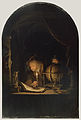
"Astronomer by candlelight"

Icon with globe

Wikipedia logo (with globe)

UN logo

National coat of arms of the Soviet Union with the globe

Earth and celestial globe in the coat of arms of Oberperfuss

Logo of the Natural Research Society of Emden from 1814.

Globe as a logo on the cover of the magazine Remarquable Curiosa from 1715 to 1727.

Globe as a hood ornament on the Ford Taunus 12M / 15M


Collections, museums and organizations

Because of their historical, cultural, aesthetic, material and scientific value, globes were and are collected by enthusiasts . Historical globes testify to a past understanding of the world and reflect the state of cartographic knowledge of their time and are therefore historical documents. They are geographical witnesses of past centuries, they convey the geographical worldview of their respective age. The history of the geographical discoveries can be traced on the earth globes. Globe collections can be found in museums, libraries (map departments), archives, but also by private collectors. When you collect globes, your main concern is the development of cartography.
The Austrian National Library in Vienna has had a globe museum since April 14, 1956 . Since December 2005, part of the collection has been exhibited in the Palais Mollard. The collection consists of over 700 globes and globe-related objects. This makes the collection the largest in the world. In addition, objects from a total of four private collectors who have made part of their collection available to the Globe Museum will also be presented. Among the objects there is also a globe by Gemma Frisius, which is also the oldest globe in Austria.
The National Maritime Museum in Greenwich , London , also houses a globe collection with 240 globes and 160 globe segments. The oldest globe dates from 1537. The smallest globe has a diameter of 7 cm (pocket globe), the largest globe a diameter of 1 m (library globe from Coronelli). You can also see Islamic celestial globes, some manuscript globes and many globes by the globe makers Gemma Frisius, Jodocus Hondius and Gerhard Mercator.
The Royal Geographical Society in London has a collection of old maps and globes ( map and globe collection ).
Yale University's Sterling Memorial Library Map Collection houses 30 globes in the Lanman Globe Collection .
The globe collection of the map department of the Berlin State Library includes globes from the German-speaking area from 1801 to 1912. As early as 1661 there were four globes in the library of the “Electoral Library” (later the Old Library ).
The globe collection of the Mathematisch-Physikalischer Salon in Dresden comprises 61 globes from 6 centuries.
Coronelli globes are exhibited in the treasure chamber of the Trier City Library .
The globe collection of the Kremsmünster observatory in Upper Austria comprises 49 globes.
In 1952 the International Coronelli Society for Globe Studies, named after Vincenzo Coronelli , the most famous globe maker, was founded in Vienna . It is dedicated to the Globes , the historical exploration of the globes. The Coronelli Society for Globe Studies publishes the magazine "Der Globusfreund: Scientific Journal for Globography and Instrument Studies" , which deals with globe and instrument studies.
literature
- Peter E. Allmayer-Beck, Models of the World: Earth and Celestial Globes. Cultural heritage from Austrian collections. , ISBN 3-85447-733-3
- Alois Fauser: Kulturgeschichte des Globus , Schuler Verlagsgesellschaft 1967, edition: Vollmer Verlag, Munich 1973
- Felix Lühning, Gottorf in the splendor of the Baroque IV, The Gottorfer Globus ... , Schleswig-Holsteinisches Landesmuseum, Gottorf Castle, 1997
- Andreas Riedl, Virtual Globes in Geovisualization , = Wiener Schriften zur Geographie und Kartographie, Volume 13, Vienna, 2000, ISBN 3-900830-41-X
- Ernst Schlee, The Gottorfer Globe Duke Friedrich III. , Boyens & Co. 1991, ISBN 3-8042-0524-0
- Jürgen Schweikart, Jonas Pieper, Bennet Schulte, Virtual Globes: Development History and Perspectives , Kartographische Nachrichten 03/2009, 59th year, Kirschbaum Verlag, Bonn, ISSN 0022-9164
- Jan Mokre (author), Peter Allmayer Beck (ed.): Around the globe: About earth and celestial globes and their representations. Verlag Bibliophile Edition, 2008, ISBN 978-3-9502052-3-7
- Daniel Fenning: A new and easy guide to the use of the globes , printed for S. Crowder (London), 1779
- Peter van der Krogt: Globi Neerlandici. The production of globes in the low countries. HES Publishers, Utrecht, 1993, ISBN 978-90-6194-138-5
- Elly Decker, Peter van der Krogt: Globes from the Western world. Zwemmer, London, 1993, ISBN 0-302-00618-4
- National Maritime Museum: An inventory of the navigation and astronomy collections in the National Maritime Museum. 1970 Greenwich
- Oswald Muris, Gert Saarmann: The globe through the ages. Berlin 1961, Columbus Verlag
- Wolfram Dolz, Esther Wipfler: Globus . In: RDK Labor (2015).
Web links
- Globe museum of the Austrian National Library
- coronelli.org - International Coronelli Society for Globe Studies
- Virtual globes - development history and perspectives (screenshots of virtual globes).
- Image gallery of globes in the David Rumsey Map Collection
- The Mainz celestial globe ( Memento from October 23, 2005 in the Internet Archive )
- Martin Waldseemueller globe 1507 with America
- A short cultural history of the globes at Monumente Online
- Globe production (1955) on YouTube
Individual evidence
- ↑ Nicolaus Bubnov (ed.): Gerberti opera mathematica (972-1003) . Berlin 1899, ep. 148
- ↑ January Kurlemann: Gerhard Mercator - Pioneer navigation system GPS. . www.belgieninfo.net, accessed on March 31, 2020.
- ↑ Doris Wolfangel: Dr. Melchior Ayrer (1520-1579). Medical dissertation Würzburg 1957, p. 36.
- ↑ Doris Wolfangel: Dr. Melchior Ayrer (1520-1579). Medical dissertation Würzburg 1957, p. 4, 30–32 and 34 f.
- ↑ A Globus terristris and a Globus coelestis, made by Bloen in Amsterdam around 1600. In the auction from July 10, 1826 in Nuremberg from the collection of the postmistress Schuster, who died in Nuremberg. Johann Lorenz Schmidmer (1779–1831): Directory of the collection of books, oil paintings, copperplate engravings, water and enamel paintings,… of the postmaster's postmistress Schustern, who died in Nuremberg, which… p. 22, items 67 and 68, Text Archive - Internet Archive .
- ↑ The Japanese advertise with the smallest globe in the world . heise online
- ↑ News Release 040202. ntt.co.jp
- ↑ Gottorf Castle - Baroque Garden & Globe House Schleswig ( Memento of the original from January 8, 2009 in the Internet Archive ) Info: The archive link has been inserted automatically and has not yet been checked. Please check the original and archive link according to the instructions and then remove this notice.
- ↑ Cornelis Koeman: Vander Maelen 1 . In: Atlantes Neerlandici . Bibliography of terrestrial, maritime and celestial atlases and pilot books, published in the Netherlands up to 1880. 1st edition. Volume III (Merula – Zeegers). Amsterdam 1969, p. 142 (English, XXVI + 220 pp, abbreviated source: Koeman VDM 1).
- ^ World's Largest World, Wellesley, Massachusetts
- ↑ Eartha, World's Largest Rotating Globe, Yarmouth, Maine
- ↑ Film about the modern globe production (English, 4:40 min; from the Chicago History Museum )
- ^ Geographical-artistic institute Ludwig Julius Heymann (1883–1930)
- ↑ The globe segments were designed by Henry Lange .
- ↑ Dietrich Reimer Verlag (1852–1960)
- ↑ Caspar Garthe: Description of the cosmoglobus, a mathematical-geographical-astronomical instrument which combines the earth and celestial spheres, such as the planetarium, tellurium and lunarium, in such a way that all phenomena of the world as a whole can be clearly seen. Cotta publishing house, 1833
- ↑ For a shrinking world. in: Popular Mechanics Magazin, Feb. 1946, pp. 50-53
- ^ Charles C. Lane: Development of spherical map sections and transparent conforming overlays. Engineer Research and Development Laboratories, Fort Belvoir, Va., March 1956, contrails.iit.edu ( Memento of the original from May 5, 2010 in the Internet Archive ) Info: The archive link has been inserted automatically and has not yet been checked. Please check the original and archive link according to the instructions and then remove this notice. (PDF; 4.6 MB) Page 317 bottom right
- ↑ fwkruecken.de
- ↑ Globensammlung of the Austrian National Library ( Memento of the original dated August 4, 2003 in the Internet Archive ) Info: The archive link was automatically inserted and not yet checked. Please check the original and archive link according to the instructions and then remove this notice.
- ^ The Lanman Globe Collection
- ↑ Kremsmünster globes inventory