
Eastern Gondwana
East Gondwana was the eastern part of the greater continent Gondwana and essentially consisted of the fragments of the supercontinent Rodinia Greater India, Proto- East Antarctica and Proto-Australia .
The evolution of East Gondwana is understood as a lengthy and large-scale geodynamic cycle of tectonic , magmatic , metamorphic and sedimentary processes with mountain formation or unfolding of orogenic belts with the closure of oceans. These belts contributed significantly to the formation of Eastern Gondwanas.
Pre-East Gondwanean geodynamic processes can be traced back to the Mesoproterozoic Era about 1600 million years ago (abbreviated mya ). The tectonic formation of Eastern Gondwana began in the Neoproterozoic from 650 mya and was largely completed in the early Phanerozoic , the lower Ordovician, around 470 mya.
Geological framework of East Gondwans
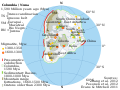
Hypothetical paleogeography of Columbia

Mutmaßiche Paleogeography Rodinia around 750 mya

Probable paleogeography of Pannotia around 550 mya


The formation of Eastern Gondwana is based on plate tectonic processes of global proportions, starting with the breakup of lithospheric plates (continental plates ) and the opening of intra-continental rift breaks up to the closing of the oceans that have formed . These processes, which correspond to the Wilson cycle , can be traced back to the developmental phases of the hypothetical supercontinent Columbia (presumably from around 2100 to 1800 mya), in which early continental masses of Proto-India, Proto-Australia and Proto-Antarctica were already present .
After the collapse of Columbia, the Grenville orogeny formed , which led to the formation of Rodinia (from approx. 1100 to 900 mya). This orogeny also had a significant impact on the configuration of Columbias Fragments to eastern Gondwana. With the disintegration of Rodinia, Pannotia (from approx. 630 to 530 mya) formed with the major continent Gondwana as its most important continental mass. The latter consisted of East and West Gondwana. West Gondwana contained the land masses from which today's continents Africa and South America were formed (see also → Pan-African orogeny and Brasiliano orogeny ). The Pan-African orogeny had an impact on the tectonic processes of Eastern Gondwana.
Oceans
The tectonic merger of the various continental masses to form East Gondwana was preceded by the opening of several oceans and their subsequent closure. Although the location and extent of most of them is not known in detail, their formation and closure can be inferred from structural (e.g. ophiolites ), petrological (e.g. oceanic lithosphere ) and marine sediments . The most important were the Mozambique Ocean, the Mawson Ocean, and the Proto-Pacific Ocean .

Mozambique belt with crust domains and ages

- The Mozambique Ocean spread between Greater India and the East African land masses. Its closure led u. a. between 650 and 620 mya for the formation of the Mozambique belt (see also → East African Orogen ). The southern extension of the Mozambique Ocean opened up between the Grunehogna craton (as part of the Kalahari or Kaapvaal craton ) (see → Grunehogna craton ) and the rest of East Antarctica, as demonstrated by ocean floor relics in the northern Shackleton Range.

East African Orogen and Kuunga Orogen

Abbreviations relating to East Gondwana: AFB = Albany-Fraser-Orogen (Australia); BH = Bunger Hills (East Antarctica); BR = Bongolava – Ranotsara Shear Zone (Madagascar); BS = Betsimisaraka suture zone (Madagascar); DDS = Darling – Denman Suture (East Antarctica – Australia); DG = Denman Glacier (East Antarctica); DMS = Dronning Maud-Suture (East Antarctica); EG = Eastern Ghats (India); HC = Highland Complex (Sri Lanka); LG = Lambert Graben (East Antarctica); LHB = Lützow-Holm-Gürtel (East Antarctica); MP = Queen Maud Land (East Antarctica); NC = Napier Complex (East Antarctica); nPCSM = Northern Prince Charles Mountains (East Antarctica); PBB = Prydz Bay Belt (East Antarctica); PC = Paughat – Cauvery (India); SR = Shackleton Range (East Antarctica); VC = Vijayan Complex (Sri Lanka); WC = Wanni Complex (Sri Lanka); WI = Windmill Islands (East Antarctica)
- The Mawson Ocean separated Greater India from the protocontinents of East Antarctica and Australia and from Southeast African crustal blocks. The closure of this ocean created collisions between these continental masses. This process is called Kuunga orogenesis. It occurred in the late Neoproterozoic to the earliest Paleozoic , the Cambrian , from about 570 to 530 mya.
- On the southern edges of Proto-East Antarctica and Proto-Australia, the Proto- Pacific Ocean opened up . The Ross and Delamara orogeneses formed here (see → Peripheral orogeneses ).
Continents and blocks of crust
The most important continental masses of East Gondwana were the Proto-Indian Subcontinent (here abbreviated Proto-India), East Madagascar, Sri Lanka , the Seychelles , Proto-East Antarctica and Proto-Australia . India, Eastern Madagascar, Sri Lanka and the Seychelles formed a contiguous continental mass at that time, which was called Greater India. Eastern Madagascar contains two Kraton fragments, the Antogil block, which were originally part of the Indian Dharwar kratons. The Betsimisaraka suture zone separates the Antogil block from the other Madagascan crustal units (see also → Antogil block ). Proto-East Antarctica and Proto-Australia also formed a geological unit that only began to disintegrate around 160 mya.
Greater India
Proto-India

Location of the Indian subcontinent
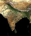
Satellite image of the Indian subcontinent

Geographical overview of the Indian subcontinent

Simplified geological map of the Indian subcontinent

Map of the states and union territories of India

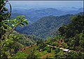
Dekkan traps in the Western Ghats near Matheran in Maharashtra state
_with_national_boundaries.png)


Proto-India forms the central crustal unit of Greater India and occupies a key position in the formation of Eastern Gondwanas. It is located in a kind of triple junction position between the early structures of Southeast Africa as well as East Antarctica and Australia. As a result of the closure of the Mozambique Ocean, the western area of India collided with Azania, a lithospheric plate broken off by Southeast Africa , also called Proto-Madagascar, and the Mozambique Belt , while the southern edge of India collided with the northern flank of East Antarctica and the southwestern areas of Australia, closing the Mawson Ocean collided.
Proto-India consists of a mosaic of several archaic basement units and paleoproterozoic to mesoproterozoic fold mountains or orogenic belt as well as several sedimentary basins. The orogenic belts were subject to tectono-thermal overprints during the formation of Eastern Gondwana. Large areas of western central India were covered by mighty flood basalt layers of the Dekkan-Trapps at the end of the chalk .
- Basement units
Proto-India's basement contains the archaic Dharwar, Bastar, Singhbhum, Rajasthan and Meghalaya cratons. The cratons consist mainly of TTG complexes with tonalites , trondhjemites and granodiorites as well as volcanic-sedimentary greenstone belts . They are often interspersed with granitic intrusions, shear zones , faults and orogenic belts of folds from deformed and metamorphosed Proterozoic rocks.

Location of the Indian state of Karnataka

Location of the Indian state of Telangana
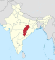
Location of the Indian state of Chhattisgarh

Location of the Indian state of Jharkhand

Location of the Indian state of West Bengal
.svg)


.svg)
.svg)
The first three cratons form a contiguous chain that extends from the central south to the northeast of India, which roughly corresponds to the states of Karnataka , Telangana , Chhattisgarh , Jharkhand and West Bengal . They are referred to as the southern protocontinent of India.
The Mesoproterozoic Chhotanagpur Granite-Gneiss Complex developed north of the Singhbhum Craton . Both are separated by the singhbhum belt. The igneous parent rocks (protoliths) formed in a continental expansion phase around 1450 mya. During the Rodinia formation they were deformed by 943 mya and metamorphically overprinted as a result of a continent / continent collision.

Location of the Indian state of Madhya Pradesh
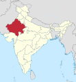
Location of the Indian state of Rajasthan .
.svg)
.svg)
The Rajasthan craton is located in the central northwest of the Indian subcontinent. This roughly corresponds to the northwest areas of the state of Madhya Pradesh and Rajasthan . The Kraton is composed of the Bundelkhand granite massif, also called Bundelkhand Kraton, and the Banded Gneissic complex. They form the northern Indian protocontinent. The two crustal blocks show similar petrographs with TTG complexes , greenstone belts and intrusions . They were subject to multiple deformations and metamorphoses. Their origins go back to the Paleo-Archean .
The Central India Tectonic Zone (CITZ) represents an outstanding geological unit of India, which extends in an east-northeast-west-southwest direction over a length of approx. 800 km and a width of approx. 400 km. It is criss-crossed by several rift breaks , lineaments , shear zones and faults , of which the Central Indian Geosuture represents the southernmost limit of the CITZ. This emerged as a result of subduction processes and collisions of the southeast Indian Dharwar, Bastar and Singhbhum cratons with the northwest Indian Rajasthan craton. The main collision phase and thus metamorphosis occurred around 1600 mya as part of the development of the supercontinent Columbia . With this the Indian subcontinent was united.

Location of the Indian state of Meghalaya
Location of the Indian state of Assam

Location of Karbi Anglong District / Assam
Location of the Indian state of Arunachal Pradesh

Satellite image of the Brahmaputra course (Assam valley) with the Shillong plateau

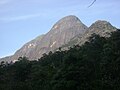
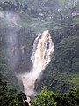
Rock formations at Cherrapunji / Shillong Plateau / Meghalaya
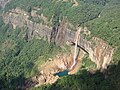
Nohkalikai Falls near Cherrapunji / Shillong Plateau / Meghalaya
.svg)
.svg)

.svg)


The Meghalaya craton is located in the extreme northeast of India in the Indian states of Meghalaya and Assam . Its formations appear in the Shillong Plateau / Meghalaya and in the Mikir Hills / Assam, also called Kabri Anglong Plateau, and in the Mishmi Hills / Arunachal Pradesh . These are limited in the north by the Brahmaputra . The oldest basement rocks form the archaic gneiss complex with an age between 2637 and 2230 mya. The overburden , which consists mainly of silica plastic , dates from 1700 to 1500 mya. It was deformed, folded and metamorphically overprinted several times. Various intrusions penetrated the basement and overburden between 1150 and 480 mya.
- Orogens
The orogenic belts surround the cratons and were created when they collided with one another or with other crustal blocks. The Eastern Ghats along the eastern flanks of the Dharwar and Bastor cratons, the Pandyan Belt within the Southern Granulite Terran and the Aravalli Mountains on the northwestern edge of the Rajasthan Craton are important for the formation of Eastern Gondwana .

Location of the state of Kerala

Location of the state of Tamil Nadu

Anamudi Mountains in the Cardamom Mountains / Kerala

Highest mountain peaks in the state of Kerala
Jambu Malai mountain formation in the Anaimalai Hills / Kerala and Tamil Nadu

Nagamalai Pudukottai rocks near Madurai / Tamil Nadu

Mountains in the Western Catchments area of the Nilgiris District / Tamil Nadu
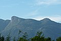
Akka Tangi rock formations in the Biligiriranga Hills near Tamil Nadu
.svg)
.svg)


The Southern Granulite Terran or Southern Granulite Belt formed at the southern end of the Dharwar Craton. It extends mainly into the states of Kerala and Tamil Nadu . The western, or northern, and the eastern, or southern, Madurai Province form the majority of the belt. The western province formed as an igneous island arch complex, which consists of 2530 to 2460 mya old Enderbites , which were highly metamorphic overprinted between 2470 and 2430 mya. The collision with the Dharwar craton took place from 2550 to 2520 mya with the formation of the Moyar-Bhavani-Cauvery suture zone. The eastern province emerged as an igneous island arch complex with a 1740 to 1620 mya old basement made of reworked archaic rock units. Above that, a mighty supracrustal sequence of predominantly siliciclastics arose , which was deposited in a shallow water area. The accretion of this province took place in the earliest Mesoproterozoic on the eastern edge of the western province, which had already collided with the Dharwar craton, forming the Karur-Kambam-Painavu-Trissur shear zone. Both blocks were subject to metamorphic influences during a rift phase between 830 and 780 mya, combined with massive intrusions. These tectonic processes are related to the developments of the supercontinent Columbia and Rodinia .
With the closure of the Mozambique Ocean, around 550 mya western areas of the Southern Granulite Terran collided with the southeastern structures of Azania and Madagascar under high-grade deformations, metamorphoses and intense intrusions. Eastern areas of the Southern Granulite Terran had tectonic contact with the Wanni Complex of Sri Lanka.

Location of the Indian state of Odisha
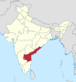
Location of the Indian state of Andhra Pradesh

Naglapeak / Eastern Ghats
Akka Tangi peaks of the Biligirirangans Mountains / Eastern Ghats

Javadi Hills in Tamil Nadu / Eastern Ghats
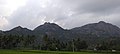
Kalvarayan hills / Eastern Ghats
.svg)


The Eastern Ghats (Engl .: Eastern Ghats Belt) extend approximately 930 kilometers parallel to the Bay of Bengal from the State Odishas in the north to about the place Vinjamur in the state of Andhra Pradesh in the south. This orogenic belt consists of a composition of deformed and highly metamorphosed mostly granulitic terranes, which are separated by a large number of shear zones and faults, and which have different geodynamic histories. The terranes were pushed onto the edges of the Dharwar, Bastor and Singhbhum cratons, where they form a fold and thrust belt with tectonic covers . It is divided from south to north into the Krishna, Jeypore, Eastern Ghats and Rengali provinces. The tectonic development occurred during a series of continental rift breaks, ocean floor spreading and subduction, and collisions between crustal blocks of Proto-India and Proto-East Antarctica. The southern areas developed between 1900 and 1300 mya. This period coincides with the existence and decay of the supercontinent of Columbia . The central sections show a development phase between 1500 and 900 mya, which correlates temporally with the Grenville orogeny and formation of the supercontinent Rodinia .
The East Ghats collided with the East Antarctic Napier Complex , the Rayner Complex and the geological structures of Prydz Bay , the southern Prince Charles Mountains and the Lützow-Holm Bay .

Location of the Indian state of Gujarat
Location of the Indian state of Rajasthan

Location of the Indian state of Haryana

Mountain ranges in the Aravalli Mountains / Rajasthan

Aravalli mountain ranges / Rajasthan

Arbuda Mountains in the Aravalli Mountains / Rajasthan

Idarberge rock formation in the Aravalli Mountains / Rajasthan

View of the Aravalli Mountains / Rajasthan
.svg)
.svg)


The approx. 700 kilometer long Aravalli Mountains (English: Aravalli – Delhi Belt) formed in the northwest of Proto-India. It is a multi-subdivided orogenic belt of folds in today's northwest India and runs in almost parallel strips in southwest / northeast direction from the extreme north of the state of Gujarat through all of Rajasthan to Haryana , where it gradually merges into the Ganges plain . This mountain range is made up of the sedimentary Aravalli and Delhi belts. They developed in continental rift systems between the eastern Bundelkhand granite massif and the western Banded Gneissic complex and these rifts closed again. The first development phase began between 2500 and 1900 mya with spreading processes and deposition of the sedimentary, later metamorphically overprinted, Aravalli supergroup. Around 1800 mya the basin closed again, unfolding the Aravalli belt with the formation of the Aravalli geosuture. The Aravalli Belt forms the southeastern section of the Aravalli Mountains. New basins opened from 1900 to 1600 mya. It was in these rifts that the Delhi super group emerged. Between 1500 and 1400 mya these basins closed again, whereby these deposited sediments were unfolded with the formation of the Delhi geosuture. The Delhi Belt represents the western and northern sections of the Aravalli Mountains. All formations were heavily metamorphosed up to 900 mya. Postorogenic magmatic events occurred between 850 and 750.
Eastern Madagascar

Location of Madagascar

Topography of Madagascar
.svg)

Madagascar contains two crustal blocks that were of particular importance in the formation of Eastern Gondwana: the neo-archaic Antananarivo kraton or block in the center and the Antogil block, which emerges in the central east and north-east. The Antananarivo craton corresponds to Azania, a lithospheric plate broken off from the eastern African flank . The Antogil block consists of the Antogil kraton and the Masora kraton and was originally part of the western Indian Dharwar kraton. It is the oldest Madagascan crust block and consists of up to 3320 mya old TTG complexes and up to 3178 mya overlying old metasediments. Between 2570 and 2147 mya, dykes and plutonites of various compositions intruded .
To the north of the Antogil block, the Bemarivo belt was created, which is a juvenile island-arch terran. This consists of the southern metasedimentary paragneiss terran with paleoproterozoic parent rocks and the northern terran of metamorphic supracrustal rocks with 750 to 720 mya old magmatic and magmatic-sedimentary sequences. The merger of the two terranos took place between 563 and 532 mya and both with the northern Madagascar craton area around 540 to 520 mya, each connected with magmatic intrusions. They are separated by a shear zone . The metamorphic rocks of the northern terran can be associated with the Seychelles and north-west India .
The wide Betsimisaraka- Geosuturzone separates the Antananarivo craton from Antogil block and the Bemarivo belt. The suture zone consists of metasediments that originate from the Indian Dharwar craton and were deposited between 800 and 550 mya as well as the remains of an oceanic lithosphere. It represents the collisions of the Antogil block and the Bemarivo belt with the Antananarivo kraton, which occurred between 630 and 530 mya.
Sri Lanka

Location of Sri Lanka

Topography of Sri Lanka

Map of the political provinces of Sri Lanka

Satellite image of the Adam's Bridge between Sri Lanka and South India

Bible Rock rock formations in the Wanni Complex in the Kegalle District / Sri Lanka

Rock formations in the Highland Complex in Nuwara Eliya District / Sri Lanka

Dunsiane Waterfall in the Highland Complex near Nuwara Eliya in the Central Province / Sri Lanka
Devon waterfall in the Highland Complex near Nuwara Eliya in the Central Province / Sri Lanka

Mountain formations in the Vijayan Complex near Ella in the Badulla District / Sri Lanka
Mountain formations in the Vijayan Complex near Wellawaya in the Moneragala District / Sri Lanka
.svg)


Sri Lanka is located in the Indian Ocean , southeast of the Indian subcontinent . Currently, the coral rock islands of the Adam's Bridge represent a loose connection between the northwest of Sri Lanka and the southern Indian mainland. Sri Lanka contains three different tectonic provinces: the west to northern Wanni, the central Highland, which stretches from the southwest to the northeast, and the southeastern Vijayan. Complex.
The Highland Complex consists mainly of granitic / igneous rock ( Charnockite ) as well as differently composed supracrustal sediment packages into which granitoid and basaltic intrusions penetrated several times. The age of these sediments dates between 3100 and 2000 mya. The high-grade metamorphosis took place from 550 to 540 mya.
The Wanni and Vijayan complexes are between 1900 and 1000 mya. The Vijayan Complex contains mostly granitoids that originated from an active continental margin. They were metamorphically overprinted to a low degree between 558 and 465 mya. The Wanni complex consists mainly of various gneisses and migmatites as well as 1040 to 750 mya old intrusions. The Vijayan Complex was pushed onto the Highland Complex and forms tectonic nappes there .
It is believed that the Vijayan Complex correlates with the Yamato-Belgica Complex , the Highland Complex with the Lutzöw-Holm Complex, and the Wanni Complex with the Rayner Complex in the East Antarctic region of Enderbyland .
Seychelles

Location of the Seychelles

Seychelles archipelago

Takamaka beach bay / Mahé (Seychelles)

Morne Seychellois, the highest mountain on the main island of Mahé (Seychelles)

Praslin Island / Seychelles

Aerial view of the island of La Digue / Seychelles

Silhouette Island / Seychelles

Saint-Pierre Island (Seychelles)

Ave Maria Cocos Island / Seychelles

Panorama of the island of Anse / Seychelles
.svg)

.jpg)
.JPG)

.jpg)

.jpg)
.jpg)
The Seychelles belong topographically to Africa. South of the Seychelles and off the East African coast lie the island states of Madagascar , Mauritius and the Comoros . The Seychelles form a group of islands made up of the Inner Islands, also known as Granitic Seychelles, and the Outer Islands. The Inner Islands consist of around 42 islands, of which Mahé , Praslin and La Digue are the largest. The Outer Islands comprise about 73 coral reef islands ( atolls ); they have no relation to Eastern Gondwana.
The Inner Islands are dominated by undeformed, differently colored granites. They can be geochemically and isotopically divided into two groups, which suggest different sources of the earth's crust. Locally the granites were penetrated by mafic dykes , which are similar in age to the granites. The granites are petrological , geochemical and age similar to those found in northeast Madagascar and northwest India. It is believed that they originated in a subduction zone along an active continental margin of Rodinia. Between 67 and 61 mya, volcanic complexes formed, forming the islands of Silhouette and North Island . These events are assigned to the occurrence of the Dekkan trap .
Rocks in the Seychelles correlate with those in the northern terran of the Malagasy Bemarivo belt.
Proto-East Antarctica

Present situation of the Antarctic

Map of Antarctica with East Antarctica and the surrounding waters
.svg)

- Basement

Simplified geological map of the East Antarctic Mawson Craton and the Australian Grawler Craton

Geological map of the Grunehogna craton and its surroundings

View from the north of Stinear Lake and the Vestfold Mountains

Transantarctic Mountains in Northern Victoria Land
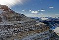
Aerial view of the Transantarctic Mountains
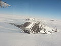
Aerial view of the Thiel Mountains

Coastal area of the American highlands with Princess Elizabeth Land , Kaiser Wilhelm II Land and Queen Marie Land

Landsat satellite map of the Lambert Glacier


The basement of Proto-East Antarctica includes the Mawson craton , the Grunehogna craton , the Napier craton , and the Crohn craton . Other small crystallized and exposed areas are the southern edge of the Shackleton Range , the Vestfold Hills ( Vestfold Mountains ), the mouth of the Denman Glacier and the Bertrab , Littlewood and Moltke outcrops near the southeast coast of the Weddell Sea .
The Mawson Craton is the largest East Antarctic craton and appears along the Wilkesland , Adélieland and George V coasts , which are opposite Australia. Further outcrops are on the back of the Ross orogen or the central Transantarctic Mountains that were later formed . It also occurs at the rear of the Transantarctic Mountains in the Geologists Range , the Miller Range and in the eastern Thiel Mountains under its otherwise almost complete ice cover. The Mawson Kraton is made up of crust fragments of old, highly metamorphic gneisses, granulites and enderbites , which date between 2560 and 1700 mya. In the eastern part of the Thiel Mountains there are flat-lying sediments. The Mawson Craton was formerly tectonically connected to today's Australian Gawler Kraton .
The Crohn Craton is open in the area between Mac Robertson Land , Princess Elizabeth Land and the American Highlands . Only the southern Prince Charles Mountains on both sides of the Lambert Glacier are definitely critical . The main rocks of the Crohn's craton are 3,000 mya old ortho gneisses . How far the craton extends into the interior of East Antarctica is unknown because of the ice cover.
The Grunehogna Kraton occurs as a small outcrop in the westernmost Queen Maud Land . The granitic basement dates back to 3000 mya, on which 1000 mya of old undeformed sediments rest. This kraton appears to be a small fragment of the African Kaapvaal kraton .
The Napier Craton, or Napier Complex, appears in the form of the Napier Mountains in Enderbyland and was presumably a fragment of the Indian Dharwar craton. The highly metamorphic gneisses, granulites and enderbites are between 3800 and 2500 mya.
- Orogens

Location of Queen Maud Land
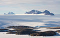
Partial view of the Shackleton Range
Satellite image of the ice-covered Enderbyland

Satellite image of un-ice-covered rocks in the Sør Rondane Mountains

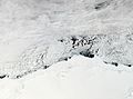
Satellite image of the Bunger Hills
Australian Mawson Station on Welch Island (Antarctica) off the coast of Mac Robertson Land

Location of the Wilkesland

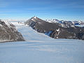
Northwest end of the Mühlig-Hofmann Mountains with the Hoggestabben (left) and the Hochlinfjellet (right)


_(cropped).jpg)


The basement mountains of Proto-East Antarctica were tectonically combined in three orogenic phases.
The Maud Belt , which developed at the end of the Mesoproterozoic around 1100 mya, represents the geosuture between the Grunehogna Craton on the one hand and the Crohn Craton with the southern Shackleton Range on the other. It stretches from Coatsland over the western to the eastern Queen Maud -Land and includes the Heimefrontfjella , Kirwanveggen , Sverdrupfjella , Mühlig-Hofmann Mountains , Wohlthatmassiv , Schirmacher-Oase , Sør Rondane and the Yamato-Belgica complex . The Maud Belt is an orogenic belt, which consists mainly of igneous-volcanic island arch components and has been severely deformed and metamorphosed several times.
The Rayner Belt emerges in the northern Prince Charles Mountains and the Rayner Complex and connects the Napier Complex with the Crohn Craton (southern Prince Charles Mountains) in Enderbyland , Kempland and Mac-Robertson Land . The granitic belt was formed during an accretion phase in the late Mesoproterozoic, during which the rocks were highly tectono-thermally revised.
Wilkes Province appears in the Bunger Hills and Windmill Islands of Wilkesland . This province welds the Mawson-Kraton with the part of the Crohn-Kraton possibly reaching to Queen-Marie-Land or with the Vestfold Mountains . The province was subject to high-grade deformations and metamorphoses between 1330 and 1280 mya and between 1200 and 1130 mya. It correlates with the Australian Albany Fraser Belt, which connects the Gawler Kraton with the Yilgarn Kraton.
Proto-Australia

Current situation of Australia
_(Oceania_centered)_with_borders.svg)
- Basement

Geological map of Australia

Location Western Australias

Location South Australias

Geological map of the Gawler Craton

Basalt columns of the Gawler Ranges in the Gawler Ranges National Park in the Gawler Kraton


The basement of Proto- Australia consists mainly of the Yilgarn-Kraton, the Pilbara-Kraton and the Gawler-Kraton , all archaic to paleoproterozoic ages.
The Yilgarn Craton is located in Southwest Australia. It was formed from several terrans, which accreted between 2940 and 2630 mya with the formation of folds and thrust belts. The Kraton is composed predominantly of highly metamorphosed granite / gneiss provinces and granite-greenstone belts. Their parent rocks date from 3200 to 2800 mya. The oldest zircons were between 4400 and 4270 mya.
The Pilbara Craton is located in Western Australia. Its exclusively archaic rocks date from 3600 to 2700 mya, similar to the Kaapvaal craton in South Africa. It is believed that both were part of the hypothetical original continent Vaalbara and Ur .
The Gawler Craton stretches across central South Australia and was originally part of the East Antarctic Mawson continent. Its basement units consist of archaic TTG complexes and gneisses that date from 3400 to 2560 mya. Proterozoic magmatic / sedimentary complexes also developed. The kraton is structured into several tectonic provinces and orogenic belts, which developed from 1855 to 1450 mya.
- Orogens
The tectonic union of Proto-Australia took place during several orogenic phases. The Western Australian craton formed as a result of the collision of the archaic Yilgarn and Pilbara cratons. The Capricorn orogen unfolded between them from 2215 mya. The South Australian kraton emerged from 1845 from the merger of the Gawler kraton and the Curnamona province along the Kimban orogen. The North Australian craton formed from 1880 mya from the accretion of several crust fragments with the formation of orrogens, which represent the corresponding geosutures.
Between 1300 and 1100 mya the western, northern and southern Australian cratons collided to the continent Proto-Australia, which was part of Rodinia. From 830 mya on, rifting began in Proto-Australia in connection with the decay of Rodinia.
Merger of Proto-India, Proto-East Antarctica and Proto-Australia
Suspected paleogeography of the supercontinent Columbia
Suspected paleogeography of the supercontinent Rodinias
Present situation of Antarctica
Map of Antarctica with East Antarctica
The now separate continents India, East Antarctica and Australia previously had a common geological history. This can be traced back to the time of the supercontinent Columbia and Rodinia.
The individual proto-continents India, East Antarctica and Australia united from the middle Mesoproterozoic to form a common, larger land mass . This period is roughly comparable to the Grenville orogeny , which led to the formation of Rodinias. The northeastern area of India, the Australian Yilgrin and Grawler cratons and the East Antarctic Mawson craton are significant for the merger. The Mawson-Kraton with the Terre Adélie-Kraton and the Gawler-Kraton are also called Mawson-Continent.
During the continental collisions, the Albany-Fraser Orogen and the Pinjarra Orogen formed, which occur today in the southern and western areas of Australia and on the edges of East Antarctica. Between India and Proto-Eastern Antactica, the Eastern Ghats and the Rayner Complex were tectono-thermal overprinted. Tectonic contacts between Proto-East Antarctica and the Kalahari Craton occurred along the fringes of Queen Maud Land , the Maud Belt and the Shackleton Range on the one hand and the Kaapvaal Kraton and the Namaqua Natal Belt on the other.

Location of the Australian Western Australia

Location of the Australian Northern Territory
Satellite image of the Bunger Hills / East Antarctica
Satellite image of the region around the Lambert Glacier / East Antarctica
Map of Antarctica with Wilkesland / East Antarctica

Satellite image of the Himalayas with the highlands of Tibet

Ganges with its tributaries


The approximately 1200 kilometers long Albany Fraser Orogen runs on the southern flank of the Yilgarn craton and connects to the Pinjarra Orogen in the west. The eastern extension is hidden under thick layers of sediment. The orogen is divided into the eastern Albany and western Fraser belts and other tectonic sub-units. It went through a multi-stage geodynamic development between 1350 and 1140 mya with the formation of different basins, subductions and accretions of island arch complexes. The parent rocks in the orogen are up to 3000 mya old and come from the Yilgrin craton or from up to 1388 mya old island arch complexes. The collision of the Yilgarn Craton with the East Antarctic Mawson Craton took place from 550 to 500 mya, with the processing of older structures and the rise of intrusions. The Albany-Fraser Orogen has an extension in the Bunger Hills and Windmill Islands in Wilkesland, East Antarctica .
The Pinjarra Orogen extends approximately 1000 kilometers almost entirely along the western flank of Australia and the Yilgarn craton. To the south it borders the Albany-Fraser Orogen. The Darling fault separates the orogen from the Yilgarn kraton. The Pinjarra Orogen appears in the form of three gneiss inliers ( island mountains ). The rest lies under Phanerozoic sediments. The parent rocks are between 2181 and 1130 mya, with the older ones descending from the Yilgarn Craton and the younger ones from the Albany-Fraser Orogen. The tectonic development is an expression of the collision of Western Australia with northeast India and the East Antarctic in the period from 1100 to 650 mya. The Indian segment of the Pinjarra orogen was subducted under the highlands of Tibet during the unfolding of the Himalayas or is hidden under sedimentary layers of the Ganges plain . The East Antarctic orrogen segment forms the area between the Denman Glacier and the Lambert Graben with the Lambert Glacier and is not exposed due to ice cover. During the collision of the Australian, Indian and East Antarctic continental masses, the inliers of the Pinjarra ore were tectono-thermally impressed between 550 and 500 mya.
The approx. 2000 km long Paterson Orogen appears on the eastern edge of the Pilbara Craton. It consists of three paleo- to mesoproterozoic magmatic and sedimentary, multiple deformed and metamorphosed basement ropes. The oldest protoliths are around 2300 mya. On these basement units, Neoproterozoic deposits formed in two sedimentary basins . These date between 850 and 830 mya. Foldings and low-grade metamorphoses took place around 650 mya, which were followed by further tectono-thermal overprints around 550 mya.
The Petermann Orogen, or the Petermann Ranges , extend about 320 kilometers from the east in central Western Australia to the southeast corner of the Northern Territory . It arose during the intra-continental Petermann orogenesis between 550 and 535 mya and led u. a. for the exhumation of the Mesoproterozoic Musgrave Bloc, which is regarded as an extension of the Albany-Fraser orogen and which comes to light as the Musgrave range .
Peripheral orogenesis
On the southern edge of eastern Gondwana, sedimentary basins formed on the continental edges during the disintegration of Rodinia during expansion regimes . They were caused by the transfer of tectonically conditioned tensions in the continental crust to the outer flanks of the continents. The Proto-Pacific also began to open up. These processes coincide with Rodinia's decay. Subsequent collision-related inversions of the stretching phases led to the East Antarctic Ross orogeny and Australian Delameric orogeny with the formation of the corresponding orogenes.
- Ross orogeny
Holmes Summit , the highest mountain in the Shackleton Ranges

Location of Viktorialand with Oatesland in the south
Pensacola Glacier in the Pensacola Mountains

Course of the Transantarctic Mountains

Rock formations of the Transantarctic Mountains in northern Victoria Land


The Ross orogeny occurred on the southern edge of Proto-East Antarctica. It was preceded by the expansion-related formation of oceanic basins in which marine sediment packages were deposited. When these basins closed, the Ross orogen formed. It stretches over a length of approximately 3400 kilometers between northern Victoria Land on the Pacific and the Pensacola Mountains on the Atlantic . It arose between 550 and 480 mya along a subduction zone on the east Antarctic active continental margin in connection with the accretion of several differently composed and metamorphic island arch complexes. It is generally characterized by granites, terranos, flysch and molasses-like sediments. Part of the Ross orogen is u. a. the Shackleton Range . In Oatesland , at the southern end of Victoria Land, symmetrical west and east thrusts have been discovered that can be traced into the Australian Delamerian orogen. The Ross Orogen forms the basement on which the Transantarctic Mountains developed from 65 mya .
- Delamerican orogeny
Location of the Australian state of South Australia

Location of Tasmania
Location of the Australian state of Victoria

Sedimentary cliff in the Mount Lofty Ranges / South Australia

Satellite image of the northern Flinders Range / South Australia
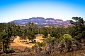
Rock formation in the Flinders Range / South Australia


.jpg)
The Delamerican Orogeny occurred on the southern edge of Proto-Australia. At the passive continental margins, the formation of large sedimentary basins began, in which an approx. 24 kilometers thick sediment pile of different compositions as well as rift-related volcanic rocks and igneous intrusions were deposited. Between 514 and 490 mya the strain inverted in a compression phase as a result of subduction which led to Delamerischen Orogenese with formation of considerable thrusts , folds , faults and domes . Rapid crust uplifts, expansion processes with post-orogenic igneous intrusions ended this phase. These structures are present in the approximately one thousand kilometers long and several hundred kilometers wide Adelaide Rift Complex as well as other orrogens in what is now Australia and Tasmania . The Adelaide Rift Complex extends north of Adelaide in the state of South Australia and further from western Tasmania , north-northwest towards western Victoria to north-central Australia. Eroded stumps now represent the Mount Lofty Ranges and Flinders Range , both in South Australia. This orogeny was accompanied by several intrusions, e. As the Granite in the cities of Victor Harbor and Palmer and the granite / gneiss complex of Mount Crawford near Williamstown in the southeastern Mount Lofty Ranges.
Web links
- Simon L. Harley, Ian CW Fitzsimons, Yue Zhao: Antarctica and supercontinent evolution: historical perspectives, recent advances and unresolved issues. In: Geological Society, London, Special Publications. 383, October 9, 2013, pp. 1-34. doi: 10.1144 / SP383.9 , alternatively
- TH Torsvik, C. Gaina, TF Redfield: Antarctica and Global Paleogeography: From Rodinia, Through Gondwanaland and Pangea, to the Birth of the Southern Ocean and the Opening of Gateways. In: The National Academies Press, Antarctica: A Keystone in a Changing World. Book excerpt
- MH Monroe: Antarctica - Before and After Gondwana. In: Australia: The Land Where Time Began, A biography of the Australian continent. Online article
- Evgeny Mikhalsky: Main Stages and Geodynamic Regimes of the Earth's Crust Formation in East Antarctica in the Proterozoic and Early Paleozoic. In: Geotectonics. Vol. 42, no. 6, 2008, pp. 413-429. doi: 10.1134 / S0016852108060010 , alternatively
Individual evidence
- ↑ ZX Li, SV Bogdanova, AS Collins, A. Davidson, B. De Waele, RE Ernst and others: Assembly, configuration, and break-up history of Rodinia: A synthesis. In: Precambrian Research. 160, 2008, pp. 179-210. doi: 10.1016 / j.precamres.2007.04.021 , alternatively
- ^ A b Alan S. Collins, Sergei A. Pisarevsky: Amalgamating eastern Gondwana: The evolution of the Circum-Indian Orogens. In: Earth Science Reviews. 71, 2005, pp. 229-270. doi: 10.1016 / j.earscirev.2005.02.004 , alternatively
- ^ Joseph G. Meert: A synopsis of events related to the assembly of eastern Gondwana. In: Tectonophysics. 362 (1), February 2003, pp. 1-40. doi: 10.1016 / S0040-1951 (02) 00629-7 , alternatively nio
- ↑ M. Santosh: India's Paleoproterozoic legacy. In: Geological Society London Special Publications. 365 (1), March 2012. doi: 10.1144 / SP365.14 , alternative
- ↑ B. Emmel, N. Jöns, A. Kröner, J. Jacobs, J.-A. Wartho, V. Schenk, T. Razakamanana, A. Austegard: From Closure of the Mozambique Ocean to Gondwana Breakup: New Evidence from Geochronological Data of the Vohibory Terrane, Southwest Madagascar. In: The Journal of Geology. volume 116, 2008, pp. 21-38. doi: 10.1086 / 524121 , alternatively
- ↑ Simon E. Williams, Joanne M. Whittaker, R. Dietmar Müller: Full-fit reconstructions of the southern Australian margin and Antarctica - implications for correlating geology between Australia and Antarctica. In: Eastern Australasian Basins Symposium IV. (PDF)
- ↑ Dilip Saha, Santanu Kumar Bhowmik, Sankar Bose, Krishnan Sajeev: Proterozoic Tectonics and Trans-Indian Mobile Belts: A Status Report. In: Proc Indian Natn Sci Acad. 82, no. 3, Spl Issue, July 2016, pp. 445-460. doi: 10.16943 / ptinsa / 2016/48460 , alternatively
- ↑ RS Sharma: Cratons and Fold Belts of India. In: Lecture Notes in Earth Sciences. 127. doi: 10.1007 / 978-3-642-01459-8 , download file
- ↑ Subham Mukherjee, Anindita Dey, Sanjoy Sanyal, Pulak Sengupta: Petrology and U-Pb geochronology of zircon in a suite of charnockitic gneisses from parts of the Chotanagpur Granite Gneiss Complex (CGGC): Evidence for the reworking of a Mesoproterozoic basement during the formation of the Rodinia supercontinent. In: Geological Society London Special Publications. 457 (1), SP457.6, April 2017. doi: 10.1144 / SP457.6 , alternative
- ↑ S. Mahato, S. Goon, A. Bhattacharya, B. Mishra, Heinz-J. Bernhardt: Thermo-tectonic evolution of the North Singhbhum Mobile Belt (eastern India): A view from the western part of the belt. In: Precambrian Research. Volume 162, Issues 1-2, April 5, 2008, pp. 102-127. doi: 10.1016 / j.precamres.2007.07.015 , alternatively
- ↑ Mohan lal Gupta, Shadi Sharma: Heat flow in Rajasthan Craton, North-Western Indian Shield and its Implications. In: International Journal of Terrestrial Heat Flow and Applied Geothermics. Vol. 1, No. 1, 2018, pp. 30-34. doi: 10.13140 / RG.2.2.25053.10721 , alternatively
- ↑ Santanu Kumar Bhowmik and Somnath Dasgupta: Tectonothermal evolution of the Banded Gneissic Complex in central Rajasthan, northwest India: Present status and correlation. In: Journal of Asian Earth Sciences. 49, 2012, pp. 339-348. doi: 10.1016 / j.jseaes.2011.07.025 , alternatively
- ↑ K. Naganjaneyulu, M. Santos: The Central India Tectonic Zone: A geophysical perspective on continental amalgamation along a Mesoproterozoic suture. In: Gondwana Research. Volume 18, No. 4, November 2010, pp. 547-564. doi: 10.1016 / j.gr.2010.02.017 , alternatively
- ↑ Sönke Brandt, Michael M. Raith, Volker Schenk, P. Sengupta and others: Crustal evolution of the Southern Granulite Terrane, south India: New geochronological and geochemical data for Felsic orthogneisses and granites. In: Precambrian Research. 246, January 2014, pp. 91-122. doi: 10.1016 / j.precamres.2014.01.007 , online article
- ↑ Somnath Dasgupta, Sankar Bose, Kaushik Das: Tectonic evolution of the Eastern Ghats Belt, India. In: Precambrian Research. Volume 227, April 2013, pp. 247-258. doi: 10.1016 / j.precamres.2012.04.005 , alternatively
- ↑ a b Tomokazu Hokada, Simon Leigh Harley: Zircon growth in UHT leucosome: constraints from zircon − garnet rare earth elements (REE) relations in Napier Complex, East Antarctica. In: Journal of Mineralogical and Petrological Sciences. Volume 99, Special Issue, 2004, pp. 180-190. doi: 10.2465 / jmps.99.180 , alternatively
- ↑ Evgeny Mikhalsky, JW Sheraton: The Rayner tectonic Province of East Antarctica: compositional features and Geodynamic setting. In: Geotectonics. 45 (6), November 2011. doi: 10.1134 / S0016852111060057 , alternative
- ↑ Xiaohan Liu: Polymetamorphism of the Prydz Belt, East Antarctica: Implications for the reconstruction of the Rodinia and Gondwana supercontinents. In: Article in Acta Petrologica Sinica. 25 (8), August 2009, pp. 1808-1818. (researchgate.net)
- ↑ Yusuke Takamura, Toshiaki Tsunogaea, M. Santosh, YukiyasuTsutsumi: Detrital zircon geochronology of the Lützow-Holm Complex, East Antarctica: Implications for Antarctica – Sri Lanka correlation. In: Geoscience Frontiers. Volume 9, No. 2, March 2018, pp. 355–375. doi: 10.1016 / j.gsf.2017.08.006 , alternatively
- ^ V. Vijaya Rao, Rajendra Prasad Bitragunta, PR Reddy, HC Tewari: Evolution of Proterozoic Aravalli Delhi Fold Belt in the northwestern Indian Shield from seismic studies. In: Tectonophysics. 327 (1), Nov. 2000, pp. 109-130. doi: 10.1016 / S0040-1951 (00) 00156-6 , alternatively
- ↑ Sheree Armistead, Alan Collins, Ahmad Redaa, Sarah Gilbert and others: Structural evolution and medium-temperature thermochronology of central Madagascar: implications for Gondwana amalgamation. In: Journal of the Geological Society. January 8, 2019. Article
- ^ DI Schofield, Bob Thomas, Kathryn M. Goodenough, Bert De Waele: Geological evolution of the Antongil Craton, NE Madagascar. In: Precambrian Research. October 2010. doi: 10.1016 / j.precamres.2010.07.006 , alternatively
- ^ RJ Thomas, B. De Waele, DI Schofield, KM Goodenough, M. Horstwood and others: Geological evolution of the Neoproterozoic Bemarivo Belt, northern Madagascar. In: Precambrian Research. Volume 172, No. 3-4, August 2009, pp. 279-300. doi: 10.1016 / j.precamres.2009.04.008 , alternatively
- ↑ LD Ashwal, D. Demaiffe, TH Torsvik: Petrogenesis of Neoproterozoic Granitoids and Related Rocks from the Seychelles: the Case for an Andean-type Arc Origin. In: Journal of Petrology. Volume 43, No. 1, January 1, 2002, pp. 45-83. doi: 10.1093 / petrology / 43.1.45 , alternatively
- ↑ RD Tucker, JY Roig, C. Delor, Y. Amelin, P. Goncalves and others: Neoproterozoic extension in the Greater Dharwar Craton: a reevaluation of the `` Betsimisaraka suture '' in Madagascar. In: NRC Research Press website. April 12, 2010. doi: 10.1139 / E10-034 , alternatively
- ↑ V. Mathavan, WKBN Prame, PG Cooray: Geology of the High Grade Proterozoic terrains of Sri Lanka, and the Assembly of Gondwana: an Update on Recent Developments. In: Gondwana Research. Volume 2, No. 2, April 1999, pp. 237-250. doi: 10.1016 / S1342-937X (05) 70148-9 , alternative
- ↑ X. Nogi, W. Jokat, K. Kitada, D. Steinhage: Geological structures inferred from airborne geophysical surveys around Lützow-Holm Bay, East Antarctica. In: Precambrian Research. 234, pp. 279-287. Online article
- ↑ RD Tucker, LD Ashwal, TH Torsvik: U ^ Pb geochronology of Seychelles granitoids: a Neoproterozoic continental arc fragment. In: Earth and Planetary Science Letters. 187, 2001, pp. 27-38. (PDF)
- ^ Georg Kleinschmidt: Geological development and tectonic structure of the Antarctic. In: Warning signal climate: The polar regions. Scientific evaluations, Hamburg 2014, ISBN 978-3-9809668-6-3 . (PDF)
- ↑ Yebo Liu, Zheng-Xiang Li, Sergei A. Pisarevsky, Uwe Kirscher and others: First Precambrian palaeomagnetic data from the Mawson Craton (East Antarctica) and tectonic implications. Article | OPEN | Published: 06 November 2018. In: Scientific Reportsvolume 8. Article number: 16403 (2018). doi: 10.1038 / s41598-018-34748-2 , alternatively
- ↑ Avinash Bisnath, Hartwig E. Frimmel: Metamorphic evolution of the Maud Belt: P-T-t path for high-grade gneiss in gjelsvik mountains, Dronning Maud Land, East Antarctica. In: Journal of African Earth Sciences. Volume 43, No. 5, December 2005, pp. 505-524. doi: 10.1016 / j.jafrearsci.2005.09.007 , alternatively
- ↑ EV Mikhalsky, F. Henjes Art, BV Belyatsky, NW Roland, SA Sergeev: New Sm-Nd, Rb-Sr, Pb and Hf isotope U-systematics for the southern Prince Charles Mountains (East Antarctica) and its tectonic implications. In: Precambrian Research. 182 (1-2), September 2010, pp. 101-123. doi: 10.1016 / j.precamres.2010.07.004 , alternatively
- ^ MH Monroe: Yilgarn Craton, Western Australia. In: Australia: The Land Where Time Began, A biography of the Australian continent. Online article
- ^ David Wacey: Earliest evidence for life on Earth: An Australian perspective. In: Australian Journal of Earth Sciences. 59 (2), March 2012, pp. 153-166. doi: 10.1080 / 08120099.2011.592989 , alternatively
- ↑ The Gawler Craton is an extensive region of Archaean to Mesoproterozoic crystalline basement underlying approximately 440,000km² of central South Australia. In: Geology of South Australia. Online article
- ^ John S. Myers, Russell Douglas Shaw, Ian M Tyler: Tectonic evolution of Proterozoic Australia. In: Tectonics. 15 (6), December 1996, pp. 1431-1446. doi: 10.1029 / 96TC02356 , alternatively
- ↑ Capricorn Orogen. In: Geological Survey of Western Australia, Geology and geophysics GSWA Projects. Online article
- ^ RJ Korsch, Wolfgang Preiss, Richard Blewett, Adrian J. Fabris and others: Geological interpretation of deep seismic reflection and magnetotelluric line 08GA-C1: Curnamona Province, South Australia. In: South Australian Seismic and MT Workshop 2010. Online article, download possible
- ^ Anthony J. Reid, Stacey O. McAvaney, Geoff L. Fraser: Nature of the Kimban Orogeny across northern Eyre Peninsula. In: MESA Journal. 51 December 2008. (PDF)
- ^ Ian CW Fitzsimons: Proterozoic basement provinces of southern and southwestern Australia, and their correlation with Antarctica. In: Geological Society London Special Publications. 206 (1), January 2003, pp. 93-130. doi: 10.1144 / GSL.SP.2003.206.01.07 , alternatively
- ↑ Justin L. Payne, Martin Hand, Karin M. Barovich, Anthony Reid, David AD Evans: Correlations and reconstruction models for the 2500-1500 Ma evolution of the Mawson Continent. In: Geological Society, London, Special Publications. v. 323, 2009, pp. 319-355. doi: 10.1144 / SP323.16 , alternatively
- ↑ David H. Cornell, Bob Thomas, HFG Moen, DL Reid and others: The Namaqua-Natal Province. In: Geology of South Africa. January 2006. Article
- ^ Ian CW Fitzsimons, Craig Buchan: Geology of the western Albany – Fraser Orogen, Western Australia - a field guide. In: Book, September 2005, from Geological Survey of Western Australia, Record 2005/11. OCLC 756914962 . Online article
- ↑ Vanessa Markwitz, Christopher L. Kirkland, Noreen J. Evans: Early Cambrian metamorphic zircon in the northern Pinjarra Orogen: Implications for the structure of the West Australian Craton margin. In: Lithosphere. 9 (1), 2017, pp. 3–13, Research Article, February 1, 2017. doi: 10.1130 / L569.1 , alternative
- ↑ Karol Czarnota, Ed Gerner, David W Maidment, Anthony J Meixner, Leon Bagas: Paterson Area 1: 250,000 Scale Solid Geology Interpretation and Depth to Basement Model. In: Geoscience Australia, Record 2009/16. (PDF)
- ↑ Tom Raimondo, Alan S. Collins, Martin Hand, Althea Walker-Hallam and others: The anatomy of a deep intracontinental orogen. In: Tectonics. Vol. 29, TC4024, 2010. doi: 10.1029 / 2009TC002504 , alternative
- ^ Stress and Strain. In: Lumen Geology, Module 7: Crustal Deformation. Online article
- ^ John W. Goodge: Metamorphism in the Ross orogen and its bearing on Gondwana margin tectonics. In: Geological Society of America, Special Paper 419, 2007. (PDF)
- ↑ TM Willa, A. Zeha, A. Gerdes, HE Frimmel, IL Millar, E. Schmädicke: Palaeoproterozoic to Palaeozoic magmatic and metamorphic events in the Shackleton Range, East Antarctica: Constraints from zircon and monazite dating, and implications for the amalgamation of Gondwana. In: Precambrian Research. Volume 172, No. 1-2, July 2009, pp. 25-45. doi: 10.1016 / j.precamres.2009.03.008 , alternatively
- ↑ John Foden, Marlina A. Elburg, Jon Dougherty-Page, Andrew Burtt: The timing and duration of the Delaware Merian Orogeny: Correlation with the Ross Orogen and Implications for Gondwana assembly. In: The Journal of Geology. volume 114, 2006, pp. 189-210. (PDF)