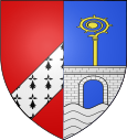
Pont-l'Évêque (Oise)
| Pont-l'Évêque | ||
|---|---|---|

|
|
|
| region | Hauts-de-France | |
| Department | Oise | |
| Arrondissement | Compiègne | |
| Canton | Noyon | |
| Community association | Pays Noyonnais | |
| Coordinates | 49 ° 34 ′ N , 2 ° 59 ′ E | |
| height | 36-44 m | |
| surface | 1.13 km 2 | |
| Residents | 672 (January 1, 2017) | |
| Population density | 595 inhabitants / km 2 | |
| Post Code | 60400 | |
| INSEE code | 60506 | |
Pont-l'Évêque is a French municipality with 672 inhabitants (as of January 1 2017) in the department of Oise in the region of Hauts-de-France . It belongs to the canton of Noyon and the municipality association Pays Noyonnais . The inhabitants are called Pontépiscopois .
geography
Pont-l'Évêque is located in the Pays Noyonnais about 22 kilometers northeast of Compiègne on the Canal du Nord and the Canal latéral à l'Oise . The Verse River runs along the eastern parish boundary . Pont-l'Évêque is surrounded by the neighboring communities of Noyon in the north and east, Sempigny in the south and south-east and Passel in the west and south-west.
Population development
| year | 1962 | 1968 | 1975 | 1982 | 1990 | 1999 | 2006 | 2013 |
|---|---|---|---|---|---|---|---|---|
| Residents | 622 | 656 | 663 | 596 | 659 | 803 | 739 | 689 |
| Source: Cassini and INSEE | ||||||||
Attractions
- church
Web links
Commons : Pont-l'Évêque - Collection of images, videos and audio files
- Monuments historiques (objects) in Pont-l'Évêque (Oise) in the base Palissy of the French Ministry of Culture
