
User talk:87.185.181.95 and Portland, Oregon: Difference between pages
Ridge Runner (talk | contribs) October 2008 |
Undid revision 244378653 by Michellecrisp (talk) not POV. |
||
| Line 1: | Line 1: | ||
{{verylong}} |
|||
== October 2008 == |
|||
{{Infobox Settlement |
|||
[[Image:Nuvola apps important.svg|25px]] Please stop. If you continue to [[Wikipedia:What Wikipedia is not#Wikipedia is not a soapbox|add promotional material to Wikipedia]]{{#if:|, as you did to [[:{{{1}}}]]}}, you will be [[Wikipedia:Conflict of interest#Blocks|blocked]] from editing. {{#if:|{{{2}}}|}}<!-- Template:Uw-advert3 -->--[[User:Flash176|Flash176]] ([[User talk:Flash176|talk]]) 16:21, 10 October 2008 (UTC) |
|||
|official_name = City of Portland |
|||
|settlement_type = [[City]] |
|||
|nickname = <!-- please don't add nicknames without reviewing discussion on talk page first --> "Rose City," "[[Stumptown]]," "Bridgetown," "P-town," "[[Rip City]]," "[[PDX]]", and "Little Beirut"<ref name="Oregonian1">{{cite news |
|||
|last=McCall |
|||
|first=William |
|||
|title='Little Beirut' nickname has stuck |
|||
|work=[[The Oregonian]] |
|||
|date=August 19, 2003 |
|||
|accessdate=2007-01-21 |
|||
}}</ref> |
|||
|website = http://www.portlandonline.com/ |
|||
|image_skyline = Portland panorama3.jpg |
|||
|imagesize = |
|||
|image_caption = |
|||
|image_flag = Flag of Portland, Oregon.svg |
|||
|image_seal = Seal of Portland OR.png |
|||
<!-- see http://factfinder.census.gov/servlet/ACSSAFFFacts?_event=Search&geo_id=&_geoContext=&_street=&_county=Portland&_cityTown=Portland&_state=04000US41&_zip=&_lang=en&_sse=on&pctxt=fph&pgsl=010 for more detailed map that is public domain --> |
|||
|image_map = Multnomah_County_Oregon_Incorporated_and_Unincorporated_areas_Portland_Highlighted.svg |
|||
|mapsize = 250px |
|||
|map_caption = Location of Portland in [[Multnomah County, Oregon|Multnomah County]] and the state of [[Oregon]] |
|||
|image_map1 = |
|||
|mapsize1 = |
|||
|map_caption1 = |
|||
|subdivision_type = [[List of countries|Country]] |
|||
|subdivision_type1 = [[Political divisions of the United States|State]] |
|||
|subdivision_type2 = [[List of counties in Oregon|Counties]] |
|||
|subdivision_name = [[United States]] |
|||
|subdivision_name1 = [[Oregon]] |
|||
|subdivision_name2 = [[Multnomah County, Oregon|Multnomah]], [[Washington County, Oregon|Washington]], [[Clackamas County, Oregon|Clackamas]] |
|||
|government_type = [[City commission government|Commission]] |
|||
|leader_title = [[Mayor]] |
|||
|leader_name = [[Tom Potter]]<ref>{{cite web |url=http://www.portlandonline.com/index.cfm?c=25999 |title=Elected Officials |accessdate=2007-08-26 |year=2007 |publisher=City of Portland, Oregon}}</ref> |
|||
|leader_title1 = Commissioners |
|||
|leader_name1 = [[Sam Adams (Oregon politician)|Sam Adams]]<br/>[[Randy Leonard]]<br/>[[Dan Saltzman]]<br/>[[Nick Fish]] |
|||
|leader_title2 = Auditor |
|||
|leader_name2 = [[Gary Blackmer]] |
|||
|established_title = [[Municipal corporation|Incorporated]] |
|||
|established_date = [[February 8]] [[1851]] |
|||
|area_magnitude = 1 E8 |
|||
|area_total_km2 = 376.5 |
|||
|area_total_sq_mi = 145.4 |
|||
|area_land_km2 = 347.9 |
|||
|area_land_sq_mi = 134.3 |
|||
|area_water_km2 = 28.6 |
|||
|area_water_sq_mi = 11.1 |
|||
|population_as_of = 2007 |
|||
|population_total = 568,380 ([[List of United States cities by population|30th]]) |
|||
|population_metro = 2,159,720 |
|||
|population_density_km2 = 1640.30 |
|||
|population_density_sq_mi = 4199.17 |
|||
|timezone = [[Pacific Standard Time Zone|PST]] |
|||
|utc_offset = -8 |
|||
|timezone_DST = [[Pacific Daylight Time|PDT]] |
|||
|utc_offset_DST = -7 |
|||
|postal_code_type = [[ZIP code]]s |
|||
|postal_code = 97086-97299 |
|||
|area_code = [[Area codes 503 and 971|503/971]] |
|||
|latd = 45 |latm = 31 |lats = 12 |latNS = N |
|||
|longd = 122 |longm = 40 |longs = 55 |longEW = W |
|||
|elevation_m = 15.2 |
|||
|elevation_ft = 50 |
|||
|blank_name = [[Federal Information Processing Standard|FIPS code]] |
|||
|blank_info = 41-59000{{GR|2}} |
|||
|blank1_name = [[Geographic Names Information System|GNIS]] feature ID |
|||
|blank1_info = 1136645{{GR|3}} |
|||
|footnotes = |
|||
}} |
|||
'''Portland''' is a city located in the [[Northwestern United States|Northwestern]] [[United States]], near the [[confluence]] of the [[Willamette River|Willamette]] and [[Columbia River|Columbia]] rivers in the state of [[Oregon]]. It has an estimated population of 568,380,<ref>{{cite web |title=2007 Oregon Population Report |publisher=Population Research Center |url=http://www.pdx.edu/media/p/r/PRC_2007_Population_Report2_rev.pdf |accessdate=2008-07-06}}</ref> and has been referred to as the greenest city in the United States.<ref>{{cite web |url=http://www.grist.org/news/maindish/2007/07/19/cities/ |title=15 Green Cities |accessdate=2008-07-08 |author=Kate Sheppard |date=2007-07-19 |publisher=Environmental News and Commentary }}</ref> Portland is Oregon's most populous city, and the third most populous city in the [[Pacific Northwest]], after [[Vancouver]], [[British Columbia]], and [[Seattle, Washington|Seattle]], [[Washington]]. Approximately two million people live in the [[Portland metropolitan area]] ([[United States metropolitan area|MSA]]), the [[List of United States metropolitan areas|23rd most populous]] in the [[United States]] as of July 2006.<ref>{{cite web|title=JULY 1, 2006 Population estimates for Metropolitan Combined Statistical Areas| publisher=U.S. Census Bureau|url=http://www.census.gov/population/www/estimates/metro_general/2006/CBSA-EST2006-01.csv|format=[[csv]]|accessdate=2007-10-19}}</ref> |
|||
Portland was incorporated in 1851 and is the [[county seat]] of [[Multnomah County, Oregon|Multnomah County]].{{GR|6}} The city extends slightly into [[Washington County, Oregon|Washington County]] to the west and [[Clackamas County, Oregon|Clackamas County]] to the south. It is governed by a [[City commission government|commission-based government]] headed by a mayor and four other commissioners. |
|||
The city and region are noted for strong land-use planning<ref name="smartplan"/> and investment in [[public transport|public transit]], supported by [[Metro (Oregon regional government)|Metro]], a distinctive regional-government scheme. Portland is also known for its large number of [[microbrewery|microbreweries]] and [[microdistillery|microdistilleries]], and as the home of the [[Portland Trail Blazers|Trail Blazers]] [[National Basketball Association|NBA basketball]] team. |
|||
Portland lies in the [[Marine west coast]] climate region, marked by warm summers and rainy but temperate winters. This climate is ideal for growing [[rose]]s, and for more than a century, Portland has been known as "The City of Roses" <ref>http://www.frommers.com/articles/1721.html</ref> <ref>http://encarta.msn.com/encyclopedia_761561539/portland.html</ref> with many [[rose garden]]s — most prominently the [[International Rose Test Garden]]. |
|||
==History== |
|||
[[Image:portland 1890.jpg|thumb|left|Portland in 1890]] |
|||
{{main|History of Portland, Oregon}} |
|||
Portland started as a spot known as "the clearing,"<ref>{{cite journal |quotes=no |last=Orloff |first=Chet |year=2004 |title=Maintaining Eden: John Charles Olmsted and the Portland Park System |journal=Yearbook of the Association of Pacific Coast Geographers |volume=66 |pages=114–119 |doi=10.1353/pcg.2004.0006 }}</ref> which was on the banks of the Willamette about halfway between [[Oregon City, Oregon|Oregon City]] and [[Fort Vancouver]]. In 1843, [[William Overton (Portland founder)|William Overton]] saw great commercial potential for this land but lacked the funds required to file a land claim. He struck a bargain with his partner [[Asa Lovejoy]] of [[Boston, Massachusetts]]: for [[quarter (U.S. coin)|25¢]], Overton would share his claim to the 640 acre (2.6 km²) site. Overton later sold his half of the claim to [[Francis W. Pettygrove]] of [[Portland, Maine]]. Pettygrove and Lovejoy each wished to name the new city after his respective home town; this was decided with a [[coin toss]], which Pettygrove won in a series of two out of three tosses.<ref>{{cite web | title = Portland: The Town that was Almost Boston | publisher = Portland Oregon Visitors Association | url = http://www.travelportland.com/media/history.html | accessdate = 2006-11-18}}</ref> The coin used for this decision, now known as the [[Portland Penny]], is on display in the headquarters of the [[Oregon Historical Society]]. |
|||
At the time of its incorporation on [[February 8]], [[1851]] Portland had over 800 inhabitants,<ref name="Gibson">Gibson, Campbell (June 1998). [http://www.census.gov/population/www/documentation/twps0027.html Population of the 100 Largest Cities and Other Urban Places in the United States: 1790 to 1990]. ''U.S. Bureau of the Census - Population Division''.</ref> a steam sawmill, a [[log cabin]] hotel, and a newspaper, the ''[[The Oregonian|Weekly Oregonian]]''. By 1879, the population had grown to 17,500.<ref>{{cite book|last=Loy|first=William G.|coauthors=Stuart Allan, Aileen R. Buckley, James E. Meecham|title= Atlas of Oregon|publisher=[[University of Oregon Press]]|date=2001|pages=32-33|id=ISBN 0-87114-102-7}}</ref> |
|||
Portland's location, with access both to the [[Pacific Ocean]] via the Willamette and the Columbia rivers and to the agricultural [[Tualatin Valley]] via the "Great Plank Road" through a canyon in the West Hills (the route of current-day [[U.S. Route 26 (Oregon)|U.S. Route 26]]), gave it an advantage over nearby ports, and it grew quickly.<ref>"City keeps lively pulse." (Spencer Heinz, ''[[The Oregonian]]'', [[January 23]], [[2001]])</ref> It remained the major port in the Pacific Northwest for much of the 19th century, until the 1890s, when [[Seattle, Washington|Seattle]]'s deepwater harbor was connected to the rest of the mainland by rail, affording an inland route without the treacherous navigation of the Columbia River. |
|||
The most common nickname for Portland is "The City of Roses".<ref name="cityrecorder" /> The first known reference to Portland as "The City of Roses" was made by visitors to an 1888 [[Episcopal Church in the United States of America|Episcopal Church]] convention, the nickname growing in popularity after the 1905 [[Lewis and Clark Centennial Exposition]] where Mayor Harry Lane suggested that the city needed a "festival of roses."<ref name="cityrecorder">[http://www.portlandonline.com/auditor/index.cfm?a=jbgc&c=cheid City Flower]. ''City of Portland Auditor's Office - City Recorder Division''.</ref> The first [[Portland Rose Festival]] was held two years later and remains the city's major annual festival a century later. |
|||
Other nicknames for Portland include "[[Stumptown]]" (because of early logging to clear land for development<ref name="endoftheoregontrail">{{cite web | publisher= End of the Oregon Trail Interpretive Center | title = From Robin's Nest to Stumptown | url = http://www.endoftheoregontrail.org/road2oregon/sa33pdx.html | accessdate = 2006-11-07 }}</ref>), and "Bridgetown" (because of its numerous bridges<ref name="bridgetown">{{cite web | publisher = [[Portland State University]] | title = The Water | url = http://www.pdx.edu/water.html | accessdate = 2006-11-07}}</ref>). City officials are promoting Portland's thriving microbrewery industry with the nicknames "Beervana" and "Brewtopia".<ref name="Beer"/><ref>{{cite web | title = Portland Lifts A Glass To Its New Name | publisher = KOIN 6 News | url = http://www.koin.com/Global/story.asp?S=5932394 | accessdate = 2007-01-14}}</ref> Many Portlanders and Oregonians also refer to Portland [[synecdoche|synecdochically]] by the [[International Air Transport Association airport code|Airport code]] of [[Portland International Airport]], "PDX". |
|||
"Rip City" is a nickname coined by Blazer's broadcaster [[Bill Schonely]] when referring to the basketball team and its surrounding culture. |
|||
Staffers of former US President [[George H. W. Bush]] used to refer to Portland as "Little [[Beirut]]" because of the protesters he encountered during his visits.<ref name="Oregonian1"/> |
|||
==Geography== |
|||
{{wide image|WillametteRvrPano edit.jpg|1500px|The [[Willamette River]] runs through the center of the city, while [[Mount Tabor, Portland, Oregon|Mount Tabor]] (center) rises on the city's east side. [[Mount Saint Helens]] (left) and [[Mount Hood]] (right center) are visible from many places in the city.}} |
|||
===Topography=== |
|||
Portland lies at the northern end of Oregon's most populated region, the [[Willamette Valley]]. However, as the metropolitan area is culturally and politically distinct from the rest of the valley, local usage often excludes Portland from the valley proper. Although almost all of Portland lies within Multnomah County, small portions of the city lie within [[Clackamas County, Oregon|Clackamas]] and [[Washington County, Oregon|Washington]] counties with mid-2005 populations estimated at 785 and 1,455, respectively. The [[Willamette River]] runs north through the city center, separating the east and west sections of the city before veering slightly northwest to join with the [[Columbia River]] (which separates the state of [[Washington]] from the state of [[Oregon]]) a short distance north of the city. |
|||
According to the [[United States Census Bureau]], the city has a total area of 145.4 [[square mile|sq mi]] (376.5 km²). 134.3 sq mi (347.9 km²) of it is land and 11.1 sq mi (28.6 km²), or 7.6%, is water. {{fact}} |
|||
Portland lies on top of an extinct Plio-Pleistocene volcanic field known as the [[Boring Lava Field]].<ref name="volcano">{{cite web | title = The Boring Lava Field, Portland, Oregon | publisher = [[USGS]] Cascades Volcano Observatory | url = http://vulcan.wr.usgs.gov/Volcanoes/Oregon/BoringLavaField/description_boring_lava.html | accessdate = 2006-11-07 }}</ref> The Boring Lava Field includes at least 32 cinder cones such as [[Mount Tabor, Portland, Oregon|Mount Tabor]],<ref>{{cite web | title = Mount Tabor Cinder Cone, Portland, Oregon | publisher = [[USGS]] Cascades Volcano Observatory | url = http://vulcan.wr.usgs.gov/Volcanoes/Oregon/BoringLavaField/VisitVolcano/mount_tabor.html | accessdate = 2007-04-20}}</ref>, and its center lies in Southeast Portland. The dormant but potentially active volcano [[Mount Hood]] to the east of Portland is easily visible from much of the city. The active volcano [[Mount Saint Helens]] to the north in [[Washington]] is visible in the distance from high-elevation locations in the city and is close enough to have dusted the city with volcanic ash after an [[1980_eruption_of_Mount_St._Helens#Later eruptions|eruption on June 12, 1980.]] {{fact}} |
|||
===Climate=== |
|||
{{unreferencedsect}} |
|||
Portland lies within the [[Marine west coast]] climate zone, with some distinct characteristics of the [[Mediterranean climate]] as well. Summers in Portland are warm and relatively dry, with July averaging a high of 27 °C (81 °F) and a low of 14 °C (58 °F). Winters can be mild to chilly, and very moist, with January averaging a high of 8 °C (46 °F) and a low of 3 °C (37 °F). The rainfall averages {{convert|42.7|in|mm}} per year in downtown Portland. Portland averages 155 days with measurable [[Precipitation (meteorology)|precipitation]] a year. Snowfall occurs no more than a few times per year, although the city has been known to see major snow and ice storms thanks to cold air outflow from the [[Columbia River Gorge]]. The city's winter snowfall totals have ranged from just a trace on many occasions, to 154.7 cm (60.9 inches) in 1892-93. The lowest temperature ever recorded in Portland was −19 °C (−3 °F), set on [[February 2]] [[1950]]. The highest temperature ever recorded was 42 °C (107 °F), set on [[July 30]] [[1965]] as well as [[August 8]] [[1981]] and [[August 10]] [[1981]]. Temperatures of 38 °C (100 °F) have been recorded in each of the months from May through September. |
|||
<!--Infobox begins--> |
|||
{{climate chart|[[Portland, Oregon]] |
|||
|34|45|5.4 |
|||
|36|50|4.1 |
|||
|39|56|3.7 |
|||
|42|61|2.5 |
|||
|48|68|2 |
|||
|53|73|1.6 |
|||
|57|80|0.5 |
|||
|57|79|0.9 |
|||
|52|74|1.6 |
|||
|46|64|3.1 |
|||
|40|52|5.5 |
|||
|36|46|6.5 |
|||
|float=none |
|||
|clear=both |
|||
|units=imperial |
|||
|source=[http://www.weatherbase.com/weather/weather.php3?s=089627&refer Weatherbase] |
|||
}} |
|||
<!--Infobox ends--> |
|||
==Cityscape== |
|||
[[Image:HawthorneBridge-Pano.jpg|center|thumb|950px|<center>Panorama of downtown Portland. [[Hawthorne Bridge]] viewed from a dock on the [[Willamette River]] near the [[Oregon Museum of Science and Industry]].</center>]] |
|||
{{see also|Architecture of Portland, Oregon|List of tallest buildings in Portland, Oregon|Downtown Portland|Portland, Oregon neighborhoods}} |
|||
[[Image:portland.png|thumb|right|The sections of Portland.]] |
|||
Portland straddles the Willamette River near its confluence with the Columbia River. The denser and earlier-developed west side is mostly hemmed in by the nearby [[Tualatin Mountains|West Hills (Tualatin Mountains)]], though it extends over them to the border with Washington County. The flatter east side fans out for about 180 blocks, until it meets the suburb of [[Gresham, Oregon|Gresham]]. Rural Multnomah County lies farther east. |
|||
In 1891 the cities of Portland, [[Albina, Oregon|Albina]], and [[East Portland, Oregon|East Portland]] were consolidated, and duplicate street names were given new names. The "great renumbering" on [[September 2]], [[1931]] standardized street naming patterns, and changed house numbers from 20 per block to 100 per block. It divided Portland into five sections: Southwest, Southeast, Northwest, North, and Northeast. Burnside St. divides north and south, and the Willamette River divides east and west. The river curves west five blocks north of Burnside and in place of it, Williams Ave. is used as a divider. The North section lies between Williams Ave. and the Willamette River to the west. |
|||
On the west side, the RiverPlace, John's Landing and South Waterfront Districts lie in a "sixth quadrant" where addresses go higher from west to east toward the river. This "sixth quadrant" is roughly bounded by Naito Parkway and Barbur Boulevard to the west, Montgomery Street to the north and Nevada Street to the south. |
|||
====Southwest==== |
|||
[[Image:Portland Night panorama.jpg|thumb|Downtown, in the southwest area of Portland, at night, from the east.]] |
|||
[[Image:Pioneer-SquareDaytime.jpg||right|thumb|[[Pioneer Courthouse Square]], with [[Fox Tower]] in the background.]] |
|||
[[Image:Steel Bridge, Portland, Oregon.jpg|thumb|right|The [[Steel Bridge]]]] |
|||
[[Downtown Portland]] lies in the Southwest section between the I-405 freeway loop and the Willamette River, centered around [[Pioneer Courthouse Square]] ("Portland's living room"). Downtown and many other parts of inner Portland have compact square blocks (200 ft [60 m] on a side) and narrow streets (64 ft [20 m] wide), a pedestrian-friendly combination. |
|||
Many of Portland's recreational, cultural, educational, governmental, business, and retail resources are concentrated downtown, including: |
|||
* [http://www.portlandonline.com/parks/finder/index.cfm?action=ViewPark&PropertyID=674 South Park Blocks], [http://www.portlandonline.com/parks/finder/index.cfm?action=ViewPark&PropertyID=511 Pettygrove] and [http://www.portlandonline.com/parks/finder/index.cfm?action=ViewPark&PropertyID=242 Lovejoy] Parks, and [[Tom McCall Waterfront Park]] |
|||
* [[Arlene Schnitzer Concert Hall]], [[Portland Art Museum]], and [[Oregon Historical Society|Oregon Historical Society Museum]] |
|||
* [[Portland City Hall (Oregon)|Portland City Hall]], [[Multnomah County Courthouse]], the [[Portland Public Service Building|Portland Building]], [[Pioneer Courthouse]], and [[Mark O. Hatfield United States Courthouse]] |
|||
* [[Portland State University]], with the largest student body of any in Oregon |
|||
* The [[Meier & Frank Building]] and [[Pioneer Place]] mall |
|||
* [[Wells Fargo Center (Portland, Oregon)|Wells Fargo Center]], the tallest building in Oregon (546 feet [166 m]) |
|||
Beyond downtown, the Southwest section also includes: |
|||
* The campuses of [[Oregon Health & Science University]] (OHSU), [[Lewis & Clark College]], and [[Portland Community College]]/Sylvania |
|||
* Neighborhoods like [[South Portland, Portland, Oregon|South Portland]], [[South Burlingame, Portland, Oregon|South Burlingame]], [[Hillsdale, Oregon|Hillsdale]], and [[Multnomah, Portland, Oregon|Multnomah]], with unique residential houses and well defined commercial and retail districts |
|||
* [[Alpenrose Dairy]] in the [[Hayhurst, Portland, Oregon|Hayhurst]] neighborhood, the grounds of which host [[track cycling]] and [[Little League]] sports |
|||
* [[Washington Park, Portland|Washington Park]], site of [[North America]]'s [[Washington Park (MAX station)|deepest transit station]], the [[Oregon Zoo]], [[Hoyt Arboretum]], the [[International Rose Test Garden]], the [[Portland Japanese Garden]], the Vietnam Veterans Memorial, and many hiking trails. |
|||
* The [[South Waterfront|south Willamette riverfront]] along SW Macadam Ave., over 100 acres (0.4 km²) of former industrial land. This area is undergoing redevelopment as a mixed-use, high-density neighborhood, with an anticipated 2,700 residential units and 5,000 high-tech jobs after build-out. |
|||
====Northwest==== |
|||
[[Image:Northwest01.jpg|thumb|left|NW 21st Ave.]] |
|||
Northwest Portland includes the [[Pearl District, Portland, Oregon|Pearl District]], most of [[Old Town Chinatown, Portland, Oregon|Old Town Chinatown]], the [[Northwest District, Portland, Oregon|Northwest District]], and various residential and industrial neighborhoods. A range of streets in Northwest Portland is named alphabetically from Ankeny (actually one block South Of Burnside, which even though it is technically the divider between north and south, is the "B" street in the alphabetical sequence) north to Wilson (Though some claim Yeon is the northernmost "alphabet" street, there is no "X" street, and Yeon is not contiguous with the rest. Chronologically Yeon is a later addition as well.) Several characters in Portland native [[Matt Groening]]'s TV show ''[[The Simpsons]]'' have names based on these: [[Ned Flanders|Ned ''Flanders'']], the bully [[Kearney (Simpsons)|''Kearney'']], [[Reverend Lovejoy|Reverend ''Lovejoy'']], [[Mayor Quimby|Mayor ''Quimby'']], [[Milhouse Van Houten|Milhouse ''Van Houten'']] (actually in North Portland), and possibly [[C. Montgomery Burns|C. Montgomery (also named for the large Montgomery Park (Formerly Montgomery Ward) sign) ''Burns''[ide]]]. Contrary to popular belief, the character [[Sideshow Bob|Sideshow Bob Terwilliger]] is not named after SW Terwilliger Boulevard in Southwest Portland.<ref>{{cite news|url=http://www.mtv.com/movies/news/articles/1565538/20070725/story.jhtml|title='Simpsons' Trivia, From Swearing Lisa To 'Burns-Sexual' Smithers|accessdate=2007-08-17|date=[[2007-07-26]]|author=Larry Carroll|publisher=[[MTV]]}}</ref> |
|||
The Pearl District is a recent name for a former [[warehouse]] and industrial area just north of downtown. Many of the warehouses have been converted into [[loft]]s, and new multistory [[condominium (housing)|condominium]]s have also been developed on previously vacant land. The increasing density has attracted a mix of restaurants, [[brewpub]]s, shops, and art galleries. The galleries sponsor simultaneous artists' receptions on the first Thursday of every month. |
|||
Between the Pearl District and the Willamette is the Old Town Chinatown neighborhood. It includes Portland's [[Chinatown]], marked by a pair of [[foo dog|lions]] at its entrance at NW 4th Ave. and W Burnside St. and home to the [[Portland Classical Chinese Garden]]. Before [[World War II]], this area was known as Japan Town or Little Tokyo; Chinatown was previously located just south of W. Burnside St. along the riverfront. |
|||
Further west is the compact but thriving NW 21st and 23rd Avenue restaurant and retail area, the core of the Northwest District. Parts of this area are also called ''Uptown'' and [http://www.portlandneighborhood.com/nobhill.html ''Nob Hill'']. The residential areas adjacent to the shopping district include the ''Alphabet Historic District'' (with large Victorian and Craftsman homes built in the years before and shortly after 1900) and a large district centered around [http://www.portlandonline.com/parks/finder/index.cfm?action=ViewPark&PropertyID=839 Wallace Park]. The neighborhood has a mix of [[Victorian-era]] houses, apartment buildings from throughout the 20th century, and various businesses centered around Legacy Good Samaritan Medical Center. The [[Portland Streetcar]] connects Nob Hill to downtown, via the Pearl. |
|||
West of the developed areas is the northern portion of Portland's West Hills, including the majority of extensive [[Forest Park (Portland)|Forest Park]] and the Willamette Heights, Hillside, Sylvan, Skyline and Forest Heights neighborhoods. |
|||
====North==== |
|||
{{unreferencedsect}} |
|||
[[Image:StJohnsBridge1.jpg|thumb|right|[[St. Johns Bridge]].]] |
|||
North Portland is a diverse mixture of residential, commercial, and industrial areas. It includes the [[Portland International Raceway]], the [[University of Portland]], and massive cargo facilities of the [[Port of Portland]]. Slang-names for it include "NoPo" (shortened from North Portland) and "the Fifth Quadrant" (for being the odd-man out from the four-cornered logic of SE, NE, SW, and NW). |
|||
North Portland is connected to the industrial area of Northwest Portland by the [[St. Johns Bridge]], a {{convert|2067|ft|m|1|abbr=on}} long suspension bridge completed in 1931 and extensively rehabilitated in 2003-05. |
|||
During [[World War II]], a planned development named [[Vanport, Oregon|Vanport]] was constructed to the north of this section between the city limits and the [[Columbia River]]. It grew to be the second largest city in Oregon, but was wiped out by a disastrous flood in 1948. Columbia Villa, another wartime housing project in the Portsmouth Neighborhood, is being rebuilt; the new $150 million community is known as New Columbia and offers public housing, rental housing, and single family home ownership units. Since 2004, a [[MAX Yellow Line|light rail line runs along Interstate Avenue]], which parallels I-5, stopping short of crossing the [[Columbia River]]. |
|||
====Northeast==== |
|||
[[Image:PortlandConventionCenter.jpg|thumb|The [[Oregon Convention Center]] in inner NE Portland.]] |
|||
Northeast Portland contains a diverse collection of neighborhoods. For example, while [[Irvington, Portland, Oregon|Irvington]] and the [[Alameda Ridge]] feature some of the oldest and most expensive homes in Portland, nearby [[King, Portland, Oregon|King]] is a more working-class neighborhood. Because it is so large, Northeast Portland can essentially be divided ethnically, culturally, and geographically into inner and outer sections. The inner Northeast neighborhoods that surround Martin Luther King Jr. Blvd. were once predominantly African American, resembling typical urban inner-city environments found in most major U.S. cities. However, the demographics are now changing due to the process of [[gentrification]]. Inner Northeast includes several shopping areas, such as the [[Lloyd District, Portland, Oregon|Lloyd District]], [[Alberta Street, Portland, Oregon|Alberta]] Arts District and [[Hollywood District|Hollywood]], and part of the affluent [[Irvington, Portland, Oregon|Irvington]], [[Alameda, Portland, Oregon|Alameda]], [[Grant Park, Portland, Oregon|Grant Park]] and [[Laurelhurst, Portland, Oregon|Laurelhurst]] neighborhoods and nearby developments. The city plan targets Lloyd District as another mixed-use area, with high-density residential development. |
|||
Straddling the base of the borders of North and Northeast is the Rose Quarter. It is named after the [[Rose Garden (arena)|Rose Garden]], home of the [[Portland Trail Blazers]], and also includes the Blazers' former home, the [[Memorial Coliseum]]. The Coliseum is the home to Portland's hockey team, the [[Portland Winter Hawks]], of the [[Western Hockey League]], though they often play at the Rose Garden. The newest Rose Quarter tenants are the [[Portland LumberJax|LumberJax]] of the [[National Lacrosse League]]. The city still holds the lease to the land and owns the Coliseum, but the Rose Garden and other buildings were owned by private business interests until they went into receivership. The area is quite active during the teams' home games, and the city hopes to extend the activity by promoting a major increase in residential units in the quarter using zoning and tax incentives. |
|||
At the base of Northeast where its border meets Southeast, an area near the Burnside Bridge has been redeveloped into a bustling nightlife and entertainment district. The area features bars like [http://www.chesterfieldpdx.com/ The Chesterfield] and music venues like [http://www.dougfirlounge.com/ The Doug Fir Lounge]. In 2006 the area was established enough to get its own nickname: LoBU.<ref>[http://findarticles.com/p/articles/mi_qn4184/is_20061116/ai_n16863955 Portland neighborhoods receive some new nicknames] Daily Journal of Commerce (Portland, OR), Nov 16, 2006 by Kennedy Smith</ref> |
|||
====Southeast==== |
|||
[[Image:BagdadTheatre.jpg|thumb|The [[Bagdad Theater]] in the [[Hawthorne, Portland, Oregon|Hawthorne]] district.]] |
|||
Southeast Portland stretches from the warehouses along the Willamette, through the historic [[Ladd's Addition]] to the [[Hawthorne, Portland, Oregon|Hawthorne]] and [[Belmont, Portland, Oregon|Belmont]] districts out to [[Gresham]]. Southeast Portland initially tended toward the blue-collar but, with its lower real-estate prices, has since evolved to encompass a wide mix of backgrounds; inner southeast is something of a haven for [[hippie]]s, [[Hipster (contemporary subculture)|hipsters]], and [[environmentalist]]s {{fact}} , while the outer edges remain populated by an increasingly diverse, largely working-class population constituted of significantly large immigrant communities from [[Eastern Europe]] and [[Southeast Asia]]. {{fact}} The Hawthorne district in particular is known for its hippie/radical crowd and small subculturally-oriented shops; not far away is [[Reed College]], whose campus expands from Woodstock Boulevard to Sullivan Street, and from the 28th to the 39th Avenues. |
|||
Between the 1920s and the 1960s, Southeast was home to [[Lambert Gardens]]. Southeast Portland also features [[Mount Tabor, Oregon|Mt. Tabor]], a [[Cinder cone|cinder cone volcano]] that has become one of Portland’s more scenic and popular parks. |
|||
[[Image:Taborpanojpeg.JPG|center|thumb|600px|Reservoir 6 At Mt. Tabor]] |
|||
===Parks and gardens=== |
|||
[[Image:Portland rose.jpg|thumb|right|The rose has played a significant role in Portland's history and inspires one of the city's nicknames.]] |
|||
Portland is proud of its parks and its legacy of preserving open spaces. Parks and Greenspace planning dates back to [[John Charles Olmsted]]'s 1903 ''Report to the Portland Park Board'', inspiring generations of urban greenspace advocates.{{Fact|date=February 2007}} In 1995, voters in the Portland metropolitan region passed a regional bond measure to acquire valuable natural areas for fish, wildlife, and people. Ten years later, more than {{convert|8100|acre|km2|0}} of ecologically valuable natural areas had been purchased and permanently protected from development.<ref>{{cite web | last = Houck | first = Mike | title = Metropolitan Greenspaces: A Grassroots Perspective | publisher = Audubon Society of Portland | url =http://www.audubonportland.org/conservation_advocacy/urbanconservation/metro_greenspaces | accessdate = 2006-11-07 }}</ref> |
|||
Portland is one of only two cities in the [[Continental United States|contiguous U.S.]] with extinct volcanoes within their boundaries (the other being [[Bend, Oregon]]). [[Mount Tabor, Portland, Oregon|Mt. Tabor Park]] was inadvertently built on one of Portland's; it is known for its scenic views and historic reservoirs.<ref>{{ cite web | title = Mt. Tabor Park | publisher = Portland Parks & Recreation | url = http://www.portlandonline.com/parks/finder/index.cfm?action=ViewPark&PropertyID=275 | accessdate = 2006-11-07}}</ref> |
|||
[[Forest Park (Portland)|Forest Park]] is among the largest wilderness parks within city limits in the United States, covering over 5,000 acres (20 km²). Portland is also home to [[Mill Ends Park]], the world's smallest park (a two-foot-diameter circle, the park's area is only about 0.3 square m). [[Washington Park, Portland|Washington Park]] is just west of downtown, and is home to the [[Oregon Zoo]], the [[Portland Japanese Garden]], and the [[International Rose Test Garden]]. Nearby is [[Council Crest Park]], the highest point in Portland. |
|||
[[Image:TomMcCallWaterfrontPark.jpg|thumb|left|[[Tom McCall Waterfront Park]] seen from the north.]] |
|||
[[Tom McCall Waterfront Park]] runs along the west bank of the Willamette for the length of downtown. The 37 acre (150,000 m²) park was built in 1974 after [[Harbor Drive]] was removed and now plays host to large events throughout the year. Portland's downtown also features two groups of contiguous city blocks dedicated for park space; they are referred to as the North and South Park Blocks. |
|||
The only state park in Portland is [[Tryon Creek State Natural Area]]; its creek still has a run of [[rainbow trout|steelhead]]. |
|||
The [[Beverly Cleary]] Sculpture Garden, which immortalizes three of the award-winning author's best known characters with bronze sculptures, quote plaques, and a fountain, is located in [[Grant Park, Portland, Oregon|Grant Park]], just a few blocks from the real [[Klickitat Street]] of "[[Henry Huggins]]" fame. |
|||
[[Leach Botanical Garden]] is a {{convert|15.6|acre|m2|sing=on}} [[botanical garden]] in the Southeast section of the city, emphasizing plants of the Pacific Northwest. |
|||
[[Image:IntnlRoseTestGarden.jpg|thumb|240px|A panoramic view of the [[International Rose Test Garden]]]] |
|||
[[Crystal Springs Rhododendron Garden]] is a {{convert|9.49|acre|m2|sing=on}} garden in the Southeast section of the city, adjoining [[Reed College]], featuring more than 2,500 [[rhododendron]], [[azalea]], and companion plants. |
|||
[[Hoyt Arboretum]] is a well used Portland open space, covering {{convert|185|acre|km2|1}} of ridge-top about two miles (3 km) west of downtown. It is home to a collection of trees representing more than 1,100 species gathered from around the world. |
|||
[[Audubon Society|Audubon Society of Portland]], founded 1903, is one of the largest local Audubon chapters in the country with over 10,000 members. |
|||
==Culture and contemporary life== |
|||
{{seealso|List of fiction set in Oregon|List of Portlanders}} |
|||
Portland is well known as a hub of American youth culture. From the late 1980s through today, Portland has been a major center for movements such as [[zine]]-making, including hosting such events as the [[Portland Zine Symposium]]<ref>{{ cite web |url= http://www.pdxzines.com/info/|title= Portland Zine Symposium Official Site |accessdate= 2007-09-15 }}</ref> and home to major [[zine]] distributors such as [[Microcosm]]. The [[Do it yourself|DIY]] craft community has also seen a population explosion in Portland since the 1990s and now hosts such events as [[Crafty Wonderland]]<ref>{{ cite web |url= http://www.craftywonderland.com/|title= Crafty Wonderland Official Site |accessdate= 2007-09-15 }}</ref> and regular [[Church of Craft]]<ref>{{ cite web |url= http://www.churchofcraft.org/index4.html|title= Church of Craft Official Site |accessdate= 2007-09-15 }}</ref> meetings, and is home to such stores as [[Knittn' Kitten]],<ref>{{ cite web |url= http://knittnkitten.com/|title= Knittn Kitten Official Site |accessdate= 2007-09-15 }}</ref> [[SCRAP]],<ref>{{ cite web |url= http://www.scrapaction.org/|title= School & Community Reuse Action Project Official Site |accessdate= 2007-09-15 }}</ref> and many independently-owned stores such as [[Bolt]], [[Yarn Garden]],<ref>{{ cite web |url= http://www.yarngarden.net/|title= Yarn Garden Official Site |accessdate= 2007-09-15 }}</ref> and the downtown [[Fiber District]]. Portland is also home to radical [[feminist]] and [[lesbian]] activist movements {{fact}} , and the city is also considered a haven for [[Punk subculture|punk]], [[Hardcore punk|hardcore]], [[crust punk]] and [[anarchist]] movements and subgenres, including the self-reliant [[DIY culture]] movement that has been part of the aforementioned [[subculture]]s. |
|||
===Entertainment and performing arts=== |
|||
[[Image:SchnitzerAtNightFront.jpg|thumb|left|[[Arlene Schnitzer Concert Hall]], home of the Oregon Symphony, among others.]] |
|||
Major performing arts institutions include the [[Oregon Ballet Theatre]], [[Oregon Symphony]], [[Portland Center Stage]], and the [[Portland Opera]]. |
|||
The city's many theater companies include: [[Portland Center Stage]], [[Artists Repertory Theatre]], [[Miracle Theatre]], [[Stark Raving Theatre]], and [[Tears of Joy Theatre]]. |
|||
Portland hosts the world's only [[Lovecraft|HP Lovecraft Film Festival]]<ref>{{ cite web |url= http://www.hplfilmfestival.com/|title= Lovecraft Film Festival Official Site |accessdate= 2007-11-25 }}</ref> at the [[Hollywood Theatre]]. |
|||
It has been home to many performing artists and bands including [[The Kingsmen]], [[The Wipers]], [[Poison Idea]], [[Gary Jarman]] from [[The Cribs]], [[Jacob Golden]], [[The Dandy Warhols]], [[Everclear (band)|Everclear]], [[Elliott Smith]], [[Pink Martini]], [[Floater (band)|Floater]], Quarterflash, [[Quasi]], [[Sleater-Kinney]], [[Stephen Malkmus]], [[Lifesavas]], [[The Decemberists]], [[The Shins]], [[The Thermals]], [[Menomena]], [[Viva Voce]], [[Portugal. The Man]], and [[M. Ward]]; animators [[Matt Groening]], [[Will Vinton]], and [[Bill Plympton]]; filmmakers [[Todd Field]], [[Gus Van Sant]] and [[Todd Haynes]]; actors [[Sam Elliott]] and [[Lindsay Wagner]] and authors [[Beverly Cleary]], [[Katherine Dunn]], [[Ursula K. Le Guin]], Phillip Margolin, Jean M. Auel, and [[Chuck Palahniuk]]. |
|||
An unusual feature of Portland entertainment is the large number of movie theaters that serve beer, often with second-run or revival films. Examples of these "brew and view" theaters include the Academy Theater, [[The Bagdad Theater and Pub|Bagdad Theater]], Clinton Street Theater, Edgefield, Kennedy School, Laurelhurst Theater, Mission Theater, and St. John's Theater. |
|||
===Tourism=== |
|||
{{see also|Tourism in Portland, Oregon|List of artists and art institutions in Portland, Oregon}} |
|||
Portland is home to a diverse array of artists and arts organizations, and was named in 2006 by ''[[American Style (magazine)|American Style]]'' magazine as the 10th best Big City Arts Destination in the U.S. |
|||
The [[Portland Art Museum]] owns the city's largest art collection and presents a variety of touring exhibitions each year and with the recent addition of the Modern and Contemporary Art wing it became one of the United States' 25 largest museums. Art galleries abound downtown and in the Pearl District, as well as in the Alberta Arts District and other neighborhoods throughout the city. Other organizations displaying visual arts include the Portland Art Center, Disjecta, and Portland Institute for Contemporary Art (PICA). |
|||
The [[Oregon Museum of Science and Industry]] (OMSI) is located on the east bank of the Willamette River across from downtown Portland, and contains a variety of hands-on exhibits covering the physical sciences, life science, earth science, technology, astronomy, and early childhood education. OMSI also has an OMNIMAX Theater and is home to the [[USS Blueback (SS-581)|USS ''Blueback'' (SS-581)]] submarine (which was featured in the film ''[[The Hunt for Red October (film)|The Hunt for Red October]]''). |
|||
[[Image:Portlandia.jpg|right|thumb|The copper statue [[Portlandia]] above the entry to the [[Portland Building]] on SW 5th Avenue.]] |
|||
Portland is also home to [[Portland Classical Chinese Garden]], an authentic representation of a [[Suzhou]]-style walled garden. |
|||
[[Portlandia]], a statue on the west side of the [[Portland Building]], is the second-largest hammered-copper statue in the U.S. (after the Statue of Liberty). Portland's public art is managed by the [[Regional Arts & Culture Council]]. |
|||
[[Powell's City of Books]] claims to be the largest independent bookstore in the United States and the largest bookstore west of the [[Mississippi River]]. |
|||
Portland has five indoor [[skatepark]]s and is home to the rather historically significant [[Burnside Skatepark]]. [[Gabriel Skatepark]] is the most recent, which opened on July 12, 2008. Another 14 are in the planning or development stage.<ref>{{cite web |url=http://skateportland.org/?page_id=11 |title=19: Portland’s Skatepark Master Plan |accessdate=2006-07-18 |publisher=Skaters for Portland Skateparks }}</ref> |
|||
Portland hosts a number of festivals throughout the year in celebration of beer, including the [http://www.oregonbrewfest.com/ Oregon Brewers Festival]. Held each July, it is the largest gathering of independent craft brewers in North America. {{fact}} Other major beer festivals throughout the calendar year are: the [http://www.springbeerfest.com/ Spring Beer and Wine Festival] in April, the [[Portland International Beerfest]] in July, and the [[Holiday Ale Festival]] in December. |
|||
===Breweries=== |
|||
[[Image:Widmer Brothers Hefeweizen.jpg|80px|thumb|A bottle of [[Widmer Brothers]]' [[Hefeweizen]].]] |
|||
Portland is well-known for its [[microbrewery]] [[beer]]. It is often said that Portland is the home of the [[microbrew]] revolution in the United States, sometimes being called Beervana. Some illustrate Portlanders' interest in the [[alcoholic beverage|beverage]] by an offer made in 1888, when local brewer [[Henry Weinhard]] volunteered to pump beer from his [[brewery]] into the newly dedicated Skidmore Fountain. However, the renown for quality beer dates to the 1980s, when state law was changed to allow consumption of beer on brewery premises. In short order, [[microbrewery|microbreweries]] and [[brewpub]]s began to pop up all over the city. Their growth was supported by the abundance of local ingredients, including two-row [[barley]], over a dozen varieties of [[hop (plant)|hops]], and pure water from the [[Bull Run Watershed]]. The Wilamette Valley is one of the leading hop growing regions in the United States. |
|||
Today, with 28 breweries within the city, Portland is home to more breweries than any other city in the country.<ref>{{cite web | first = Jessica | last = Merrill | title = In Oregon, It's a Brew Pub World | publisher = [[New York Times]] | date = [[January 18]], [[2006]] | url = http://travel2.nytimes.com/2006/01/13/travel/escapes/13beer.html?n=Top%2FFeatures%2FTravel%2FDestinations%2FUnited%20States%2FOregon&adxnnl=1&adxnnlx=1163921884-ziwlKudruJL3vPSDRJhOqg | accessdate = 2006-11-18}}</ref> The [[McMenamins|McMenamin brothers]] alone have over thirty brewpubs, distilleries, and wineries scattered throughout the metropolitan area, several in renovated [[movie theater|theaters]] and other old buildings otherwise destined for demolition. Other notable Portland brewers include [[Widmer Brothers Brewing Company|Widmer Brothers]], [[BridgePort Brewing Company|BridgePort]], and [[Hair of the Dog Brewing Company|Hair of the Dog]], as well as numerous smaller quality brewers. In 1999, author [[Michael Jackson (writer)|Michael "Beerhunter" Jackson]] called Portland a candidate for the ''beer capital of the world'' because the city boasted more breweries than [[Cologne]], [[Germany]]. The Portland Oregon Visitors Association is promoting "Beervana" and "Brewtopia" as nicknames for the city.<ref name="Beer">{{cite web | title = Portland: The center of the beer universe | publisher = Portland Oregon Visitors Association | url = http://www.travelportland.com/media/mbmedkit/mb_beer.html | accessdate = 2006-11-18}}</ref> In mid-January of 2006, Mayor Tom Potter officially gave the city a new nickname-- Beertown.<ref>{{cite web | title = Portland lifts a glass to its new name | publisher = KOIN 6 News | date = [[January 12]], [[2006]] | url = http://www.koin.com/Global/story.asp?S=5932394 | accessdate = 2007-01-26}}</ref> |
|||
===Cuisine=== |
|||
Portland has a growing restaurant scene, and among three nominees, was recognized by the [[Food Network Awards]] as their "Delicious Destination of the Year: A rising city with a fast-growing food scene" for 2007.<ref>{{cite web|url=http://www.foodnetwork.com/food/show_aw/text/0,3151,FOOD_28456_61089,00.html |title=TV : Food Network Awards : Food Network Awards Winners : Food Network |publisher=Foodnetwork.com |date= |accessdate=2008-10-06}}</ref> The ''[[New York Times]]'' also spotlighted Portland for its burgeoning restaurant scene in the same year.<ref>{{cite web|url=http://www.nytimes.com/2007/09/26/dining/26port.html?pagewanted=3&_r=1 |title=In Portland, a Golden Age of Dining and Drinking - New York Times |publisher=Nytimes.com |date=Published: September 26, 2007 |accessdate=2008-10-06}}</ref> ''[[Travel + Leisure]]'' ranked Portland #9 among all national cities in 2007.<ref>{{cite web|url=http://www.travelandleisure.com/afc/2007/category/6 |title=America's Favorite Cities 2007 | Food/Dining | Food/Dining (Overall) | Travel + Leisure |publisher=Travelandleisure.com |date= |accessdate=2008-10-06}}</ref> The city is also known for being the most [[vegetarian]]-friendly city in America.<ref>{{cite web|url=http://www.goveg.com/f-vegcities-portland.asp |title=GoVeg.com // Features // North America's Most Vegetarian-Friendly Cities! // Portland, Oregon |publisher=Goveg.com |date= |accessdate=2008-10-06}}</ref> {{POV-statement}} |
|||
===Sports=== |
|||
{{main|Sports in Portland, Oregon}} |
|||
[[Image:RoseGardenArenaS.jpg|thumb|right|The [[Rose Garden (arena)|Rose Garden]], home of the Portland Trail Blazers, the only top-level sports team in Oregon.]] |
|||
Portland has one [[Major North American professional sports teams|major professional sports team]] (the NBA's Trail Blazers) and is home to a number of minor league teams. [[Running]] is a major sport in the metropolitan area, which hosts the [[Portland Marathon]] and much of the [[Hood to Coast]] Relay (the world's largest such event). [[Skiing]] and [[snowboarding]] are also highly popular, with a number of nearby resorts on [[Mount Hood]], including year-round [[Timberline Lodge|Timberline]]. |
|||
It was formerly home to the [[Portland Rosebuds]] of the [[Pacific Coast Hockey Association]], the first professional sports team in Oregon and the first professional hockey team in the U.S. |
|||
Portland has one of the most active [[bicycle racing]] scenes in the United States, with hundreds of events sanctioned each year by the [[Oregon Bicycle Racing Association]]. Weekly events at [[Alpenrose Dairy|Alpenrose Velodrome]] and [[Portland International Raceway]] allow for racing nearly every night of the week during spring and summer, and fall [[cyclocross]] races such as the [[Cross Crusade]] can have over 1000 riders and boisterous spectators. |
|||
The League of American Bicyclists has given Portland their highest rating for a bicycle-friendly community.<ref>{{cite web|url=http://www.bikeleague.org/media/press/ |title=League of American Bicyclists * Press Releases |publisher=Bikeleague.org |date= |accessdate=2008-10-06}}</ref> |
|||
{{List of Portland, Oregon sports teams}} |
|||
===Media=== |
|||
{{see also|List of newspapers in Oregon|List of radio stations in Oregon}} |
|||
''[[The Oregonian]]'' is the only daily general-interest newspaper serving Portland. It also circulates throughout the state and in [[Clark County, Washington]]. |
|||
Smaller local newspapers, distributed free of charge in newspaper boxes and at venues around the city, include the ''[[Portland Tribune]]'' (general-interest paper published on Thursdays), ''[[Willamette Week]]'' (general-interest [[alternative weekly]]), the ''[[The Portland Mercury]]'' (another weekly, targeted at younger urban readers), ''[[The Asian Reporter (newspaper)|The Asian Reporter]]'' (a weekly covering Asian news, both international and local). |
|||
[[Indymedia|Portland Indymedia]] is one of the oldest and largest Independent Media Centers. The ''[[Portland Alliance]]'', a largely anti-authoritarian socialist monthly, is the largest radical print paper in the city. ''[[Just Out]]'', published in Portland twice monthly, is the region's foremost [[LGBT]] publication. A biweekly paper, ''[[Street Roots]]'', is also sold within the city by members of the homeless community. |
|||
''The Portland [[American City Business Journals|Business Journal]]'', a weekly, covers business-related news, as does ''The [[Daily Journal of Commerce]]''. ''[[Portland Monthly]]'' is a monthly news and culture magazine. |
|||
Portland is well served by television and radio. The metro area is the 23rd largest [[Designated market area|Designated Market Area]] (DMA) in the U.S., consisting of 1,086,900 homes and 0.992% of the U.S. market. The major network television affiliates include: |
|||
*[[KATU]] 2 ([[American Broadcasting Company|ABC]]) |
|||
*[[KOIN]] 6 ([[CBS]]) |
|||
*[[KGW]] 8 ([[National Broadcasting Company|NBC]]) |
|||
*[[KOPB-TV]] 10 Oregon Public Broadcasting ([[PBS]]) |
|||
*[[KPTV]] 12 ([[Fox Broadcasting Company|FOX]]) |
|||
*[[KPXG]] 22 ([[ION Television|ION]]) |
|||
*[[KNMT]] 24 ([[Trinity Broadcasting Network|TBN]]) |
|||
*[[KRCW-TV]] 32 ([[The CW Television Network|The CW]]) |
|||
*[[KUNP|KUNP-LP]] 47 ([[Univision]]) |
|||
*[[KPDX]] 49 ([[MyNetworkTV]]) |
|||
==Economy== |
|||
Portland's metro area population growth has outpaced the national average during the last decade, with current estimates showing an 80% chance of population growth in excess of 60% over the next 50 years.<ref name="pt_growth">{{cite web | title = Metro takes long view of growth | url=http://www.portlandtribune.com/news/story.php?story_id=121200846357363500 | last = Law | first = Steve | publisher = Portland Tribune | date = [[2008-05-29]] | accessdate = 2008-06-04 }}</ref> This population growth improved Portland's economic forecast. |
|||
Portland's location is beneficial for several industries. Relatively low energy cost, accessible resources, North-South and East-West Interstates, international air terminals, large marine shipping facilities, and both west coast intercontinental railroads are all economic advantages.<ref name="citydata_economy"/> |
|||
'''Real estate and construction''' |
|||
[[Image:Portland house price index.gif|thumb|The Portland House-Price Index has remained stronger than the national average.]] |
|||
Portland's 1973 "[[urban growth boundary]]" (UGB) law limits the boundaries for large scale development in each metropolitan area in Oregon.<ref name="metro_ugb">{{cite web | title = Metro: Urban growth boundary | url=http://www.metro-region.org/index.cfm/go/by.web/id/277 | accessdate = 2008-06-04 }}</ref> This limits access to utilities such as sewage, water and telecommunications, as well as coverage by fire, police and schools.<ref name="metro_ugb"/> Originally this law mandated that the city must maintain enough land within the boundary to provide an estimated 20 years of growth, however in 2007 the legislature altered the law to require the maintenance of an estimated 50 years of growth within the boundary, as well as the protection of accompanying farm/rural lands.<ref name="pt_growth"/> |
|||
This UGB, along with efforts of the PDC to create economic development zones, has led to the development of a large portion of downtown, a large number of mid- and high-rise developments, an overall increase in housing and business density, and an increase in average house prices.<ref name="ssp_portland">{{cite web | title = Portland - SkyscraperPage | url=http://skyscraperpage.com/cities/?cityID=29 | accessdate = 2008-06-04}}</ref><ref name="olmis_jobgrowth">{{cite web | title = OLMIS - Portland Metro Area: A Look at Recent Job Growth | url=http://www.qualityinfo.org/olmisj/ArticleReader?itemid=00005735 | accessdate = 2008-06-04 }}</ref> |
|||
'''Manufacturing''' |
|||
Computer components manufacturer [[Intel]] is the Portland area's largest employer, providing jobs for more than 14,000 residents, with several campuses on the west end of the city in the more sparse community of Hillsboro.<ref name="citydata_economy">{{cite web | title = Portland: Economy - Major Industries and Commercial Activity | url=http://www.city-data.com/us-cities/The-West/Portland-Economy.html | accessdate = 2008-06-04 }}</ref> The metro area is home to more than 1,200 technology companies.<ref name="citydata_economy"/> This high density of technology companies has led to the nickname [[Silicon Forest]] being used to describe Portland, a reference to the abundance of trees in the region. |
|||
Portland is home to the regional headquarters for [[Adidas]], and also serves as the headquarters for the [[Columbia Sportswear]] corporation, and [[Nike, Inc.]], the only [[Fortune 500]] company which is located primarily in the Portland Metro Area. [[Philip Knight]], co-founder and chairman of Nike, is an Oregon native and [[University of Oregon]] alumnus. |
|||
The steel industry's history in Portland predates [[World War II]]. By the 1950s, the steel industry became the city's number one industry for employment.<ref name="history_pdx_steel">{{cite web | title = Steel Industry | url=http://www.history.pdx.edu/guildslake/industry/steel1.htm | accessdate = 2008-06-04}}</ref> The steel industry thrives in the region, with [[Schnitzer Steel Industries]], a prominent steel company, shipping a record 1.15 billion tons of scrap metal to Asia during 2003.<ref name="history_pdx_steel"/> |
|||
The aluminum industry expanded in the Portland area during the later half of the 20th century. This was primarily due to the comparatively low cost electricity in the region, courtesy of the many dams on local rivers. The industry has been one of the more intrusive industries pollitically however, due to the effect on residential and business energy costs to the rest of the city, and the pollution associated with aluminum production.<ref name="jstor">{{cite web | title = The Juice Junkie | url=http://wweek.com/editorial/2730/1708/ | accessdate = 2008-06-04}}</ref> |
|||
'''Logistics''' |
|||
Portland is the largest shipper of wheat in the United States, and is the third largest port for wheat in the world.<ref name="portofportland">{{cite web | title = Port of Portland | url=http://www.portofportland.com/ | accessdate = 2008-06-04 }}</ref> The marine terminals alone handle over 13 million tons of cargo per year, and is home to one of the largest commercially run dry docks in the country.<ref name="answers_cg">{{cite web | title = Cascade General, Inc. | url=http://www.answers.com/topic/cascade-general-inc?cat=biz-fin | accessdate = 2008-06-04 }}</ref><ref name="portofportland_report">{{cite web | title= Portfolio | url=http://www.portofportland.com/PDFPOP/Portfolio_06_07.pdf | accessdate = 2008-06-04 }}</ref> The Port of Portland is the third largest U.S. port on the west coast, despite the fact that it is located about {{convert|80|mi|km}} upriver.<ref name="portofportland_report"/><ref name="citydata_economy"/> |
|||
==Transportation== |
|||
[[Image:PortlandTriMetMAX.jpg|thumb|right|[[MAX Light Rail]] is the centerpiece of the city's public transportation system.]] |
|||
[[Image:Portland Max Tunnel.jpg|thumb|right|[[MAX Light Rail]] and underground station at the [[Oregon Zoo]]]] |
|||
[[Image:PortlandStreetcar5.jpg|thumbnail|right|A [[Portland Streetcar]] at [[Portland State University]].]] |
|||
{{main|Transportation in Portland, Oregon}} |
|||
The Portland metropolitan area has the typical transportation services common to major U.S. cities, though Oregon's emphasis on proactive [[Land use forecasting|land-use planning]] and [[transit-oriented development]] within the [[urban growth boundary]] means that [[commuting|commuters]] have multiple well-developed options. |
|||
Some Portlanders use mass transit for their daily commute. In 2005, 13%<ref name="money1"> "New Yorkers are Top Transit Users", CNNMoney.com [http://money.cnn.com/2007/06/13/real_estate/public_transit_commutes/index.htm]</ref> rode buses, light rail, or the downtown streetcar. [[TriMet]] operates most of the region's buses and the [[MAX Light Rail|MAX]] (short for Metropolitan Area Express) [[light rail]] system, which connects the city and suburbs. The [[Portland Streetcar]] operates from the southern waterfront, through Portland State University north to nearby homes and shopping districts. Fifth and 6th Avenues used to be the [[Portland Transit Mall]], devoted primarily to bus traffic with limited automobile access. Intense public transit development continues as two light rail lines are under construction, as well as a commuter rail line, and a new downtown transit mall linking several transit options. |
|||
[[Interstate 5 (Oregon)|I-5]] connects Portland with the [[Willamette Valley]], [[Southern Oregon]], and [[California]] to the south and with [[Washington]] to the north. [[Interstate 405 (Oregon)|I-405]] forms a loop with I-5 around the central downtown area of the city and [[Interstate 205 (Oregon-Washington)|I-205]] is a loop freeway route on the east side which connects to the [[Portland International Airport]]. [[U.S. Route 26 (Oregon)|US 26]] supports commuting within the metro area and continues to the [[Pacific Ocean]] westward and [[Mount Hood]] and [[Central Oregon]] eastward. [[U.S. Route 30 (Oregon)|US 30]] has a main, bypass and business route through the city extending to [[Astoria, Oregon]] to the west; through [[Gresham, Oregon]], and the eastern [[Commuter town|exurbs]], and connects to [[Interstate 84 (Oregon)|I-84]], traveling towards [[Boise, Idaho]]. |
|||
[[Image:PortlandTramCar3.jpg|thumb|left|[[Portland Aerial Tram]] car descends towards the growing [[South Waterfront]] district.]] |
|||
Portland's main airport is [[Portland International Airport]], located about 20 minutes by car (40 minutes by MAX) northeast of downtown. In addition Portland is home to [[List of airports in Oregon|Oregon's]] only public use heliport, the [[Portland Downtown Heliport]]. |
|||
[[Amtrak]], the national passenger rail system, provides service to Portland at [[Union Station (Portland)|Union Station]] on three routes. Long-haul train routes include the [[Coast Starlight]] (with service from Los Angeles to Seattle) and the [[Empire Builder]] (with service from Portland to Chicago.) The [[Amtrak Cascades]] commuter trains operate between [[Vancouver, British Columbia]] and [[Eugene, Oregon]], and serve Portland several times daily in both directions. |
|||
The city is particularly supportive of [[urban bicycling]] and has been recognized by the [[League of American Bicyclists]] among others for its network of paths and other bicycle-friendly services. The [[Bicycle Transportation Alliance]] sponsors an annual Bicycle Commute Challenge, in which thousands of commuters compete for prizes and recognition based on the length and frequency of their commutes.<ref>[http://www.bikecommutechallenge.com/oregon Bicycle Commute Challenge] information</ref> Three and a half percent of commuters bike to work, more than in any other major U.S. city.<ref name="money1"/> [[Car sharing]] through [[Zipcar]] is also available to residents of the city and some inner suburbs. Portland even has an aerial tram. The [[Portland Aerial Tram]] connects the [[South Waterfront]] district on the Willamette River and the [[Oregon Health & Science University]] campus on Marquam Hill above. Construction of the tram was completed in December 2006. |
|||
==Law and government== |
|||
{{seealso|Government of Portland, Oregon}} |
|||
[[Image:PortlandCityHall.jpg|right|thumb|[[Portland City Hall (Oregon)|Portland City Hall]]]] |
|||
The city of Portland is governed by the [[Portland, Oregon City Council|Portland City Council]], which includes the Mayor and four other Commissioners; and an auditor. Each is elected citywide to serve a four year term. The auditor provides checks and balances in the commission form of government and accountability for the use of public resources. In addition, the auditor provides access to information for all Council members and the public and issues reports on various matters of city government. |
|||
The city's Office of Neighborhood Involvement serves as a conduit between city government and [[Portland, Oregon neighborhoods|95 neighborhood associations]], which are grouped into seven coalitions. |
|||
Portland and its surrounding metropolitan area are also served by [[Metro (Oregon regional government)|Metro]], the United States' only directly elected regional government. Metro's charter includes land use and transportation planning, solid waste management, and map development. It also owns and operates the [[Oregon Convention Center]], [[Oregon Zoo]], [[Portland Center for the Performing Arts]], and [[Portland Metropolitan Exposition Center]]. The [[Multnomah County, Oregon|Multnomah County]] government also provides many services to the Portland area, along with that of [[Washington County, Oregon|Washington]] and [[Clackamas County, Oregon|Clackamas]] Counties to the west and south. |
|||
Since the 1950s, if not earlier, Portland has strongly favored the [[United States Democratic Party|Democratic Party]] at all levels of government. Although local elections are nonpartisan, most of the city's elected officials are Democrats. Democrats also dominate the city's delegation to the [[Oregon Legislature]]. |
|||
Federally, Portland is split between three [[congressional districts]]. Most of the city is in the [[Oregon's 3rd congressional district|3rd District]], represented by [[Earl Blumenauer]], who served on the city council from 1986 until his election to Congress in 1996. Most of the city west of the Willamette River is part of the [[Oregon's 1st congressional district|1st District]], represented by [[David Wu]]. A small portion of the city is in the [[Oregon's 5th congressional district|5th District]], represented by [[Darlene Hooley]]. All three are Democrats; a [[United States Republican Party|Republican]] has not represented a significant portion of Portland since 1975. Oregon's senior [[United States Senate|Senator]], [[Ron Wyden]], is from Portland. |
|||
=== Planning and development === |
|||
[[Image:PortlandOR-aerial.jpg|thumb|Aerial view of central Portland]] |
|||
The city consulted with urban planners as far back as 1903. Development of [[Washington Park, Portland|Washington Park]] and one of the country's finest greenways, the [[40 Mile Loop]], which interconnects many of the city's parks, began. |
|||
Portland is often cited as an example of a city with strong [[land use planning]] controls;<ref name="smartplan">{{cite web | title = The "Smart Growth" Debate Continues | publisher = Urban Mobility Corporation | date = May/June 2003 | url = http://www.innobriefs.com/editor/20030423smartgrowth.html | accessdate = 2006-11-07 }}</ref> This is largely the result of statewide land conservation policies adopted in 1973 under Governor [[Tom McCall]], in particular the requirement for an [[urban growth boundary]] (UGB) for every city and metropolitan area. The opposite extreme, a city with few or no controls, is typically illustrated by [[Houston, Texas]].<ref>[http://www.businessweek.com/the_thread/hotproperty/archives/2007/10/how_houston_get.html]</ref><ref>[http://www.usatoday.com/travel/destinations/cityguides/houston/2003-10-07-spotlight-zoning_x.htm]</ref><ref>[http://www.planetizen.com/node/109]</ref><ref>[http://query.nytimes.com/gst/fullpage.html?res=9A0DEFDB103FF934A2575BC0A960948260]</ref><ref>[http://houston.bizjournals.com/houston/stories/2006/04/10/editorial1.html]</ref> |
|||
Portland's urban growth boundary, adopted in 1979, separates urban areas (where high-density development is encouraged and focused) from traditional farm land (where restrictions on non-agricultural development are very strict).<ref>[http://www.oregon.gov/LCD/goals.shtml Statewide Planning Goals.] Oregon Department of Land Conservation and Development. Retrieved [[December 23]] [[2007]].</ref> This was atypical in an era when automobile use led many areas to neglect their core cities in favor of development along [[interstate highway]]s, in [[suburb]]s, and [[satellite city|satellite cities]]. |
|||
As the population has grown, and undeveloped land inside the urban growth boundary has dwindled, there has been pressure to change or relax the rules. {{fact}} The rapid growth of two major employers in Washington County, namely [[Nike, Inc.|Nike]] and [[Intel]], contributed to this pressure. {{fact}} |
|||
The original state rules included a provision for expanding urban growth boundaries, but critics felt this wasn't being accomplished. In 1995, the State passed a law requiring cities to expand UGBs to provide enough undeveloped land for a 20 year supply of future housing at projected growth levels.<ref>{{cite web | title = Comprehensive Land Use Planning Coordination | publisher = Legislative Counsel Committee of the Oregon Legislative Assembly | url = http://www.leg.state.or.us/ors/197.html | accessdate = 2006-11-07}}</ref> |
|||
[[Image:PDX1966PGEplant.jpg|thumb|left|1966 photo shows sawdust-fired power plant on the edge of Downtown that was removed to make way for dense residential development. High rises to left in background were early projects of the Portland Development Commission.]] |
|||
The [[Portland Development Commission]] is a semi-public agency that plays a major role in downtown development; it was created by city voters in 1958 to serve as the city’s [[urban renewal]] agency. It provides housing and economic development programs within the city, and works behind the scenes with major local developers to create large projects. |
|||
In the early 1960s, the PDC led the razing of a large Italian-Jewish neighborhood downtown, bounded roughly by the I-405 freeway, the Willamette River, 4th Avenue and Market street. |
|||
Mayor [[Neil Goldschmidt]] took office in the 1970s as a proponent of bringing housing and the associated vitality back to the downtown area, which was seen as emptying out after 5pm. The effort has had dramatic effects in the 30 years since, with many thousands of new housing units clustered in 3 areas: north of Portland State University (between the I-405 freeway, SW Broadway, and SW Taylor St.); the RiverPlace development along the waterfront under the Marquam (I-5) bridge; and most notably in the Pearl District (between I-405, Burnside St., NW Northrup St., and NW 9th Ave.). |
|||
The [http://www.urbangreenspaces.org/ Urban Greenspaces Institute], housed in Portland State University Geography Department's Center for Mapping Research, promotes better integration of the built and natural environments. The institute works on urban park, trail, and natural areas planning issues, both at the local and regional levels. |
|||
According to [[Grist Magazine]], Portland is the second most [[eco-friendly]] or "green" city in the world trailing only [[Reykjavík]], [[Iceland]].<ref>{{ cite web | title = Grist 15 Green Cities | publisher = Grist Magazine Online | url = http://www.grist.org/news/maindish/2007/07/19/cities/index.html | accessdate = 2007-01-02}}</ref> |
|||
=== Free speech === |
|||
Because of strong free speech protections of the [[Oregon Constitution]],{{Clarifyme|date=October 2008}}<ref>{{cite web | last = Busse | first = Phil | publisher = [[The Portland Mercury]] | title = Cover Yourself! | date = [[November 7]], [[2002]] | url = http://www.portlandmercury.com/portland/Content?oid=27886&category=22101 | accessdate = 2007-02-01}}</ref> Portland reportedly has more strip clubs per capita than either Las Vegas or San Francisco.<ref>{{cite web | last = Moore | first = Adam S. | coauthors = Beck, Byron | title = Bump and Grind | publisher = [[Willamette Week]] | date = [[November 8]], [[2004]] | url = http://www.wweek.com/story.php?story=6093 | accessdate = 2007-02-01}}</ref> |
|||
==Demographics== |
|||
{{USCensusPop |
|||
|1850 = 821 |
|||
|1860 = 2874 |
|||
|1870 = 8293 |
|||
|1880 = 17577 |
|||
|1890 = 46385 |
|||
|1900 = 90426 |
|||
|1910 = 207214 |
|||
|1920 = 258288 |
|||
|1930 = 301815 |
|||
|1940 = 305394 |
|||
|1950 = 373628 |
|||
|1960 = 372676 |
|||
|1970 = 382619 |
|||
|1980 = 366383 |
|||
|1990 = 437319 |
|||
|2000 = 529121 |
|||
| footnote=<ref>{{cite web | title = State & County QuickFacts | publisher = U.S. Census Bureau | url = http://quickfacts.census.gov/qfd/states/41/4159000.html | accessdate = 2006-11-07 }}</ref> |
|||
|}} |
|||
As of 2000, there are 529,121 people residing in the city, organized into 223,737 households and 118,356 families. The [[population density]] is 3,939.2 people per square mile (1,521/km²). There are 237,307 housing units at an average density of 1,766.7/sq mi (682.1/km²). The racial makeup of the city is 77.91% [[White American|White]], 6.64% [[African American]], 6.33% [[Asian American|Asian]], 1.06% [[Native Americans in the United States|Native American]], 0.38% [[Pacific Islander American|Pacific Islander]], 3.55% from [[Race (U.S. Census)|other races]], and 4.15% from two or more races. 6.81% of the population are [[Hispanics in the United States|Hispanic or Latino]] of any race. 15.3% were of [[germans|German]], 8.9% [[irish people|Irish]] and 8.8% [[english people|English]] ancestry according to [[Census 2000]]. 83.3% spoke [[english language|English]], 5.6% [[spanish language|Spanish]], 2.0% [[vietnamese language|Vietnamese]] and 1.3% [[russian language|Russian]] as their first language. |
|||
Out of 223,737 households, 24.5% have children under the age of 18 living with them, 38.1% are [[Marriage|married couples]] living together, 10.8% have a female householder with no husband present, and 47.1% are non-families. 34.6% of all households are made up of individuals and 9% have someone living alone who is 65 years of age or older. The average household size is 2.3 and the average family size is 3. |
|||
The age distribution was 21.1% under the age of 18, 10.3% from 18 to 24, 34.7% from 25 to 44, 22.4% from 45 to 64, and 11.6% who are 65 years of age or older. The median age is 35 years. For every 100 females there are 97.8 males. For every 100 females age 18 and over, there are 95.9 males. |
|||
The median income for a household in the city is $40,146, and the median income for a family is $50,271. Males have a reported median income of $35,279 versus $29,344 reported for females. The [[per capita income]] for the city is $22,643. 13.1% of the population and 8.5% of families are below the [[poverty line]]. Out of the total population, 15.7% of those under the age of 18 and 10.4% of those 65 and older are living below the poverty line. Oregon has a 9% income tax which tends to suppress accurate reporting. Figures delineating the income levels based on race are not available at this time. |
|||
However, though the population of the city is increasing, the total population of children is diminishing, which has put pressure on the public school system to close schools. A 2005 study found that Portland is now educating fewer children than it did in 1925, despite the city's population having almost doubled since then, and the city will have to close the equivalent of three to four elementary schools each year for the next decade.<ref>{{ cite web | last = Egan | first = Timothy | url = http://www.nytimes.com/2005/03/24/national/24childless.html?ei=5090&en=cbfa254535a51a5f&ex=1269320400&partner=rssuserland&pagewanted=all&position= | title = Vibrant Cities Find One Thing Missing: Children | publisher = ''[[The New York Times]]'' | date = [[March 24]], [[2005]] }}</ref> |
|||
As of the 2000 census, three of its high schools (Cleveland, Lincoln and Wilson) were over 70% white, while Jefferson High School was 86% non-white. The remaining six schools are more integrated.<ref>{{cite web | title = Abernethy Elementary School: Recent Enrollment Trends, 1995-96 through 2002-03 | publisher = Portland Public Schools, Prepared by Management Information Services | url = http://www.pps.k12.or.us/depts/mis/enroll/current/EnrollxSchl95-03.pdf | format = PDF | date = [[October 30]], [[2002]] }}</ref> |
|||
In 1940, Portland's [[African-American]] population was approximately 2,000 and largely consisted of railroad employees and their families. During the war-time [[Liberty Ship|liberty ship]] construction boom, the need for workers drew many blacks to the city. The new influx of blacks settled in specific neighborhoods, such as the [[Albina, Oregon|Albina]] district and [[Vanport, Oregon|Vanport]]. The post-war destruction of [[Vanport, Oregon|Vanport]] eliminated the only integrated neighborhood, and an influx of blacks into the NE quadrant of the city continued. |
|||
==Education== |
|||
===Public elementary and secondary education=== |
|||
Portland is served by six school districts, [[Parkrose School District|Parkrose]], [[David Douglas School District|David Douglas]], [[Centennial School District (Oregon)|Centennial]], [[Reynolds School District (Oregon)|Reynolds]], [[Riverdale High School (Portland, Oregon)|Riverdale]], and Portland Public. The largest, [[Portland Public Schools, Oregon|Portland Public School District]] consists of about 100 schools covering, in various combinations, grades kindergarten through 12, as well as 50 [[Special education in the United States|special education]] programs. The number of students in the school district is approximately 53,000 — an enrollment of over 90% of the available school-age children, a higher percentage than other large urban school districts.<ref>{{cite web | title = Effects of Census Undercount on School Planning: Report Series: Report Number 5 | publisher = U.S. Census Monitoring Board | date = February, 2001 | url = http://govinfo.library.unt.edu/cmb/cmbp/downloads/report-021301-schoolplanng.pdf | accessdate = 2006-11-08}}</ref><ref>{{ cite web | last = Buckingham | first = Matt | title = Teach Your Children Well - Lunch Money Leading Indicator | publisher = [[Willamette Week]] | date = [[March 27]], [[1996]] | url= http://www.marijuanalibrary.org/lunch$.html }}</ref> |
|||
Portland Public Schools [[high school]]s include [[Benson Polytechnic High School]], [[Cleveland High School (Portland, Oregon)|Cleveland High School]], [[Franklin High School (Oregon)|Franklin High School]], [[Grant High School (Oregon)|Grant High School]], [[Jefferson High School (Portland, Oregon)|Jefferson High School]], [[Lincoln High School (Portland, Oregon)|Lincoln High School]], [[Madison High School (Oregon)|Madison High School]], Marshall High School, Metropolitan Learning Center, and [[Woodrow Wilson High School (Portland)|Woodrow Wilson High School]]. Lincoln, one of the oldest public high schools west of the [[Mississippi River]], was established in 1869 and boasts several famous alumni, including cartoon voice actor [[Mel Blanc]], [[singer-songwriter]] [[Elliott Smith]], [[Matt Groening]] (creator of ''[[The Simpsons]]''), [[Golfer]] [[Peter Jacobsen]], and [[astronaut]] [[S. David Griggs]]. Both Lincoln and Cleveland draw many students because of the [[International Baccalaureate]] program. [[Phil Knight]], the founder of [[Nike, Inc.|Nike]], graduated from Cleveland. [[Sally Struthers]], [[Beverly Cleary]], and [[Thomas M. Lauderdale]] of [[Pink Martini]] graduated from Grant. Benson is a citywide [[magnet school|magnet]] high school named for [[lumber baron]] and social entrepreneur [[Simon Benson]], who in 1917 endowed the school with a grant worth $1.5 million in 2006 dollars. |
|||
The Parkrose District, which is fully contained within the city, has a single high school, a middle school and four elementary schools. |
|||
===Private primary and secondary education=== |
|||
The region also has a number of private schools, including: [[Central Catholic High School (Portland, Oregon)|Central Catholic High School]], [[Franciscan Montessori Earth School & Saint Francis Academy]], [[The International School]], [[The Northwest Academy]], [[St. Mary's Academy (Portland)|St. Mary's Academy]], Trinity Lutheran Church and School, Portland Waldorf School, Portland Jewish Academy, [[Village Free School]] and [[Portland Adventist Academy]]. |
|||
===Colleges and universities=== |
|||
====Public colleges and universities==== |
|||
[[Image:WaldschmidtHall.png|thumb|right|Waldschmidt Hall at the University of Portland.]] |
|||
[[Portland State University]], with graduate and undergraduate enrollment of over 26,000, is Oregon's largest university. Its primary campus is at the southern edge of downtown. |
|||
[[Oregon Health and Science University|Oregon Health and Science University (OHSU)]] began as the University of Oregon Medical School in 1913. In addition to its medical, nursing, and dental divisions (see below), it merged with the Oregon Graduate Institute of Science and Technology in 2001, taking on its current name and composition. |
|||
[[Portland Community College]] has two major campuses in the city—Cascade and Sylvania—as well as the smaller Southeast Center and Metropolitan Workforce Training Center. The third large campus—Rock Creek—is located outside of the city in unincorporated Washington County. |
|||
====Private colleges and universities==== |
|||
{| border="0" width="100%" |
|||
| valign="top" | |
|||
{| cellpadding="1" border="1" cellspacing="0" width="80%" |
|||
!bgcolor="#02461D"| <font color=white>Institution |
|||
!bgcolor="#02461D"| <font color=white>Type |
|||
!bgcolor="#02461D"| <font color=white>Founded |
|||
!bgcolor="#02461D"| <font color=white>President |
|||
!bgcolor="#02461D"| <font color=white>Enrollment |
|||
|- align="center" |
|||
| [[Cascade College]] || Christian || 1993 || Dr. William Goad || 300 |
|||
|- align="center" |
|||
| [[Concordia University (Portland, Oregon)|Concordia University]] || Lutheran || 1905 || Dr. Charles Schlimpert || 1700 |
|||
|- align="center" |
|||
| [[Lewis & Clark College]] || Private || 1867 || Dr. Thomas J. Hochstettler || 3433 |
|||
|- align="center" |
|||
| [[Linfield College]] (Portland Campus) || Private || 1858 || Dr. Thomas L. Hellie || 350 |
|||
|- align="center" |
|||
| [[Multnomah Bible College and Biblical Seminary]] || Christian || 1936 || Daniel R. Lockwood || 860 |
|||
|- align="center" |
|||
| [[Pacific Northwest College of Art]] || Private || 1910 || Thomas Manley || 550 |
|||
|- align="center" |
|||
| [[University of Portland]] || Catholic || 1901 || Rev. E. W. Beauchamp || 3200 |
|||
|- align="center" |
|||
| [[Reed College]] || Private || 1908 || Colin Diver || 1464 |
|||
|- align="center" |
|||
| [[Warner Pacific College]] || Christian || 1937 || Dr. Andrea Cook || 644 |
|||
|- align="center" |
|||
!bgcolor="#DAA520"| Total |
|||
!bgcolor="#DAA520"| |
|||
!bgcolor="#DAA520"| |
|||
!bgcolor="#DAA520"| |
|||
!bgcolor="#DAA520"| 11,951 |
|||
|- |
|||
| |
|||
|} |
|||
[[Portland Bible College]], [[Walla Walla University]] (School of Nursing) and Western Seminary are also located in the city. |
|||
====Medical schools==== |
|||
[[Image:OregonHealthSciUniv.jpg|thumb|The majority of the OHSU campus is located on Marquam Hill southwest of Downtown Portland.]] |
|||
[[OHSU]] has a major medical, dental, and nursing school at its primary campus just south of downtown, in the West Hills. The campus anchors a medical district (affectionately called "Pill Hill") surrounded by other hospitals including a [[Veterans Health Administration|Veterans Affairs]] Hospital, [[Shriners Hospitals for Children|Portland Shriners Hospital]], and [[Doernbecher Children's Hospital]]. |
|||
Schools of alternative medicine include [[Oregon College of Oriental Medicine]], the [[National College of Naturopathic Medicine]], and [[Western States Chiropractic College]]. |
|||
====Art schools==== |
|||
These include the [[Art Institute of Portland]], [[Pacific Northwest College of Art]], [[Oregon College of Art and Craft]], and [[Northwest Film Center]]. |
|||
====Other private schools==== |
|||
[[Western Culinary Institute]]. |
|||
==See also== |
|||
* [[1972 Portland-Vancouver Tornado]] |
|||
* [[List of hospitals in Portland, Oregon]] |
|||
* [[Portland metropolitan area]] |
|||
==Sister cities== |
|||
Portland has eleven [[Town twinning|sister cities]], as designated by [[Sister Cities International]]: |
|||
<div style="float:left; width:48%;"> |
|||
*{{flagicon|Israel}} [[Ashkelon]], [[Israel]] |
|||
*{{flagicon|Italy}} [[Bologna]], [[Italy]] |
|||
*{{flagicon|Nicaragua}} [[Corinto (Nicaragua)|Corinto]], [[Nicaragua]] |
|||
*{{flagicon|Mexico}} [[Guadalajara, Jalisco|Guadalajara]], [[Mexico]] |
|||
*{{flagicon|Taiwan}} [[Kaohsiung]], [[Republic of China|Taiwan]] |
|||
*{{flagicon|Russia}} [[Khabarovsk]], [[Russia]] |
|||
</div><div style="float:right; width:48%;"> |
|||
*{{flagicon|Zimbabwe}} [[Mutare]], [[Zimbabwe]] |
|||
*{{flagicon|Honduras}} [[San Pedro Sula]], [[Honduras]] |
|||
*{{flagicon|Japan}} [[Sapporo]], [[Japan]] |
|||
*{{flagicon|China}} [[Suzhou]], [[People's Republic of China|China]] |
|||
*{{flagicon|South Korea}} [[Ulsan]], [[South Korea]] |
|||
</div> |
|||
{{-}} |
|||
Portland also has a friendship city relationship with [[Tallinn]], [[Estonia]].<ref>{{cite web | title = About Portland's Sister Cities | publisher = Office of Mayor Tom Potter | url = http://www.portlandonline.com/mayor/index.cfm?c=eajig | accessdate = 2006-11-08 }}</ref> |
|||
== References == |
|||
{{Reflist|2}} |
|||
== Further reading == |
|||
* C. Abbott, ''Greater Portland: Urban Life and Landscape in the Pacific Northwest''. Philadelphia: University of Pennsylvania Press, 2001. ISBN 0-8122-1779-9 |
|||
* C. Ozawa (Ed.), ''The Portland Edge: Challenges and Successes in Growing Communities''. Washington: Island Press, 2004. ISBN 1-55963-695-5 |
|||
* [[Chuck Palahniuk]], ''[[Fugitives and Refugees: A Walk in Portland, Oregon]]''. Crown, 2003. ISBN 1-4000-4783-8 |
|||
* [[Stewart Holbrook]], ''The Far Corner''. Comstock Editions, 1952. ISBN 0-89174-043-0 |
|||
* E. Kimbark MacColl, ''The Shaping of a City: Business and Politics in Portland, Oregon 1885 to 1915''. Portland: Georgian Press, 1976. {{OCLC|2645815}} {{ASIN|B0006CP2A0}} |
|||
*E. Kimbark MacColl, ''The Growth of a City: Power and Politics in Portland, Oregon 1915 to 1950''. Portland: Georgian Press, 1979. ISBN 0-9603408-1-5 |
|||
*Jewel Lansing, ''Portland: People, Politics, and Power, 1851-2001''. Oregon State University Press, 2003. ISBN 978-0870715594 |
|||
*{{cite book|author=MacGibbon, Elma|title=[http://www.secstate.wa.gov/history/publications%5Fdetail.aspx?p=63 Leaves of knowledge]|publisher=Shaw & Borden Co|year=1904}} Elma MacGibbons reminiscences of her travels in the United States starting in 1898, which were mainly in Oregon and Washington. Includes chapter "Portland, the western hub." |
|||
* O'Toole, Randal. [http://www.cato.org/pubs/pas/pa-596.pdf ''Debunking Portland: The City That Doesn’t Work'']. ''Policy Analysis. No. 596. Cato Institute, July 9, 2007. '' |
|||
== External links == |
|||
{{sisterlinks|Portland, Oregon}} |
|||
<!-- ==============================({{NoMoreLinks}})============================== --> |
|||
<!-- DO NOT ADD MORE LINKS TO THIS ARTICLE. WIKIPEDIA IS NOT A COLLECTION OF LINKS --> |
|||
<!-- If you think that your link might be useful, instead of placing it here, put --> |
|||
<!-- it on this article's discussion page first. Links that have not been verified --> |
|||
<!-- WILL BE DELETED --> |
|||
<!-- ============================================================================= --> |
|||
* [http://www.portlandonline.com/ City of Portland, Oregon] |
|||
** [http://www.portlandmaps.com/ Portland Maps] (lot-level GIS) |
|||
** [http://www.gis.ci.portland.or.us/maps/police/index.cfm Portland CrimeMapper] |
|||
* [http://www.portlandalliance.com/ Portland Business Alliance - Portland Chamber of Commerce] |
|||
* [http://www.travelportland.com/ Travel Portland] |
|||
* [http://www.platial.com/tinzeroes/map/2221?title=Demolished_Buildings_of_PDX. Map of now-Demolished Buildings of PDX] Mapped on Platial. |
|||
{{Geolinks-US-cityscale|45.52304|-122.640155}} |
|||
=== Portland wiki sites === |
|||
<small>''Portland websites that are also [[wiki]]s''</small> |
|||
<!--[http://PortlandWiki.com/ PortlandWiki]--> |
|||
* [[WikiWikiWeb:|WikiWikiWeb]] installed by [[Ward Cunningham|Howard Cunningham]] from [[Beaverton, Oregon|Beaverton]]. Since Ward invented the concept of a wiki wiki web, this is the very first wiki in existence. |
|||
* {{wikitravelpar|Portland (Oregon)}} |
|||
<!--[http://www.ourlaurelhurst.org/wiki/index.php/Main_Page Laurelhurst Neighborhood]--> |
|||
{{PortlandOR}} |
|||
{{Portland neighborhoods}} |
|||
{{Clackamas County, Oregon}} |
|||
{{Multnomah County, Oregon}} |
|||
{{Washington County, Oregon}} |
|||
{{Oregon}} |
|||
{{USLargestCities}} |
|||
{{Portland Freeways}} |
|||
[[Category:Cities in Oregon]] |
|||
[[Category:County seats in Oregon]] |
|||
[[Category:New Urbanism]] |
|||
[[Category:Portland, Oregon| ]] |
|||
[[Category:Towns and cities with limited zero-fare transport]] |
|||
[[Category:Settlements established in the 1840s]] |
|||
[[Category:Port settlements in Oregon]] |
|||
[[Category:Settlements on the Columbia River]] |
|||
[[Category:Portland metropolitan area]] |
|||
[[ar:بورتلاند، أوريغون]] |
|||
[[bs:Portland]] |
|||
[[bg:Портланд]] |
|||
[[ca:Portland]] |
|||
[[cs:Portland]] |
|||
[[cy:Portland (Oregon)]] |
|||
[[da:Portland]] |
|||
[[de:Portland (Oregon)]] |
|||
[[et:Portland]] |
|||
[[es:Portland (Oregón)]] |
|||
[[eo:Portlando (Oregono)]] |
|||
[[fa:پورتلند]] |
|||
[[fr:Portland]] |
|||
[[ko:포틀랜드 (오리건 주)]] |
|||
[[hr:Portland, Oregon]] |
|||
[[io:Portland, Oregon]] |
|||
[[ia:Portland, Oregon]] |
|||
[[is:Portland (Oregon)]] |
|||
[[it:Portland (Oregon)]] |
|||
[[he:פורטלנד (אורגון)]] |
|||
[[pam:Portland, Oregon]] |
|||
[[ka:პორტლენდი]] |
|||
[[ht:Portland, Oregon]] |
|||
[[la:Portlandia (Oregonia)]] |
|||
[[lt:Portlandas]] |
|||
[[hu:Portland (Oregon)]] |
|||
[[mk:Портланд, Орегон]] |
|||
[[nl:Portland (Oregon)]] |
|||
[[ja:ポートランド (オレゴン州)]] |
|||
[[no:Portland (Oregon)]] |
|||
[[nn:Portland i Oregon]] |
|||
[[oc:Portland, Oregon]] |
|||
[[pl:Portland (Oregon)]] |
|||
[[pt:Portland]] |
|||
[[ro:Portland]] |
|||
[[ru:Портленд (Орегон)]] |
|||
[[simple:Portland, Oregon]] |
|||
[[sk:Portland]] |
|||
[[sr:Портланд]] |
|||
[[fi:Portland (Oregon)]] |
|||
[[sv:Portland, Oregon]] |
|||
[[ta:போர்ட்லன்ட் (ஒரிகன்)]] |
|||
[[vi:Portland, Oregon]] |
|||
[[tr:Portland, Oregon]] |
|||
[[uk:Портленд (Орегон)]] |
|||
[[vo:Portland (Oregon)]] |
|||
[[zh:波特蘭 (奧勒岡州)]] |
|||
Revision as of 16:26, 10 October 2008
This article may be too long to read and navigate comfortably. |
City of Portland | |
|---|---|
 | |
| Nickname(s): | |
 Location of Portland in Multnomah County and the state of Oregon | |
| Country | United States |
| State | Oregon |
| Counties | Multnomah, Washington, Clackamas |
| Incorporated | February 8 1851 |
| Government | |
| • Type | Commission |
| • Mayor | Tom Potter[2] |
| • Commissioners | Sam Adams Randy Leonard Dan Saltzman Nick Fish |
| • Auditor | Gary Blackmer |
| Area | |
| • City | 145.4 sq mi (376.5 km2) |
| • Land | 134.3 sq mi (347.9 km2) |
| • Water | 11.1 sq mi (28.6 km2) |
| Elevation | 50 ft (15.2 m) |
| Population (2007) | |
| • City | 568,380 (30th) |
| • Density | 4,199.17/sq mi (1,640.30/km2) |
| • Metro | 2,159,720 |
| Time zone | UTC-8 (PST) |
| • Summer (DST) | UTC-7 (PDT) |
| ZIP codes | 97086-97299 |
| Area code(s) | 503/971 |
| FIPS code | 41-59000Template:GR |
| GNIS feature ID | 1136645Template:GR |
| Website | http://www.portlandonline.com/ |


Portland is a city located in the Northwestern United States, near the confluence of the Willamette and Columbia rivers in the state of Oregon. It has an estimated population of 568,380,[3] and has been referred to as the greenest city in the United States.[4] Portland is Oregon's most populous city, and the third most populous city in the Pacific Northwest, after Vancouver, British Columbia, and Seattle, Washington. Approximately two million people live in the Portland metropolitan area (MSA), the 23rd most populous in the United States as of July 2006.[5]
Portland was incorporated in 1851 and is the county seat of Multnomah County.Template:GR The city extends slightly into Washington County to the west and Clackamas County to the south. It is governed by a commission-based government headed by a mayor and four other commissioners.
The city and region are noted for strong land-use planning[6] and investment in public transit, supported by Metro, a distinctive regional-government scheme. Portland is also known for its large number of microbreweries and microdistilleries, and as the home of the Trail Blazers NBA basketball team.
Portland lies in the Marine west coast climate region, marked by warm summers and rainy but temperate winters. This climate is ideal for growing roses, and for more than a century, Portland has been known as "The City of Roses" [7] [8] with many rose gardens — most prominently the International Rose Test Garden.
History
Portland started as a spot known as "the clearing,"[9] which was on the banks of the Willamette about halfway between Oregon City and Fort Vancouver. In 1843, William Overton saw great commercial potential for this land but lacked the funds required to file a land claim. He struck a bargain with his partner Asa Lovejoy of Boston, Massachusetts: for 25¢, Overton would share his claim to the 640 acre (2.6 km²) site. Overton later sold his half of the claim to Francis W. Pettygrove of Portland, Maine. Pettygrove and Lovejoy each wished to name the new city after his respective home town; this was decided with a coin toss, which Pettygrove won in a series of two out of three tosses.[10] The coin used for this decision, now known as the Portland Penny, is on display in the headquarters of the Oregon Historical Society.
At the time of its incorporation on February 8, 1851 Portland had over 800 inhabitants,[11] a steam sawmill, a log cabin hotel, and a newspaper, the Weekly Oregonian. By 1879, the population had grown to 17,500.[12]
Portland's location, with access both to the Pacific Ocean via the Willamette and the Columbia rivers and to the agricultural Tualatin Valley via the "Great Plank Road" through a canyon in the West Hills (the route of current-day U.S. Route 26), gave it an advantage over nearby ports, and it grew quickly.[13] It remained the major port in the Pacific Northwest for much of the 19th century, until the 1890s, when Seattle's deepwater harbor was connected to the rest of the mainland by rail, affording an inland route without the treacherous navigation of the Columbia River.
The most common nickname for Portland is "The City of Roses".[14] The first known reference to Portland as "The City of Roses" was made by visitors to an 1888 Episcopal Church convention, the nickname growing in popularity after the 1905 Lewis and Clark Centennial Exposition where Mayor Harry Lane suggested that the city needed a "festival of roses."[14] The first Portland Rose Festival was held two years later and remains the city's major annual festival a century later.
Other nicknames for Portland include "Stumptown" (because of early logging to clear land for development[15]), and "Bridgetown" (because of its numerous bridges[16]). City officials are promoting Portland's thriving microbrewery industry with the nicknames "Beervana" and "Brewtopia".[17][18] Many Portlanders and Oregonians also refer to Portland synecdochically by the Airport code of Portland International Airport, "PDX".
"Rip City" is a nickname coined by Blazer's broadcaster Bill Schonely when referring to the basketball team and its surrounding culture.
Staffers of former US President George H. W. Bush used to refer to Portland as "Little Beirut" because of the protesters he encountered during his visits.[1]
Geography

Topography
Portland lies at the northern end of Oregon's most populated region, the Willamette Valley. However, as the metropolitan area is culturally and politically distinct from the rest of the valley, local usage often excludes Portland from the valley proper. Although almost all of Portland lies within Multnomah County, small portions of the city lie within Clackamas and Washington counties with mid-2005 populations estimated at 785 and 1,455, respectively. The Willamette River runs north through the city center, separating the east and west sections of the city before veering slightly northwest to join with the Columbia River (which separates the state of Washington from the state of Oregon) a short distance north of the city.
According to the United States Census Bureau, the city has a total area of 145.4 sq mi (376.5 km²). 134.3 sq mi (347.9 km²) of it is land and 11.1 sq mi (28.6 km²), or 7.6%, is water. [citation needed]
Portland lies on top of an extinct Plio-Pleistocene volcanic field known as the Boring Lava Field.[19] The Boring Lava Field includes at least 32 cinder cones such as Mount Tabor,[20], and its center lies in Southeast Portland. The dormant but potentially active volcano Mount Hood to the east of Portland is easily visible from much of the city. The active volcano Mount Saint Helens to the north in Washington is visible in the distance from high-elevation locations in the city and is close enough to have dusted the city with volcanic ash after an eruption on June 12, 1980. [citation needed]
Climate
Portland lies within the Marine west coast climate zone, with some distinct characteristics of the Mediterranean climate as well. Summers in Portland are warm and relatively dry, with July averaging a high of 27 °C (81 °F) and a low of 14 °C (58 °F). Winters can be mild to chilly, and very moist, with January averaging a high of 8 °C (46 °F) and a low of 3 °C (37 °F). The rainfall averages 42.7 inches (1,080 mm) per year in downtown Portland. Portland averages 155 days with measurable precipitation a year. Snowfall occurs no more than a few times per year, although the city has been known to see major snow and ice storms thanks to cold air outflow from the Columbia River Gorge. The city's winter snowfall totals have ranged from just a trace on many occasions, to 154.7 cm (60.9 inches) in 1892-93. The lowest temperature ever recorded in Portland was −19 °C (−3 °F), set on February 2 1950. The highest temperature ever recorded was 42 °C (107 °F), set on July 30 1965 as well as August 8 1981 and August 10 1981. Temperatures of 38 °C (100 °F) have been recorded in each of the months from May through September.
| Portland, Oregon | ||||||||||||||||||||||||||||||||||||||||||||||||||||||||||||
|---|---|---|---|---|---|---|---|---|---|---|---|---|---|---|---|---|---|---|---|---|---|---|---|---|---|---|---|---|---|---|---|---|---|---|---|---|---|---|---|---|---|---|---|---|---|---|---|---|---|---|---|---|---|---|---|---|---|---|---|---|
| Climate chart (explanation) | ||||||||||||||||||||||||||||||||||||||||||||||||||||||||||||
| ||||||||||||||||||||||||||||||||||||||||||||||||||||||||||||
| ||||||||||||||||||||||||||||||||||||||||||||||||||||||||||||
Cityscape


Portland straddles the Willamette River near its confluence with the Columbia River. The denser and earlier-developed west side is mostly hemmed in by the nearby West Hills (Tualatin Mountains), though it extends over them to the border with Washington County. The flatter east side fans out for about 180 blocks, until it meets the suburb of Gresham. Rural Multnomah County lies farther east.
In 1891 the cities of Portland, Albina, and East Portland were consolidated, and duplicate street names were given new names. The "great renumbering" on September 2, 1931 standardized street naming patterns, and changed house numbers from 20 per block to 100 per block. It divided Portland into five sections: Southwest, Southeast, Northwest, North, and Northeast. Burnside St. divides north and south, and the Willamette River divides east and west. The river curves west five blocks north of Burnside and in place of it, Williams Ave. is used as a divider. The North section lies between Williams Ave. and the Willamette River to the west.
On the west side, the RiverPlace, John's Landing and South Waterfront Districts lie in a "sixth quadrant" where addresses go higher from west to east toward the river. This "sixth quadrant" is roughly bounded by Naito Parkway and Barbur Boulevard to the west, Montgomery Street to the north and Nevada Street to the south.
Southwest


Downtown Portland lies in the Southwest section between the I-405 freeway loop and the Willamette River, centered around Pioneer Courthouse Square ("Portland's living room"). Downtown and many other parts of inner Portland have compact square blocks (200 ft [60 m] on a side) and narrow streets (64 ft [20 m] wide), a pedestrian-friendly combination.
Many of Portland's recreational, cultural, educational, governmental, business, and retail resources are concentrated downtown, including:
- South Park Blocks, Pettygrove and Lovejoy Parks, and Tom McCall Waterfront Park
- Arlene Schnitzer Concert Hall, Portland Art Museum, and Oregon Historical Society Museum
- Portland City Hall, Multnomah County Courthouse, the Portland Building, Pioneer Courthouse, and Mark O. Hatfield United States Courthouse
- Portland State University, with the largest student body of any in Oregon
- The Meier & Frank Building and Pioneer Place mall
- Wells Fargo Center, the tallest building in Oregon (546 feet [166 m])
Beyond downtown, the Southwest section also includes:
- The campuses of Oregon Health & Science University (OHSU), Lewis & Clark College, and Portland Community College/Sylvania
- Neighborhoods like South Portland, South Burlingame, Hillsdale, and Multnomah, with unique residential houses and well defined commercial and retail districts
- Alpenrose Dairy in the Hayhurst neighborhood, the grounds of which host track cycling and Little League sports
- Washington Park, site of North America's deepest transit station, the Oregon Zoo, Hoyt Arboretum, the International Rose Test Garden, the Portland Japanese Garden, the Vietnam Veterans Memorial, and many hiking trails.
- The south Willamette riverfront along SW Macadam Ave., over 100 acres (0.4 km²) of former industrial land. This area is undergoing redevelopment as a mixed-use, high-density neighborhood, with an anticipated 2,700 residential units and 5,000 high-tech jobs after build-out.
Northwest
Northwest Portland includes the Pearl District, most of Old Town Chinatown, the Northwest District, and various residential and industrial neighborhoods. A range of streets in Northwest Portland is named alphabetically from Ankeny (actually one block South Of Burnside, which even though it is technically the divider between north and south, is the "B" street in the alphabetical sequence) north to Wilson (Though some claim Yeon is the northernmost "alphabet" street, there is no "X" street, and Yeon is not contiguous with the rest. Chronologically Yeon is a later addition as well.) Several characters in Portland native Matt Groening's TV show The Simpsons have names based on these: Ned Flanders, the bully Kearney, Reverend Lovejoy, Mayor Quimby, Milhouse Van Houten (actually in North Portland), and possibly C. Montgomery (also named for the large Montgomery Park (Formerly Montgomery Ward) sign) Burns[ide]. Contrary to popular belief, the character Sideshow Bob Terwilliger is not named after SW Terwilliger Boulevard in Southwest Portland.[21]
The Pearl District is a recent name for a former warehouse and industrial area just north of downtown. Many of the warehouses have been converted into lofts, and new multistory condominiums have also been developed on previously vacant land. The increasing density has attracted a mix of restaurants, brewpubs, shops, and art galleries. The galleries sponsor simultaneous artists' receptions on the first Thursday of every month.
Between the Pearl District and the Willamette is the Old Town Chinatown neighborhood. It includes Portland's Chinatown, marked by a pair of lions at its entrance at NW 4th Ave. and W Burnside St. and home to the Portland Classical Chinese Garden. Before World War II, this area was known as Japan Town or Little Tokyo; Chinatown was previously located just south of W. Burnside St. along the riverfront.
Further west is the compact but thriving NW 21st and 23rd Avenue restaurant and retail area, the core of the Northwest District. Parts of this area are also called Uptown and Nob Hill. The residential areas adjacent to the shopping district include the Alphabet Historic District (with large Victorian and Craftsman homes built in the years before and shortly after 1900) and a large district centered around Wallace Park. The neighborhood has a mix of Victorian-era houses, apartment buildings from throughout the 20th century, and various businesses centered around Legacy Good Samaritan Medical Center. The Portland Streetcar connects Nob Hill to downtown, via the Pearl.
West of the developed areas is the northern portion of Portland's West Hills, including the majority of extensive Forest Park and the Willamette Heights, Hillside, Sylvan, Skyline and Forest Heights neighborhoods.
North

North Portland is a diverse mixture of residential, commercial, and industrial areas. It includes the Portland International Raceway, the University of Portland, and massive cargo facilities of the Port of Portland. Slang-names for it include "NoPo" (shortened from North Portland) and "the Fifth Quadrant" (for being the odd-man out from the four-cornered logic of SE, NE, SW, and NW).
North Portland is connected to the industrial area of Northwest Portland by the St. Johns Bridge, a 2,067 ft (630.0 m) long suspension bridge completed in 1931 and extensively rehabilitated in 2003-05.
During World War II, a planned development named Vanport was constructed to the north of this section between the city limits and the Columbia River. It grew to be the second largest city in Oregon, but was wiped out by a disastrous flood in 1948. Columbia Villa, another wartime housing project in the Portsmouth Neighborhood, is being rebuilt; the new $150 million community is known as New Columbia and offers public housing, rental housing, and single family home ownership units. Since 2004, a light rail line runs along Interstate Avenue, which parallels I-5, stopping short of crossing the Columbia River.
Northeast

Northeast Portland contains a diverse collection of neighborhoods. For example, while Irvington and the Alameda Ridge feature some of the oldest and most expensive homes in Portland, nearby King is a more working-class neighborhood. Because it is so large, Northeast Portland can essentially be divided ethnically, culturally, and geographically into inner and outer sections. The inner Northeast neighborhoods that surround Martin Luther King Jr. Blvd. were once predominantly African American, resembling typical urban inner-city environments found in most major U.S. cities. However, the demographics are now changing due to the process of gentrification. Inner Northeast includes several shopping areas, such as the Lloyd District, Alberta Arts District and Hollywood, and part of the affluent Irvington, Alameda, Grant Park and Laurelhurst neighborhoods and nearby developments. The city plan targets Lloyd District as another mixed-use area, with high-density residential development.
Straddling the base of the borders of North and Northeast is the Rose Quarter. It is named after the Rose Garden, home of the Portland Trail Blazers, and also includes the Blazers' former home, the Memorial Coliseum. The Coliseum is the home to Portland's hockey team, the Portland Winter Hawks, of the Western Hockey League, though they often play at the Rose Garden. The newest Rose Quarter tenants are the LumberJax of the National Lacrosse League. The city still holds the lease to the land and owns the Coliseum, but the Rose Garden and other buildings were owned by private business interests until they went into receivership. The area is quite active during the teams' home games, and the city hopes to extend the activity by promoting a major increase in residential units in the quarter using zoning and tax incentives.
At the base of Northeast where its border meets Southeast, an area near the Burnside Bridge has been redeveloped into a bustling nightlife and entertainment district. The area features bars like The Chesterfield and music venues like The Doug Fir Lounge. In 2006 the area was established enough to get its own nickname: LoBU.[22]
Southeast

Southeast Portland stretches from the warehouses along the Willamette, through the historic Ladd's Addition to the Hawthorne and Belmont districts out to Gresham. Southeast Portland initially tended toward the blue-collar but, with its lower real-estate prices, has since evolved to encompass a wide mix of backgrounds; inner southeast is something of a haven for hippies, hipsters, and environmentalists [citation needed] , while the outer edges remain populated by an increasingly diverse, largely working-class population constituted of significantly large immigrant communities from Eastern Europe and Southeast Asia. [citation needed] The Hawthorne district in particular is known for its hippie/radical crowd and small subculturally-oriented shops; not far away is Reed College, whose campus expands from Woodstock Boulevard to Sullivan Street, and from the 28th to the 39th Avenues.
Between the 1920s and the 1960s, Southeast was home to Lambert Gardens. Southeast Portland also features Mt. Tabor, a cinder cone volcano that has become one of Portland’s more scenic and popular parks.
Parks and gardens
Portland is proud of its parks and its legacy of preserving open spaces. Parks and Greenspace planning dates back to John Charles Olmsted's 1903 Report to the Portland Park Board, inspiring generations of urban greenspace advocates.[citation needed] In 1995, voters in the Portland metropolitan region passed a regional bond measure to acquire valuable natural areas for fish, wildlife, and people. Ten years later, more than 8,100 acres (33 km2) of ecologically valuable natural areas had been purchased and permanently protected from development.[23]
Portland is one of only two cities in the contiguous U.S. with extinct volcanoes within their boundaries (the other being Bend, Oregon). Mt. Tabor Park was inadvertently built on one of Portland's; it is known for its scenic views and historic reservoirs.[24]
Forest Park is among the largest wilderness parks within city limits in the United States, covering over 5,000 acres (20 km²). Portland is also home to Mill Ends Park, the world's smallest park (a two-foot-diameter circle, the park's area is only about 0.3 square m). Washington Park is just west of downtown, and is home to the Oregon Zoo, the Portland Japanese Garden, and the International Rose Test Garden. Nearby is Council Crest Park, the highest point in Portland.

Tom McCall Waterfront Park runs along the west bank of the Willamette for the length of downtown. The 37 acre (150,000 m²) park was built in 1974 after Harbor Drive was removed and now plays host to large events throughout the year. Portland's downtown also features two groups of contiguous city blocks dedicated for park space; they are referred to as the North and South Park Blocks.
The only state park in Portland is Tryon Creek State Natural Area; its creek still has a run of steelhead.
The Beverly Cleary Sculpture Garden, which immortalizes three of the award-winning author's best known characters with bronze sculptures, quote plaques, and a fountain, is located in Grant Park, just a few blocks from the real Klickitat Street of "Henry Huggins" fame.
Leach Botanical Garden is a 15.6-acre (63,000 m2) botanical garden in the Southeast section of the city, emphasizing plants of the Pacific Northwest.

Crystal Springs Rhododendron Garden is a 9.49-acre (38,400 m2) garden in the Southeast section of the city, adjoining Reed College, featuring more than 2,500 rhododendron, azalea, and companion plants.
Hoyt Arboretum is a well used Portland open space, covering 185 acres (0.7 km2) of ridge-top about two miles (3 km) west of downtown. It is home to a collection of trees representing more than 1,100 species gathered from around the world.
Audubon Society of Portland, founded 1903, is one of the largest local Audubon chapters in the country with over 10,000 members.
Culture and contemporary life
Portland is well known as a hub of American youth culture. From the late 1980s through today, Portland has been a major center for movements such as zine-making, including hosting such events as the Portland Zine Symposium[25] and home to major zine distributors such as Microcosm. The DIY craft community has also seen a population explosion in Portland since the 1990s and now hosts such events as Crafty Wonderland[26] and regular Church of Craft[27] meetings, and is home to such stores as Knittn' Kitten,[28] SCRAP,[29] and many independently-owned stores such as Bolt, Yarn Garden,[30] and the downtown Fiber District. Portland is also home to radical feminist and lesbian activist movements [citation needed] , and the city is also considered a haven for punk, hardcore, crust punk and anarchist movements and subgenres, including the self-reliant DIY culture movement that has been part of the aforementioned subcultures.
Entertainment and performing arts

Major performing arts institutions include the Oregon Ballet Theatre, Oregon Symphony, Portland Center Stage, and the Portland Opera.
The city's many theater companies include: Portland Center Stage, Artists Repertory Theatre, Miracle Theatre, Stark Raving Theatre, and Tears of Joy Theatre.
Portland hosts the world's only HP Lovecraft Film Festival[31] at the Hollywood Theatre.
It has been home to many performing artists and bands including The Kingsmen, The Wipers, Poison Idea, Gary Jarman from The Cribs, Jacob Golden, The Dandy Warhols, Everclear, Elliott Smith, Pink Martini, Floater, Quarterflash, Quasi, Sleater-Kinney, Stephen Malkmus, Lifesavas, The Decemberists, The Shins, The Thermals, Menomena, Viva Voce, Portugal. The Man, and M. Ward; animators Matt Groening, Will Vinton, and Bill Plympton; filmmakers Todd Field, Gus Van Sant and Todd Haynes; actors Sam Elliott and Lindsay Wagner and authors Beverly Cleary, Katherine Dunn, Ursula K. Le Guin, Phillip Margolin, Jean M. Auel, and Chuck Palahniuk.
An unusual feature of Portland entertainment is the large number of movie theaters that serve beer, often with second-run or revival films. Examples of these "brew and view" theaters include the Academy Theater, Bagdad Theater, Clinton Street Theater, Edgefield, Kennedy School, Laurelhurst Theater, Mission Theater, and St. John's Theater.
Tourism
Portland is home to a diverse array of artists and arts organizations, and was named in 2006 by American Style magazine as the 10th best Big City Arts Destination in the U.S.
The Portland Art Museum owns the city's largest art collection and presents a variety of touring exhibitions each year and with the recent addition of the Modern and Contemporary Art wing it became one of the United States' 25 largest museums. Art galleries abound downtown and in the Pearl District, as well as in the Alberta Arts District and other neighborhoods throughout the city. Other organizations displaying visual arts include the Portland Art Center, Disjecta, and Portland Institute for Contemporary Art (PICA).
The Oregon Museum of Science and Industry (OMSI) is located on the east bank of the Willamette River across from downtown Portland, and contains a variety of hands-on exhibits covering the physical sciences, life science, earth science, technology, astronomy, and early childhood education. OMSI also has an OMNIMAX Theater and is home to the USS Blueback (SS-581) submarine (which was featured in the film The Hunt for Red October).
Portland is also home to Portland Classical Chinese Garden, an authentic representation of a Suzhou-style walled garden.
Portlandia, a statue on the west side of the Portland Building, is the second-largest hammered-copper statue in the U.S. (after the Statue of Liberty). Portland's public art is managed by the Regional Arts & Culture Council.
Powell's City of Books claims to be the largest independent bookstore in the United States and the largest bookstore west of the Mississippi River.
Portland has five indoor skateparks and is home to the rather historically significant Burnside Skatepark. Gabriel Skatepark is the most recent, which opened on July 12, 2008. Another 14 are in the planning or development stage.[32]
Portland hosts a number of festivals throughout the year in celebration of beer, including the Oregon Brewers Festival. Held each July, it is the largest gathering of independent craft brewers in North America. [citation needed] Other major beer festivals throughout the calendar year are: the Spring Beer and Wine Festival in April, the Portland International Beerfest in July, and the Holiday Ale Festival in December.
Breweries
Portland is well-known for its microbrewery beer. It is often said that Portland is the home of the microbrew revolution in the United States, sometimes being called Beervana. Some illustrate Portlanders' interest in the beverage by an offer made in 1888, when local brewer Henry Weinhard volunteered to pump beer from his brewery into the newly dedicated Skidmore Fountain. However, the renown for quality beer dates to the 1980s, when state law was changed to allow consumption of beer on brewery premises. In short order, microbreweries and brewpubs began to pop up all over the city. Their growth was supported by the abundance of local ingredients, including two-row barley, over a dozen varieties of hops, and pure water from the Bull Run Watershed. The Wilamette Valley is one of the leading hop growing regions in the United States.
Today, with 28 breweries within the city, Portland is home to more breweries than any other city in the country.[33] The McMenamin brothers alone have over thirty brewpubs, distilleries, and wineries scattered throughout the metropolitan area, several in renovated theaters and other old buildings otherwise destined for demolition. Other notable Portland brewers include Widmer Brothers, BridgePort, and Hair of the Dog, as well as numerous smaller quality brewers. In 1999, author Michael "Beerhunter" Jackson called Portland a candidate for the beer capital of the world because the city boasted more breweries than Cologne, Germany. The Portland Oregon Visitors Association is promoting "Beervana" and "Brewtopia" as nicknames for the city.[17] In mid-January of 2006, Mayor Tom Potter officially gave the city a new nickname-- Beertown.[34]
Cuisine
Portland has a growing restaurant scene, and among three nominees, was recognized by the Food Network Awards as their "Delicious Destination of the Year: A rising city with a fast-growing food scene" for 2007.[35] The New York Times also spotlighted Portland for its burgeoning restaurant scene in the same year.[36] Travel + Leisure ranked Portland #9 among all national cities in 2007.[37] The city is also known for being the most vegetarian-friendly city in America.[38] [neutrality is disputed]
Sports

Portland has one major professional sports team (the NBA's Trail Blazers) and is home to a number of minor league teams. Running is a major sport in the metropolitan area, which hosts the Portland Marathon and much of the Hood to Coast Relay (the world's largest such event). Skiing and snowboarding are also highly popular, with a number of nearby resorts on Mount Hood, including year-round Timberline.
It was formerly home to the Portland Rosebuds of the Pacific Coast Hockey Association, the first professional sports team in Oregon and the first professional hockey team in the U.S.
Portland has one of the most active bicycle racing scenes in the United States, with hundreds of events sanctioned each year by the Oregon Bicycle Racing Association. Weekly events at Alpenrose Velodrome and Portland International Raceway allow for racing nearly every night of the week during spring and summer, and fall cyclocross races such as the Cross Crusade can have over 1000 riders and boisterous spectators.
The League of American Bicyclists has given Portland their highest rating for a bicycle-friendly community.[39]
Template:List of Portland, Oregon sports teams
Media
The Oregonian is the only daily general-interest newspaper serving Portland. It also circulates throughout the state and in Clark County, Washington.
Smaller local newspapers, distributed free of charge in newspaper boxes and at venues around the city, include the Portland Tribune (general-interest paper published on Thursdays), Willamette Week (general-interest alternative weekly), the The Portland Mercury (another weekly, targeted at younger urban readers), The Asian Reporter (a weekly covering Asian news, both international and local).
Portland Indymedia is one of the oldest and largest Independent Media Centers. The Portland Alliance, a largely anti-authoritarian socialist monthly, is the largest radical print paper in the city. Just Out, published in Portland twice monthly, is the region's foremost LGBT publication. A biweekly paper, Street Roots, is also sold within the city by members of the homeless community.
The Portland Business Journal, a weekly, covers business-related news, as does The Daily Journal of Commerce. Portland Monthly is a monthly news and culture magazine.
Portland is well served by television and radio. The metro area is the 23rd largest Designated Market Area (DMA) in the U.S., consisting of 1,086,900 homes and 0.992% of the U.S. market. The major network television affiliates include:
- KATU 2 (ABC)
- KOIN 6 (CBS)
- KGW 8 (NBC)
- KOPB-TV 10 Oregon Public Broadcasting (PBS)
- KPTV 12 (FOX)
- KPXG 22 (ION)
- KNMT 24 (TBN)
- KRCW-TV 32 (The CW)
- KUNP-LP 47 (Univision)
- KPDX 49 (MyNetworkTV)
Economy
Portland's metro area population growth has outpaced the national average during the last decade, with current estimates showing an 80% chance of population growth in excess of 60% over the next 50 years.[40] This population growth improved Portland's economic forecast.
Portland's location is beneficial for several industries. Relatively low energy cost, accessible resources, North-South and East-West Interstates, international air terminals, large marine shipping facilities, and both west coast intercontinental railroads are all economic advantages.[41]
Real estate and construction

Portland's 1973 "urban growth boundary" (UGB) law limits the boundaries for large scale development in each metropolitan area in Oregon.[42] This limits access to utilities such as sewage, water and telecommunications, as well as coverage by fire, police and schools.[42] Originally this law mandated that the city must maintain enough land within the boundary to provide an estimated 20 years of growth, however in 2007 the legislature altered the law to require the maintenance of an estimated 50 years of growth within the boundary, as well as the protection of accompanying farm/rural lands.[40]
This UGB, along with efforts of the PDC to create economic development zones, has led to the development of a large portion of downtown, a large number of mid- and high-rise developments, an overall increase in housing and business density, and an increase in average house prices.[43][44]
Manufacturing
Computer components manufacturer Intel is the Portland area's largest employer, providing jobs for more than 14,000 residents, with several campuses on the west end of the city in the more sparse community of Hillsboro.[41] The metro area is home to more than 1,200 technology companies.[41] This high density of technology companies has led to the nickname Silicon Forest being used to describe Portland, a reference to the abundance of trees in the region.
Portland is home to the regional headquarters for Adidas, and also serves as the headquarters for the Columbia Sportswear corporation, and Nike, Inc., the only Fortune 500 company which is located primarily in the Portland Metro Area. Philip Knight, co-founder and chairman of Nike, is an Oregon native and University of Oregon alumnus.
The steel industry's history in Portland predates World War II. By the 1950s, the steel industry became the city's number one industry for employment.[45] The steel industry thrives in the region, with Schnitzer Steel Industries, a prominent steel company, shipping a record 1.15 billion tons of scrap metal to Asia during 2003.[45]
The aluminum industry expanded in the Portland area during the later half of the 20th century. This was primarily due to the comparatively low cost electricity in the region, courtesy of the many dams on local rivers. The industry has been one of the more intrusive industries pollitically however, due to the effect on residential and business energy costs to the rest of the city, and the pollution associated with aluminum production.[46]
Logistics
Portland is the largest shipper of wheat in the United States, and is the third largest port for wheat in the world.[47] The marine terminals alone handle over 13 million tons of cargo per year, and is home to one of the largest commercially run dry docks in the country.[48][49] The Port of Portland is the third largest U.S. port on the west coast, despite the fact that it is located about 80 miles (130 km) upriver.[49][41]
Transportation


The Portland metropolitan area has the typical transportation services common to major U.S. cities, though Oregon's emphasis on proactive land-use planning and transit-oriented development within the urban growth boundary means that commuters have multiple well-developed options.
Some Portlanders use mass transit for their daily commute. In 2005, 13%[50] rode buses, light rail, or the downtown streetcar. TriMet operates most of the region's buses and the MAX (short for Metropolitan Area Express) light rail system, which connects the city and suburbs. The Portland Streetcar operates from the southern waterfront, through Portland State University north to nearby homes and shopping districts. Fifth and 6th Avenues used to be the Portland Transit Mall, devoted primarily to bus traffic with limited automobile access. Intense public transit development continues as two light rail lines are under construction, as well as a commuter rail line, and a new downtown transit mall linking several transit options.
I-5 connects Portland with the Willamette Valley, Southern Oregon, and California to the south and with Washington to the north. I-405 forms a loop with I-5 around the central downtown area of the city and I-205 is a loop freeway route on the east side which connects to the Portland International Airport. US 26 supports commuting within the metro area and continues to the Pacific Ocean westward and Mount Hood and Central Oregon eastward. US 30 has a main, bypass and business route through the city extending to Astoria, Oregon to the west; through Gresham, Oregon, and the eastern exurbs, and connects to I-84, traveling towards Boise, Idaho.

Portland's main airport is Portland International Airport, located about 20 minutes by car (40 minutes by MAX) northeast of downtown. In addition Portland is home to Oregon's only public use heliport, the Portland Downtown Heliport. Amtrak, the national passenger rail system, provides service to Portland at Union Station on three routes. Long-haul train routes include the Coast Starlight (with service from Los Angeles to Seattle) and the Empire Builder (with service from Portland to Chicago.) The Amtrak Cascades commuter trains operate between Vancouver, British Columbia and Eugene, Oregon, and serve Portland several times daily in both directions.
The city is particularly supportive of urban bicycling and has been recognized by the League of American Bicyclists among others for its network of paths and other bicycle-friendly services. The Bicycle Transportation Alliance sponsors an annual Bicycle Commute Challenge, in which thousands of commuters compete for prizes and recognition based on the length and frequency of their commutes.[51] Three and a half percent of commuters bike to work, more than in any other major U.S. city.[50] Car sharing through Zipcar is also available to residents of the city and some inner suburbs. Portland even has an aerial tram. The Portland Aerial Tram connects the South Waterfront district on the Willamette River and the Oregon Health & Science University campus on Marquam Hill above. Construction of the tram was completed in December 2006.
Law and government

The city of Portland is governed by the Portland City Council, which includes the Mayor and four other Commissioners; and an auditor. Each is elected citywide to serve a four year term. The auditor provides checks and balances in the commission form of government and accountability for the use of public resources. In addition, the auditor provides access to information for all Council members and the public and issues reports on various matters of city government.
The city's Office of Neighborhood Involvement serves as a conduit between city government and 95 neighborhood associations, which are grouped into seven coalitions.
Portland and its surrounding metropolitan area are also served by Metro, the United States' only directly elected regional government. Metro's charter includes land use and transportation planning, solid waste management, and map development. It also owns and operates the Oregon Convention Center, Oregon Zoo, Portland Center for the Performing Arts, and Portland Metropolitan Exposition Center. The Multnomah County government also provides many services to the Portland area, along with that of Washington and Clackamas Counties to the west and south.
Since the 1950s, if not earlier, Portland has strongly favored the Democratic Party at all levels of government. Although local elections are nonpartisan, most of the city's elected officials are Democrats. Democrats also dominate the city's delegation to the Oregon Legislature.
Federally, Portland is split between three congressional districts. Most of the city is in the 3rd District, represented by Earl Blumenauer, who served on the city council from 1986 until his election to Congress in 1996. Most of the city west of the Willamette River is part of the 1st District, represented by David Wu. A small portion of the city is in the 5th District, represented by Darlene Hooley. All three are Democrats; a Republican has not represented a significant portion of Portland since 1975. Oregon's senior Senator, Ron Wyden, is from Portland.
Planning and development

The city consulted with urban planners as far back as 1903. Development of Washington Park and one of the country's finest greenways, the 40 Mile Loop, which interconnects many of the city's parks, began.
Portland is often cited as an example of a city with strong land use planning controls;[6] This is largely the result of statewide land conservation policies adopted in 1973 under Governor Tom McCall, in particular the requirement for an urban growth boundary (UGB) for every city and metropolitan area. The opposite extreme, a city with few or no controls, is typically illustrated by Houston, Texas.[52][53][54][55][56]
Portland's urban growth boundary, adopted in 1979, separates urban areas (where high-density development is encouraged and focused) from traditional farm land (where restrictions on non-agricultural development are very strict).[57] This was atypical in an era when automobile use led many areas to neglect their core cities in favor of development along interstate highways, in suburbs, and satellite cities.
As the population has grown, and undeveloped land inside the urban growth boundary has dwindled, there has been pressure to change or relax the rules. [citation needed] The rapid growth of two major employers in Washington County, namely Nike and Intel, contributed to this pressure. [citation needed]
The original state rules included a provision for expanding urban growth boundaries, but critics felt this wasn't being accomplished. In 1995, the State passed a law requiring cities to expand UGBs to provide enough undeveloped land for a 20 year supply of future housing at projected growth levels.[58]

The Portland Development Commission is a semi-public agency that plays a major role in downtown development; it was created by city voters in 1958 to serve as the city’s urban renewal agency. It provides housing and economic development programs within the city, and works behind the scenes with major local developers to create large projects.
In the early 1960s, the PDC led the razing of a large Italian-Jewish neighborhood downtown, bounded roughly by the I-405 freeway, the Willamette River, 4th Avenue and Market street.
Mayor Neil Goldschmidt took office in the 1970s as a proponent of bringing housing and the associated vitality back to the downtown area, which was seen as emptying out after 5pm. The effort has had dramatic effects in the 30 years since, with many thousands of new housing units clustered in 3 areas: north of Portland State University (between the I-405 freeway, SW Broadway, and SW Taylor St.); the RiverPlace development along the waterfront under the Marquam (I-5) bridge; and most notably in the Pearl District (between I-405, Burnside St., NW Northrup St., and NW 9th Ave.).
The Urban Greenspaces Institute, housed in Portland State University Geography Department's Center for Mapping Research, promotes better integration of the built and natural environments. The institute works on urban park, trail, and natural areas planning issues, both at the local and regional levels.
According to Grist Magazine, Portland is the second most eco-friendly or "green" city in the world trailing only Reykjavík, Iceland.[59]
Free speech
Because of strong free speech protections of the Oregon Constitution,[clarification needed][60] Portland reportedly has more strip clubs per capita than either Las Vegas or San Francisco.[61]
Demographics
| Census | Pop. | Note | %± |
|---|---|---|---|
| 1850 | 821 | — | |
| 1860 | 2,874 | 250.1% | |
| 1870 | 8,293 | 188.6% | |
| 1880 | 17,577 | 111.9% | |
| 1890 | 46,385 | 163.9% | |
| 1900 | 90,426 | 94.9% | |
| 1910 | 207,214 | 129.2% | |
| 1920 | 258,288 | 24.6% | |
| 1930 | 301,815 | 16.9% | |
| 1940 | 305,394 | 1.2% | |
| 1950 | 373,628 | 22.3% | |
| 1960 | 372,676 | −0.3% | |
| 1970 | 382,619 | 2.7% | |
| 1980 | 366,383 | −4.2% | |
| 1990 | 437,319 | 19.4% | |
| 2000 | 529,121 | 21.0% | |
| [62] | |||
As of 2000, there are 529,121 people residing in the city, organized into 223,737 households and 118,356 families. The population density is 3,939.2 people per square mile (1,521/km²). There are 237,307 housing units at an average density of 1,766.7/sq mi (682.1/km²). The racial makeup of the city is 77.91% White, 6.64% African American, 6.33% Asian, 1.06% Native American, 0.38% Pacific Islander, 3.55% from other races, and 4.15% from two or more races. 6.81% of the population are Hispanic or Latino of any race. 15.3% were of German, 8.9% Irish and 8.8% English ancestry according to Census 2000. 83.3% spoke English, 5.6% Spanish, 2.0% Vietnamese and 1.3% Russian as their first language.
Out of 223,737 households, 24.5% have children under the age of 18 living with them, 38.1% are married couples living together, 10.8% have a female householder with no husband present, and 47.1% are non-families. 34.6% of all households are made up of individuals and 9% have someone living alone who is 65 years of age or older. The average household size is 2.3 and the average family size is 3.
The age distribution was 21.1% under the age of 18, 10.3% from 18 to 24, 34.7% from 25 to 44, 22.4% from 45 to 64, and 11.6% who are 65 years of age or older. The median age is 35 years. For every 100 females there are 97.8 males. For every 100 females age 18 and over, there are 95.9 males.
The median income for a household in the city is $40,146, and the median income for a family is $50,271. Males have a reported median income of $35,279 versus $29,344 reported for females. The per capita income for the city is $22,643. 13.1% of the population and 8.5% of families are below the poverty line. Out of the total population, 15.7% of those under the age of 18 and 10.4% of those 65 and older are living below the poverty line. Oregon has a 9% income tax which tends to suppress accurate reporting. Figures delineating the income levels based on race are not available at this time.
However, though the population of the city is increasing, the total population of children is diminishing, which has put pressure on the public school system to close schools. A 2005 study found that Portland is now educating fewer children than it did in 1925, despite the city's population having almost doubled since then, and the city will have to close the equivalent of three to four elementary schools each year for the next decade.[63]
As of the 2000 census, three of its high schools (Cleveland, Lincoln and Wilson) were over 70% white, while Jefferson High School was 86% non-white. The remaining six schools are more integrated.[64]
In 1940, Portland's African-American population was approximately 2,000 and largely consisted of railroad employees and their families. During the war-time liberty ship construction boom, the need for workers drew many blacks to the city. The new influx of blacks settled in specific neighborhoods, such as the Albina district and Vanport. The post-war destruction of Vanport eliminated the only integrated neighborhood, and an influx of blacks into the NE quadrant of the city continued.
Education
Public elementary and secondary education
Portland is served by six school districts, Parkrose, David Douglas, Centennial, Reynolds, Riverdale, and Portland Public. The largest, Portland Public School District consists of about 100 schools covering, in various combinations, grades kindergarten through 12, as well as 50 special education programs. The number of students in the school district is approximately 53,000 — an enrollment of over 90% of the available school-age children, a higher percentage than other large urban school districts.[65][66]
Portland Public Schools high schools include Benson Polytechnic High School, Cleveland High School, Franklin High School, Grant High School, Jefferson High School, Lincoln High School, Madison High School, Marshall High School, Metropolitan Learning Center, and Woodrow Wilson High School. Lincoln, one of the oldest public high schools west of the Mississippi River, was established in 1869 and boasts several famous alumni, including cartoon voice actor Mel Blanc, singer-songwriter Elliott Smith, Matt Groening (creator of The Simpsons), Golfer Peter Jacobsen, and astronaut S. David Griggs. Both Lincoln and Cleveland draw many students because of the International Baccalaureate program. Phil Knight, the founder of Nike, graduated from Cleveland. Sally Struthers, Beverly Cleary, and Thomas M. Lauderdale of Pink Martini graduated from Grant. Benson is a citywide magnet high school named for lumber baron and social entrepreneur Simon Benson, who in 1917 endowed the school with a grant worth $1.5 million in 2006 dollars.
The Parkrose District, which is fully contained within the city, has a single high school, a middle school and four elementary schools.
Private primary and secondary education
The region also has a number of private schools, including: Central Catholic High School, Franciscan Montessori Earth School & Saint Francis Academy, The International School, The Northwest Academy, St. Mary's Academy, Trinity Lutheran Church and School, Portland Waldorf School, Portland Jewish Academy, Village Free School and Portland Adventist Academy.
Colleges and universities
Public colleges and universities

Portland State University, with graduate and undergraduate enrollment of over 26,000, is Oregon's largest university. Its primary campus is at the southern edge of downtown.
Oregon Health and Science University (OHSU) began as the University of Oregon Medical School in 1913. In addition to its medical, nursing, and dental divisions (see below), it merged with the Oregon Graduate Institute of Science and Technology in 2001, taking on its current name and composition.
Portland Community College has two major campuses in the city—Cascade and Sylvania—as well as the smaller Southeast Center and Metropolitan Workforce Training Center. The third large campus—Rock Creek—is located outside of the city in unincorporated Washington County.
Private colleges and universities
Portland Bible College, Walla Walla University (School of Nursing) and Western Seminary are also located in the city. Medical schools OHSU has a major medical, dental, and nursing school at its primary campus just south of downtown, in the West Hills. The campus anchors a medical district (affectionately called "Pill Hill") surrounded by other hospitals including a Veterans Affairs Hospital, Portland Shriners Hospital, and Doernbecher Children's Hospital. Schools of alternative medicine include Oregon College of Oriental Medicine, the National College of Naturopathic Medicine, and Western States Chiropractic College. Art schoolsThese include the Art Institute of Portland, Pacific Northwest College of Art, Oregon College of Art and Craft, and Northwest Film Center. Other private schoolsSee alsoSister citiesPortland has eleven sister cities, as designated by Sister Cities International: Portland also has a friendship city relationship with Tallinn, Estonia.[67] References
Further reading
External links
Portland, Oregon at Wikipedia's sister projects
Template:Geolinks-US-cityscale Portland wiki sitesPortland websites that are also wikis
|
|||||||||||||||||||||||||||||||||||||||||||||||||||||||||||||||||||||||||||||||||||||||||||||||||||||||||||||||||||||||||||||||||

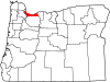
