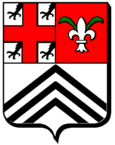
Bettelainville
| Bettelainville | ||
|---|---|---|

|
|
|
| region | Grand Est | |
| Department | Moselle | |
| Arrondissement | Thionville | |
| Canton | Metzervisse | |
| Community association | Arc Mosellan | |
| Coordinates | 49 ° 14 ′ N , 6 ° 18 ′ E | |
| height | 198-301 m | |
| surface | 13.71 km 2 | |
| Residents | 625 (January 1, 2017) | |
| Population density | 46 inhabitants / km 2 | |
| Post Code | 57640 | |
| INSEE code | 57072 | |
 Saint-Jean-Baptiste church |
||
Bettelainville ( German Bettsdorf ) is a French commune with 625 inhabitants (as of January 1, 2017) in the Moselle department in the Grand Est region (until 2015 Lorraine ).
geography
The municipality of Bettelainville is located on a ridge above the Canner valley , about 18 kilometers northeast of Metz .
history
The place was first mentioned in 1179 as Bethesdorf . The place has belonged to France since 1661 and was then still called Betstroff .
The two neighboring villages of Altroff ( Altdorf ) and Mancy ( Menchen ) have been incorporated since 1811 .
Population development
| year | 1962 | 1968 | 1975 | 1982 | 1990 | 1999 | 2007 |
| Residents | 394 | 348 | 393 | 511 | 513 | 598 | 608 |
traffic
Bettelainville is located on the Metz – Anzeling and Merzig – Bettelainville railway lines , both of which are largely closed .
Web links
Commons : Bettelainville - collection of pictures, videos and audio files
Individual evidence
- ↑ Burkhard Dietz, Helmut Gabel, Ulrich Tiedau: Reach for the West: The "West Research" of the ethnic-national sciences on northwestern Europe (1919-1960) (= studies on the history and culture of northwestern Europe 6). Waxmann, Münster et al., 2003, ISBN 3-8309-1144-0 .
