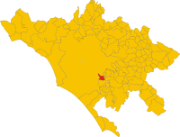
Ciampino
| Ciampino | ||
|---|---|---|

|
|
|
| Country | Italy | |
| region | Lazio | |
| Metropolitan city | Rome (RM) | |
| Coordinates | 41 ° 48 ′ N , 12 ° 36 ′ E | |
| height | 124 m slm | |
| surface | 11 km² | |
| Residents | 39,118 (Dec 31, 2019) | |
| Population density | 3,556 inhabitants / km² | |
| Post Code | 00043 (Ciampino), 00040 (Airport) | |
| prefix | 0039 - 06 | |
| ISTAT number | 058118 | |
| Popular name | Ciampinesi | |
| Patron saint | Holy Heart of Jesus | |
| Website | Ciampino | |
Ciampino is an Italian city in the metropolitan city of Rome in the Lazio region with 39,118 inhabitants (as of December 31, 2019).
geography
Ciampino is on the edge of the Alban Hills , 18 km southeast of Rome . The center is between the Rome - Frascati railway line and the Via Appia Nuova . It was created in a radial pattern in the 1920s. The municipality extends over a height of 87 to 235 m slm
The community is located in earthquake zone 3 (little risk).
The neighboring municipalities are: Grottaferrata , Marino and Rome.
traffic
Ciampino is a short distance from the GRA ring road , with junction 23 Via Appia . It has five train stations (Ciampino, Casabianca, Acqua Acetosa, Sassone and Pantanella) on the regional line FR4 Rome - Ciampino - Frascati, Albano Laziale and Velletri .
The adjoining Rome Ciampino Airport is largely in the municipal area of Rome.
history
Ciampino owes its name to the prelate and Christian archaeologist Giovanni Giustino Ciampini , who acquired the Ad Decimum estate in the 17th century . This later became known as Il casale di Ciampino ( Ciampino's estate). With the opening of the first railway line of the Papal States from Rome to Frascati in 1856 a first small settlement arose which belonged to the municipality Marino at the breakpoint Ciampino. In 1910, the Società Anonima Cooperativa Colli Parioli acquired land in the area on the Via Appia Nuova to create a garden city . In 1916, the Regia Marina's first airfield was designated. The military airfield was opened in 1924 and has also been used for civil flights since 1947.
Ciampino was heavily bombed during World War II. Then the actual expansion of the settlement began. In 1974 Ciampino was spun off from Marino as an independent municipality. In 2004 it received city rights.
population
Population development

Source ISTAT
Ethnic groups and migration
As of December 31, 2018, there were 2,547 people of foreign origin in Ciampino. Most of them come from the following countries:
politics
Simone Lupi ( PD ) was elected mayor in May 2011. He replaced his fellow party member Walter Enrico Perandini (2001-2006), who was no longer running. His center-left alliance also has a majority in the municipal council with 17 out of 24 seats.
religion
The majority of the inhabitants of Ciampino belong to the Roman Catholic religious community. The community belongs to the diocese of Albano and has five parishes.
swell
- ↑ Statistiche demografiche ISTAT. Monthly population statistics of the Istituto Nazionale di Statistica , as of December 31 of 2019.
- ^ Italian civil defense
- ↑ History of the airfield on assoaeronauticaciampino.it
- ↑ Statistiche demografiche ISTAT . Population statistics from the Istituto Nazionale di Statistica, as of December 31, 2011.
- ^ Istituto Nazionale di Statistica
- ↑ Information from the Ministry of the Interior ( Memento of the original dated May 19, 2011 in the Internet Archive ) Info: The archive link was inserted automatically and has not yet been checked. Please check the original and archive link according to the instructions and then remove this notice.
- ^ Diocese of Albano (Italian), accessed December 20, 2015
Web links
- ProLoco Ciampino ( Memento from January 19, 2008 in the Internet Archive ) (Italian)
- Ciampino on www.comuni-italiani.it (Italian)


