Labécède-Lauragais
| Labécède-Lauragais | ||
|---|---|---|

|
|
|
| region | Occitania | |
| Department | Aude | |
| Arrondissement | Carcassonne | |
| Canton | La Malpère à la Montagne Noire | |
| Community association | Castelnaudary Lauragais Audois | |
| Coordinates | 43 ° 24 ' N , 2 ° 0' E | |
| height | 230-593 m | |
| surface | 19.96 km 2 | |
| Residents | 412 (January 1, 2017) | |
| Population density | 21 inhabitants / km 2 | |
| Post Code | 11400 | |
| INSEE code | 11181 | |
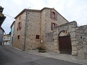
 former castle from the 17th century |
||
Labécède-Lauragais ( La Beceda in Occitan ) is a French commune with 412 inhabitants (as of January 1, 2017) in the Aude department in the Occitanie region . It belongs to the Arrondissement of Carcassonne and the canton of La Malpère à la Montagne Noire .
Neighboring communities
Neighboring municipalities of Labécède-Lauragais are Les Brunels in the north-east, Verdun-en-Lauragais in the south-east, Issel in the south-west and Vaudreuille in the north-west.
Population development
| year | 1962 | 1968 | 1975 | 1982 | 1990 | 1999 | 2013 |
| Residents | 258 | 231 | 234 | 279 | 317 | 331 | 430 |
Personalities
- Olivier de Termes († 1274), defended Labécède against the king
Web links
Commons : Labécède-Lauragais - Collection of images, videos and audio files
