Caux-et-Sauzens
| Caux-et-Sauzens | ||
|---|---|---|

|
|
|
| region | Occitania | |
| Department | Aude | |
| Arrondissement | Carcassonne | |
| Canton | La Malpère à la Montagne Noire | |
| Community association | Carcassonne Agglo | |
| Coordinates | 43 ° 14 ′ N , 2 ° 15 ′ E | |
| height | 103-177 m | |
| surface | 9 km 2 | |
| Residents | 979 (January 1, 2017) | |
| Population density | 109 inhabitants / km 2 | |
| Post Code | 11170 | |
| INSEE code | 11084 | |
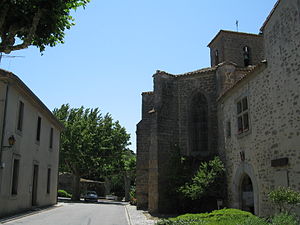
 Mairie and St. Sebastian Church |
||
Caux-et-Sauzens is a French commune with 979 inhabitants (as of January 1, 2017) in the Aude department in the Occitanie region ; it belongs to the Arrondissement of Carcassonne and the municipality of Carcassonne Agglo .
geography
The municipality of Caux-et-Sauzens is eight kilometers west of Carcassonne on the Canal du Midi . The Autoroute A61 (AutoRoute des Deux Mers) from Toulouse to Narbonne touches the south of the municipality.
The 9 km² area of the municipality is located in a low relief, wide valley section of the Fresquel river , which is also used by the Canal du Midi. About five kilometers south of Caux-et-Sauzens, the terrain gradually rises to over 200 m above sea level to merge into the foothills of the Malepère massif. With the exception of small forest remains in the northeast ( Bois du Sigala ), the surrounding area is characterized by fields and vines.
The municipality consists of the core town of Caux , the small village of Sauzens in the north and the small hamlet of Samary in the south.
Caux is located in the approach path of Carcassonne airport .
Neighboring municipalities of Caux-et-Sauzens are Pezens in the north, Carcassonne in the east, Lavalette in the southeast, Alairac in the south, Arzens in the southwest and Villesèquelande in the west.
history
In 908 the village of Caux first appeared as a Chaucas in a document from the Benedictine monastery of Montolieu ( Abbaye Saint-Jean-Baptiste de Montolieu ). However, several indications indicate that there could have been a settlement at the same place as early as Roman times. Finally, the Roman road from Castelnaudary to Carcassonne ( Voie Romaine d'Aquitaine ) passed immediately north of Caux. It is disputed whether Caux is a place called Coedros , which is mentioned in the records of the itinerary of one of the Roman emperors (Antoninus).
About the origin of the village Sauzens, first mentioned in 1791, it is speculated that it could have been a Visigothic foundation because of the ending -ens .
The image of the village of Caux with the church in the middle, which is still preserved today, dates from the 12th century. The backs of the rows of houses formed a kind of city wall through which three gates led. For better defense, a system of trenches was created directly outside the wall. The village of Sauzens developed in the 17th century outside the walls of Caux in an agricultural environment. At that time around 70 hectares of land were planted with vines, while today almost 500 hectares are available for viticulture in the municipality. Sauzens benefited from the course of the Canal du Midi , which was completed at the end of the 17th century and gave the entire region an economic boom. Locally produced - mostly agricultural - products could now be shipped inexpensively and in large quantities to the ports on the Atlantic and Mediterranean. From Sauzens they sailed to Toulouse and Béziers for almost two days each.
From 1296 to 1791, the lords of Caux and Sauzens were the heads of the de Caux Cahuzac family, loyal to the king , which belonged to the oldest noble families in the Languedoc.
In 1791 Caux and Sauzens were merged, from which the municipality in its present size was created. To date, no coat of arms has been developed for the community
Population development
| year | 1962 | 1968 | 1975 | 1982 | 1990 | 1999 | 2008 | 2017 | |
| Residents | 450 | 429 | 516 | 594 | 705 | 739 | 774 | 979 | |
| Sources: Cassini and INSEE | |||||||||
Attractions
- Church of St. Sebastian ( Église Saint-Sébastien )
- Château de Samary, now a winery and hotel
- 1.50 m high wayside cross monolith from the 13th century
Economy and Infrastructure
In addition to small craft and service businesses, viticulture is the main line of business in Caux-et-Sauzens. In addition to eight farmers who are involved in harvesting grain, there are 28 wineries in the municipality. The vines cultivated here are part of the Malepère appellation .
Several traffic routes run parallel to the Canal du Midi through the municipality :
- Trunk road from Carcassonne to Bram (D 33)
- Trunk road from Carcassonne to Mirepoix (D 119)
- Railway line from Bordeaux via Toulouse and Narbonne to Sète ( Ligne de Bordeaux-Saint-Jean à Sète-Ville )
supporting documents
- ↑ History and Heritage at www.cauxetsauzens.org. Retrieved April 17, 2014 (French).
- ↑ Caux-et-Sauzens on cassini.ehess.fr
- ↑ Caux-et-Sauzens on insee.fr
- ↑ wayside cross in the Base Mérimée of the French Ministry of Culture (French)
- ↑ Farmers and winemakers on annuaire-mairie.fr (French)

