List of listed objects in Vienna / Döbling / Grinzing – Neustift am Wald
The list of listed objects in Vienna-Döbling contains the listed , immovable objects of the 19th district of Vienna Döbling .
This part of the list contains the 202 objects in the cadastral communities Grinzing , Heiligenstadt , Josefsdorf , Kahlenbergerdorf and Neustift am Wald . For the other cadastral communities, see the list of listed buildings in Vienna / Döbling / Nussdorf – Untersievering .
Monuments
| photo | monument | Location | description | Metadata |
|---|---|---|---|---|

|
Grinzinger Friedhof, Weil grave chapel ObjectID : 114098 |
At the long river 33 KG location : Grinzing |
The grave chapel for Karl Weil on the Grinzing cemetery has cubic, graecizing shapes and is crowned by a figure of Victoria . |
ObjectID : 114098 Status: § 2a Status of the BDA list: 2020-02-29 Name: Grinzinger Friedhof, Weil grave chapel GstNr .: 406/1 Weil grave chapel, Grinzing |

|
Sculpture ObjectID : 84364 |
opposite Aslangasse 1 location KG: Grinzing |
The steel sculpture at the beginning of Aslangasse was designed by Herbert Schwarz and executed by Otto Berger. |
ObjectID : 84364 Status: § 2a Status of the BDA list: 2020-02-29 Name: Sculpture GstNr .: 420/24 Sculpture Aslangasse |

|
Dr.-Karl-Lueger-Monument ObjectID : 81702 |
Cobenzl location KG: Grinzing |
The larger than life, stone portrait bust of Karl Lueger is on a concrete stele on the way from the Cobenzl to the former castle hotel. It was designed in 1915 by Fritz Zerritsch with secessionist laurel rose hangings. |
ObjectID : 81702 Status: § 2a Status of the BDA list: 2020-02-29 Name: Dr.-Karl-Lueger-Denkmal GstNr .: 1102/1 Lueger-Denkmal, Cobenzl |

|
Grotto ObjectID : 42136 |
Cobenzl location KG: Grinzing |
Note: According to a garden historian, it was listed in the 1920s and no longer exists today. Former location according to the receipt. |
ObjectID : 42136 Status : Notification Status of the BDA list: 2020-02-29 Name: Grotte GstNr .: 1006/1 |

|
Cobenzl water tank including inlet structure ObjectID: 12796 |
Cobenzl location KG: Grinzing |
The Cobenzl water reservoir was built between 1908 and 1909 as an elevated reservoir for the 2nd Vienna High Spring Pipeline according to plans by the Vienna City Building Office in a late historical-neo-baroque style. |
ObjectID: 12796 Status: Notification Status of the BDA list: 2020-02-29 Name: Cobenzl water tank including inlet structure GstNr .: 1102/3; 1105/2 water tank Cobenzl |
|
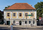
Windhaberhaus ObjektID : 84362 since 2019 |
Cobenzlgasse 2 KG location : Grinzing |
The two-story former winegrower's house was rebuilt in the first half of the 18th century. The grooved façade has stone blocks and a frame structure. Note: Ident address Grinzinger Steig 1–3 |
ObjectID : 84362 Status : Notification Status of the BDA list: 2020-02-29 Name: Windhaberhaus GstNr .: 125 Cobenzlgasse 2 |

|
Residential and commercial building ObjectID : 131034 since 2019 |
Cobenzlgasse 4 KG location : Grinzing |
The former vintner's house is marked 1775 on the wedge stone of the basket arch portal. |
ObjectID : 131034 Status : Notification Status of the BDA list: 2020-02-29 Name: Residential and commercial building GstNr .: 122 Cobenzlgasse 4 |

|
Residential house, Rudolfshof ObjectID : 116720 since 2019 |
Cobenzlgasse 6 KG location : Grinzing |
The core of the winegrower's house dates from the 17th century, the facade was rebuilt in the third quarter of the 19th century. The entrance is barrel vaulted and there is a baroque fountain in the courtyard. |
ObjektID : 116720 Status : Notification Status of the BDA list: 2020-02-29 Name: Residential house, Rudolfshof GstNr .: 121 |

|
Gasthaus, residential building ObjectID : 113638 since 2019 |
Cobenzlgasse 8 KG location : Grinzing |
This house corresponds to the village development of the Grinzing town center. |
ObjektID : 113638 Status : Notification Status of the BDA list: 2020-02-29 Name: Gasthaus, Wohnhaus GstNr .: 118; 119/2 Cobenzlgasse 8 |

|
Passauer Hof ObjectID : 41895 |
Cobenzlgasse 9 KG location : Grinzing |
The Passauer Hof is the former grape harvesting yard of the Canon Monastery of St. Nikola in Passau. The three-sided complex was built in the first half of the 16th century. The core of the gabled houses date from the late Middle Ages. |
ObjectID : 41895 Status : Notification Status of the BDA list: 2020-02-29 Name: Passauer Hof GstNr .: 19 Passauerhof (Döbling) |

|
Residential and commercial building, pharmacy ObjectID : 113639 since 2019 |
Cobenzlgasse 10 KG location : Grinzing |
Former winegrower's house with a renewed facade |
ObjectID : 113639 Status : Notification Status of the BDA list: 2020-02-29 Name: Residential and commercial building, pharmacy GstNr .: 115 |

|
Residential and commercial building ObjectID : 131041 since 2019 |
Cobenzlgasse 11 KG location : Grinzing |
The core of the former winegrower's house dates from the 17th century. |
ObjectID : 131041 Status : Notification Status of the BDA list: 2020-02-29 Name: Residential and commercial building GstNr .: 22 Cobenzlgasse 11 |

|
Residential house, Hauerhaus ObjectID : 113640 since 2019 |
Cobenzlgasse 12 KG location : Grinzing |
Former winemaker's house |
ObjectID : 113640 Status : Notification Status of the BDA list: 2020-02-29 Name: Residential house, Hauerhaus GstNr .: 112 |

|
Residential and commercial building ObjectID : 131042 since 2019 |
Cobenzlgasse 13 KG location : Grinzing |
The house dates from the first half of the 19th century, but may have an older core. |
ObjectID : 131042 Status : Notification Status of the BDA list: 2020-02-29 Name: Residential and commercial building GstNr .: 23 Cobenzlgasse 13 |

|
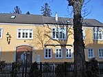
Former Winegrower's house including late medieval cellar ObjectID : 113641 |
Cobenzlgasse 15 KG location : Grinzing |
The core of the winery probably dates back to the 16th century, although a renovation took place in the 18th century and later. |
ObjectID : 113641 Status : Notification Status of the BDA list: 2020-02-29 Name: Former Winegrower's house including late medieval cellar GstNr .: 27/1; 28 Cobenzlgasse 15 |
|
Residential and commercial building ObjectID : 131036 since 2019 |
Cobenzlgasse 16 KG location : Grinzing |
This house corresponds to the village development of the Grinzing town center |
ObjektID : 131036 Status : Notification Status of the BDA list: 2020-02-29 Name: Residential and commercial building GstNr .: 106/1; 106/2 |

|
Hauerhaus ObjectID : 41896 |
Cobenzlgasse 17 KG location : Grinzing |
The Hauerhaus belongs to an association of single-storey houses from the 17th to 19th centuries. |
ObjectID : 41896 Status : Notification Status of the BDA list: 2020-02-29 Name: Hauerhaus GstNr .: 29 Cobenzlgasse 17 |

|
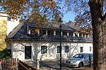
Hauerhaus, residential building ObjectID : 113644 since 2019 |
Cobenzlgasse 19 KG location : Grinzing |
The Hauerhaus belongs to an association of single-storey houses from the 17th to 19th centuries. |
ObjectID : 113644 Status : Notification Status of the BDA list: 2020-02-29 Name: Hauerhaus, residential building GstNr .: 32 |
|
Hauerhaus ObjectID : 109033 |
Cobenzlgasse 20 KG location : Grinzing |
The building is a single-storey, eaves-standing tuscher house with a bent front, the core of which dates from the 17th century. |
ObjectID : 109033 Status : Notification Status of the BDA list: 2020-02-29 Name: Hauerhaus GstNr .: 102 Cobenzlgasse 20 |

|
Hauerhaus ObjectID : 113645 since 2019 |
Cobenzlgasse 21 KG location : Grinzing |
The core of the house dates from the early 17th century. |
ObjectID : 113645 Status : Notification Status of the BDA list: 2020-02-29 Name: Hauerhaus GstNr .: 33 Cobenzlgasse 21 |

|
Hauerhaus ObjectID : 113646 since 2016 |
Cobenzlgasse 22 KG location : Grinzing |
The stately Hauerhof, which probably dates from the 16th century, received a new facade at the beginning of the 19th century. The torrisalit with a gable-crowned loggia also dates from this period. It is an irregular complex consisting of several components, which is mainly grouped on two floors around a courtyard with outside stairs. |
ObjektID : 113646 Status : Notification Status of the BDA list: 2020-02-29 Name: Hauerhaus GstNr .: 98; 99 Cobenzlgasse 22 |

|
Hauerhaus ObjectID : 113647 since 2019 |
Cobenzlgasse 23 KG location : Grinzing |
The Hauerhaus belongs to an association of single-storey houses from the 17th to 19th centuries. |
ObjectID : 113647 Status : Notification Status of the BDA list: 2020-02-29 Name: Hauerhaus GstNr .: 38 Cobenzlgasse 23 |

|
Hauerhaus ObjectID : 102704 |
Cobenzlgasse 24 KG location : Grinzing |
The core of the building at Cobenzlgasse 24 dates from the 18th century. It consists of one and two-storey tracts with a gate wall on both sides. |
ObjektID : 102704 Status : Notification Status of the BDA list: 2020-02-29 Name: Hauerhaus GstNr .: 95/2; 95/3; 97 Cobenzlgasse 24 |

|
Residential and commercial building ObjectID : 131044 since 2019 |
Cobenzlgasse 25 KG location : Grinzing |
The house is marked 1896. |
ObjectID : 131044 Status : Notification Status of the BDA list: 2020-02-29 Name: Residential and commercial building GstNr .: 39/2 |

|
Hauerhaus ObjectID : 41897 |
Cobenzlgasse 26 KG location : Grinzing |
The late Gothic Hauerhof was built in the 16th century and came into the possession of the Jesuits in 1572. |
ObjectID : 41897 Status : Notification Status of the BDA list: 2020-02-29 Name: Hauerhaus GstNr .: 92 Cobenzlgasse 26 |

|
Hauerhaus ObjectID : 116170 since 2019 |
Cobenzlgasse 27 KG location : Grinzing |
In contrast to most of the houses belonging to this association, this house has two floors. |
ObjectID : 116170 Status : Notification Status of the BDA list: 2020-02-29 Name: Hauerhaus GstNr .: 43 |

|
Hauerhaus ObjectID : 113668 since 2019 |
Cobenzlgasse 29 KG location : Grinzing |
The Hauerhaus belongs to an association of single-storey houses from the 17th to 19th centuries. |
ObjectID : 113668 Status : Notification Status of the BDA list: 2020-02-29 Name: Hauerhaus GstNr .: 45 Cobenzlgasse 29 |

|
Ansitz, Trummelhof ObjectID : 41898 |
Cobenzlgasse 30 KG location : Grinzing |
The Trummelhof was a residence that was a fiefdom of the Lords of Grinzing from the 13th to the 15th century. The building, which is essentially high medieval, served as a brewery from 1835 onwards. |
ObjectID : 41898 Status : Notification Status of the BDA list: 2020-02-29 Name: Ansitz, Trummelhof GstNr .: 87/1 Trummelhof |
|
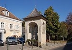
Way Chapel St. Johannes Nepomuk ObjectID : 113517 |
at Cobenzlgasse 30 KG location : Grinzing |
The baroque path chapel was built in the middle of the 18th century on a rectangular floor plan. It has arched windows, an open basket arch and a shingled pyramid roof. The stone figure of Johannes Nepomuk from the construction period is framed by putti and cherub heads . |
ObjectID : 113517 Status : Notification Status of the BDA list: 2020-02-29 Name: Wegkapelle hl. Johannes Nepomuk GstNr .: 1166/7 Johann Nepomuk Chapel, Grinzing |

|
Hauerhaus ObjectID : 113671 since 2019 |
Cobenzlgasse 31 KG location : Grinzing |
The core of the house dates from around 1700. |
ObjectID : 113671 Status : Notification Status of the BDA list: 2020-02-29 Name: Hauerhaus GstNr .: 47 Cobenzlgasse 31 |

|
Lößhof, former farm yard of the St. Pölten Abbey ObjectID : 52537 since 2019 |
Cobenzlgasse 33 KG location : Grinzing |
The core of the two-storey complex with a bent street front and tower-like middle section probably dates from the late Middle Ages and was rebuilt several times in the period that followed. |
ObjektID : 52537 Status : Notification Status of the BDA list: 2020-02-29 Name: Lößhof, former farm yard of St. Pölten Monastery GstNr .: 48; 49 |

|
Residential and commercial building ObjectID : 131045 since 2019 |
Cobenzlgasse 35 KG location : Grinzing |
The former Hauerhaus in its present form dates from 1859. |
ObjectID : 131045 Status : Notification Status of the BDA list: 2020-02-29 Name: Residential and commercial building GstNr .: 52/2 |

|
Gasthaus ObjektID : 52544 since 2019 |
Cobenzlgasse 36, 38 KG location : Grinzing |
This house corresponds to the village development of the Grinzing town center. |
ObjectID : 52544 Status : Notification Status of the BDA list: 2020-02-29 Name: Gasthaus GstNr .: 83; 82 |

|
Residential and commercial building ObjectID : 131040 since 2019 |
Cobenzlgasse 40 KG location : Grinzing |
The core of the single-storey eaves house dates from the 18th century. |
ObjectID : 131040 Status : Notification Status of the BDA list: 2020-02-29 Name: Residential and commercial building GstNr .: 78 |

|
Niche figure St. Johannes Nepomuk ObjectID : 41899 |
Cobenzlgasse 41 KG location : Grinzing |
In this original depiction from the 18th century, Saint John Nepomuk is depicted without attributes on a round, curved base that shows a relief of his lintel. |
ObjectID : 41899 Status : Notification Status of the BDA list: 2020-02-29 Name: Niche figure hl. Johannes Nepomuk GstNr .: 833/2 |

|
Residential house, Feilerhof ObjectID : 41900 |
Cobenzlgasse 42 KG location : Grinzing |
The Feilerhof served as a casino until 1847 and was owned by Franz Xaver Feiler. The two-story building itself was built in the second third of the 19th century. |
ObjectID : 41900 Status : Notification Status of the BDA list: 2020-02-29 Name: Residential house, Feilerhof GstNr .: 75 Feilerhof |

|
Elevation road structure ObjectID : 113673 |
opposite Cobenzlgasse 44 KG location : Grinzing |
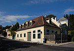
The structure was built in the course of the second construction phase of the Vienna Höhenstrasse . |
ObjectID : 113673 Status: § 2a Status of the BDA list: 2020-02-29 Name: Höhenstraßen-Bauwerk GstNr .: 1126/2 Höhenstraßenbauwerk (opposite Cobenzlgasse 44) |
|
Residential building ObjectID : 113675 since 2020 |
Cobenzlgasse 46 KG location : Grinzing |
Behind an older single-storey street there is an extension from the 3rd quarter of the 19th century. This is in three parts with a hipped roof on the central wing and early historic decor. |
ObjectID : 113675 Status : Notification Status of the BDA list: 2020-02-29 Name: Residential house GstNr .: 65; 66; 67/4 Cobenzlgasse 46 |

|
Residential building ObjectID : 116066 since 2019 |
Cobenzlgasse 48 KG location : Grinzing |
The house is part of an association of single-storey houses from the 17th to 19th centuries. |
ObjectID : 116066 Status : Notification Status of the BDA list: 2020-02-29 Name: Residential house GstNr .: 61 |

|
Residential and commercial building ObjectID : 131043 since 2019 |
Cobenzlgasse 50 KG location : Grinzing |
The house is part of an association of single-storey houses from the 17th to 19th centuries. |
ObjectID : 131043 Status : Notification Status of the BDA list: 2020-02-29 Name: Residential and commercial building GstNr .: 60 Cobenzlgasse 50 |

|
Fire station of the city of Vienna ObjectID : 52546 |
Cobenzlgasse 63 KG location : Grinzing |
The guard building, which was built in the style of the interwar period, was built according to plans by the then Municipal Department 22 and the architect Konstantin Peller and moved into on November 24, 1929. In 1991/92 a general renovation took place, the two exit gates were replaced by an eight-leaf automatic gate. |
ObjectID : 52546 Status: § 2a Status of the BDA list: 2020-02-29 Name: Fire station of the city of Vienna GstNr .: 852 Fire station Grinzing |

|
Haus Hock ObjectID : 41901 |
Cobenzlgasse 71 KG location : Grinzing |
Haus Hock was the first villa to be built by the architects Oskar Wlach and Oskar Strnad . The villa, built between 1910 and 1912, has a side terrace with a neoclassical column portico. |
ObjectID : 41901 Status : Notification Status of the BDA list: 2020-02-29 Name: Haus Hock GstNr .: 865/4 Haus Hock |

|
Catholic parish church, Kaasgrabenkirche Mariae pain ObjectID: 52551 |
Ettingshausengasse 1 KG location : Grinzing |
This neo-baroque church was built in 1909/10 in place of a pilgrimage chapel by Franz Kupka and Gustav Orglmeister . The church is at the end of an elaborate horseshoe-shaped staircase. The building itself has a retracted choir with a hipped roof, the three-axis tower front is structured with Ionic pilasters. The interior is formed by a barrel-vaulted hall with baroque shapes. The facility is from the construction period. |
ObjectID: 52551 Status: § 2a Status of the BDA list: 2020-02-29 Name: Catholic parish church, Kaasgrabenkirche Mariae pain GstNr .: 436/2; 438/2; 436/3 Kaasgrabenkirche |

|
Residential and commercial building ObjectID : 131031 since 2019 |
Feilergasse 5 KG location : Grinzing |
The corner house was designed by Joseph Löwitsch in 1905 . Note: Identity address Himmelstraße 18 |
ObjectID : 131031 Status : Notification Status of the BDA list: 2020-02-29 Name: Residential and commercial building GstNr .: 25/3 |

|
House Lemberger ObjectID : 41915 |
Grinzinger Allee 50, 52 KG location : Grinzing |
The Lemberger house was built in 1913/14 by the Wagner student Jan Kotěra and is his only work in Vienna. The house consists of several independent buildings, which are grouped around a courtyard. The facade is kept in an expressionist style that was only later established in Vienna. The upper floor is clad with ocher-colored bricks, which gives it a mansard-like character. |
ObjectID : 41915 Status : Notification Status of the BDA list: 2020-02-29 Name: Haus Lemberger GstNr .: 459 Haus Lemberger |

|
Municipal housing, Julius-Deutsch-Hof including art-in-building ObjectID : 52520 |
Grinzinger Allee 54 KG location : Grinzing |
The communal housing was built in 1952/53 by Rudolf Eisler and Carl Wilhelm Schmidt . The art objects consist of the natural stone relief family by Alfons Loner and a fountain with figures of monkeys and turtles by Hubert Wilfan . |
ObjectID : 52520 Status: § 2a Status of the BDA list: 2020-02-29 Name: Municipal housing, Julius-Deutsch-Hof including Kunst-am-Bau GstNr .: 461/4 Julius-Deutsch-Hof |

|
Residential and commercial building ObjectID : 131025 since 2019 |
Grinzinger Allee 86 KG location : Grinzing |
The two-story house with a hipped roof dates from the second quarter of the 19th century, but has an older core. |
ObjectID : 131025 Status : Notification Status of the BDA list: 2020-02-29 Name: Residential and commercial building GstNr .: 180 |

|
Municipal Housing ObjectID : 113628 |
Grinzinger Straße 2 KG location : Grinzing |
This residential complex was built between 1955 and 1957 by Hans Steineder . These are two separate structures, the appearance of which is relatively conservative with a grooved base storey, risalits and crooked roofs and is adapted to the surrounding villa area. |
ObjectID : 113628 Status: § 2a Status of the BDA list: 2020-02-29 Name: Kommunaler Wohnbau GstNr .: 187/4; 187/14; 187/13 Grinzinger Strasse 2 residential complex |

|
Former Winery ObjectID : 101923 |
Grinzinger Straße 17 KG location : Grinzing |
The single-storey, eaves-standing former winegrower's house, which is partially under monument protection, dates from the early 19th century. It was left to decay and in 2013 turned into an "eyesore". It was later renovated and the house got a new roof structure with attic apartments and chimneys. |
ObjectID : 101923 Status : Notification Status of the BDA list: 2020-02-29 Name: Former Winery GstNr .: 157 |

|
Kramreiter residential building and enclosure ObjektID : 128419 since 2012 |
Grinzinger Straße 37 KG location : Grinzing |
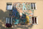
The house was built by Robert Kramreiter in 1938/39 and renovated from 2013 to 2015. |
ObjektID : 128419 Status : Notification Status of the BDA list: 2020-02-29 Name: Kramreiter residential building and enclosure GstNr .: 575/70; 575/16 |
|
Art in architecture, figures and ceramic reliefs ( Anton Proksch-Hof ) ObjectID : 115313 |
Grinzinger Straße 54 KG location : Grinzing |
The following art objects are located in the Anton-Proksch-Hof : Artificial stone sculpture pair of lions ( Herbert Schwarz , 1954), play sculpture slide ( Josef Schagerl , 1955–1957), play sculpture fox ( Walter Leitner , 1954/55), four majolica reliefs, orientation plans ( Hubert Wilfan , 1955–1959), mosaic mural work in the vineyard ( Hilde Prinz , 1955/56), sgraffito image of the sun and signs of the zodiac ( Richard Exler , 1955–1957), plastic mother and child ( Erich Pieler , 1955–1960). This includes the following mosaic-house signs: Tempelhupfen , boy and snowman ( Roman Haller , 1954-55), children's pool , school , Children Playing ( Mea Bratusch , 1954), Playing children (three mosaics, Luka Bojin , 1954-55), kite flying , Children playing ( Marianne Neugebauer , 1954), Children playing ( Herbert Schütz , 1954). Note: Most of it is part of the Unterdöbling KG |
ObjectID : 115313 Status: § 2a Status of the BDA list: 2020-02-29 Name: Kunst-am-Bau, figures and ceramic reliefs GstNr .: 511/5 Kunst am Bau, Anton-Proksch-Hof |

|
Habsburgwarte ObjektID : 41927 |
Hermannskogel location KG: Grinzing |
The observation tower was built in 1888 by Franz von Neumann . It is built in the style of a castle with bosses, bay windows and battlements. The wrought iron grille is remarkable. |
ObjectID : 41927 Status : Notification Status of the BDA list: 2020-02-29 Name: Habsburgwarte GstNr .: 1184/2 Habsburgwarte |

|
Residential and commercial building ObjectID : 131028 since 2019 |
Himmelstrasse 2 KG location : Grinzing |
The house corresponds to the village development of Grinzing from the 16th to 18th centuries. Century. Note: Ident address Cobenzlgasse 1 |
ObjektID : 131028 Status : Notification Status of the BDA list: 2020-02-29 Name: Residential and commercial building GstNr .: 110; 105/2 |

|
Hauerhaus ObjectID : 109022 |
Himmelstrasse 3 KG location : Grinzing |
The core of the house dates from the 17th / 18th centuries. Century and was rebuilt at the beginning of the 19th century. |
ObjectID : 109022 Status : Notification Status of the BDA list: 2020-02-29 Name: Hauerhaus GstNr .: 198/1 Himmelstraße 3 (Vienna) |

|
Kirchenstöckl, former bathing room ObjectID : 130725 since 2017 |
Himmelstrasse 4 KG location : Grinzing |
The former bathing room in Angermitte dates from the 17th to 18th centuries. The walled-in stone door frame is marked 1758. |
ObjectID : 130725 Status : Notification Status of the BDA list: 2020-02-29 Name: Kirchenstöckl, former Badestube GstNr .: 8 Himmelstraße 4, Vienna |

|
Tram terminus with administrative and residential buildings ObjectID : 52540 |
Himmelstrasse 5 KG location : Grinzing |
The building was built in 1914/15. It is kept in the form of the Heimat style, the biaxial passage has stitch cap barrel vaults on pillars, the rear parts have a canopy on iron posts. |
ObjectID : 52540 Status : Notification Status of the BDA list: 2020-02-29 Name: Tram terminus with administrative and residential buildings GstNr .: 200/2 Himmelstraße 5 (Vienna) |

|
Residential building, former Heuriger ObjektID : 98815 since 2019 |
Himmelstrasse 7 KG location : Grinzing |
The core of the house probably dates from the 16th / 17th centuries. There is a niche with a late Gothic figure of the Madonna in the vaulted driveway. |
ObjectID : 98815 Status : Notification Status of the BDA list: 2020-02-29 Name: Residential house, former Heuriger GstNr .: 203 Himmelstraße 7 |

|
Residential building ObjectID : 106121 |
Himmelstrasse 9 KG location : Grinzing |
The two-storey house with a hipped roof dates from the end of the 18th century and was rebuilt in the 19th century. There is a Nepomuk figure in a niche . |
ObjectID : 106121 Status : Notification Status of the BDA list: 2020-02-29 Name: Residential building GstNr .: 204 Himmelstraße 9 (Vienna) |

|
Residential and commercial building ObjectID : 131029 since 2019 |
Himmelstrasse 10, 12, 14 KG location : Grinzing |
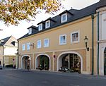
The facade of this converted winery dates from the second quarter of the 19th century. Note: Ident address Cobenzlgasse 7 |
ObjectID : 131029 Status : Notification Status of the BDA list: 2020-02-29 Name: Residential and commercial building GstNr .: 236 |
|
Pöltingerhof ObjectID : 41928 |
Himmelstrasse 11 KG location : Grinzing |
It is a former monastery courtyard of the canons of St. Pölten , the core of which dates from the 17th century and was later rebuilt several times. It consists of a two-storey main building with a barrel vaulted cap on the ground floor and a gate wing with a banded arched portal and a secondary relief of the coat of arms. |
ObjectID : 41928 Status : Notification Status of the BDA list: 2020-02-29 Name: Pöltingerhof GstNr .: 206 Himmelstraße 11 (Vienna) |

|
Residential building ObjectID : 106270 |
Himmelstrasse 13 KG location : Grinzing |
The house is a former commercial building or bakery of the Pöltinger Hof with a Gothic facade decor from the third quarter of the 19th century. |
ObjectID : 106270 Status : Notification Status of the BDA list: 2020-02-29 Name: Residential building GstNr .: 207/1 Himmelstraße 13 (Vienna) |

|
Residential building ObjectID : 106267 |
Himmelstrasse 15 KG location : Grinzing |
The facade of the house dates from the end of the 19th century, the driveway from the end of the 18th century. |
ObjectID : 106267 Status : Notification Status of the BDA list: 2020-02-29 Name: Residential building GstNr .: 209 Himmelstraße 15 (Vienna) |

|
Residential building ObjectID : 115944 since 2019 |
Himmelstrasse 17 KG location : Grinzing |
The house with its broad, barrel-vaulted stab cap comes from the 18th century, the strictly historical facade from the third quarter of the 19th century. |
ObjectID : 115944 Status : Notification Status of the BDA list: 2020-02-29 Name: Residential building GstNr .: 211 |

|
Residential and commercial building ObjectID : 131027 since 2019 |
Himmelstrasse 19 KG location : Grinzing |
The former winery dates from around 1800 and was rebuilt in the second half of the 19th century. |
ObjectID : 131027 Status : Notification Status of the BDA list: 2020-02-29 Name: Residential and commercial building GstNr .: 215 |

|
Residential and commercial building ObjectID : 131033 since 2019 |
Himmelstrasse 20 KG location : Grinzing |
The house belongs to the village center. |
ObjectID : 131033 Status : Notification Status of the BDA list: 2020-02-29 Name: Residential and commercial building GstNr .: 245/1
|

|
Baker House Object ID: 41929 |
Himmelstrasse 21 KG location : Grinzing |
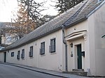
The bakery's house is a two-storey, late Gothic building with a bent front and flat bay window from around 1500. The round arched gate dates from the 18th century, the outside staircase in the courtyard with an open pawlatsche from around 1800. |
ObjectID : 41929 Status : Notification Status of the BDA list: 2020-02-29 Name: Bäckerhaus GstNr .: 216 Himmelstraße 21 (Vienna) |
|
Residential and commercial building ObjectID : 131032 since 2019 |
Himmelstrasse 22 KG location : Grinzing |
The house is single-storey and eaves, it dates from after 1819. |
ObjectID : 131032 Status : Notification Status of the BDA list: 2020-02-29 Name: Residential and commercial building GstNr .: 244 |

|
Catholic Parish Church of the Holy Cross and Cemetery ObjectID : 52553 |
Himmelstrasse 23 KG location : Grinzing |
This late Gothic hall church with a 5/8 end and a tower adjoining to the northeast with a baroque onion helmet dates from the third quarter of the 15th century. The outer wall is accentuated by stepped buttresses and two-lane windows, the saddle roof is hipped off the choir. The transversely rectangular nave bays are vaulted with cross ribs with disc connecting stones, the belt arches end in semicircular services . The organ gallery is bordered by a late Gothic tracery parapet. Most of the furnishings date from the 18th century, the glass paintings from the 19th century. |
ObjektID : 52553 Status : Notification Status of the BDA list: 2020-02-29 Name: Catholic parish church Hl. Kreuz and Kirchhof GstNr .: 1 Grinzinger parish church |

|
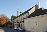
Villa / country house, former Residential building Wessely / Hörbiger / former Villa Halbmayr, "Theater zum Himmel" ObjectID : 126269 since 2019 |
Himmelstrasse 24 KG location : Grinzing |
Behind the eaves house with a facade from the second half of the 19th century is a Swiss-style house from the beginning of the 20th century. It was later the residence of the Hörbiger / Wessely family of actors, Maresa Hörbiger runs a summer theater here. |
ObjectID : 126269 Status : Notification Status of the BDA list: 2020-02-29 Name: Villa / country house, Former Residential building Wessely / Hörbiger / former Villa Halbmayr, "Theater am Himmel" GstNr .: 249
|
|
Vicarage ObjectID : 41930 |
Himmelstrasse 25 KG location : Grinzing |
The rectory was probably built in 1783 using older components. It is a broad, two-story building with a frame and slab structure. The two side portals are flanked by vase attachments and raised with heraldic cartouches. |
ObjectID : 41930 Status : Notification Status of the BDA list: 2020-02-29 Name: Pfarrhof GstNr .: 4 Pfarrhof Grinzing |

|
Glass house ObjectID : 131209 since 2019 |
Himmelstrasse 25 KG location : Grinzing |
ObjectID : 131209 Status : Notification Status of the BDA list: 2020-02-29 Name: Glashaus GstNr .: 2 |
|

|
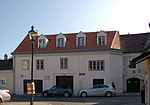
Residential house, farmhouse ObjectID : 52545 |
Himmelstrasse 27 KG location : Grinzing |
The former farmhouse with courtyard was built in the 18th century. |
ObjectID : 52545 Status : Notification Status of the BDA list: 2020-02-29 Name: Residential house, farmhouse GstNr .: 220 Himmelstraße 27 (Vienna) |
|
Hauerhaus, gate construction and side wings with a cellar ObjectID : 79378 |
Himmelstrasse 29 KG location : Grinzing |
The Hauerhaus, which originally dates from the 16th century, was rebuilt in the second half of the 18th century. There is a memorial plaque for the composer Sepp Fellner on the facade . |
ObjectID : 79378 Status : Notification Status of the BDA list: 2020-02-29 Name: Hauerhaus, gate construction and side wings with a basement GstNr .: 221 Himmelstraße 29 (Vienna) |
|
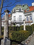
Residential and studio building, Delug Painting Academy ObjectID : 41931 |
Himmelstrasse 30 KG location : Grinzing |
The former painting academy Alois Delug was built in 1910/11 by the architect Friedrich Ohmann . The three-storey building, built in the late historical style, has a semicircular, protruding central projectile structured with pilasters, which is crowned by a bell-shaped roof. The surrounding balcony is supported by Tuscan columns. |
ObjectID : 41931 Status : Notification Status of the BDA list: 2020-02-29 Name: Residential and studio building, Delug Painting Academy, GstNr .: 257/3 |

|
Hauerhaus ObjectID : 41932 |
Himmelstrasse 31 KG location : Grinzing |
The winery with a basement dates from the 17th / early 18th century. |
ObjectID: 41932 Status: Notification Status of the BDA list: 2020-02-29 Name: Hauerhaus GstNr .: 226 Himmelstraße 31 (Vienna) |

|
Residential building ObjectID : 115942 since 2019 |
Himmelstrasse 33 KG location : Grinzing |
The house in the Neo-Biedermeier style with a bay window, built around 1900, may have an older core. |
ObjectID : 115942 Status : Notification Status of the BDA list: 2020-02-29 Name: Residential building GstNr .: 229 |

|
Hauerhaus ObjectID : 115941 since 2019 |
Himmelstrasse 35 KG location : Grinzing |
The core of the house with the bent front dates from the 16th century, the framed Immaculata mural from the 18th century. |
ObjectID : 115941 Status : Notification Status of the BDA list: 2020-02-29 Name: Hauerhaus GstNr .: 234 |

|
Residential house, Hauerhaus ObjectID : 115939 since 2019 |
Himmelstrasse 37 KG location : Grinzing |
The stately Hauerhof with a staggered front around a four-sided courtyard dates from the 16th century. |
ObjectID : 115939 Status : Notification Status of the BDA list: 2020-02-29 Name: Residential house, Hauerhaus GstNr .: 233 |

|
Residential building ObjectID : 115940 since 2019 |
Himmelstrasse 39 KG location : Grinzing |
The core of the house dates from the beginning of the 18th century, the facade with its gabled central projections from the third quarter of the 19th century. |
ObjectID : 115940 Status : Notification Status of the BDA list: 2020-02-29 Name: Residential house GstNr .: 238 |

|
Rental house ObjektID : 114182 since 2019 |
Himmelstrasse 41, 43 KG location : Grinzing |
The rental house with Neoempire decor was built in 1914 by Oskar Neumann . The symmetrical middle section is resolved into a two-story loggia arcade. |
ObjectID : 114182 Status : Notification Status of the BDA list: 2020-02-29 Name: Miethaus GstNr .: 242/3; 242/5 Himmelstrasse 41–43, Vienna |

|
Höhenstraße ObjectID : 101570 since 2020 |
Höhenstraße location KG: Grinzing |
The Höhenstraße is a scenic route between Neuwaldegg and the Kahlenberg . It was built in 1934/35 under the direction of Erich Franz Leischner . It is considered to be one of the prestige projects of the time and not least had the purpose of creating jobs in the crisis years. |
ObjectID : 101570 Status : Notification Status of the BDA list: 2020-02-29 Name: Höhenstraße GstNr .: 1019/2; 1022/2; 1109/3; 1165/4; 1195; 1196/2; 1108; 1109/2; 1120/1; 1005; 1006/1; 1008; 1211/3 Höhenstraße, Vienna |

|
Hungerberg water tank including valve chamber ObjectID : 12794 |
Hungerbergstrasse Location KG: Grinzing |
Built between 1908/10 by the Vienna City Planning Department as part of the 2nd Vienna High Spring Water Pipeline . |
ObjectID : 12794 Status : Notification Status of the BDA list: 2020-02-29 Name: Hungerberg water tank including valve chamber GstNr .: 453/16 Hungerberg water tank |

|
House Botstieber ObjectID : 41941 |
Kaasgrabengasse 30 KG location : Grinzing |
The house of the musicologist Hugo Botstiber belongs to the Kaasgraben colony built in 1913 according to plans by the architect Josef Hoffmann |
ObjectID : 41941 Status : Notification Status of the BDA list: 2020-02-29 Name: Haus Botstieber GstNr .: 450/37 Kaasgrabengasse 30-32 |

|
House Hertzka ObjectID : 41942 |
Kaasgrabengasse 32 KG location : Grinzing |
The home of the music publisher Emil Hertzka and his wife, the women's rights activist Jella Hertzka , is part of the Kaasgraben colony built in 1913 according to plans by the architect Josef Hoffmann. |
ObjectID : 41942 Status : Notification Status of the BDA list: 2020-02-29 Name: Haus Hertzka GstNr .: 450/36 Kaasgrabengasse 30-32 |

|
House printer ObjectID : 41943 |
Kaasgrabengasse 36 KG location : Grinzing |
The house is part of the Kaasgraben colony built in 1913 according to plans by the architect Josef Hoffmann. |
ObjectID : 41943 Status : Notification Status of the BDA list: 2020-02-29 Name: Haus Drucker GstNr .: 450/35 Kaasgrabengasse 36-38 |

|
House Wellesz ObjectID : 41944 |
Kaasgrabengasse 38 KG location : Grinzing |
The house of the composer Egon Wellesz belongs to the Kaasgraben colony built in 1913 according to plans by the architect Josef Hoffmann. |
ObjectID : 41944 Status : Notification Status of the BDA list: 2020-02-29 Name: Haus Wellesz GstNr .: 450/34 Kaasgrabengasse 36-38 |

|
Residential building ObjectID : 131210 since 2019 |
Krapfenwaldgasse 2 KG location : Grinzing |
The core of the row of single-storey residential houses on the eaves dates from the period after 1800. |
ObjectID : 131210 Status : Notification Status of the BDA list: 2020-02-29 Name: Residential house GstNr .: 73/1 |

|
Residential building ObjectID : 131211 since 2019 |
Krapfenwaldgasse 4 KG location : Grinzing |
The core of the row of single-storey residential houses on the eaves dates from the period after 1800. |
ObjectID : 131211 Status : Notification Status of the BDA list: 2020-02-29 Name: Residential building GstNr .: 71 Krapfenwaldgasse 4 |

|
Residential building ObjectID : 131212 since 2019 |
Krapfenwaldgasse 6 KG location : Grinzing |
The core of the row of single-storey residential houses on the eaves dates from the period after 1800. |
ObjectID : 131212 Status : Notification Status of the BDA list: 2020-02-29 Name: Residential house GstNr .: 70/2 |

|
Residential building ObjectID : 131213 since 2019 |
Krapfenwaldgasse 6a KG location : Grinzing |
The core of the row of single-storey houses dates back to after 1800, this house is the only one with a gable end. |
ObjectID : 131213 Status : Notification Status of the BDA list: 2020-02-29 Name: Residential house GstNr .: 70/1 |

|
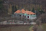
Residential building ObjectID : 131214 since 2019 |
Krapfenwaldgasse 8 KG location : Grinzing |
The core of the row of single-storey residential houses on the eaves dates back to the time after 1800. The facade of this house was later changed from a strictly historical perspective. |
ObjectID : 131214 Status : Notification Status of the BDA list: 2020-02-29 Name: Residential house GstNr .: 69 |
|
Summer pool Krapfenwaldl ObjektID : 46569 |
Krapfenwaldgasse 65-73 KG location : Grinzing |
After Josef Pürzl had built a people's restaurant in 1910/11, the building was incorporated into the newly built municipal outdoor pool in 1923 as the entrance and cabin wing. The two-storey component was built in the asymmetrical Heimatstil form and has a natural stone base, risal structure and large windows. |
ObjectID : 46569 Status : Notification Status of the BDA list: 2020-02-29 Name: Sommerbad Krapfenwaldl GstNr .: 968/1 Krapfenwaldlbad |
|
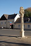
Trinity Column ObjectID : 41447 |
Corner of Langackergasse / Sandgasse KG location : Grinzing |
The Trinity Column in Langacker- or Sandgasse was moved here in 1969. It was originally located on Laaer Berg , then on Schwendermarkt and by the bridge over the Seeschlachtgraben in Kaiserebersdorf . The column from the end of the 17th century has a trinity group with analogous relief on both sides. |
ObjektID : 41447 Status : Notification Status of the BDA list: 2020-02-29 Name: Dreifaltigkeitssäule GstNr .: 1147/1 Dreifaltigkeitssäule Langackergasse |
|
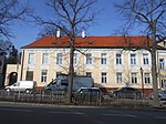
Residential and commercial building ObjectID : 131024 since 2019 |
Langackergasse 1 KG location : Grinzing |
This house corresponds to the village development of the Grinzing town center and was changed in the 19th century. |
ObjectID : 131024 Status : Notification Status of the BDA list: 2020-02-29 Name: Residential and commercial building GstNr .: 127 |

|
Residential and commercial building ObjectID : 131023 since 2019 |
Langackergasse 3 KG location : Grinzing |
This house corresponds to the village development of the Grinzing town center and was changed in the 19th century. |
ObjectID : 131023 Status : Notification Status of the BDA list: 2020-02-29 Name: Residential and commercial building GstNr .: 130 |

|
Residential and commercial building ObjectID : 131026 since 2019 |
Langackergasse 5 KG location : Grinzing |
This house corresponds to the village development of the Grinzing town center and was changed in the 19th century. |
ObjectID : 131026 Status : Notification Status of the BDA list: 2020-02-29 Name: Residential and commercial building GstNr .: 131/2 |

|
Grinzing elementary school ObjectID : 52547 |
Mannagettagasse 1 KG location : Grinzing |
The elementary school of the city of Vienna was built between 1871 and 1872 as the elementary school of Grinzing. The architect of the building, which was redesigned in 1960, was Heinrich von Ferstel . |
ObjectID : 52547 Status: § 2a Status of the BDA list: 2020-02-29 Name: Grinzing elementary school GstNr .: 3/3 Mannagettagasse elementary school |

|
Waterworks, water tank Krapfenwaldl including inlet structure ObjektID : 12793 |
Mukenthalerweg 1 KG location : Grinzing |
The water reservoir with elevator was built in 1923–1925 under the direction of Friedrich Jäckel . The elevator and service building is in the traditions of the Heimat style with elements of the New Objectivity and expressive details, such as the segment-arched lintel with stepped consoles. |
ObjectID : 12793 Status : Notification Status of the BDA list: 2020-02-29 Name: Waterworks, Krapfenwaldl water tank including inlet structure GstNr .: 778/2 Krapfenwaldl water tank |

|
Wayside shrine, Half Bucket Cross ObjectID : 116473 |
Oberer Reisenbergweg location KG: Grinzing |
The broad pillar with Pietà in a round arch niche is marked with the year 1734. |
ObjectID : 116473 Status: § 2a Status of the BDA list: 2020-02-29 Name: Bildstock, Halbeimerkreuz GstNr .: 876/42; 1165/1 Half Bucket Cross |

|
Former Aquarius House ObjectID : 84367 since 2016 |
Paul-Ehrlich-Gasse 4 KG location : Grinzing |
The house was built in 1914 by Oskar Strnad and Oskar Wlach . |
ObjectID : 84367 Status : Notification Status of the BDA list: 2020-02-29 Name: Former House Wassermann GstNr .: 450/19 |

|
Residential and commercial building ObjectID : 131015 since 2019 |
Sandgasse 2 KG location : Grinzing |
The core of the house on the eaves dates from the 18th century. |
ObjectID : 131015 Status : Notification Status of the BDA list: 2020-02-29 Name: Residential and commercial building GstNr .: 176 |

|
Hauerhaus ObjectID : 84357 since 2019 |
Sandgasse 4 KG location : Grinzing |
The core of the house with a crooked hips and covered driveway dates from the 17th / 18th centuries. |
ObjectID : 84357 Status : Notification Status of the BDA list: 2020-02-29 Name: Hauerhaus GstNr .: 177 |

|
Residential and commercial building ObjectID : 131020 since 2019 |
Sandgasse 5 KG location : Grinzing |
The house is a former part of the Lower Mill, which was built in 1793 . |
ObjectID : 131020 Status : Notification Status of the BDA list: 2020-02-29 Name: Residential and commercial building GstNr .: 133 |

|
Hauerhaus ObjectID : 84358 since 2020 |
Sandgasse 6 KG location : Grinzing |
This hook yard comes from the 17th / 18th centuries. Century and has crooked fronts and a central gate wall. |
ObjectID : 84358 Status : Notification Status of the BDA list: 2020-02-29 Name: Hauerhaus GstNr .: 172 |

|
Residential and commercial building ObjectID : 131021 since 2019 |
Sandgasse 7, 9 KG location : Grinzing |
The house is a former part of the Untere Mühle , built in 1793 , and the hipped roof dates from the end of the 19th century. |
ObjectID : 131021 Status : Notification Status of the BDA list: 2020-02-29 Name: Residential and commercial building GstNr .: 134; 135/1; 135/2; 144; 145 |
|
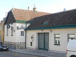
Hauerhaus ObjectID : 84359 since 2019 |
Sandgasse 8 KG location : Grinzing |
The house dates from the beginning of the 19th century. |
ObjectID : 84359 Status : Notification Status of the BDA list: 2020-02-29 Name: Hauerhaus GstNr .: 167 |

|
Former Poor House ObjectID : 41974 |
Sandgasse 10 KG location : Grinzing |
The house at Sandgasse 10 served as a community center and was built as a two-story building with a hipped roof. Subsequently, from the second quarter of the 19th century, a single-storey, eaves-facing construction took place. |
ObjectID : 41974 Status : Notification Status of the BDA list: 2020-02-29 Name: Former Poor house GstNr .: 166 Sandgasse 10 (Vienna) |

|
Residential and commercial building ObjectID : 131016 since 2019 |
Sandgasse 12 KG location : Grinzing |
The house belongs to a group of single-storey eaves-standing houses from the second quarter of the 19th century. |
ObjectID : 131016 Status : Notification Status of the BDA list: 2020-02-29 Name: Residential and commercial building GstNr .: 165/6 |

|
Residential and commercial building ObjectID : 131017 since 2019 |
Sandgasse 14 KG location : Grinzing |
The house belongs to a group of single-storey eaves-standing houses from the second quarter of the 19th century. |
ObjectID : 131017 Status : Notification Status of the BDA list: 2020-02-29 Name: Residential and commercial building GstNr .: 146 |

|
Residential and commercial building ObjectID : 131018 since 2019 |
Sandgasse 16 KG location : Grinzing |
The house belongs to a group of single-storey eaves-standing houses from the second quarter of the 19th century. |
ObjectID : 131018 Status : Notification Status of the BDA list: 2020-02-29 Name: Residential and commercial building GstNr .: 149 |

|
Residential and commercial building ObjectID : 131019 since 2019 |
Sandgasse 18 KG location : Grinzing |
The house belongs to a group of single-storey eaves-standing houses from the second quarter of the 19th century. |
ObjectID : 131019 Status : Notification Status of the BDA list: 2020-02-29 Name: Residential and commercial building GstNr .: 150 |

|
Forestry / Hunting Lodge / Forestry Office Building ObjectID : 72535 |
Sieveringer Straße 230 KG location : Grinzing |
ObjectID : 72535 Status: § 2a Status of the BDA list: 2020-02-29 Name: Forestry / Hunting House / Forestry Office Building GstNr .: 1189/2 |
|

|
House Sokolowski ObjectID: 41986 |
Suttingergasse 12 KG location : Grinzing |
The house is part of the Kaasgraben colony built in 1913 according to plans by the architect Josef Hoffmann. |
ObjectID: 41986 Status: Notification Status of the BDA list: 2020-02-29 Name: Haus Sokolowski GstNr .: 450/33 Suttingergasse 12-14 |

|
House Küpper ObjectID: 41987 |
Suttingergasse 14 KG location : Grinzing |
The house is part of the Kaasgraben colony built in 1913 according to plans by the architect Josef Hoffmann. |
ObjectID: 41987 Status: Notification Status of the BDA list: 2020-02-29 Name: Haus Küpper GstNr .: 450/32 Suttingergasse 12-14 |

|
House Vetter ObjectID: 41988 |
Suttingergasse 16 KG location : Grinzing |
The house is part of the Kaasgraben colony built in 1913 according to plans by the architect Josef Hoffmann. |
ObjectID: 41988 Status: Notification Status of the BDA list: 2020-02-29 Name: Haus Vetter GstNr .: 450/31 Suttingergasse 16-18 |

|
House Michel ObjectID: 41989 |
Suttingergasse 18 KG location : Grinzing |
The home of the writer Robert Michel is part of the Kaasgraben colony built in 1913 according to plans by the architect Josef Hoffmann. |
ObjectID: 41989 Status: Notification Status of the BDA list: 2020-02-29 Name: Haus Michel GstNr .: 450/16 Suttingergasse 16-18 |

|
Underground corridor / Camaldolese grotto ObjectID : 42139 |
Wildgrube location KG: Grinzing |
The underground passage was examined by the city archeology in 2012 and dated to around 1830. The assumption, expressed in the name of the property, that he was connected to the Camaldulensians on Kahlenberg can be considered refuted, as their hermitage was abandoned in 1781. The actual use is unknown. |
ObjectID : 42139 Status : Notification Status of the BDA list: 2020-02-29 Name: Unterirdischer Gang / Camaldulensergrotte GstNr .: 991 Unterirdischer Gang (Wildgrube) |

|
Danube Canal regulation and construction (including bridges, railings and other) ObjectID : 129779 since 2012 |
KG location : Heiligenstadt |
The Danube Canal is the arm of the Danube that leads past the city center, the name came up before 1700. There were already attempts at regulation in earlier centuries, but the current appearance goes back to the Danube regulation after 1867, when bank fortifications and bridges were built. |
ObjectID : 129779 Status : Notification Status of the BDA list: 2020-02-29 Name: Danube Canal regulation and construction (including bridges, railings and other) GstNr .: 1072/10 Danube Canal |

|
Residence of Bruno Kreisky ObjectID : 129851 since 2012 |
Armbrustergasse 15 KG location : Heiligenstadt |
The core of the house dates from the first half of the 19th century and has a small courtyard and a gabled central projectile. A Madonna figure is located on a broad pillar integrated into the garden wall. |
ObjectID : 129851 Status : Notification Status of the BDA list: 2020-02-29 Name: Bruno Kreisky's house, GstNr .: 90 Armbrustergasse 15 |

|
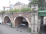
Pedestrian bridge, Döblinger Steg ObjectID : 77169 |
Döblinger Steg location KG: Heiligenstadt |
The Döblinger Steg crosses the Danube Canal in Vienna and connects the districts of Döbling and Brigittenau . It was built between 1910 and 1911 according to plans by Friedrich Jäckel and serves as a pedestrian link and as a pipe bridge for water pipes and a gas pipe. At each end it is flanked by pylon-flanked archways with bosses. |
ObjectID : 77169 Status: § 2a Status of the BDA list: 2020-02-29 Name: Pedestrian Bridge, Döblinger Steg GstNr .: 1072/6; 1072/10; 1072/12 Döblinger Steg |

|
Figure shrine St. Johannes Nepomuk ObjectID : 87025 |
at Eroicagasse 37 KG location : Heiligenstadt |
The stone figure on the pedestal dates from the middle of the 18th century. |
ObjectID : 87025 Status: § 2a Status of the BDA list: 2020-02-29 Name: Figurine picture stick hl. Johannes Nepomuk GstNr .: 608/1 |

|
Beethoven and Grillparzer residential building ObjectID: 41917 |
Grinzinger Straße 64 KG location : Heiligenstadt |
The two-storey house was built at the end of the 18th century. A plaque commemorates the former residents Ludwig van Beethoven and Franz Grillparzer . |
ObjektID: 41917 Status: Notification Status of the BDA list: 2020-02-29 Name: Beethoven- and Grillparzer-Wohnhaus GstNr .: 125; 123 Beethoven Grillparzer House |
|
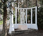
Beethoven monument in the Heiligenstädter Park ObjectID : 117553 |
Grinzinger Straße 84 KG location : Heiligenstadt |
The monument with pillar colonnade was erected in 1910 by the sculptor Fritz Hä (h) nlein and the architect Robert Oerley . The standing figure goes back to a model by Robert Weigl from 1902. |
ObjectID : 117553 Status: § 2a Status of the BDA list: 2020-02-29 Name: Beethoven monument in Heiligenstädter Park GstNr .: 194/1 Beethoven monument, Heiligenstädter Park |

|
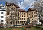
School ObjectID : 118869 |
Grinzinger Straße 88 KG location : Heiligenstadt |
The school building was built in 1970–1973 by Hannes Lintl and Robert Krapfenbauer . |
ObjectID : 118869 Status: § 2a Status of the BDA list: 2020-02-29 Name: School GstNr .: 246/1 |
|
Lycee Francais ObjectID : 52433 |
Grinzinger Straße 95 KG location : Heiligenstadt |
The towering, four-story school building with a street courtyard was built in 1895. The building has high, partially boarded-up gable structures, niche figures on the courtyard side and lintel cartouches with the Vienna coat of arms. The cast iron vestibules are just as original as the fences. |
ObjectID : 52433 Status: § 2a Status of the BDA list: 2020-02-29 Name: Lycee Francais GstNr .: 182/1 |

|
Railway line, Vienna suburb line - sub-area Heiligenstadt with station Heiligenstadt ObjectID : 52468 |
Gunoldstrasse 7, 10 KG location : Heiligenstadt |
The suburban line opened in 1898 and was originally part of the Vienna Stadtbahn . Like this one, it was built according to plans by Otto Wagner . After the First World War, however, it was not put into operation as part of the Vienna Electric Light Rail, but mainly used for freight transport. It was not until 1987 that it became part of local public transport again as the S-Bahn line . Only three of the original stations could be used again.
The main features of the Heiligenstadt train station also originated from Wagner and is now an important traffic junction. |
ObjectID : 52468 Status : Notification Status of the BDA list: 2020-02-29 Name: Railway line, Vienna suburb line - sub-area Heiligenstadt with station Heiligenstadt GstNr .: 1016; 1017; 1018; 1021/1; 1030; 1031; 1032; 1070/2 suburb line |

|
Former gatehouse of the Rothschild Gardens ObjectID : 83445 |
Heiligenstädter Park KG location : Heiligenstadt |
The single-storey building in historicist design was originally part of the Rothschild Gardens created by Baron Nathaniel Mayer Anselm Freiherr von Rotschild and is now the only remaining structural part of this garden. The former gatekeeper's house is now at the entrance to Heiligenstädter Park . |
ObjectID : 83445 Status: § 2a Status of the BDA list: 2020-02-29 Name: Former Gatehouse of the Rothschild gardens GstNr .: 232 Gatehouse of Rothschild gardens, Döbling |
|
Former Stadtbahn - section Nussdorfer Straße - Heiligenstadt ObjectID : 86502 |
Heiligenstädter Straße KG location : Heiligenstadt |
The light rail system was planned from 1892 as part of the regulation of the Danube Canal and Vienna River , and Otto Wagner had been the aesthetic adviser since 1894 . Together with his employees, he planned the substructure, high-rise structures (retaining walls, bridges, tunnel portals, viaducts, stations) and details (railings, grilles, gates, furniture, lighting, etc.) for all light rail lines. After six years of construction, around forty kilometers of railway with 36 stations were built in the style of late historicism with art nouveau elements . From 1969 to 1989 the system was modernized and gradually integrated into the subway network .
This route, which is mainly designed as an elevated railway, is now closed. |
ObjectID : 86502 Status : Notification Status of the BDA list: 2020-02-29 Name: Former Stadtbahn - section Nußdorfer Straße - Heiligenstadt GstNr .: 982/1; 1019 Heiligenstädter branch |

|
Stadtbahn, sub-area Heiligenstadt ObjectID : 116954 |
KG location : Heiligenstadt |
This part of the former light rail is still in service with the underground. More detailed description here . |
ObjektID : 116954 Status : Notification Status of the BDA list: 2020-02-29 Name: Stadtbahn, sub-area Heiligenstadt GstNr .: 985/2 Wiener Stadtbahn |

|
Municipal housing, Svoboda-Hof ObjectID : 115517 |
Heiligenstädter Straße 80 KG location : Heiligenstadt |
The Svoboda-Hof was built between 1926 and 1927 according to plans by the architect Karl Ehn with 59 apartments. It is a relatively simple building, which is determined by cubic bay windows that are connected to balconies. |
ObjectID : 115517 Status: § 2a Status of the BDA list: 2020-02-29 Name: Municipal housing, Svoboda-Hof GstNr .: 601/9 Svoboda-Hof |

|
Karl-Marx-Hof and Kunst-am-Bau ObjectID : 52462 |
Heiligenstädter Straße 82-92, even numbers, KG location : Heiligenstadt |
The Karl-Marx-Hof is the most representative and best-known communal residential building of the interwar period and is considered a prime example of the “superblocks” developed at that time. It was built from 1926 to 1933 according to plans by Karl Ehn , but officially opened on October 12, 1930. It is built on a long but narrow piece of land, the central part with the six monumental towers is particularly representative. In the middle courtyard is the figure of the sower by Otto Hofner , the ceramic figures above the arches are by Josef Franz Riedl . |
ObjectID : 52462 Status: § 2a Status of the BDA list: 2020-02-29 Name: Karl-Marx-Hof and Kunst-am-Bau GstNr .: 601/1; 601/2; 601/3; 601/4; 601/5; 601/6; 601/7; 601/8; 601/15; 601/23; 601/40; 601/38; 601/39; 601/41; 601/42; 601/43 Karl-Marx-Hof |

|
Unterheiligenstädter Parish Church Mary Mother of Grace ObjectID : 86967 |
Heiligenstädter Straße 101 KG location : Heiligenstadt |
The church was built from 1965 according to plans by the architect Carl Müller and his son Wolfgang and was consecrated on November 5, 1966. It is a three-sided free-standing building, on the side fronts window slots open between lamellar concrete pillars, the window openings facing Klabundgasse are arranged irregularly. The square bell tower is also criss-crossed by lamellar pillars. The interior has a rounded choir wall with exposed bricks and a continuous southern organ gallery. The copper figure of the Returning Christ on the altar wall comes from Paul Peschke , the designs for the glass windows from the architects. |
ObjectID : 86967 Status: § 2a Status of the BDA list: 2020-02-29 Name: Unterheiligenstädter Parish Church Maria Mother of Grace GstNr .: 322/3; 322/4; 322/6 Unterheiligenstadt parish church |

|
Municipal Housing ObjectID : 128806 |
Heiligenstädter Strasse 129 KG location : Heiligenstadt |
The community housing was built between 1953 and 1954 according to plans by Josef Hoffmann and Josef Kalbac . The building consists of three separate structures of the same size that stand parallel to each other with the longitudinal front facing Heiligenstädter Straße and thus break with the tradition of block-like arrangement. |
ObjectID : 128806 Status : Notification Status of the BDA list: 2020-02-29 Name: Kommunaler Wohnbau GstNr .: 291/9 Housing complex Heiligenstädter Straße 129 |
|
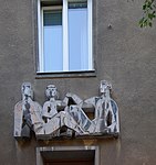
House sign, relief ObjectID : 52461 |
Heiligenstädter Strasse 129 KG location : Heiligenstadt |
The family stone relief was made in 1953/54 by Heinz Leinfellner . |
ObjectID : 52461 Status : Notification Status of the BDA list: 2020-02-29 Name: House sign, relief GstNr .: 291/9 Residential complex Heiligenstädter Straße 129 |

|
Kunst-am-Bau, Sculptures ObjectID : 52458 |
Heiligenstädter Strasse 141, 143, 145 KG location : Heiligenstadt |
The works of art in this council are: the sculpture horses of Hubert Wilfan (1954/57), the sculpture cattle from Fritz Dobrowa (1954/57) and the mosaic mural beach life of Hans Thomas (1957). |
ObjectID : 52458 Status: § 2a Status of the BDA list: 2020-02-29 Name: Kunst-am-Bau, Skulpturen GstNr .: 278/7 Kunst am Bau (residential complex Heiligenstädter Straße 141-145) |

|
Kunst-am-Bau, Figures Seated ObjectID : 115518 |
at Heiligenstädter Straße 151 KG location : Heiligenstadt |
The sculpture (also called Men in Conversation ) was made by Hilde Uray between 1956–1961. |
ObjectID : 115518 Status: § 2a Status of the BDA list: 2020-02-29 Name: Kunst-am-Bau, Figures Seated GstNr .: 985/1 Plastic Seated (Heiligenstädter Straße, Döbling) |

|
Volksheim with Kunst-am-Bau ObjektID : 52459 |
Heiligenstädter Straße 155 KG location : Heiligenstadt |
The Volksheim was built in 1961 according to plans by Gustav Peichl . It contains a wall mosaic made of glass Knowledge makes free by Roman Haller from 1960/61. |
ObjectID : 52459 Status: § 2a Status of the BDA list: 2020-02-29 Name: Volksheim mit Kunst-am-Bau GstNr .: 278/3 Volksheim Heiligenstädter Straße |

|
Karner at the parish church of St. Michael ObjectID : 66320 |
Hohe Warte location KG: Heiligenstadt |
The Karner is integrated into the surrounding wall of the abandoned cemetery. On the long side there is a central late Gothic gate and symmetrical arched windows. The supporting pillars added later, however, could not prevent the collapse of the groin vault , so that a renewal of the roof was necessary. |
ObjectID : 66320 Status: § 2a Status of the BDA list: 2020-02-29 Name: Karner at the parish church hl. Michael GstNr .: 194/3 Karner St. Michael, Heiligenstadt (Vienna) |

|
House with Severins Cross ObjectID : 41937 |
Hohe Warte 31 KG location : Heiligenstadt |
The two-storey country house was built in the first half of the 19th century with a classicist front, triangular gable and wood cladding on the weather side. The broad pillar with a picture of St. Matthias (or Severin?) On the garden wall dates from the second third of the 19th century. |
ObjectID : 41937 Status : Notification Status of the BDA list: 2020-02-29 Name: House with Severinskreuz GstNr .: 143 Hohe Warte 31 |

|
House with garden ObjectID : 41939 |
Hohe Warte 33 KG location : Heiligenstadt |
The house dates from the first half of the 19th century and was later changed. |
ObjectID : 41939 Status : Notification Status of the BDA list: 2020-02-29 Name: House with garden GstNr .: 146 Hohe Warte 33 |

|
Central Institute for Meteorology and Geodynamics ObjectID : 52532 since 2017 |
Hohe Warte 38 KG location : Heiligenstadt |
The building called Julius-Hann- Haus is the headquarters of the Central Institute for Meteorology and Geodynamics and was built in 1882 by Heinrich von Ferstel . |
ObjectID : 52532 Status : Notification Status of the BDA list: 2020-02-29 Name: Central Institute for Meteorology and Geodynamics GstNr .: 345 Julius-Hann-Haus |

|
Catholic parish church hl. Michael with churchyard ObjectID : 52531 |
Hohe Warte 72 KG location : Heiligenstadt |
A three-aisled staggered church, which incorporates the foundation walls and the choir of the previous church in neo-Gothic style and similar to the previous church (except for the tower) according to plans by Richard Jordan , with the participation of Martin and Josef Schömer , built from 1894 and on May 26, 1898 was inaugurated.
A lower, polygonally closed Gothic choir adjoins a nave with a high hipped roof and tracery windows between gabled buttresses. The western gable facade has a neo-Gothic shoulder arch portal in an ogival frame, and the octagonal tower is also neo-Gothic. The interior is vaulted with mesh ribs with fan brackets and figural keystones. The choir has a 5/8 end with a window. Most of the furnishings were made by Richard Jordan in the 19th century. |
ObjectID : 52531 Status: § 2a Status of the BDA list: 2020-02-29 Name: Catholic parish church hl. Michael with churchyard GstNr .: 160; 159/1 Heiligenstadt parish church of St. Michael |

|
Figure shrine St. Johannes Nepomuk ObjectID : 84353 |
in front of Hohe Warte 72 KG location : Heiligenstadt |
The figure of St. John Nepomuk comes from the first quarter of the 18th century. She carries a cross and a martyr's palm in her hand, but has no biretta . It stands on a curved pedestal with lateral volutes, which has a relief of the saint in the waves of the Vltava . |
ObjectID : 84353 Status: § 2a Status of the BDA list: 2020-02-29 Name: Figurine picture stick hl. Johannes Nepomuk GstNr .: 996/6 |

|
Beethoven Monument ObjectID : 116481 |
opposite Kahlenberger Straße 69 KG location : Heiligenstadt |
The bronze bust was created by Anton Dominik von Fernkorn in 1862 . |
ObjektID : 116481 Status: § 2a Status of the BDA list: 2020-02-29 Name: Beethoven monument GstNr .: 616/5 Beethovenruhe |

|
Figure shrine St. Johannes Nepomuk ObjectID : 87028 |
at Kahlenberger Straße 81 KG location : Heiligenstadt |
This statue of St. Johannes Nepomuk on a curved base dates from the 18th century. |
ObjectID : 87028 Status: § 2a Status of the BDA list: 2020-02-29 Name: Figurine picture stick hl. Johannes Nepomuk GstNr .: 776/1 Johannes Nepomuk, Schreiberbach |

|
Main building of the former Samum cigarette paper factory ObjectID : 52457 |
Kreilplatz 1 KG location : Heiligenstadt |
The reinforced concrete frame construction with an elongated, four-storey front was built between 1908 and 1909 according to plans by Philipp J. Manz . The building now houses the Q19 shopping center, among other things. |
ObjectID : 52457 Status : Notification Status of the BDA list: 2020-02-29 Name: Main building of the former Samum cigarette paper factory GstNr .: 557/8 |

|
Former Steam -powered power station ObjectID : 41961 |
Muthgasse 109 KG location : Heiligenstadt |
The former power station in a representative exposed brick construction was built in 1897 by R. Barthelmus & Co for the power supply of the light rail, the Westbahnhof and the Franz-Josefs-Bahnhof and served as a training workshop after 1945. |
ObjectID : 41961 Status : Notification Status of the BDA list: 2020-02-29 Name: Former Steam -powered power station GstNr .: 550/1 |

|
Figure shrine St. Johannes Nepomuk ObjectID : 84349 |
Pfarrplatz location KG: Heiligenstadt |
The stone figure of St. John Nepomuk on a pedestal was created in the third quarter of the 18th century. |
ObjectID : 84349 Status: § 2a Status of the BDA list: 2020-02-29 Name: Figurine picture stick hl. Johannes Nepomuk GstNr .: 959/1 Statue of John of Nepomuk, Pfarrplatz Döbling |
|
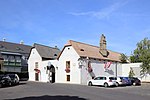
Beethoven House ObjectID : 41967 |
Pfarrplatz 2 KG location : Heiligenstadt |
The winegrower's house has a core from the 17th century and served as Ludwig van Beethoven's residence in 1817. The building consists of two parallel, gable-facing wings with a gate wall and a rear transverse wing. On the south-west edge of the building there is a figure of St. Florian, probably from the 18th century. The winegrower's house now serves as the “Mayr am Pfarrplatz” wine tavern. |
ObjectID : 41967 Status : Notification Status of the BDA list: 2020-02-29 Name: Beethoven-Wohnhaus GstNr .: 12 Pfarrplatz 2 (Döbling) |

|
Heiligenstadt Church of St. Jakob with ruins ObjectID : 66313 |
Pfarrplatz 3 KG location : Heiligenstadt |
This Romanesque hall church, partially rebuilt in Baroque style, was built above a Roman-early Christian stone building that stands across the current church building and dates from the 2nd century. The church itself is a simple building with a choir square, facing the parish square it has a gable front with a façade rider from 1752 and a portal house from the 20th century, Romanesque arched windows alternate with those from the 17th century on the nave. The core of the interior is also from the 12th century with pillars and groin vaults from the 17th century. The ribbed vault with keystone in the choir dates from the 14th century. Some of the furnishings date from the 20th century. |
ObjectID : 66313 Status: § 2a Status of the BDA list: 2020-02-29 Name: Heiligenstädter Church hl. Jakob with ruins GstNr .: 1 Heiligenstädter Church St. Jakob |

|
Pfarrhof Heiligenstadt ObjectID: 41968 |
Pfarrplatz 3 KG location : Heiligenstadt |
The rectory consists of an irregular group of buildings, the core of which dates from the 14th century and was rebuilt in the 17th century. It consists of the actual rectory with a bent front, irregular windows and a hip roof and the cooperator's house , which is connected to the church by a flying buttress. |
ObjectID: 41968 Status: § 2a Status of the BDA list: 2020-02-29 Name: Pfarrhof Heiligenstadt GstNr .: 2/1; 2/2 Heiligenstadt rectory |

|
Former School ObjectID: 41969 |
Pfarrplatz 4 KG location : Heiligenstadt |
The building served as a primary school and a sacristan's house and its core dates from the beginning of the 16th century. The two-storey traufständige building whose facade was built in the third quarter of the 19th century, has on the southern front late Gothic rectangular windows on the ground floor and lunette tons - and groin vault . |
ObjectID: 41969 Status: § 2a Status of the BDA list: 2020-02-29 Name: Former. School GstNr .: 10 Pfarrplatz 4 (Döbling) |

|
Gasthaus Zur Schöne Aussicht / Pfarrwirt ObjectID : 52436 |
Pfarrplatz 5 KG location : Heiligenstadt |
The building, which has been in the possession of Klosterneuburg Monastery since 1250 , served as the Berghof for the vineyards in Heiligenstadt. It has been run as a coffee house since the beginning of the 19th century and later as a restaurant. The high Gothic building from the second half of the 13th century was rebuilt at the end of the 15th and the end of the 17th century. |
ObjectID : 52436 Status: § 2a Status of the BDA list: 2020-02-29 Name: Gasthaus Zur Schöne Aussicht / Pfarrwirt GstNr .: 6/2 Gasthaus Zur Schöne Aussicht / Pfarrwirt |

|
Former Garden house ObjectID : 41970 |
Pfarrplatz 6 KG location : Heiligenstadt |
The single-storey Stöckl has a facade from the 19th century, but the wooden beams and abutments inside probably date from the 16th century. |
ObjectID : 41970 Status: § 2a Status of the BDA list: 2020-02-29 Name: Former Garden house GstNr .: 959/2 Gasthaus Zur Schöne Aussicht / Pfarrwirt |

|
Beethoven House ObjectID: 41971 |
Probusgasse 6 KG location : Heiligenstadt |
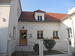
The Beethoven House in Probusgasse is essentially a late Gothic, two-storey, four-sided complex around a small courtyard. The bent street wing was rebuilt in the 18th century. Beethoven wrote the Heiligenstadt Testament here in 1802 . |
ObjectID: 41971 Status: Notification Status of the BDA list: 2020-02-29 Name: Beethoven-Wohnhaus GstNr .: 175 House of the Heiligenstädter Testament |
|
Residential building and day-care center ObjectID : 77006 |
Probusgasse 9 KG location : Heiligenstadt |
The house dates from the post-war period and its appearance and eaves height have been adapted to the neighboring houses. |
ObjectID : 77006 Status: § 2a Status of the BDA list: 2020-02-29 Name: Residential house and day-care center GstNr .: 41 |

|
Housing with Kunst-am-Bau ObjektID : 52438 |
Probusgasse 14, 16 KG location : Heiligenstadt |
A mosaic depicting the Roman Emperor Probus can be seen on this communal residential building by Eva Poduschka (1958–1960) . It comes from Helene Hädelmayr . In the courtyard there are also two ceramic wall reliefs by Leopold Hohl (at the Heurigen ) and Richard Ruepp ( wine press ). |
ObjektID : 52438 Status: § 2a Status of the BDA list: 2020-02-29 Name: Housing with Kunst-am-Bau GstNr .: 182/2; 184; 185 Probusgasse 14-16 |

|
Hauerhaus, Mandahus ObjectID : 41972 |
Probusgasse 27 KG location : Heiligenstadt |
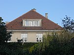
The core of the house with its bent front dates from the 16th and 17th centuries. |
ObjectID : 41972 Status : Notification Status of the BDA list: 2020-02-29 Name: Hauerhaus, Mandahus GstNr .: 24 Probusgasse 27 |
|
Villa Bernatzik ObjectID : 41984 |
Springsiedelgasse 28 KG location : Heiligenstadt |
The Villa Bernatzik was built between 1912 and 1913 according to plans by Josef Hoffmann in a cubic block-like construction with a hipped roof. |
ObjektID : 41984 Status : Notification Status of the BDA list: 2020-02-29 Name: Villa Bernatzik GstNr .: 83/1; 83/4; 83/5 |

|
Villa complex Ast ObjektID : 66137 since 2017 |
Steinfeldgasse 2 KG location : Heiligenstadt |
The complex belonging to the Hohe Warte villa colony was built in 1909–19011 by Josef Hoffmann . Its closed structure makes it stand out from the neighboring houses, and the fluting that defines the facade is a striking element . |
ObjektID : 66137 Status : Notification Status of the BDA list: 2020-02-29 Name: Villa complex Ast GstNr .: 201/3; 201/22 |

|
House Spitzer ObjectID : 66136 |
Steinfeldgasse 4 KG location : Heiligenstadt |
The Spitzer house is part of a group of spacious villas, each designed by contemporary artists, with the Spitzer house, together with the Moser-Moll and Henneberg houses, forming the core of the complex. The complex, planned by Josef Hoffmann, captivates with its cubic structure, which is accentuated by color-graded half-timbering, gables and woodwork. |
ObjectID : 66136 Status : Notification Status of the BDA list: 2020-02-29 Name: Haus Spitzer GstNr .: 201/12 |

|
Stefaniewarte ObjektID : 87010 |
Am Kahlenberg location KG: Josefsdorf |
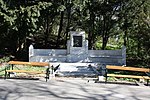
The observation tower was built according to plans by the Fellner & Helmer architects on behalf of the Kahlenberg Railway Company at the terminus of the Kahlenberg Railway and opened on May 29, 1887 under the name "Crown Princess Stephanie-Warte". The 22 meter high observation tower in the late historical castle style was built with alternating layers of exposed bricks and an observation platform in the form of a battlement. |
ObjectID : 87010 Status: § 2a Status of the BDA list: 2020-02-29 Name: Stefaniewarte GstNr .: 73/59 Kronprinzessin Stefanie-Warte |
|
Personality monument , Elisabethruhe ObjektID : 87012 |
Am Kahlenberg location KG: Josefsdorf |
The 1904 monument for Empress Elisabeth in the form of a resting bench was made by Oskar Flegel von Farnholz and Eduard Hauser , the bronze portrait relief by Rudolf Bachmann . |
ObjektID : 87012 Status: § 2a Status of the BDA list: 2020-02-29 Name: Personality monument , Elisabethruhe GstNr .: 73/54 Elisabethruhe am Kahlenberg |

|
Former Bus shelter of Wiener Linien ObjectID : 72289 |
Am Kahlenberg location KG: Josefsdorf |
The transparent glass construction was built in 1935. |
ObjectID : 72289 Status: § 2a Status of the BDA list: 2020-02-29 Name: Former Bus shelter of Wiener Linien GstNr .: 66/18 Bus shelter Kahlenberg |

|
Höhenstraße ObjectID : 87011 since 2020 |
Höhenstraße location KG: Josefsdorf |
see KG Grinzing |
ObjectID : 87011 Status : Notification Status of the BDA list: 2020-02-29 Name: Höhenstraße GstNr .: 74/1; 75/3; 75/4; 78; 79/1; 73/13; 71/2; 73/1; 70; 73/14; 69; 66/18; 66/14; 66/16; 66/17; 73/17; 73/18; 73/16 Höhenstraße, Vienna |

|
Staircase, memorial stone and head structure Höhenstraße ObjectID : 115484 |
Höhenstraße location KG: Josefsdorf |
The staircase with memorial inscription comes from the construction time of the Höhenstraße (this section was opened in 1935), the relief Relief Army 1683 comes from 1960 by Heinz Leinfellner . |
ObjectID : 115484 Status: § 2a Status of the BDA list: 2020-02-29 Name: Staircase , memorial stone and head structure Höhenstraße GstNr .: 73/1 Gedenkanlage Höhenstraße |

|
Catholic parish church, Kahlenbergkirche hl. Josef ObjectID : 52450 |
Josefsdorf 1 KG location : Josefsdorf |
The former Camaldulenserkirche on the Kahlenberg is a simple baroque hall church with a south-facing tower. The mass is said to have been read here before the Battle of Kahlenberg , and numerous memorials remind of it. It was originally part of a hermitage that was built until 1639, the church itself was rebuilt from 1683 to 1734 after severe damage. The floor plan of the church is rectangular, the facade is simple with Tuscan pilasters on the edges and a gable field on the entrance front. The baroque high altar consists of a crucifixion group with drapery, the drapery painting on the back is from 1852. |
ObjectID : 52450 Status: § 2a Status of the BDA list: 2020-02-29 Name: Catholic parish church, Kahlenbergkirche hl. Josef GstNr .: 1/1; 1/3 St. Josef (Kahlenberg) |

|
Fountain ObjectID : 87013 |
Josefsdorf 1V location KG: Josefsdorf |
The well was built in 1686 by the Camaldulens after the spring was opened up . It consists of a round basin with wrought iron decorations. |
ObjectID : 87013 Status: § 2a Status of the BDA list: 2020-02-29 Name: Brunnen GstNr .: 74/1 Brunnen Kahlenbergerkirche |

|
Hotel-Restaurant am Kahlenberg ObjectID : 79020 |
Josefsdorf 2, 3 KG location : Josefsdorf |
The restaurant was built in 1935 by Erich Boltenstern and later rebuilt several times. |
ObjectID : 79020 Status : Notification Status of the BDA list: 2020-02-29 Name: Hotel-Restaurant am Kahlenberg GstNr .: 42/1 Modul, Kahlenberg |

|
Defense tower and wall ObjectID : 41940 |
Josefsdorf 6, 8 KG location : Josefsdorf |
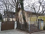
Note: The address Josefsdorf 6, 8 does not exist |
ObjectID : 41940 Status : Notification Status of the BDA list: 2020-02-29 Name: Defense tower and wall GstNr .: 18 |
|
3 former Camaldulenser cells ObjectID : 115479 since 2012 |
Josefsdorf 15 - 17 KG location : Josefsdorf |
Between 1629 and 1639, under Emperor Ferdinand II, a hermitage of the Camaldolese order was laid out on the Kahlenberg . After the destruction by the Turks in 1683 and the abolition of the monastery in 1782, the buildings came into private ownership at the beginning of the 19th century. The houses were newly faced in the 19th century. Note: This refers to the three gable houses facing the street. The middle and eastern cell houses are now connected by an additional building and appear as one building. |
ObjectID : 115479 Status : Notification Status of the BDA list: 2020-02-29 Name: Former Camaldulenser cell GstNr .: 20; 22/1 |

|
Former Camaldulenser cell ObjectID : 42138 |
Josefsdorf 18 KG location : Josefsdorf |
House Josefsdorf No. 18 of the former Camaldolese cells has remained almost unchanged. The former prayer room is located north of the central corridor. The square room with a flat dome was painted in the 2nd half of the 18th century with the Eye of God in the center, surrounded by putti heads and lateral flower tendrils. |
ObjectID : 42138 Status : Notification Status of the BDA list: 2020-02-29 Name: Former Camaldulenser cell GstNr .: 17/1 Josefsdorf 18 (Vienna) |

|
Former Camaldulenser cell ObjectID : 115481 since 2013 |
Josefsdorf 20, 21 KG location : Josefsdorf |
The former Camaldulenser cell has an eaves-side extension from 1800. |
ObjectID : 115481 Status : Notification Status of the BDA list: 2020-02-29 Name: Former Camaldulenser cell GstNr .: 10/1; 11/1 |

|
Landmark ObjectID : 115490 |
Josefsdorf 48 KG location : Josefsdorf |
The boundary stone is marked with the year 1744. |
ObjectID : 115490 Status: § 2a Status of the BDA list: 2020-02-29 Name: Grenzstein GstNr .: 73/1 Grenzstein Kahlenberg |

|
Kahlenberger Friedhof / Josefsdorfer Friedhof including hidden tombs ObjectID : 86969 |
Kahlenberger Friedhof KG location : Josefsdorf |
The cemetery on the southern slope of the Kahlenberg was opened in 1783. The grave chapel of the Finsterle family from the middle of the 19th century is in neo-Gothic form and contains the wall painting Risen Christ by Friedrich Schilcher inside . In addition, some grave monuments from the Biedermeier period have been preserved. |
ObjectID : 86969 Status: § 2a Status of the BDA list: 2020-02-29 Name: Kahlenberger Friedhof / Josefsdorfer Friedhof including grave monuments that have fallen victim to GstNr .: 47 Waldfriedhof Kahlenberg |

|
Figure shrine St. Johannes Nepomuk ObjectID : 87008 |
at Kahlenberger Friedhof, KG location : Josefsdorf |
This Nepomuk figure from 1724 stands on a high column with a dedication inscription. |
ObjectID : 87008 Status: § 2a Status of the BDA list: 2020-02-29 Name: Figurine picture stick hl. Johannes Nepomuk GstNr .: 45 figure shrine St. Johannes Nepomuk at the Kahlenberger Friedhof, Vienna |

|
Camaldolese grotto ObjectID : 129145 |
KG location : Josefsdorf |
Note: According to a garden historian, it was listed in the 1920s and no longer exists / accessible today. |
ObjectID : 129145 Status : Notification Status of the BDA list: 2020-02-29 Name: Camaldulensergrotte GstNr .: 16 |

|
Catholic branch church hl. Leopold am Leopoldsberg ObjectID : 86965 |
At the Leopoldsberg location KG: Kahlenbergerdorf |
The church was originally part of the " castle ", in its present form it dates back to 1679. Damaged in 1683, it was rebuilt and expanded by Antonio Beduzzi from 1718–1730 . It is a central building with a dome and double tower facade. It has a uniform Tuscan pilaster structure, the towers protrude slightly and are braced to the main facade via cornices. The high altar dates from the late 18th century, the side altars are mostly baroque. |
ObjectID : 86965 Status: § 2a Status of the BDA list: 2020-02-29 Name: Kath. Filialkirche hl. Leopold am Leopoldsberg GstNr .: 282 Sankt Leopold auf dem Leopoldsberg |

|
Homecoming Memorial ObjectID : 131253 since 2018 |
At the Leopoldsberg location KG: Kahlenbergerdorf |
There are four stone blocks in memory of prisoners of war and displaced persons. These were originally part of a monument erected by Mario Petrucci in 1948 . It consisted of a ring-shaped wall with four niches and a pylon with a sacrificial bowl. It was reopened in 2018 in its current, reduced form at a slightly offset location. |
ObjectID : 131253 Status : Notification Status of the BDA list: 2020-02-29 Name: Homecoming memorial GstNr .: 315/1 Category: Homecoming memorial (new) |
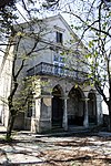
|
Palas, beneficiary house, forester's house and remains of the castle complex including walling ObjektID : 41885 |
Am Leopoldsberg 1 location KG: Kahlenbergerdorf |
These buildings, which are part of Kahlenberg Castle, mentioned in a document in 1248, are located north of the church. Remnants of a medieval defensive wall are still preserved. The hall has a structure from the 13th century, the beneficiary's house from the 17th and the forester's house from the 18th century. Later redesigns took place in the 19th century. |
ObjektID : 41885 Status: § 2a Status of the BDA list: 2020-02-29 Name: Palas, Benefiziatenhaus, Försterhaus and remains of the castle complex including walling GstNr .: 283/1; 283/3; 283/4; 281/12 Castle on Leopoldsberg |

|
Bürgerhaus ObjektID : 41892 |
Bloschgasse 1 KG location : Kahlenbergerdorf |
This mighty free-standing structure is essentially medieval. It was expanded after 1683 and rebuilt in the 19th century. The facade shows a rich plaster field structure and a late historical portal. Inside there are partly capped barrels and in the passage to the courtyard there is a late baroque square vault. The pawlatschengang in the courtyard dates from around 1900. |
ObjectID : 41892 Status : Notification Status of the BDA list: 2020-02-29 Name: Bürgerhaus GstNr .: 19 Bloschgasse 1 |
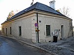
|
Vicarage ObjectID : 41893 |
Bloschgasse 2 KG location : Kahlenbergerdorf |
The rectory is a U-shaped building facing the Danube on steeply sloping terrain. It dates from the first third of the 17th century and was extensively rebuilt around 1900. The facade shows trickle plaster, smoothed corner cuboids, bezels and eaves cornices. Inside there are needle cap barrels. |
ObjectID : 41893 Status: § 2a Status of the BDA list: 2020-02-29 Name: Pfarrhof GstNr .: 27 |
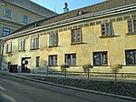
|
Bürgerhaus ObjektID : 41894 |
Bloschgasse 3 KG location : Kahlenbergerdorf |
The two-storey town house from the late 16th / early 17th century with a saddle roof has a facade with stone reveals, profiled sills and a sgraffito decor marked 1617. |
ObjectID : 41894 Status : Notification Status of the BDA list: 2020-02-29 Name: Bürgerhaus GstNr .: 18 |

|
Garden portal ObjektID : 115782 |
behind Heiligenstädter Straße 357 KG location : Kahlenbergerdorf |
The round arched baroque garden portal has relief stones walled in on the sides: one with a coat of arms and the designation IT 1609 , one with a crown and the designation L. |
ObjectID : 115782 Status: § 2a Status of the BDA list: 2020-02-29 Name: Gartenportal GstNr .: 151/2 Gartenportal Kahlenbergerdorf |

|
Höhenstraße ObjectID : 101572 since 2020 |
Höhenstraße location KG: Kahlenbergerdorf |
see KG Grinzing |
ObjectID : 101572 Status : Notification Status of the BDA list: 2020-02-29 Name: Höhenstraße GstNr .: 286/1; 286/2 Höhenstraße, Vienna |

|
Tegetthoff barracks ObjectID : 52425 |
Kuchelauer Hafenstrasse 100 KG location : Kahlenbergerdorf |
The former naval barracks was built in 1939 and expanded until 1961. It is a three-sided system with hipped roofs. |
ObjectID : 52425 Status: § 2a Status of the BDA list: 2020-02-29 Name: Tegetthoff-Kaserne GstNr .: 455/4; 455/12; 455/13 Marinekaserne, Vienna |

|
Nasenweg and viewing terraces on the Leopoldsberg ObjektID : 115570 |
Nasenweg location KG: Kahlenbergerdorf |
The Nasenweg was laid out in 1877 by the Austrian Tourist Club in place of an older path as a promenade. It received its current form during the construction of the Höhenstraße . There are viewing platforms at five bends. |
ObjectID : 115570 Status: § 2a Status of the BDA list: 2020-02-29 Name: Nasenweg and viewing terraces on the Leopoldsberg GstNr .: 315/1 Nasenweg, Vienna |

|
Former Castle church complex, parish church St. Georg with churchyard and messner's house ObjectID : 52426 |
St.-Georg-Platz 1 KG location : Kahlenbergerdorf |
The Kahlenbergerdorfer parish church is a simple Romanesque-Gothic hall building that was later baroque. It dates from the first half of the 13th century, with the choir showing late Gothic features. The tower to the south dates from the construction period, but was heavily modified around 1700, during which time it also received its onion helmet. The portal with the blown gable is marked 1676, the wooden gate with rococo fittings dates from the middle of the 18th century. The high altar is an Ionic double column table with volute attachments, the altarpiece dates from 1826 and goes back to Ludwig Ferdinand Schnorr von Carolsfeld . |
ObjectID : 52426 Status: § 2a Status of the BDA list: 2020-02-29 Name: Former Castle church complex, parish church St. Georg with churchyard and Messnerhaus GstNr .: 1/1; 2 Kahlenbergerdorfer parish church |
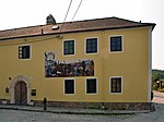
|
Residential building ObjectID : 52427 |
St.-Georg-Platz 2 KG location : Kahlenbergerdorf |
The two-storey eaves building with a flat hipped roof dates in part from the end of the 15th century and was rebuilt at the end of the 17th century. |
ObjectID : 52427 Status: § 2a Status of the BDA list: 2020-02-29 Name: Residential house GstNr .: 3 |

|
Figure shrine St. Johannes Nepomuk ObjectID : 121724 |
Waldbachsteig location KG: Kahlenbergerdorf |
The colorfully framed Nepomuk statue from the 2nd quarter of the 18th century stands on a curved rococo base with an inscription cartouche in an enclosure. |
ObjectID : 121724 Status: § 2a Status of the BDA list: 2020-02-29 Name: Figurine picture stick hl. Johannes Nepomuk GstNr .: 268 Statue of John of Nepomuk, Waldbachsteig |

|
Fire department building ObjectID : 52428 |
Wigandgasse 25 KG location : Kahlenbergerdorf |
The expressionist-style building with a three-story exercise tower was built in 1929/30 by Konstantin Peller and Josef Bittner . |
ObjectID : 52428 Status: § 2a Status of the BDA list: 2020-02-29 Name: Fire department building GstNr .: 81/8 Fire station Kahlenbergerdorf |

|
Former Elementary School of the City of Vienna ObjectID : 52429 |
Wigandgasse 29 KG location : Kahlenbergerdorf |
The former primary school building was built by the City of Vienna in 1899 in a late historical style. |
ObjectID : 52429 Status : Notification Status of the BDA list: 2020-02-29 Name: Former Elementary School of the City of Vienna GstNr .: 24 |

|
Shrine Object ID: 115280 |
Wigandgasse 30, 32 KG location : Kahlenbergerdorf |
The tabernacle shrine dates from 1683, the paintings in the barred segment niches from more recent times. |
ObjectID : 115280 Status: § 2a Status of the BDA list: 2020-02-29 Name: Bildstock GstNr .: 311/5 Bildstock Wigandgasse 30, Kahlenbergerdorf |

|
Former Klosterneuburger Freihof ObjectID : 41991 |
Wigandgasse 37 KG location : Kahlenbergerdorf |
The former Freihof of Klosterneuburg Abbey was built in the 17th century using medieval parts and includes the church wall. The facade is early baroque with a monastery and abbot coat of arms above the rectangular portal. |
ObjectID : 41991 Status: § 2a Status of the BDA list: 2020-02-29 Name: Former Klosterneuburger Freihof GstNr .: 20 Klosterneuburger Freihof, Kahlenbergerdorf |

|
Town house, former school ObjectID : 41994 |
Wigandgasse 39 KG location : Kahlenbergerdorf |
The eaves-standing building with a gable roof integrates the churchyard wall into its construction. The facade with profiled cornices and scored corner blocks is marked with 1779. |
ObjectID : 41994 Status: § 2a Status of the BDA list: 2020-02-29 Name: Bürgerhaus, former school GstNr .: 1/2 Wigandgasse 39 |

|
Residence, Maria Theresia-Schlösschen ObjectID: 41995 |
Zwillinggasse 1 KG location : Kahlenbergerdorf |
The building, which is essentially baroque, was completely rebuilt in the first third of the 19th century. The classicistic main facade faces the spacious garden, on the side there is a niche with an Immaculata figure. |
ObjectID: 41995 Status: Notification Status of the BDA list: 2020-02-29 Name: Ansitz, Maria Theresia-Schlösschen GstNr .: 34 Maria-Theresien-Schlösschen, Kahlenbergerdorf |

|
Parsonage Object ID: 52611 |
Eyblergasse 1 KG location : Neustift am Wald |
The simple, hook-shaped building with a profiled eaves cornice was built in 1774/75 as a benefit house and later rebuilt several times. |
ObjectID : 52611 Status: § 2a Status of the BDA list: 2020-02-29 Name: Pfarrhof GstNr .: 2 |

|
Neustift parish church hl. Rochus with 4 figures of saints ObjectID : 66295 |
Eyblergasse 1 KG location : Neustift am Wald |
This small church with a tower front facing Rathstraße was built in 1784/85 with the inclusion of a baroque rotunda built after 1713. In 1851/52 it was enlarged and a new tower was built. The facade with cornice and pilaster strips in Gothic-style forms also dates from the middle of the 19th century. The classicistic high altar is from the end of the 18th century, the side altars from the 19th. Two stone figures (Saints Peter and Paul ) from the late 17th century are to the side of the entrance, and in front of the sacristy there are two other stone figures (Saints Anthony and Karl Borromeo ) from the early 18th century. |
ObjectID : 66295 Status: § 2a Status of the BDA list: 2020-02-29 Name: Neustifter parish church hl. Rochus with 4 figures of saints GstNr .: 1; 495/2 Neustift parish church |

|
Marian column ObjectID : 116477 |
Mitterwurzergasse KG location : Neustift am Wald |
The statue of the Virgin Mary on a Corinthian column was donated in 1697 and is attributed to Paul Strudel . |
ObjectID : 116477 Status: § 2a Status of the BDA list: 2020-02-29 Name: Mariensäule GstNr .: 499/1 Mariensäule Neustift am Walde |

|
Municipal Housing ObjectID : 112215 |
Neustift am Walde 69, 71 KG location : Neustift am Wald |
This building was built by Hugo Gorge in 1930/31 . It consists of two three-story houses with corner balconies. |
ObjectID : 112215 Status: § 2a Status of the BDA list: 2020-02-29 Name: Kommunaler Wohnbau GstNr .: 44/4; 44/5 |

|
Fire station Neustift am Walde ObjectID : 52614 |
Rathstrasse 37 KG location : Neustift am Wald |
The fire station was built in 1927/28. The free-standing three-story exercise tower in the courtyard is remarkable. |
ObjectID : 52614 Status: § 2a Status of the BDA list: 2020-02-29 Name: Fire station Neustift am Walde GstNr .: 6 Fire station Neustift |

|
Hauerhaus ObjectID : 41973 |
Rathstrasse 54 KG location : Neustift am Wald |
The core of the Hauerhaus dates back to the 18th century and contains the remains of a lancet barrel vault in the basement. |
ObjectID : 41973 Status : Notification Status of the BDA list: 2020-02-29 Name: Hauerhaus GstNr .: 135 Schreiberhaus, Neustift am Walde |
Former monuments
| photo | monument | Location | description | Metadata |
|---|---|---|---|---|

|
Shipmaster's house with former inn ObjectID : 41925 to 2012 |
Heiligenstädter Lände 31 KG location : Heiligenstadt |
The ship master's house with the adjoining side wing, the inn for the Danube boatmen, was built in 1820 for the timber merchant and local judge of Nussdorf, Franz Michael Gunold. The two-storey building corresponds in style to the country house style of the Vormärz and was designed with a flat, gabled central projectile as well as balconies on Doric columns. |
ObjektID : 41925 Status : Notification Status of the BDA list: 2012-06-06 Name: Shipmaster's House with former Einkehrgasthof GstNr .: 454/1 |
literature
- DEHIO Vienna - X. to XIX. and XXI. to XXIII. District . Schroll, Vienna 1996, ISBN 3-7031-0693-X .
Web links
- Works of art in public space and architecture on the pages of the Vienna Cultural Property Register
Individual evidence
- ↑ a b Vienna - immovable and archaeological monuments under monument protection. (PDF), ( CSV ). Federal Monuments Office , as of February 18, 2020.
- ↑ The Cobenzl
- ↑ Building information on the online city map
- ^ City of Vienna: Section VI - Döbling main fire station, Grinzing and Neustift am Walde group stations ; accessed on April 27, 2018
- ↑ Joseph Löwitsch. In: Architects Lexicon Vienna 1770–1945. Published by the Architekturzentrum Wien . Vienna 2007.
- ↑ a b c d e f Irene Nierhaus: Kunst-am-Bau in Viennese municipal housing in the fifties, Vienna et al., Böhlau, 1993, pp. 240–242.
- ^ Housing complex Grinzinger Straße 2. Wiener Wohnen , accessed on November 16, 2013 .
- ↑ Robert Kramreiter. In: Architects Lexicon Vienna 1770–1945. Published by the Architekturzentrum Wien . Vienna 2007.
- ↑ a b c d e f g h Kaasgrabenkolonie in the Vienna History Wiki of the City of Vienna
- ^ Oskar Strnad. In: Architects Lexicon Vienna 1770–1945. Published by the Architekturzentrum Wien . Vienna 2007.
- ^ Heike Krause: Vienna 19, Kahlenberg, Flur Wildgrube . In: Stadtarchäologie Wien (Ed.): Location Vienna . Reports on archeology 16/13. 2013, ISBN 978-3-85161-107-6 , pp. 208-213 .
- ↑ Explanation of the city archeology
- ↑ Swobodahof. In: dasrotewien.at - Web dictionary of the Viennese social democracy. SPÖ Vienna (Ed.)
- ↑ Karl-Marx-Hof. In: dasrotewien.at - Web dictionary of the Viennese social democracy. SPÖ Vienna (Ed.)
- ^ Residential complex Heiligenstädter Strasse 129. Wiener Wohnen , accessed on November 16, 2013 .
- ↑ mein district.at
- ↑ Fire stations of the First Republic. In: dasrotewien.at - Web dictionary of the Viennese social democracy. SPÖ Vienna (Ed.)
- ↑ Döbling municipal residential buildings. In: dasrotewien.at - Web dictionary of the Viennese social democracy. SPÖ Vienna (Ed.)
- ↑ wien.gv.at
- ^ Vienna - immovable and archaeological monuments under monument protection. ( Memento from May 14, 2016 in the Internet Archive ) .. Federal Monuments Office , as of June 6, 2012 (PDF).
- ↑ § 2a Monument Protection Act in the legal information system of the Republic of Austria .