List of listed objects in Vienna / Währing
The list of listed objects in Vienna-Währing contains the 95 listed , immovable objects of the 18th Viennese district of Währing .
Monuments
| photo | monument | Location | description | Metadata |
|---|---|---|---|---|

|
Housing complex (Rudolf-Sigmund-Hof) and ornamental fountain ObjectID : 52394 |
Alsegger Straße 46–48 KG location : Gersthof |
Identity addresses Gersthofer Straße 75–77, Hockegasse 1–5 and 2–4. This community building was built from 1930 to 1931 according to plans by Karl and Wilhelm Schön . The "kinked" corner tower facing Gersthofer Strasse is striking. In the courtyard there is an ornamental fountain with a group of deer by the sculptor Rudolf Schmidt from 1931. |
ObjectID : 52394 Status: § 2a Status of the BDA list: 2020-02-29 Name: Residential complex and ornamental fountain GstNr .: 102/36 Rudolf-Sigmund-Hof |

|
Road bridge, Dürwaring Bridge ObjectID : 76351 |
Bastiengasse KG location : Gersthof |
The historicist - secessionist reinforced concrete arch bridge over the Scheibenbergstrasse was built in 1910 according to plans by Franz Krauss . |
ObjectID : 76351 Status: § 2a Status of the BDA list: 2020-02-29 Name: Straßenbrücke, Dürwaring-Brücke GstNr .: 326/3 Dürwaringbrücke |
|
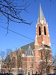
Gersthofer parish church hl. Leopold ObjectID : 52391 |
Bischof-Faber-Platz KG location : Gersthof |
The Roman Catholic , neo-Gothic hall church was built in 1887-1891 according to plans by Richard Jordan . It is a simple, symmetrical brick building with a mighty facade tower. |
ObjectID : 52391 Status: § 2a Status of the BDA list: 2020-02-29 Name: Gersthofer parish church hl. Leopold GstNr .: 687/2 Gersthofer parish church |

|
Elementary school ObjectID : 52393 |
Bischof-Faber-Platz 1 KG location : Gersthof |
Identity address Alsegger Straße 45–49. This monumental building in the Secession style and neo-empire was built in 1901 by the Vienna City Building Office (architect: Georg Löwitsch ). It has pilaster strips as well as laurel and shell decoration in the window lunettes . Towards Bischof-Faber-Platz there is a relief The five senses . |
ObjectID : 52393 Status: § 2a Status of the BDA list: 2020-02-29 Name: Volksschule GstNr .: 601 |

|
Rental house ObjektID : 75260 |
Bischof-Faber-Platz 2 KG location : Gersthof |
The neo-gothic apartment building was based on plans by how the houses 3, 4 and 5 Adolf Rossi built about 1900. |
ObjectID : 75260 Status: § 2a Status of the BDA list: 2020-02-29 Name: Miethaus GstNr .: 160/50 |

|
Parsonage Object ID: 52388 |
Bischof-Faber-Platz 7 KG location : Gersthof |
The parsonage of the Gersthofer parish church with a simple exposed brick facade was built in 1898 according to plans by Josef Schmalzhofer . |
ObjectID : 52388 Status: § 2a Status of the BDA list: 2020-02-29 Name: Pfarrhof GstNr .: 665/3 |
|
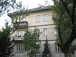
Residential building ObjectID : 10442 |
Czartoryskigasse 5 KG location : Gersthof |
The late historical - secessionist house was built in 1911–1912 according to plans by the architect Fritz Keller for the writer Fritz von Herzmanovsky-Orlando . |
ObjectID : 10442 Status : Notification Status of the BDA list: 2020-02-29 Name: Residential house GstNr .: 746/1; 746/2 |
|
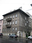
Rental house ObjektID : 52403 |
Gersthofer Straße 15 KG location : Gersthof |
The building forms a twin house with No. 17 and was built in 1911 according to plans by Karl Otto Limbach . In the highly hervorkragenden eaves are timbered deposits in the parapet fields masks and on link fence depictions of boys with garlands of fruit. |
ObjectID : 52403 Status: § 2a Status of the BDA list: 2020-02-29 Name: Miethaus GstNr .: 742/2 |

|
Railway line suburban line - section Gersthof with stop Vienna Gersthof ObjektID : 41692 |
Gersthofer Straße 2 KG location : Gersthof |
The suburban line opened in 1898 and was originally part of the Vienna Stadtbahn . Like this one, it was built according to plans by Otto Wagner . After the First World War, however, it was not put into operation as part of the Vienna Electric Light Rail, but mainly used for freight transport. It was not until 1987 that it became part of local public transport again as the S-Bahn line . Only three of the original stations could be used again.
This Secession- style station building with echoes of Renaissance villas was originally designed by Otto Wagner. |
ObjectID : 41692 Status : Notification Status of the BDA list: 2020-02-29 Name: Railway line, Wiener Vorortelinie - Gersthof sub-area with Gersthof station GstNr .: 724/1; 729; 730; 731/1; 731/2; 731/3; 724/2 Vienna Gersthof train station |

|
Rental house, former Lydlsches Stiftungshaus ObjektID : 52416 |
Gersthofer Straße 127 KG location : Gersthof |
The baroque house was built between 1736 and 1739 for Matthäus Lydl von Schwanau. The facade, modified at the end of the 18th century, features plaster ashlars and a wide, profiled arched portal. |
ObjectID : 52416 Status: § 2a Status of the BDA list: 2020-02-29 Name: Miethaus, former Lydlsches Stiftungshaus GstNr .: 4/1 Gersthofer Straße 127 |

|
Johann Nepomuk Chapel, former Trinitarian Church ObjectID : 41694 |
Gersthofer Straße 129 KG location : Gersthof |
The small, 1736-1737, built Baroque chapel with lanterns crowned dome and choir tower tower of Joseph's time was originally the home and grave chapel for Matthew Lydl of Schwanau. In the 19th century it functioned as the Gersthof parish church. |
ObjectID : 41694 Status : Notification Status of the BDA list: 2020-02-29 Name: Johann Nepomuk Chapel, former Trinitarian Church GstNr .: 6 Johannes Nepomuk chapel (Gersthofer Straße 129) |

|
Rental House ObjectID : 41695 |
Gersthofer Straße 131 KG location : Gersthof |
The late baroque house with a wide risalit and a stone-framed basket arch portal was built in the second half of the 18th century. |
ObjectID : 41695 Status : Notification Status of the BDA list: 2020-02-29 Name: Miethaus GstNr .: 11 Gersthofer Straße 131 |

|
Shrine Object ID: 76244 |
at Gersthofer Straße 131 KG location : Gersthof |
The Gothic tabernacle picture stick dates from around 1460/1470. |
ObjectID : 76244 Status: § 2a Status of the BDA list: 2020-02-29 Name: Bildstock GstNr .: 881/3 Bildstock Gersthof |

|
Hospital / Outpatient Clinic, Semmelweis Clinic ObjectID: 1587 |
Hockegasse 37 KG location : Gersthof |
The clinic was built between 1908 and 1910 according to plans by Karl Otto Limbach and Max Haupt and was originally used as a foundling house. |
ObjectID: 1587 Status: Notification Status of the BDA list: 2020-02-29 Name: Spital / Ambulatorium, Semmelweisklinik GstNr .: 70/1; 70/5; 70/6; 70/7; 70/8; 70/9; 70/10; 70/17 Semmelweis Women's Clinic |
|
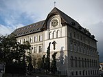
Marianum School of the Congregation of School Brothers ObjectID : 52402 |
Scheidlstrasse 2–8 KG location : Gersthof |
The school building of the school brothers in the Heimat style was built in 1901 according to plans by Gustav Neumann . |
ObjectID : 52402 Status: § 2a Status of the BDA list: 2020-02-29 Name: School Marianum of the Congregation of School Brothers GstNr .: 172/15 School Marianum, Gersthof, Vienna |
|
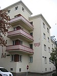
Municipal Housing ObjectID : 52397 |
Schöffelgasse 69 KG location : Gersthof |
This communal housing from the interwar period was built in 1931–1932 according to plans by Franz Wiesmann . The corner solution Schöffelgasse / Bastiengasse with corner towers and connecting balconies is striking. |
ObjectID : 52397 Status: § 2a Status of the BDA list: 2020-02-29 Name: Kommunaler Wohnbau GstNr .: 102/18 Wohnhausanlage Schöffelgasse 69 |

|
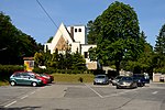
Orthopedic Hospital of the City of Vienna ObjectID : 65869 |
Wielemansgasse 28 KG location : Hernals |
The hospital was built between 1924 and 1926 according to plans by Alfred Mautner and Johann Rothmüller . It was originally used as a maternity hospital for the Viennese merchants . |
ObjectID : 65869 Status : Notification Status of the BDA list: 2020-02-29 Name: Orthopedic Hospital of the City of Vienna GstNr .: 1157/1; 828/2 Gersthof Orthopedic Hospital |
|
Mortuary, cemetery Neustift Object ID: 115432 |
at Pötzleinsdorfer Höhe 11-13 KG location : Neustift am Wald |
The hall was built in 1936 and changed after 1945. It is a rectangular hall with a high pointed gable with a relief of the Ascension of Christ . |
ObjektID : 115432 Status: § 2a Status of the BDA list: 2020-02-29 Name: Aufbahrungshalle , Friedhof Neustift GstNr .: 420/1 Hall 1, Neustifter Friedhof |

|
Entire complex of Pötzleinsdorf Palace including Pötzleinsdorf Palace Park with various buildings and sculptures ObjectID : 128865 |
Geymüllergasse 1 KG location : Pötzleinsdorf |
Originally the Ricci'sche Freihof from the 17th century, the palace was acquired by the banker Johann Heinrich Geymüller in 1797 and converted into a classicist country house. The landscape garden was laid out from 1797 by the gardeners Konrad A. Rosenthal and Franz Illner. |
ObjektID : 128865 Status : Notification Status of the BDA list: 2020-02-29 Name : Entire facility , Pötzleinsdorf Castle including park with various buildings and facilities. Sculptures GstNr .: 80; 181/1; 553 Palace and park of Pötzleinsdorf |

|
Villa and Atelier Barwig ObjectID : 75290 |
Hockegasse 92 KG location : Pötzleinsdorf |
The Heimatstil villa was built in 1912 according to plans by Hugo Blum for the sculptor Franz Barwig the Elder . |
ObjectID : 75290 Status : Notification Status of the BDA list: 2020-02-29 Name: Villa and Atelier Barwig GstNr .: 554/210 |

|
Horticultural monuments in Geymüller-Park ObjektID : 83016 |
Khevenhüllerstraße 2 KG location : Pötzleinsdorf |
In the garden of the Geymüllerschlössel there are collection items from the first half of the 19th century, including bronze sculptures, stone benches and fountain basins. |
ObjectID : 83016 Status: § 2a Status of the BDA list: 2020-02-29 Name: Horticultural monuments in Geymüller-Park GstNr .: 6/1 Horticultural monuments in Geymüller-Park |

|
Villa Mautner / Geymüller-Schlössl ObjectID : 41698 |
Khevenhüllerstraße 2 KG location : Pötzleinsdorf |
The late empire villa was built in 1808 for the banker Johann Jakob Geymüller . It has been a branch of the MAK since 1965 . It has a baroque floor plan with simultaneous facade in Gothic and oriental forms and is thus an example of the stylistic pluralism of the early 19th century. |
ObjektID : 41698 Status : Notification Status of the BDA list: 2020-02-29 Name: Villa Mautner / Geymüller-Schlössl GstNr .: 5/3; 6/1 Geymüllerschlössel |

|
Villa / Country House ObjectID : 41699 |
Khevenhüllerstraße 4 KG location : Pötzleinsdorf |
The extensive Biedermeier country house with a dominant triangular gable was built around 1850. |
ObjectID : 41699 Status : Notification Status of the BDA list: 2020-02-29 Name: Villa / Landhaus GstNr .: 15/4 |

|
Bürgerhaus ObjektID: 41854 |
Khevenhüllerstraße 6–8 KG location : Pötzleinsdorf |
The baroque country house was adapted and expanded in 1912 according to plans by Anton Wimmer . It was Sigmund Freud's summer residence during his last years in Vienna. The old building was used by revolutionaries in 1848 as a hiding place, remains of a secret passage to the Geymüller-Schlössl have been preserved. |
ObjectID: 41854 Status: Notification Status of the BDA list: 2020-02-29 Name: Bürgerhaus GstNr .: 15/3; 16; 18; 19/11; 15/5 |

|
Shrine Object ID: 76242 |
at Pötzleinsdorfer Straße 100 KG location : Pötzleinsdorf |
The column with a tabernacle comes from the second half of the 17th century, the mosaic pictures from 1914. |
ObjectID : 76242 Status: § 2a Status of the BDA list: 2020-02-29 Name: Bildstock GstNr .: 11/1 |
|
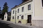
Parsonage Object ID: 77938 |
Pötzleinsdorfer Straße 108 KG location : Pötzleinsdorf |
The former rectory of the Aegydius Church was previously used as a wine grower's house. |
ObjectID : 77938 Status: § 2a Status of the BDA list: 2020-02-29 Name: Pfarrhof GstNr .: 59 |

|
Parsonage Object ID: 83011 |
Schafberggasse 2 KG location : Pötzleinsdorf |
The parsonage of the Pötzleinsdorfer parish church was built in 1976–1977. |
ObjectID : 83011 Status: § 2a Status of the BDA list: 2020-02-29 Name: Pfarrhof GstNr .: 186/2 |

|
Pötzleinsdorfer parish church Christ König with bell tower ObjektID : 52412 |
Schafberggasse 2 KG location : Pötzleinsdorf |
The Roman Catholic church with a free-standing bell tower was built between 1960 and 1963 according to plans by Karl Schwanzer . The entrance front is glazed and rhythmized by steel beams. In the sacrament chapel there is a glass window based on a design by Arnulf Rainer . |
ObjectID : 52412 Status: § 2a Status of the BDA list: 2020-02-29 Name: Pötzleinsdorfer parish church Christ König with bell tower GstNr .: 186/2 Pötzleinsdorfer parish church |

|
Villa Regenstreif (remaining buildings) ObjektID : 41864 |
Starkfriedgasse 15 KG location : Pötzleinsdorf |
The villa was built in 1914–1916 according to plans by Friedrich Ohmann for the industrialist Fritz Regenstreif. It burned down in the 1960s; The garden wall, fence and gatehouse have been preserved. |
ObjektID : 41864 Status : Notification Status of the BDA list: 2020-02-29 Name: Villa Regenstreif (remaining buildings) GstNr .: 240/5; 240/7 Villa Regenstreif |

|
Villa / country house, Haus Moller, today the home of the Ambassador of Israel ObjectID : 41880 |
Starkfriedgasse 19 KG location : Pötzleinsdorf |
The villa was built in 1927–1928 according to plans by Adolf Loos . It is a terrace house with a symmetrically structured facade and a stepped front on the garden side. |
ObjectID : 41880 Status : Notification Status of the BDA list: 2020-02-29 Name: Villa / country house, House Moller, today the home of the Ambassador of Israel GstNr .: 227/4 House Moller |

|
Catholic branch church hl. Aegidius and tombstones ObjectID : 52407 |
Pötzleinsdorfer Straße 106b KG location : Pötzleinsdorf |
The Roman Catholic , late Baroque hall church was built in 1752. It is a simple building with an eastern tower tower. Gravestones from the 18th century are located on the church forecourt. |
ObjectID : 52407 Status: § 2a Status of the BDA list: 2020-02-29 Name: Kath. Filialkirche hl. Agidius and gravestones GstNr .: 1 Agydius Church Pötzleinsdorf, Vienna |

|
House Rezek including garage with roof terrace and stairs to Peter-Jordan-Straße as well as enclosures ObjektID : 124261 |
Wilbrandtgasse 37 KG location : Pötzleinsdorf |
The villa with a stepped flat roof and terraces was built in 1932–1933 in the New Objectivity style based on plans by Hans Glas . |
ObjektID : 124261 Status : Notification Status of the BDA list: 2020-02-29 Name: House Rezek including garage with roof terrace and stairs to Peter-Jordan-Straße and enclosures GstNr .: 292/6; 292/10; 292/11 |

|
Municipal Housing ObjectID : 52343 |
Anastasius-Grün-Gasse 8 KG location : Währing |
Ident address Mollgasse 3–5. This community building was built in 1928–1929 according to plans by Franz Wiesmann . A characteristic feature are the double loggias with the triangular protruding balconies. |
ObjectID : 52343 Status: § 2a Status of the BDA list: 2020-02-29 Name: Kommunaler Wohnbau GstNr .: 481/27 |

|
Water tower ObjectID: 8002 |
Anton-Baumann-Park KG location : Währing |
The tower was built between 1836 and 1841 as part of the Kaiser-Ferdinand-Wasserleitung according to plans by Paul Wilhelm Eduard Sprenger . |
ObjectID: 8002 Status: Notification Status of the BDA list: 2020-02-29 Name: Wasserturm GstNr .: 427/1 Währinger Wasserturm |

|
Double gate with tower and candelabra ObjektID : 41687 |
Anton-Frank-Gasse 20 KG location : Währing |
The baroque garden gate belongs to the former villa of Archduke Otto , which was built in 1873 according to plans by the architect Carl von Borkowski . Today it serves as the embassy from Israel . |
ObjectID : 41687 Status : Notification Status of the BDA list: 2020-02-29 Name: Double gate with attachment and candelabra GstNr .: 950/1 |

|
Municipal Housing ObjectID : 52356 |
Antonigasse 100 KG location : Währing |
This community building was built in 1926 according to plans by Erich Franz Leischner . It is a smaller extension of the Pfannenstielhof . |
ObjectID : 52356 Status: § 2a Status of the BDA list: 2020-02-29 Name: Kommunaler Wohnbau GstNr .: 285/54 Wohnhausanlage Antonigasse 100 |

|
So-called. Guttenberg House of the University of Natural Resources and Life Sciences ObjectID : 112707 since 2013 |
Feistmantelstrasse 4 KG location : Währing |
This free-standing block-like building with a risal structure and a late-historical-secessionist design was built in 1911 by the Grünwald brothers . Inside, the stair railing with diamond shapes and stylized leaves is remarkable. |
ObjectID : 112707 Status : Notification Status of the BDA list: 2020-02-29 Name: Sog. Guttenberg-Haus of the University of Natural Resources and Life Sciences GstNr .: 1155/2 |

|
Residential and commercial building ObjectID : 41688 |
Gentzgasse 8 KG location : Währing |
The former branch of the Dorotheum was built in 1931 in an international style based on plans by Fritz Waage and Wilhelm Kroupa . |
ObjektID : 41688 Status : Notification Status of the BDA list: 2020-02-29 Name: Residential and commercial building GstNr .: 1324; 1325 Documentation Center AKH |

|
Stiftshof / Gutshof / Lesehof, former Barnabitenfreihof ObjectID : 41689 |
Gentzgasse 10 KG location : Währing |
Built from the 16th to the 18th century, the building was originally the Freihaus (farmyard) of the Barnabite Monastery of St. Michael (today the Salvatorian College and parsonage of the Mariahilfer Church ). 1983–1985 it was revitalized by the architect Alois Machatschek . Since 1986 it has been the seat of the Swedish Church in Vienna . |
ObjektID : 41689 Status : Notification Status of the BDA list: 2020-02-29 Name: Stiftshof / Gutshof / Lesehof, former Barnabitenfreihof GstNr .: 1327/1; 1327/2 Barnabitenfreihof Wien-Währing |

|
Municipal Housing ObjectID : 52336 |
Gentzgasse 45 KG location : Währing |
This community housing was built in 1926 according to plans by Siegmund Katz . The strong horizontal structure is created by cornices, the entrance is framed with a round arch. |
ObjectID : 52336 Status: § 2a Status of the BDA list: 2020-02-29 Name: Kommunaler Wohnbau GstNr .: 1482 |

|
Municipal Housing ObjectID : 52327 |
Gentzgasse 79 KG location : Währing |
This community housing was built in 1926–1927 according to plans by Ludwig Schöne . The wide facade has copper-covered bay windows, ornamental friezes and, on the second floor, medallions with depictions of animals. |
ObjectID : 52327 Status: § 2a Status of the BDA list: 2020-02-29 Name: Kommunaler Wohnbau GstNr .: 1450 Housing complex Gentzgasse 79 |

|
Währinger parish church hl. Gertrud ObjectID : 52341 |
Gertrudplatz KG location : Währing |
The Roman Catholic , late Baroque hall church from 1753 has an extension from 1934 based on plans by Karl Holey . The late baroque church functions as today's transept. The extension is a long house, with the northern section being designed as a higher transverse building. |
ObjectID : 52341 Status: § 2a Status of the BDA list: 2020-02-29 Name: Währinger parish church hl. Gertrud GstNr .: 1539 Währing parish church |

|
Türkenschanzpark including buildings ObjectID : 66321 |
Gregor-Mendel-Straße 31 KG location : Währing |
The park in the English landscape style was opened by the emperor on September 30, 1888. In the center, a 23-meter-high observation tower was built in exposed brick, which was also a small water reservoir. After the incorporation in 1892, the City of Vienna dedicated land in 1908 to expand the park. In the course of the expansion, Princess Pauline Metternich donated many exotic plants and as a token of thanks the observation tower was given the name "Paulinenwarte" in 1909. |
ObjektID : 66321 Status : Notification Status of the BDA list: 2020-02-29 Name: Türkenschanzpark including buildings GstNr .: 1144/1 Türkenschanzpark |
|
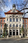
University of Natural Resources and Life Sciences , main building (Gregor-Mendel-Haus) ObjectID : 41696 |
Gregor-Mendel-Straße 33 KG location : Währing |
The characteristic university building from the late Wilhelminian era was built from 1894 according to plans by Alois Koch and was officially opened on December 5, 1896. In 1960 the main building was named after Gregor Mendel , at the same time the chemistry building (positioned axially in the middle of the open back yard of the Gregor Mendel House and connected to the wing wings of the Gregor Mendel House in 1978) in Justus von Liebig -House renamed. |
ObjectID : 41696 Status : Notification Status of the BDA list: 2020-02-29 Name: University of Natural Resources and Life Sciences GstNr .: 1704 Gregor Mendel Haus |

|
Municipal housing, Pfannenstiel courtyard with fountain ObjectID : 52357 |
Händelgasse 12 KG location : Währing |
Ident address Kreuzgasse 87–89. This community housing was built in 1924–1925 according to plans by Erich Franz Leischner . The large complex with flat facade cores has no facade decoration, just above the passage to Antonigasse there is a copper relief by Angela Stadtherr . The fountain made of cubic blocks comes from the architect. |
ObjectID : 52357 Status: § 2a Status of the BDA list: 2020-02-29 Name: Municipal housing, Pfannenstiel-Hof with fountain GstNr .: 285/14 Pfannenstielhof |

|
Elementary school Klettenhofergasse ObjectID : 52386 |
Klettenhofergasse 3 KG location : Währing |
The neo-renaissance monumental building was built in 1882 by the Vienna City Building Office. |
ObjectID : 52386 Status: § 2a Status of the BDA list: 2020-02-29 Name: School GstNr .: 425/8 Volksschule Klettenhofergasse |

|
former Lazarist monastery / cooperative middle school ObjectID : 52370 |
Klostergasse 8 KG location : Währing |
Ident Adresse Schopenhauserstraße 79. The school was built in 1868–1869 as a monastery of the Lazarists , around 1890 and 1931 it was expanded. The building has old German forms and a exposed brick facade with plaster structure. |
ObjectID : 52370 Status: § 2a Status of the BDA list: 2020-02-29 Name: former Lazarist monastery / secondary school GstNr .: 283/5 |

|
Administration building of Remise Kreuzgasse ObjectID : 128913 |
Kreuzgasse 72 KG location : Währing |
The administration building was built in the first phase of the construction of the former tram depot . |
ObjectID : 128913 Status : Notification Status of the BDA list: 2020-02-29 Name: Administration building, Währing depot GstNr .: 286/74 Währing depot |

|
Former depot Währing / Remise Kreuzgasse ObjectID : 48966 |
Kreuzgasse 74–76 KG location : Währing |
The former tram depot was built in 1883 (Hall II) and around 1902 (Hall I and III) and closed in 1999. The stables still preserved are the last representative evidence of horse-drawn tram traffic in Vienna. |
ObjektID : 48966 Status : Notification Status of the BDA list: 2020-02-29 Name: Former depot Währing / Remise Währing GstNr .: 286/8; 286/18 Währing depot |

|
Polytechnic School Leitermayergasse ObjectID : 52374 |
Leitermayergasse 47 KG location : Währing |
The neo-renaissance monumental building was built in 1897 by the Vienna City Planning Department . The facade has grooved pilaster strips and fruit garlands. |
ObjectID : 52374 Status: § 2a Status of the BDA list: 2020-02-29 Name: Bundesrealgymnasium GstNr .: 300/33 Polytechnische Schule Leitermayergasse |

|
Evang. Parish Church AB, Luther Church ObjectID : 52381 |
Lutherhof 1 KG location : Währing |
The Protestant-Lutheran , neo-Gothic church was built between 1896 and 1898 according to plans by Theodor Bach and Ludwig Schöne . It is a brick building, the facade of which is dominated by a tall, slender tower. The furnishings come from the construction period, most of the windows from the 1960s. |
ObjectID : 52381 Status: § 2a Status of the BDA list: 2020-02-29 Name: Evang. Parish Church AB, Luther Church GstNr .: 1601 Luther Church (Vienna) |

|
Lutherhof / School ObjectID : 52383 |
Lutherhof 1 KG location : Währing |
The L-shaped, neo-Gothic complex at the Luther Church was built between 1894 and 1895 according to plans by Theodor Bach and Ludwig Schöne . It has exposed brick cladding, the windows are framed with pointed gables and columns. |
ObjectID : 52383 Status: § 2a Status of the BDA list: 2020-02-29 Name: Lutherhof / Schule GstNr .: 1601 |

|
Office building for the XVIII. District ObjectID : 52338 |
Martinstrasse 100 KG location : Währing |
The neo-renaissance monumental building was built between 1890 and 1891 according to plans by Moritz and Karl Hinträger . It is kept in the forms of the German Renaissance and has a representative central projectile as well as a south-facing tower top with a pointed helmet and lantern . The columns in the foyer end in lush floral capitals . The ballroom is held in representative neo-renaissance forms. |
ObjectID : 52338 Status: § 2a Status of the BDA list: 2020-02-29 Name: Office building for the XVIII. District GstNr .: 1479 Währing district office |

|
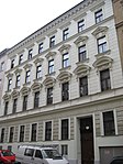
Villa Schapira ObjectID : 75296 |
Max-Emanuel-Straße 17 KG location : Währing |
The villa was built in 1922 by the construction company Carl Corn in barockisierendem home style . |
ObjectID : 75296 Status: § 2a Status of the BDA list: 2020-02-29 Name: Villa / Landhaus GstNr .: 1083/2 |
|
Rectory St. Gertrud ObjectID : 52339 |
Maynollogasse 3 KG location : Währing |
The house was built in 1884 according to plans by Adolf Endl . Since 1913 it has served as the rectory of the Währing parish church . |
ObjectID : 52339 Status: § 2a Status of the BDA list: 2020-02-29 Name: Pfarrhaus St. Gertrud GstNr .: 225/31; 225/38 |

|
Albertus Magnus Student Dormitory of the Marianists ObjectID : 52346 |
Michaelerstraße 8 KG location : Währing |
The dormitory was built between 1915 and 1916 according to plans by Richard Jordan and Max Haupt . The portal axis is kept in baroque forms. 1953–1954 a chapel was set up on the first floor. |
ObjectID : 52346 Status: § 2a Status of the BDA list: 2020-02-29 Name: School GstNr .: 482/3 Albertus-Magnus-Studentenheim |
|
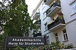
Akademikerhilfe student residence ObjectID : 52342 |
Michaelerstraße 9–13 KG location : Währing |
The home was built in 1927–1928 according to plans by Clemens Holzmeister as a single home. The simple complex is elevated on the street side by gables . |
ObjectID : 52342 Status: § 2a Status of the BDA list: 2020-02-29 Name: Rental house, former single home GstNr .: 12/3; 12/6 home for students of Akademikerhilfe, Währing |

|
Marianist Teacher Training Institute ObjectID : 52347 |
Michaelerstraße 10 KG location : Währing |
The broad-based building with simple gothic forms and a shallow central projectile with a gable was built in 1891 according to plans by Ludwig Zatzka . |
ObjectID : 52347 Status: § 2a Status of the BDA list: 2020-02-29 Name: School GstNr .: 482/2 Teacher Training Institute of the Marianists, Währing |

|
Municipal housing, Lindenhof and fountain ObjectID : 52358 |
Paulinengasse 9 KG location : Währing |
Ident addresses at Kreuzgasse 78–80, Simonygasse 2a. This community housing was built in 1924–1925 according to plans by Karl Ehn . It is built around the former Czartoryski Park, which is now its inner courtyard. The building is richly decorated on the courtyard side, in particular the loggias are decorated with ceramic panels throughout. A sculpture by Josef Franz Riedl is located above the portals to Paulinengasse and Simonygasse . There is an ornamental fountain in the courtyard with a bronze sculpture by Fritz Zerritisch . |
ObjektID : 52358 Status: § 2a Status of the BDA list: 2020-02-29 Name: Kommunaler Wohnbau, Lindenhof and Brunnen GstNr .: 285/21 Lindenhof, Vienna |

|
Residential building, small residential property ObjectID : 19725 |
Paulinengasse 11 KG location : Währing |
The single-storey residential building was built in the first half of the 20th century. |
ObjektID : 19725 Status : Notification Status of the BDA list: 2020-02-29 Name: Residential building, small residential property GstNr .: 285/51; 285/62 |

|
Fountain ObjectID : 76155 |
Richard-Kralik-Platz KG location : Währing |
The natural stone sculpture by Robert Ullmann dates from 1954. |
ObjectID : 76155 Status: § 2a Status of the BDA list: 2020-02-29 Name: Brunnen GstNr .: 1252/2 Richard-Kralik-Brunnen |

|
Former Währinger cemetery ObjectID : 76249 |
Schubertpark, Währing KG location : Währing |
The former local cemetery has been part of the Währinger Schubert Park since 1924 . Receive include Baroque , Biedermeier and frühhistoristische grave stones. |
ObjectID : 76249 Status: § 2a Status of the BDA list: 2020-02-29 Name: Währinger Friedhof GstNr .: 248/1; 248/2 Währinger local cemetery |

|
Former Official building of the district police station ObjektID : 52324 |
Schulgasse 88 KG location : Währing |
The former commissariat was built in the Secession style between 1905 and 1906 according to plans by Karl Holzer . It has a rounded corner and strong cornice structure. The upper floors are accentuated by green tiles. |
ObjectID : 52324 Status : Notification Status of the BDA list: 2020-02-29 Name: Former Official building of the district police commissioner GstNr .: 280; 275/5 Police Station Schulgasse |

|
Albertus Magnus School of the Mariae Society ObjectID : 52349 |
Semperstrasse 45 KG location : Währing |
The school was built between 1893 and 1894 according to plans by Johann Nepomuk Scheiringer . The interior was redesigned from 1953 to 1954. The grooved facade has two lateral risalites of the pediment . On the third floor there is a chapel from the construction period. |
ObjectID : 52349 Status: § 2a Status of the BDA list: 2020-02-29 Name: Albertus-Magnus-Schule of the Mariae Society GstNr .: 482/5 Albertus-Magnus-Schule, Währing |

|
Mural - Liberation of Austria ObjectID : 76349 |
Simonygasse 2a KG location : Währing |
The mosaic mural by the painter Carry Hauser dates from 1949–1956. |
ObjectID : 76349 Status: § 2a Status of the BDA list: 2020-02-29 Name: Wall picture - Liberation of Austria GstNr .: 285/21 Liberation of Austria (Carry Hauser) |

|
Bundesrealgymnasium ObjectID : 52369 |
Staudgasse 80 KG location : Währing |
Identity addresses Klostergasse 21–25, Vinzenzgasse 5. The school was built in 1906 by the building construction department of the Imperial and Royal Lieutenancy. It is a simple building block with grooving and Mansard - Attica . |
ObjectID : 52369 Status: § 2a Status of the BDA list: 2020-02-29 Name: Bundesrealgymnasium GstNr .: 282/4 |

|
Cottage district : Villa Schmutzer ObjectID : 41882 |
Sternwartestraße 62–64 KG location : Währing |
The Heimatstil villa in neo-baroque forms with a curved main facade between side projections was built in 1909–1910 according to plans by Robert Oerley . |
ObjectID : 41882 Status : Notification Status of the BDA list: 2020-02-29 Name: Villa Schmutzer GstNr .: 990/1; 991/1 Villa Schmutzer |

|
Cottage district : Villa Gessner ObjectID : 52314 |
Sternwartestraße 70 KG location : Währing |
The villa was built in 1907 according to plans by Hubert Gessner as his home and studio. It is a cubic structure with a projecting coffered eaves and bay windows . The corners are emphasized by pillars with vase attachments. |
ObjectID : 52314 Status : Notification Status of the BDA list: 2020-02-29 Name: Villa Gessner GstNr .: 1182; 1715 Villa Gessner |
|
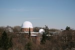
Cottage district : University observatory Vienna with outbuildings ObjectID : 52311 |
Sternwartestraße 77 KG location : Währing |
The historicist monumental building was built between 1874 and 1880 according to plans by Ferdinand Fellner . Outbuildings are the equatorial coudé (built 1889–1890, architects: Büro Fellner & Helmer ) and the astrograph building (built 1897–1907). |
ObjectID : 52311 Status: § 2a Status of the BDA list: 2020-02-29 Name: University observatory with adjoining building GstNr .: 533; 520/2; 520/3; 520/4 Vienna University Observatory |

|
Cottage district : Villa / Country House ObjectID : 76228 |
Türkenschanzstrasse 23 KG location : Währing |
The villa was built in 1907 according to plans by Robert Oerley . The dominant feature is the projecting roof section with boarded gable and half-timbered inlays. |
ObjectID : 76228 Status : Notification Status of the BDA list: 2020-02-29 Name: Villa / Landhaus GstNr .: 1180; 1712 |

|
Lazarist Church Parish and Order Church St. Severin ObjectID : 52368 |
Vinzenzgasse 3 KG location : Währing |
The Roman Catholic , neo-Gothic hall church was built from 1876 to 1878 according to plans by Friedrich von Schmidt . It is kept in exposed brick style and has a mighty double tower facade facing the street. The polygonal choir has the same eaves height as the central nave . The furnishings are uniformly from the construction period. |
ObjektID : 52368 Status: § 2a Status of the BDA list: 2020-02-29 Name: Lazarist Church Parish and Ordenskirche hl. Severin GstNr .: 291/11; 291/12; 291/13; 291/14 Lazarist Church, Währing |

|
Tram depot belt ObjectID : 52353 |
Währinger Gürtel 131–133 KG location : Währing |
The remise was built in exposed brick style from around 1900: Hall II 1902–1903, Hall III 1907 and Hall I 1913. |
ObjectID : 52353 Status : Notification Status of the BDA list: 2020-02-29 Name: Tram depot belt GstNr .: 448/2 depot Währinger belt |

|
Former General Währing Cemetery ObjectID : 76350 |
Währinger Park / Gräberhain KG location : Währing |
The cemetery was closed in 1897, and Währinger Park has been located here since 1924 . Inside is a grave grove with Biedermeier and early historical tombstones. |
ObjectID : 76350 Status: § 2a Status of the BDA list: 2020-02-29 Name: Former. Friedhof GstNr .: 477/12 Währinger Park |

|
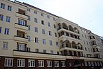
Municipal Housing ObjectID : 52331 |
Weimarer Straße 1 KG location : Währing |
This community building was built in 1924–1925 according to plans by Karl Dirnhuber . The tower-like corner construction with the curved loggias is striking . |
ObjectID : 52331 Status: § 2a Status of the BDA list: 2020-02-29 Name: Kommunaler Wohnbau GstNr .: 1565 |
|
Municipal Housing ObjectID : 52334 |
Weimarer Straße 8-10 KG location : Währing |
This community building was built in 1928–1929 according to plans by Konstantin Peller . The central projection is accentuated by arched loggias , and it is connected to the side loggias by a continuous balcony on the first floor. The base zone is lined with clinker brick and has expressionistic decorative details. The tower-like, semicircular balcony groups are striking on the courtyard side. |
ObjectID : 52334 Status: § 2a Status of the BDA list: 2020-02-29 Name: Kommunaler Wohnbau GstNr .: 1552 Housing complex Weimarer Straße 8-10 |

|
Figure shrine St. Maria Immaculata ObjectID : 76246 |
KG location : Währing |
The wayside shrine at the Währing parish church was built in 1813 and restored in 1935. |
ObjectID : 76246 Status: § 2a Status of the BDA list: 2020-02-29 Name: Figurine picture stick hl. Maria Immaculata GstNr .: 1539 Virgin Mary statue Gertrudplatz |

|
Railway line, Vienna suburb line - sub-area Währing ObjectID : 74522 |
KG location : Währing |
In Währing, the suburban line runs mostly underground, only in the area of the Türkenschanzpark there is a short section as an incision line. (Object declaration under KG Gersthof ) |
ObjektID : 74522 Status : Notification Status of the BDA list: 2020-02-29 Name: Railway line, Wiener Vorortelinie - sub-area Währing GstNr .: 1038/1; 1038/2; 1038/4; 1038/5; 1039; 1124; 1143/1; 1143/2 suburb line |

|
Former Währinger Bürgerertheater ObjektID : 52316 |
Gentzgasse 119 KG location : Weinhaus |
The theater building was built around 1910 in Secession style. It has geometric decor. |
ObjectID : 52316 Status : Notification Status of the BDA list: 2020-02-29 Name: Former Währinger Bürgerertheater GstNr .: .123 |

|
Weinhauser Parish Church of St. Josef ObjectID: 52322 |
Gentzgasse 140 KG location : Weinhaus |
The Roman Catholic , neo-Gothic hall church with a single- tower facade was built according to plans by Friedrich von Schmidt . The foundation stone was laid on September 16, 1883 and the church was completed in 1893, with the consecration of the church by Prince Archbishop Cölestin Josef Ganglbauer on May 12, 1889. It is a clearly structured exposed brick building with simple neo-Gothic shapes and economical stone decor. Most of the furnishings date from the construction period. |
ObjectID: 52322 Status: § 2a Status of the BDA list: 2020-02-29 Name: Weinhauser Pfarrkirche hl. Josef GstNr .: .95 Weinhauser Parish Church |

|
Parsonage Object ID: 52320 |
Gentzgasse 140 KG location : Weinhaus |
The rectory on the right-hand side of the Weinhauser parish church was built in 1892 according to plans by Franz Keindl . |
ObjectID : 52320 Status: § 2a Status of the BDA list: 2020-02-29 Name: Pfarrhof GstNr .: .94 |

|
Parsonage Object ID: 52321 |
Gentzgasse 142 KG location : Weinhaus |
The rectory on the left-hand side of the Weinhauser parish church was built in 1913 according to plans by Josef Schmalzhofer . |
ObjectID : 52321 Status: § 2a Status of the BDA list: 2020-02-29 Name: Pfarrhof GstNr .: .127 |

|
Railway line, Viennese suburb line - sub-area Weinhaus ObjectID : 74521 |
Gersthofer Straße 2a KG location : Weinhaus |
A short distance south of the Gersthof train station, the suburban line runs through Weinhaus (for an explanation of the property, see KG Gersthof ). |
ObjektID : 74521 Status : Notification Status of the BDA list: 2020-02-29 Name: Railway line, Wiener Vorortelinie - sub-area Weinhaus GstNr .: 100/1; 100/2; 100/3; 101/1; 101/2; 101/3; 101/4; 101/5; 101/6; 101/7 suburban line |

|
Municipal Housing ObjectID : 52317 |
Köhlergasse 1–3 KG location : Weinhaus |
Ident Adresse Währinger Straße 176. This community building was built in 1929–1930 according to plans by Paul Fischel and Heinz Siller . It is a functional corner construction with inserted loggias . |
ObjectID : 52317 Status: § 2a Status of the BDA list: 2020-02-29 Name: Kommunaler Wohnbau GstNr .: .36 / 2 |

|
All -day primary school Köhlergasse ObjectID : 52323 |
Köhlergasse 9 KG location : Weinhaus |
The school was built from 1977 to 1990 according to plans by Hans Hollein . |
ObjectID : 52323 Status: § 2a Status of the BDA list: 2020-02-29 Name: Volksschule GstNr .: .64 All -day elementary school Köhlergasse |

|
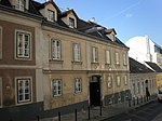
Bürgerhaus, Malfatti House ObjectID : 41856 |
Lacknergasse 79 KG location : Weinhaus |
The core of the community center owned by the physician Johann Malfatti dates from the second half of the 18th century. A plaque on the house reminds us that the Austrian physicist Johann Josef Loschmidt lived here (1890–1895). |
ObjektID : 41856 Status : Notification Status of the BDA list: 2020-02-29 Name: Bürgerhaus, Haus Malfatti GstNr .: .16 Haus Malfatti |
|
Bürgerhaus ObjektID : 41857 |
Lacknergasse 81 KG location : Weinhaus |
The town house, which essentially dates from the second half of the 18th century, was expanded in 1871. |
ObjectID : 41857 Status : Notification Status of the BDA list: 2020-02-29 Name: Bürgerhaus GstNr .: .15 Bürgerhaus Lacknergasse 81 |

|
Bürgerhaus, Zum Roten Löwen ObjectID : 41858 |
Lacknergasse 83 KG location : Weinhaus |
The core of the town house dates from the second half of the 18th century, the facade and stained glass windows from around 1890. |
ObjektID : 41858 Status : Notification Status of the BDA list: 2020-02-29 Name: Bürgerhaus, Zum Roten Löwen GstNr .: .14 / 1; .14 / 3 Bürgerhaus Zum Roten Löwen, Weinhaus |

|
Bürgerhaus ObjektID : 41859 |
Lacknergasse 85 KG location : Weinhaus |
The core of the suburban town house dates from the second half of the 18th century. It has a simple slab style facade and a pawlatsche in the courtyard. |
ObjectID : 41859 Status : Notification Status of the BDA list: 2020-02-29 Name: Bürgerhaus GstNr .: .13 Bürgerhaus Lacknergasse 85 |

|
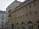
Caritas House St. Josef ObjectID : 41860 |
Lacknergasse 98 KG location : Weinhaus |
The former child protection station, a Neoempire -Stahlbetonbau in strictly stylized forms with pilasters outline and secessionistischem Fries decor, in 1907, designed by Joze Plecnik built. |
ObjectID : 41860 Status : Notification Status of the BDA list: 2020-02-29 Name: Bürgerhaus, Heim, former child protection station GstNr .: .19 / 1 Lacknergasse 98, Vienna |
|
Municipal housing, Toepler-Hof ObjektID : 52361 |
Paulinengasse 15 KG location : Weinhaus |
Identity address Währinger Straße 169–171. This community building was built in 1927–1928 according to plans by Konstantin Peller . The wide corner construction has a tower-like structure with arched loggias . The windows facing Paulinengasse have floral borders. |
ObjectID : 52361 Status: § 2a Status of the BDA list: 2020-02-29 Name: Kommunaler Wohnbau, Toepler-Hof GstNr .: .144 |

|
Municipal Housing ObjectID : 76170 |
Staudgasse 80a KG location : Weinhaus |
This community building was built in 1923 according to plans by Josef Bittner . It is a rounded corner construction with a gable above the entrance. |
ObjectID : 76170 Status: § 2a Status of the BDA list: 2020-02-29 Name: Kommunaler Wohnbau GstNr .: .134 |

|
Rental house, Johanneshof ObjectID : 41883 |
Währinger Straße 170, 170a KG location : Weinhaus |
The double rental house was built from 1899–1901 according to plans by Josef Ludwig . Some of the decorative elements are secessionist , and there are two baroque wrought iron bars on the facade . In a niche there is a statue of John Nepomuk from the middle of the 18th century. |
ObjectID : 41883 Status : Notification Status of the BDA list: 2020-02-29 Name: Miethaus, Johanneshof GstNr .: .32 / 1; .32 / 3 Johanneshof, Währing |

|
Hans Radl School, Plastic ObjectID : 52362 |
Währinger Strasse 173–181 KG location : Weinhaus |
The school building was built between 1958 and 1959 in place of the Czartoryski Castle, which was demolished in 1955, according to plans by Viktor Adler . The group of figures in front of the entrance was made by Gertrude Fronius in 1959. |
ObjectID : 52362 Status: § 2a Status of the BDA list: 2020-02-29 Name: Hans Radl Schule, Plastik GstNr .: 285/13; 285/60; .5 |

|
Municipal Housing ObjectID : 52319 |
Währinger Straße 188–190 KG location : Weinhaus |
This community housing was built in 1926–1928 according to plans by Michael Rosenauer . Around a lower courtyard there are wings with corner balconies that are otherwise unadorned. |
ObjectID : 52319 Status: § 2a Status of the BDA list: 2020-02-29 Name: Kommunaler Wohnbau GstNr .: .42 |

|
Rosenkranzweg ObjectID : 77939 |
KG location : Weinhaus |
The complex behind the Weinhauser parish church made up of 15 wayside shrines (with reliefs by Rochus Haas , 1892) as well as the Josefsgrotte and Lourdesgrotte was built around 1890 according to plans by Josef Schmalzhofer . |
ObjectID : 77939 Status: § 2a Status of the BDA list: 2020-02-29 Name: Rosenkranzweg GstNr .: 63/7 Rosenkranzweg, Weinhaus |
literature
- DEHIO Vienna - X. to XIX. and XXI. to XXIII. District . Schroll, Vienna 1996, ISBN 3-7031-0693-X .
Web links
Commons : Listed objects in Währing - collection of pictures, videos and audio files
- Works of art in public space and architecture on the pages of the Vienna Cultural Property Register
Individual evidence
- ↑ a b Vienna - immovable and archaeological monuments under monument protection. (PDF), ( CSV ). Federal Monuments Office , as of February 18, 2020.
- ^ Rudolf-Sigmund-Hof. In: dasrotewien.at - Web dictionary of the Viennese social democracy. SPÖ Vienna (Ed.)
- ↑ Georg Löwitsch. In: Architects Lexicon Vienna 1770–1945. Published by the Architekturzentrum Wien . Vienna 2007.
- ↑ a b c d e f g h i j Municipal housing in Währing. In: dasrotewien.at - Web dictionary of the Viennese social democracy. SPÖ Vienna (Ed.)
- ^ Walter Jaksch, Edith Fischer, Franz Kroller: Salvatorianerkolleg St. Michael (former Barnabite monastery) . In: Austrian library building . Vol. 1, From Gothic to Modern. ADEVA (Akademische Druck und Verlagsanstalt), Graz 1992, ISBN 978-3-201-01566-0 , p. 67-68 .
- ^ Felix Czeike : Historical Lexicon Vienna . Volume 5. Kremayr & Scheriau, Vienna 1997
- ^ City of Vienna: Paulinenwarte observation tower in Türkenschanzpark ; accessed on April 8, 2018
- ↑ Pfannenstielhof. In: dasrotewien.at - Web dictionary of the Viennese social democracy. SPÖ Vienna (Ed.)
- ↑ Lindenhof. In: dasrotewien.at - Web dictionary of the Viennese social democracy. SPÖ Vienna (Ed.)
- ↑ Irene Nierhaus : Kunst-am-Bau in Viennese municipal housing in the fifties . Böhlau, Vienna 1993, ISBN 3-205-05567-5 , p. 240.
- ^ Toepler-Hof. In: dasrotewien.at - Web dictionary of the Viennese social democracy. SPÖ Vienna (Ed.)
- ↑ § 2a Monument Protection Act in the legal information system of the Republic of Austria .