Chemin (Jura)
| Chemin | ||
|---|---|---|

|
|
|
| region | Bourgogne-Franche-Comté | |
| Department | law | |
| Arrondissement | Dole | |
| Canton | Tavaux | |
| Community association | Plaine Jurassienne | |
| Coordinates | 46 ° 59 ′ N , 5 ° 19 ′ E | |
| height | 182-188 m | |
| surface | 9.14 km 2 | |
| Residents | 343 (January 1, 2017) | |
| Population density | 38 inhabitants / km 2 | |
| Post Code | 39120 | |
| INSEE code | 39138 | |
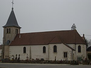
 Saint-Georges church |
||
Chemin is a French municipality with 343 inhabitants (at January 1, 2017) in the department of Jura in the region Bourgogne Franche-Comté . It belongs to the Arrondissement of Dole and the Canton of Tavaux . Chemin is also a member of the municipal association Communauté de communes de la Plaine Jurassienne . The neighboring municipalities are Saint-Loup in the north, Peseux in the northeast, Longwy-sur-le-Doubs in the east, Petit-Noir in the south and Annoire in the west.
Population development
| 1962 | 1968 | 1975 | 1982 | 1990 | 1999 | 2006 | 2011 |
|---|---|---|---|---|---|---|---|
| 295 | 317 | 294 | 333 | 383 | 380 | 358 | 346 |
Web links
Commons : Chemin - collection of images, videos and audio files
