Longwy-sur-le-Doubs
| Longwy-sur-le-Doubs | ||
|---|---|---|

|
|
|
| region | Bourgogne-Franche-Comté | |
| Department | law | |
| Arrondissement | Dole | |
| Canton | Tavaux | |
| Community association | Plaine Jurassienne | |
| Coordinates | 46 ° 58 ′ N , 5 ° 22 ′ E | |
| height | 182-189 m | |
| surface | 16.46 km 2 | |
| Residents | 505 (January 1, 2017) | |
| Population density | 31 inhabitants / km 2 | |
| Post Code | 39120 | |
| INSEE code | 39299 | |
| Website | www.longwysurledoubs.com | |
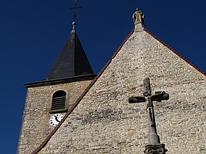
 Church of the Assumption |
||
Longwy-sur-le-Doubs is a French municipality with 505 inhabitants (at January 1, 2017) in the department of Jura in the region Bourgogne Franche-Comté . It belongs to the Arrondissement of Dole and the Canton of Tavaux . Longwy-sur-le-Doubs is a member of the community association Communauté de communes de la Plaine Jurassienne .
geography
The municipality is located around 17 kilometers southwest of the arrondissement capital Dole . The neighboring communities are
- Peseux in the north,
- Chaussin in the northeast,
- Asnans-Beauvoisin in the southeast,
- Petit-Noir in the southwest,
- Chemin in the northwest.
On the east side, the municipal boundary runs largely along the Doubs River .
Population development
| 1962 | 1968 | 1975 | 1982 | 1990 | 1999 | 2008 | 2016 |
|---|---|---|---|---|---|---|---|
| 527 | 525 | 491 | 490 | 498 | 496 | 556 | 513 |
Web links
Commons : Longwy-sur-le-Doubs - Collection of images, videos and audio files
