Drum national 17D
| Drum național DN17D in Romania | |

|
|
| map | |
| Basic data | |
| Operator: | CNAIR |
| Start of the street: |
Beclean ( 47 ° 11 ′ N , 24 ° 9 ′ E ) |
| End of street: |
Cârlibaba ( 47 ° 34 ′ N , 25 ° 3 ′ E ) |
| Overall length: | 97.6 km |
|
Jewțe ( circles ): |
|
| Requirement for use: | Rovignette |
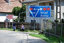
| Signpost in Salva | |
|
Course of the road
|
|
The Drum național 17D ( Romanian for “National Road 17D”, DN17D for short ) is a main road in Romania .
course
The road branches off at Beclean (Betlen) to the northeast from Drum național 17 ( European route 58 ) and leads up in the valley of Someșul Mare via Salva , where the north branch of Drum național 17C branches off, together with the DN17C to Năsăud , where the DN17C meets separates again, and along the eastern edge of the Rodna Mountains National Park through the seaside resort of Sângeorz-Băi and through Rodna over the Pasul Rotunda pass ( 1271 m ; ⊙ ) to the municipality of Cârlibaba , where it north of the Bistrița around 8 km west of the village Drum national 18 hits and ends at this.
The length of the road is around 98 kilometers. The last 18 km before Cârlibaba are not paved yet.
Individual evidence
- ↑ Information on national roads on the website of the Society for Road Infrastructure (CNAIR)
- ↑ România, Atlas rutier și turistic 1: 300,000, Budapest 2015, CARTOGRAPHIA Kft., ISBN 978-963-352-646-0 .


