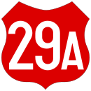
Drum national 29A
| Drum na DNional DN29A in Romania | |

|
|
| map | |
| Basic data | |
| Operator: | CNAIR |
| Start of the street: |
Suceava ( 47 ° 38 ′ N , 26 ° 14 ′ E ) |
| End of street: | Border at Rădăuți-Prut ( 48 ° 15 ′ N , 26 ° 48 ′ E ) |
| Overall length: | 100 km |
|
Jewțe ( circles ): |
|
| Requirement for use: | Rovignette |
| The street in Dorohoi | |
|
Course of the road
|
|
The Drum național 29A ( Romanian for "National Road 29A", DN29A for short ) is a main road in Romania .
course
The road starts in the district capital Suceava on Drum național 2 ( European route 85 ), crosses Drum național 29 ( European route 58 ) in the northeast of Suceava and runs north via Adâncata and Vârfu Câmpului , where it crosses the Sereth and the Drum național 29C crosses to the small town of Dorohoi , where it crosses the Jijia . There the drum na Drumional 29B meets them. In its further course, the road in the village of Dragalina crosses the former Drum na Dragional 29F, which was graduated to a county road in 2012. Later the road approaches the border river Prut , crosses Darabani , turns east and meets the Drum național 24C in Rădăuți-Prut . From there it reaches the Prut, which forms the border with the Republic of Moldova , and continues on Moldovan territory to Lipcani , where it meets the Moldovan drum public național M14 .
The length of the road is around 100 km.
Individual evidence
- ↑ Information on national roads on the website of the Society for Road Infrastructure (CNAIR)
- ↑ Monitorul official
- ↑ România, Atlas rutier și turistic 1: 300,000, Budapest 2015, CARTOGRAPHIA Kft., ISBN 978-963-352-646-0 .

