
Ilsfeld
| coat of arms | Germany map | |
|---|---|---|

|
Coordinates: 49 ° 3 ' N , 9 ° 15' E |
|
| Basic data | ||
| State : | Baden-Württemberg | |
| Administrative region : | Stuttgart | |
| County : | Heilbronn | |
| Local government association: | "Schozach-Bottwartal" | |
| Height : | 240 m above sea level NHN | |
| Area : | 26.51 km 2 | |
| Residents: | 9568 (December 31, 2018) | |
| Population density : | 361 inhabitants per km 2 | |
| Postal code : | 74360 | |
| Area code : | 07062 | |
| License plate : | HN | |
| Community key : | 08 1 25 046 | |
| LOCODE : | DE FLD | |
| Community structure: | 6 districts | |
| Address of the municipal administration: |
Rathausstrasse 8 74360 Ilsfeld |
|
| Website : | ||
| Mayor : | Thomas Knödler | |
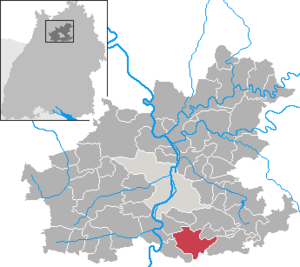
| Location of the community of Ilsfeld in the Heilbronn district | ||
  |
||

Ilsfeld is a municipality in the district of Heilbronn , Baden-Württemberg . It belongs to the Heilbronn-Franken region and the edge zone of the European metropolitan region of Stuttgart .
geography
location
Ilsfeld is located in the south of the Heilbronn district on the westward section of the central Schozach valley near the inlet of the Gruppenbach from the north. The community has a share in the natural areas of the Swabian-Franconian Forest Mountains and Neckar Basin .
Neighboring communities
Neighboring cities and communities of Ilsfeld are ( clockwise , starting in the south): Großbottwar ( district of Ludwigsburg ), Neckarwestheim , Lauffen am Neckar , Talheim , Untergruppenbach , Abstatt and Beilstein (all district of Heilbronn). Together with Abstatt, Beilstein and Untergruppenbach, Ilsfeld forms the community administration association Schozach-Bottwartal , based in Ilsfeld.
Community structure
The community of Ilsfeld consists of the districts of Ilsfeld, Auenstein and Schozach . The hamlet of Wüstenhausen and the residential areas Landturm and Untere Mühle as well as the district of Engelsberghöfe belong to Ilsfeld, while the hamlets of Abstetterhof and Helfenberg belong to Auenstein .
Disappeared, so no longer existing places were marked Ilsfeld: Beuren , Bustatt (or Boestat ), Gendach , Froßbach and Seetham ; on the Auenstein marker: Finkenbach (risen in Helfenberg) and Kapfenhardt.
Division of space

According to data from the State Statistical Office , as of 2014.
history
Franconian royal court
The district of Ilsfeld has been inhabited almost continuously since the Middle and Neolithic. In the course of the Franconian conquest of the land , a Franconian royal court was created in this old settlement area, in which five very old surrounding Alemannic settlements were dissolved and which formed the origin of the present-day place. On the Gendach an der Schozach near Ilsfeld there was once a small hilltop castle, of which there are no more remains. From the Königshof in Ilsfeld, new settlements emerged in the area, including Westheim ( Neckarwestheim ), Ostheim ( Auenstein ) and Talheim , which from Ilsfeld have names related to direction or terrain and are recognizable as Franconian settlements due to the final syllable -heim .
Ilsfeld itself was mentioned for the first time in 1102 in a deed of donation from Emperor Heinrich IV . Heinrich donated an estate in Ilisvelt to the diocese of Speyer . The name of the place was probably once the name of the entire district, the name of the Schozach , probably once called Ils , in its upper reaches could have been. In 1157 Ilsfeld came after threats from King Konrad III. back into the possession of the Staufer . In the late 12th and 13th centuries a local nobility appeared, the lords of Ilsfeld, who were the ministerials of the margraves of Baden , and to whom or whose relatives the building of a castle on the nearby Wunnenstein goes back.
Württemberg border town

In 1368 Ilsfeld came to Württemberg and was assigned to the Obervogtei in Lauffen am Neckar by 1460 at the latest . Ilsfeld was württembergischer border town, because in the north now for marginalized Teutonic Order scoring denunciation Talheim and various other dominions it as the imperial city of Heilbronn scoring Flein , the Palatine rule Stettenfels , the county Lowenstein and other territories on. During the war of the Württemberg Duke Ulrich the much-loved against 30 Swabian imperial cities, there was an attack by Heilbronn on Ilsfeld in 1450, in which the place was devastated, 40 people were killed and 300 head of cattle were stolen.
From 1456, the Württemberg Landgraben ran north of Ilsfeld as a border fortification with the Landturm near the hamlet of Wüstenhausen, which is part of Ilsfeld . In 1460 the Battle of Wüstenhausen took place there, in which Duke Ulrich defeated the troops of Count Palatine Friedrich the Victorious . The military conflicts of the 15th century were probably the reason for the construction of the high village wall around Ilsfeld, which was reinforced with ten towers.
Ilsfeld suffered greatly in the wars of the 16th and 17th centuries. In 1519 the place was quarters for the army of Duke Wilhelm IV of Bavaria . In the Thirty Years' War the plague broke out in 1626 and 1634, the place was also the quarters of imperial troops in 1638/39, and in 1645 there was looting by the French, Hesse and Weimar. During the war, the population fell from around 1200 to barely more than 100, and for years after the end of the war most of the vineyards and fields were fallow. Despite the influx of many settlers from Austria and Switzerland, the place needed around 100 years to recover from the devastating war. Meanwhile, further billeting and demands for contributions had to be endured. From 1672 to 1675, Brandenburg troops took quarters in Ilsfeld several times. During the Palatine War of Succession in 1693, the place was home to French troops who tried to attack Heilbronn from there.
Württemberg rural community
In the 18th century there was orderly conditions and modest growth in Ilsfeld. After the Napoleonic Wars , as a result of which the entire surrounding area became part of the Kingdom of Württemberg , established in 1806 , and after the reorganization of the Württemberg upper offices , Ilsfeld belonged to the Oberamt Bietigheim from 1808 and to the Oberamt Besigheim from 1810 . The place expanded gradually, first to the west and east along the main street, beyond its medieval borders. In 1832 the city gates were no longer there. In 1844 for the first time over 2000 inhabitants were counted. Nonetheless, there was always great poverty well into the 19th century. There were famines in 1816, 1831 and 1841. In the years 1810 to 1890, 651 inhabitants emigrated mostly to America, but some also to Africa (Cape Country) and Russia (Caucasus).
From 1889 to 1891 a road connection to the Oberamtsstadt Besigheim was created, in November 1899 a section of the Bottwartalbahn running near Ilsfeld was inaugurated, which was extended the following year from Ilsfeld to Heilbronn Südbahnhof . The Royal Württemberg State Railways built the station building as a type IIIa unit station . In the early 20th century, the rural Ilsfeld became a working-class community for nearby Heilbronn, where around 200 Ilsfeld fields soon found work, mainly in factories such as the Ackermann twisting mill , the Knorr soup factory , the Bruckmann silver goods factory and the Flammer soap factory . After the construction of the power station in Pleidelsheim around 1907, Ilsfeld was electrified until 1914.
City fire in 1904

On August 4, 1904, 130 buildings with town hall, school and church as well as 77 barns were destroyed in a major fire in the village with a burn area of around 420 ares. One person was killed and 706 people were left homeless. The property damage was estimated at 1,392,696 Reichsmarks. The cause of the fire was an alcohol stove that was knocked over by children while frying apples. The different hose couplings of the local Württemberg fire brigades represented a major obstacle to extinguishing the fire. The fire disaster shocked all of Germany. In addition to King Wilhelm II , more than 40,000 onlookers arrived in the following days.
As early as August 8, the Ministry of Road and Hydraulic Engineering formed a reconstruction team headed by Senior Building Officer Richard von Leibbrand, who initially built a barrack village with 100 houses to accommodate the homeless residents to survive the upcoming winter. A new site plan was then implemented. When the town center was rebuilt, the main street that is still central today (since 1906: König-Wilhelm-Straße) was widened to 11 meters by dispensing with the development on the side of the slope leading to the church, which was once a bottleneck, and the slope with the characteristic of the town and the new building the wall was extended by 100 meters . The important public buildings (town hall, church, school, teacher's house, rectory and Dorastift) were rebuilt according to plans by the architects Schmohl and Staehelin in Swabian-rural shapes with style elements of Art Nouveau. The reconstruction of the place was essentially completed by 1906.
An industrial settlement in Ilsfeld initially failed in 1911 due to a lack of infrastructure, the place remained a rural village until the Second World War. In 1935 there were 335 mostly small farms, in which 40–60% of the population found their livelihood, as well as 120 small businesses with a total of 220 employees. A transport connection to the nearby Lauffen, where the Lauffen cement works offered work, failed in 1929 when a planned Kraftpost line was not implemented.
time of the nationalsocialism
The mayor, elected in 1916 (from 1932: mayor) Hugo Heinrich joined the NSDAP in 1934 and remained in office during the Nazi era . In 1937 Heinrich applied for his retirement due to illness, but was unable to leave the post due to a medical report and held it until after the Second World War. From 1939 on, Heinrich was also the joint mayor of Schozach.
In 1935, construction began on the section of the A 81 from Heilbronn to Stuttgart, which cuts through the Ilsfeld marking in the southeast. When the Oberamt Besigheim was dissolved, Ilsfeld came to the Heilbronn district in 1938 - in contrast to most other communities .
During the Second World War , Ilsfeld was initially largely spared air raids, although heavy attacks were carried out on surrounding areas from 1941 onwards. The influx of refugees increased the population of the town during the war: in 1939 there were 1999 inhabitants, at the end of 1945 there were 2164. After the air raid on Heilbronn on December 4, 1944, around 600 people from Heilbronn fled to the area with refugees and at that time Displaced people stuffed Ilsfeld. In the last days of the war, Ilsfeld was itself the target of air raids on April 14 and 16, 1945, in which around 50 buildings were destroyed and several people died. On April 20, 1945, Ilsfeld was occupied by American troops.
Ilsfeld since the Second World War

In 1945, Ilsfeld became part of the American zone of occupation and thus belonged to the newly founded state of Württemberg-Baden , which in 1952 became the current state of Baden-Württemberg.
After Mayor Heinrich retired in 1947, there was no statutory mayor election in Ilsfeld until 1948. The professional soldier Walter Schwörer, who was appointed by District Administrator Sihler at short notice, and the pharmacist KH Frank, who was subsequently elected by the local council, quickly left the community. The long-time mayor's deputy Gottlob Frank took over the business of the mayor in 1947/48, he was followed by Eugen Härle , who was elected in 1948 and who was mayor of Ilsfeld until 1974 and again mayor of Schozach from 1954 until the incorporation in 1972.
Due to the small number of vehicles, the autobahn was only made drivable again from 1950, with Ilsfeld initially only having a one-sided driveway for military vehicles, which was to be closed by 1955. In 1956 a junction was set up and two rest stops in 1968/74. The proximity to the motorway junction and the increasing automobile traffic associated with the closure of the Bottwartalbahn in 1967 brought heavy traffic loads to the road villages of Ilsfeld and Auenstein, which in the case of Auenstein could be alleviated with a bypass road in the 1990s, but persist in Ilsfeld.
In 1950 there were 571 agricultural businesses with 1151 employees and 217 commercial businesses with 448 employees in the towns of what is now the entire municipality of Ilsfeld. With the settlement of industry and commerce, Ilsfeld has grown rapidly since the 1950s. Agriculture was soon no longer the largest local industry; its place was taken by manufacturing. The industrial area Ilsfeld Ost stretches between the town and the motorway access to the east , and large new residential areas have emerged to the north and south of the town, beginning with the core settlement in 1952. Further residential and commercial areas were also designated in the suburbs. In 1987 there were still 58 farms with 203 employees compared to 332 businesses with 2029 employees. Labor migration brought an influx of foreigners: in the early 1960s the first foreign worker was accepted, in 1987 there were around 550 foreigners among the approximately 6,200 inhabitants of the entire municipality.
In February 1970, the collapse of a large part of the wall, which had to be renewed by 1974, caused a sensation. At the same time, plans began for the extensive renovation of the aging town center, which then took place in the 1980s and in the course of which numerous old residential buildings that had survived the fire of 1904 were replaced by new buildings and buildings from 1904 were renovated.
Religions
Ilsfeld and Auenstein each have their own Protestant parish, and Ilsfeld also has a New Apostolic parish. The Catholic parish of Untergruppenbach is responsible for the Catholics, while Methodist Christians belong to the Abstatt-Happenbach parish.
Incorporations
On July 1, 1971, Schozach was incorporated into Ilsfeld. On December 31, 1973, the communities of Ilsfeld and Auenstein (with Abstetterhof and Helfenberg ) merged to form the new community of Ilsfeld.

politics

Municipal council
In Ilsfeld, the municipal council is elected using the spurious selection of a part of town. The number of local councils can change due to overhang mandates . After the last election, the municipal council in Ilsfeld has 21 members (2009: 20). The local elections on May 25, 2014 led to the following official final result. The turnout was 49.3%. The municipal council consists of the elected voluntary councilors and the mayor as chairman. The mayor is entitled to vote in the municipal council.
- BWV / CDU 57.5%, 12 seats (2009: 55.5% - 11 seats)
- SPD / Citizens' Forum Schozachtal 42.5%, 9 seats (2009: 44.5% - 9 seats)
mayor
Thomas Knödler has been the mayor since 1998 and was confirmed in office in 2006 and 2014.
badges and flags
The blazon of the Ilsfeld coat of arms reads: A green tree with roots in silver under a black deer pole. The flag of the municipality is green and white.
The tree is the spot signs Ilsfelds and detected as such in 1685, the Hirsch bar stands for belonging to Ilsfelds Württemberg . The combination of both signs in one coat of arms is proven in the Ilsfeld seals from 1468 onwards (with the stag stick turned to the right) ; the seal from 1468 is the oldest known village seal and coat of arms in Württemberg. The seals from 1596 then show the stag in its current orientation. The colors of the coat of arms have been proven since the late 16th century. The new community of Ilsfeld, which was formed after the union with Auenstein, took up the coat of arms and flag again; both were awarded to the community on January 24, 1978 by the district office of Heilbronn.

Hist. Landmark with tree and stag pole

Hist. Landmark with tree and letter I F


Partner communities
There are partnerships with Ottery St Mary in Devon , England , with Auenstein in the canton of Aargau , Switzerland and with Moșna (Meschen) in Romania .
Culture and sights

Buildings
After the great fire of 1904, a number of Art Nouveau buildings were rebuilt or rebuilt. The evangelical Bartholomäuskirche on the Spreuerberg, built by Paul Schmohl , still contains a late Gothic choir as well as parts of the tower and west gable of its predecessor. Josef Zeitler created the building decoration in the Art Nouveau style . At the same time and with similar stylistic features, the town hall with Art Nouveau portal, the schoolhouse , the rectory and the Dorastift kindergarten were also built on the Spreuerberg . The town hall was expanded in 1993.
The Dorastift is located on the site of the old parsonage that burned down. Ferdinand von Steinbeis spent his youth in the old rectory from 1811 to 1821, and his grandmother Friederike Kerner, the mother of Justinus Kerner , lived there until her death in 1817 , whose grave is preserved in the Ilsfeld cemetery . In the old rectory, after two foundations in 1881/86, an infant care facility was set up. After the city fire, the building was rebuilt in its current form thanks to a donation from Prof. Karl Vollmöller and named after his wife Theodora Elisabeth Vollmöller Dorastift . A large board on the building names the various donors. There is a humorous sandstone sculpture on the surrounding wall of the site.
The buildings along the main street that were built after the fire of 1904 show some Art Nouveau style features in their massive basement floors, but the upper floors are mostly conventional half-timbered buildings. The Gasthaus Krone still has a baroque basement with a jewelry portal from 1766.

Only fragments are left of the city wall that was built around 1500 with what was once ten towers. The south wall of the cemetery and parts of the church wall go back to the city wall. The eastern end of the once walled area is still marked by two preserved towers in Turmstrasse and Bollwerkstrasse. The upper bulwark tower has been expanded into a residential building with a half-timbered tower since 1919. One of the oldest buildings in the area is the so-called stone house, dated 1585, on Mühlstrasse .
In the hamlet of Wüstenhausen , part of Ilsfeld , the remains of a chapel from the 15th century and the land tower used as a customs post for the Württemberg land moat have been preserved.
The Helfenberg castle ruins are located above the hamlet of Helfenberg , part of the Auenstein district of Ilsfeld .
Regular events
The annual Ilsfeld wood market was mentioned as early as 1521 as being held from ancient times. In the 1970s, the event, which takes place on the last weekend in August, developed from a traditional wood market into a grocer's market with an amusement park and marquee.
Economy and Infrastructure
Ilsfeld is a wine-growing whose layers to the bulk layers Schozachtal, Wunnenstein Church and vineyard in Württembergisch bottom land area of the vineyard Württemberg belong. The wine growers from Ilsfeld, Auenstein, Helfenberg and Abstatt are united in the Mittleres Schozachtal vineyard cooperative. In 2000, Carina Läpple was the first woman from Ilsfeld to be elected as Württemberg wine queen . Ilsfeld is also located on the Württemberg Wine Route , which leads past many sights.
In the town, which was still predominantly agricultural until the 1950s, several industrial areas have emerged, including the Ilsfeld Ost area developed in the 1950s (today: Ilsfeld Süd ) and the recently expanded industrial area in Gewann Bustatt (today: Ilsfeld Nord ), as well as industrial areas in the suburbs of Auenstein and Schozach. In the 1970s and 1980s, workplaces with one to four employees made up around two-thirds of the 235 businesses, while there were only three or four companies with over 50 employees. For a long time the most important branch in Ilsfeld was the manufacturing industry , in the 1980s the number of employees in the areas of trade and services in particular increased sharply.
traffic

Ilsfeld is located directly on the A 81 ( Würzburg - Stuttgart ) with its own motorway junction . From 1899 to 1968 Ilsfeld and Auenstein were connected to the rail network by the narrow-gauge Bottwartalbahn ( Marbach am Neckar - Heilbronn-Süd ). After the tracks have been dismantled, the Alb-Neckar cycle path ( Eberbach - Ulm ) now largely runs along the route .
In the municipal area of Ilsfeld (excluding districts), the fine dust sticker has been mandatory since March 1, 2008 (originally July 1, 2007, starting time postponed due to a lack of administrative regulations) . All vehicles that drive in or through the core location from this point on must belong to at least pollutant group 2. Vehicles in pollutant group 1 (without a sticker) are subject to a driving ban. As of January 1, 2012, the driving ban according to the labeling regulation was extended to vehicles in pollutant group 2 (red sticker).
media
The daily newspaper Heilbronner Demokratie reported on the events in Ilsfeld in its SO, Süd-Ost issue.
education
The Steinbeis School Center Ilsfeld combines a primary and secondary school with a Werkrealschule and the Steinbeis Realschule . In Auenstein there is the primary school Auenstein, in Ilsfeld there is also the special school in Ilsfeld. In addition, the Unterland Adult Education Center in Ilsfeld has a branch.
Furthermore, Ilsfeld has its own community library.
Sports
There is an outdoor swimming pool in Ilsfeld, on the premises of which a DLRG home is located. Adjacent to the outdoor pool, the “Grün-Weiß” tennis club operates several tennis courts, as well as a clubhouse.
The Sportclub Ilsfeld (SCI) offers badminton, soccer, judo, karate, athletics, table tennis, rehab-fitness-health and gymnastics.
Personalities
Honorary citizen
With a municipal council resolution of July 12, 1906, the following six people were granted honorary citizenship for their services to the reconstruction of the place after the great fire of 1904:
- Senior building officer Richard von Leibbrand (1851–1929), Stuttgart
- Senior magistrate Eugen Zimmermann (1862–1911), Besigheim
- Prof. Dr. Karl Vollmöller (1848–1922), Dresden
- Councilor of Commerce Robert Vollmöller (1849–1911), Vaihingen
- Kommerzienrat Julius Spohn (1841-1919), Neckarsulm
- Pastor Ernst Hartmann
Other honorary citizens of Ilsfeld were:
- 1951: Gottlob Obenland (1871–1966), farmer and member of the state parliament
- 1971: Gottlob Frank (1900–1983), farmer and councilor
- 1976: Eugen Härle (1911–2003), mayor i. R.
- 1992: Herbert Diener (1927–2006), rector i. R.
Sons and daughters of the church
- Johann Geyling (born June 26, 1495 - † January 24, 1559 in Großbottwar), Lutheran theologian and pastor
- Johann Christoph Schwab (born December 10, 1743, † April 15, 1821 in Stuttgart), philosopher
- Johann Christian Hirzel (born March 9, 1778; † October 22, 1834 in Spaichingen), born in Auenstein, Württemberg chief bailiff
- Ernst Trumpp (born March 13, 1828; † April 5, 1885 in Munich), Protestant theologian and orientalist
- Hermann Bender (born June 13, 1835; † April 21, 1897 in Kirchheim unter Teck), classical philologist and rector of the high school in Ulm
- Adolf von Nickel (born May 26, 1847; † August 31, 1937 in Stuttgart), City Director of Stuttgart 1903–1922, later President of the Black Forest District
- Robert Vollmöller (born October 29, 1849 - † October 28, 1911 in Stuttgart), councilor and factory owner, honorary citizen of Ilsfeld and Vaihingen
- Alfred Agster (born April 12, 1858, † January 10, 1904 in Degerloch), pharmacist and politician (SPD)
- Friedrich Niethammer (born March 3, 1874 - † August 29, 1947 in Korntal), mechanical engineer
- Friedrich Losberger (born September 17, 1891; † April 7, 1962 in Heilbronn), entrepreneur
- Otto Conrad (born September 17, 1901, † March 29, 1988 in Ludwigsburg-Oßweil), teacher and local history researcher
- Robert Kohlhammer (born October 23, 1904 - † July 29, 1983 in Stuttgart), publisher (Konradin Verlag)
Other people associated with the community
- Ferdinand von Steinbeis (* 1807 in Ölbronn-Dürrn, † 1893 in Leipzig), economic developer, grew up in Ilsfeld.
- Lothar Späth (* 1937 in Sigmaringen; † 2016 in Stuttgart), grew up in Ilsfeld, German politician (CDU) and manager, Prime Minister of Baden-Württemberg 1978–91
literature
- Ilsfeld in the past and present. A home book for Ilsfeld, Auenstein and Schozach . Ilsfeld municipality, Ilsfeld 1989
Web links
- Link catalog on Ilsfeld at curlie.org (formerly DMOZ )
- Ilsfeld and Schotzach in the description of the Oberamt Besigheim from 1853
- Ilsfeld local history in the regional information system for Baden-Württemberg
Individual evidence
- ↑ State Statistical Office Baden-Württemberg - Population by nationality and gender on December 31, 2018 (CSV file) ( help on this ).
- ↑ Natural areas of Baden-Württemberg . State Institute for the Environment, Measurements and Nature Conservation Baden-Württemberg, Stuttgart 2009
-
↑ Sources for the section on community structure:
Das Land Baden-Württemberg. Official description by district and municipality. Volume IV: Stuttgart district, Franconian and East Württemberg regional associations. Kohlhammer, Stuttgart 1980, ISBN 3-17-005708-1 . Pp. 92–94 and addendum in Vol. VIII, Stuttgart 1983, ISBN 3-17-008113-6 , p. 661
Otto Conrad : Von Flur und Feld, von Wald und Veben - From the field names and the emergence of the Ilsfeld large marking . In: Ilsfeld in past and present. A home book for Ilsfeld, Auenstein and Schozach . Municipality of Ilsfeld, Ilsfeld 1989
The country description assigns Ilsfeld to the deserted Geiselhausen, which, according to Conrad, was in what is now Neckarwestheim . - ↑ State Statistical Office, area since 1988 according to actual use for Ilsfeld.
- ↑ Frank Buchali: Encyclopedia of castles in the lowlands . Page 191 ff. Heilbronn, 2008, ISBN 3-00-007056-7
- ^ Rainer Stein: The Württemberg standard station on branch lines . In: Eisenbahn-Journal Württemberg-Report . tape 1 , no. V / 96 . Merker, Fürstenfeldbruck 1996, ISBN 3-922404-96-0 , p. 80-83 .
- ^ Wolfgang Ott: The relief organization after the fire and the reconstruction of Ilsfeld after the years 1904–1906 . In: Ilsfeld in past and present . Ilsfeld municipality, Ilsfeld 1989. p. 181.
- ↑ Reader for the Protestant elementary schools in Württemberg . Edition 1932. Quoted from: Ilsfeld in Geschichte und Gegenwart , pp. 179f.
- ↑ Communications from the Württ. And Bad. State Statistical Office No. 1: Results of the population census on December 31, 1945 in Northern Württemberg
- ^ Federal Statistical Office (ed.): Historical municipality directory for the Federal Republic of Germany. Name, border and key number changes in municipalities, counties and administrative districts from May 27, 1970 to December 31, 1982 . W. Kohlhammer, Stuttgart / Mainz 1983, ISBN 3-17-003263-1 , p. 450 .
- ^ Federal Statistical Office (ed.): Historical municipality directory for the Federal Republic of Germany. Name, border and key number changes in municipalities, counties and administrative districts from May 27, 1970 to December 31, 1982 . W. Kohlhammer, Stuttgart / Mainz 1983, ISBN 3-17-003263-1 , p. 465 .
- ↑ http://www.stimme.de/heilbronn/nachrichten/schozach-bottwar/Knoedler-im-Amt-bestaetigt;art1909,3048107
-
^ Sources for the section coat of arms and flag:
Heinz Bardua: The district and community coat of arms in the Stuttgart administrative region . Theiss, Stuttgart 1987, ISBN 3-8062-0801-8 (district and municipality coat of arms in Baden-Württemberg, 1). P. 80
Eberhard Gönner: Book of arms of the city and district of Heilbronn with a territorial history of this area . Archive Directorate Stuttgart, Stuttgart 1965 (Publications of the State Archive Administration Baden-Württemberg, 9). P. 99 - ↑ Clean air action plan for the Stuttgart administrative region - partial plan Ilsfeld (PDF; 3.13 MB). Retrieved September 21, 2012
- ↑ VHS Unterland branch offices .
- ^ Obituary for Herbert Diener at www.ilsfeld.de

Abstatt | Bad Friedrichshall | Bad Rappenau | Bad Wimpfen | Beilstein | Brackenheim | Cleebronn | Eberstadt | Ellhofen | Eppingen | Erlenbach | Flein | Gemmingen | Güglingen | Gundelsheim | Hardthausen am Kocher | Ilsfeld | Ittlingen | Jagsthausen | Kirchardt | Langenbrettach | Lauffen am Neckar | Lehrensteinsfeld | Leingarten | Lion's Arch | Massenbachhausen | Möckmühl | Neckarsulm | Neckarwestheim | Neudenau | Neuenstadt am Kocher | Nordheim | Obersulm | Oedheim | Offenau | Pfaffenhofen | Roigheim | Schwaigern | Siegelbach | Talheim | Untereisesheim | Untergruppenbach | Weinsberg | Rams | Desert red | Zaberfeld