Las Quintanillas (Burgos)
| Las Quintanillas municipality | ||
|---|---|---|
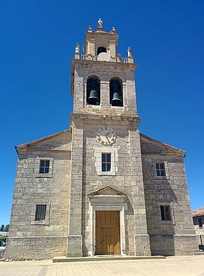
 Las Quintanillas - Iglesia de San Facundo y San Primitivo
|
||
| coat of arms | Map of Spain | |

|
|
|
| Basic data | ||
| Autonomous Community : | Castile and Leon | |
| Province : | Burgos | |
| Comarca : | Alfoz de Burgos | |
| Coordinates | 42 ° 22 ′ N , 3 ° 51 ′ W | |
| Height : | 844 msnm | |
| Area : | 24.78 km² | |
| Residents : | 370 (Jan 1, 2019) | |
| Population density : | 14.93 inhabitants / km² | |
| Postal code : | 09131 | |
| Municipality number ( INE ): | 09297 | |
| administration | ||
| Website : | Las Quintanillas | |
Las Quintanillas is a place and a municipality ( municipio ) with 370 inhabitants (as of January 1, 2019) in the province of Burgos and the region of Castile-León in northern Spain . The municipality also includes the two hamlets of Santa María Tajadura and Villarmentero .
Location and climate
Las Quintanillas is located about 500 m north of the Way of St. James ( Camino Francés ) at an altitude of about 845 m about 18 km (driving distance) west of the city of Burgos . The climate in winter is harsh, but in summer it is dry and warm; Rain (approx. 580 mm / year) falls mainly in the winter half-year.
Population development
| year | 1857 | 1900 | 1950 | 2000 | 2017 |
| Residents | 490 | 425 | 395 | 345 | 382 |
Despite the mechanization of agriculture and the abandonment of small farms, the population of the municipality has remained largely constant, which is mainly due to the relative proximity to the city of Burgos.
economy
Agriculture, which also included a little cattle breeding (e.g. pigs, chickens), has always played the most important role for the population of the region; Crafts, trade and service industries developed on a small scale in the village itself. Its location not far from the Way of St. James has so far made little use of the place in terms of income from tourism.

history
The place was probably founded or repopulated ( repoblación ) in the 9th century . In the Middle Ages, town changed landlords several times - sometimes it belonged to Burgos, sometimes to Úrbel Castle, a good 30 km north .
Attractions
- Las Quintanillas
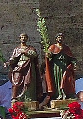
- The parish church dates from the 14th / 15th centuries. Century and is dedicated to Saints Facundus and Primitivus . The west tower and the facade were redesigned in the 18th century in the classical style.
- Santa María Tajadura
- The originally Romanesque church received a west tower in the 18th century.
- Villarmentero
- The rural Gothic church of San Esteban stands on the small square in the center of the village .
Web links
Individual evidence
- ↑ Cifras oficiales de población resultantes de la revisión del Padrón municipal a 1 de enero . Population statistics from the Instituto Nacional de Estadística (population update).
- ↑ Las Quintanillas - climate tables
- ↑ Las Quintanillas - Population Development
- ↑ Santa María Tajadura - Church, photo
