Humada
| Humada municipality | ||
|---|---|---|

|
||
| coat of arms | Map of Spain | |
 Help on coat of arms |
|
|
| Basic data | ||
| Autonomous Community : | Castile and Leon | |
| Province : | Burgos | |
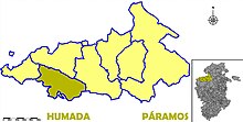
| Comarca : | Páramos | |
| Coordinates | 42 ° 40 ′ N , 4 ° 5 ′ W | |
| Height : | 954 msnm | |
| Area : | 85.19 km² | |
| Residents : | 118 (Jan 1, 2019) | |
| Population density : | 1.39 inhabitants / km² | |
| Postal code : | 09124 | |
| Municipality number ( INE ): | 09175 | |
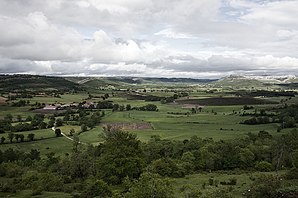
Humada is a municipality in the northern Spanish province of Burgos with 118 inhabitants (as of 2019). La Ulaña, the largest settlement of the Iberian Iron Age, is located on its territory .
history
The area of today's municipality was around the largest Iberian fortress called La Ulaña, which was built in the second half of the 1st century BC. Was abandoned.
From 1857 the municipality was made up of eight districts, namely Congosto, Fuencaliente de Puerta, Fuenteodra, Los Ordejones (which in turn consists of the settlements Ordejón de Abajo and Ordejón de Arriba), then Rebolledo de Traspeña, San Martín de Humada, Villamartín de Villadiego and Humada themselves.
In 1970, Humada was significantly reduced in size, so that its population fell from just under 1,000 to just under 300.
The Iron Age settlement was excavated from 1997 and an archaeological park has existed there since 2006.
Population development

- Origin of the numbers: INE
Individual evidence
- ↑ Cifras oficiales de población resultantes de la revisión del Padrón municipal a 1 de enero . Population statistics from the Instituto Nacional de Estadística (population update).

