Le Mesnil-Amelot
| Le Mesnil-Amelot | ||
|---|---|---|
|
|
||
| region | Île-de-France | |
| Department | Seine-et-Marne | |
| Arrondissement | Meaux | |
| Canton | Mitry-Mory | |
| Community association | Roissy Pays de France | |
| Coordinates | 49 ° 1 ′ N , 2 ° 36 ′ E | |
| height | 87-121 m | |
| surface | 9.84 km 2 | |
| Residents | 1,014 (January 1, 2017) | |
| Population density | 103 inhabitants / km 2 | |
| Post Code | 77990 | |
| INSEE code | 77291 | |
| Website | http://www.lemesnilamelot.fr/ | |
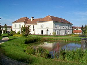
 City Hall (Mairie) of Le Mesnil-Amelot |
||
Le Mesnil-Amelot is a commune with 1,014 inhabitants (as of January 1 2017) in the Seine-et-Marne in the region Ile-de-France . It belongs to the arrondissement of Meaux and the canton of Mitry-Mory (until 2015: canton of Dammartin-en-Goële ). The inhabitants are called Mesnilois .
geography
Le Mesnil-Amelot is located about 25 kilometers northeast of Paris . Le Mesnil-Amelot is surrounded by the neighboring communities of Mauregard in the north and west, Moussy-le-Vieux in the northeast, Villeneuve-sous-Dammartin in the east and northeast, Thieux in the east, Compans in the southeast, Mitry-Mory in the south and Tremblay-en -France to the west and south-west.
The eastern part of Paris-Charles-de-Gaulle Airport is in the municipality.
Population development
| year | 1962 | 1968 | 1975 | 1982 | 1990 | 1999 | 2006 | 2013 |
|---|---|---|---|---|---|---|---|---|
| Residents | 572 | 559 | 1,458 | 823 | 705 | 565 | 682 | 844 |
| Source: Cassini and INSEE | ||||||||
Attractions
See also: List of Monuments historiques in Le Mesnil-Amelot
- Saint-Martin church, built between 1520 and 1550, monument historique since 1911
literature
- Le Patrimoine des Communes de la Seine-et-Marne. Flohic Editions, Volume 1, Paris 2001, ISBN 2-84234-100-7 , pp. 407-408.

