Le Plessis-aux-Bois
| Le Plessis-aux-Bois | ||
|---|---|---|
|
|
||
| region | Île-de-France | |
| Department | Seine-et-Marne | |
| Arrondissement | Meaux | |
| Canton | Claye-Souilly | |
| Community association | Plaines and Monts de France | |
| Coordinates | 49 ° 0 ′ N , 2 ° 46 ′ E | |
| height | 100-138 m | |
| surface | 3.41 km 2 | |
| Residents | 280 (January 1, 2017) | |
| Population density | 82 inhabitants / km 2 | |
| Post Code | 77165 | |
| INSEE code | 77364 | |
| Website | http://www.le-plessis-aux-bois.fr/ | |
Le Plessis-aux-Bois is a French commune with 280 inhabitants (at January 1, 2017) in the Seine-et-Marne in the region Ile-de-France . The place is 14 kilometers northwest of Meaux on the D54 road.
Attractions
See also: List of Monuments historiques in Le Plessis-aux-Bois
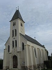
- Saint-Nicolas church, built in 1875
literature
- Le Patrimoine des Communes de la Seine-et-Marne . Flohic Editions, Volume 2, Paris 2001, ISBN 2-84234-100-7 , pp. 931-932.
Web links
Commons : Le Plessis-aux-Bois - collection of images, videos and audio files

