
Lutter (Eichsfeld)
| coat of arms | Germany map | |
|---|---|---|
.png)
|
Coordinates: 51 ° 20 ' N , 10 ° 7' E |
|
| Basic data | ||
| State : | Thuringia | |
| County : | Eichsfeld | |
| Management Community : | Uder | |
| Height : | 325 m above sea level NHN | |
| Area : | 9.85 km 2 | |
| Residents: | 707 (Dec. 31, 2019) | |
| Population density : | 72 inhabitants per km 2 | |
| Postal code : | 37318 | |
| Area code : | 036083 | |
| License plate : | EIC, HIG, WBS | |
| Community key : | 16 0 61 067 | |
| Association administration address: | Settlement 14 37318 Uder |
|
| Website : | ||
| Mayor : | Raimund Müller ( CDU ) | |
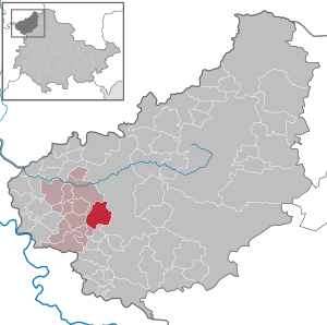
| Location of the municipality of Lutter in the Eichsfeld district | ||
  |
||

Lutter is a municipality in the Uder administrative community in the Thuringian district of Eichsfeld .
The community Lutter consists of the places Lutter and Fürstenhagen . The Fürstenhagen district is the seat of the nature park administration of the Eichsfeld-Hainich-Werratal nature park .
geography
location
Lutter is located about four kilometers southwest of Heilbad Heiligenstadt in the Luttertal valley of the same name. The immediate neighbors are Kalteneber in the southeast, Wüstheuterode and Lenterode in the west and Uder in the northwest. In terms of traffic, the place can be reached via the state road L 2023 .
landscape

The district of Lutter ranges from about 280 meters above sea level in the Lutter valley to 503 meters above sea level at Eichstruther Kopf on the Eichsfelder Höhe. Through the Lutter and its numerous small tributaries, the shell limestone plateau of the Upper Eichfeld was strongly structured and a varied landscape was created. The most important mountains are the Brandkopf and the Stein (464.2 m) in the northeast, the Springkopf (454.5 m) in the southeast, the Ölberg (455.0 m) in the southwest and the Lengenberg (460.8 m) in the west . The Lengenberg is home to the nature reserve of the same name with one of the largest populations of yew trees in Central Europe.
history
Lutter
Lutter was first mentioned in 1201 as Lutera or Luttera . The name probably comes from the Lutter stream of the same name, where the place is located. During the Thirty Years War in 1626, Lutter burned down completely.
The place belonged to Kurmainz until the secularization , from 1802 to 1945 it was part of the Prussian province of Saxony. 1945 to 1949 the place came under the Soviet occupation zone and was part of the GDR from 1949 . From 1961 until the turnaround and reunification in 1989/1990, Lutter was affected by the closure of the nearby inner-German border.
Fürstenhagen
The district of Fürstenhagen was re-established in the 19th century to the west of a settlement called Indago that existed in the 13th century and was abandoned around 1374 .
Population development
Development of the population (December 31) :
|
|
|
|
|
- Data source: Thuringian State Office for Statistics
politics
Municipal council
The municipal council of Lutter consists of eight council members.
- CDU : 8 seats
(As of: local elections on May 25, 2014)
mayor
The honorary mayor Raimund Müller (CDU) was re-elected on June 5, 2016.
Partner municipality
The partner community of Lutter is the local community Guckheim in the Westerwaldkreis ( Rhineland-Palatinate ).
coat of arms
Blazon : “Angled left by a silver wavy bar divided by blue and green; above a silver armored warrior, holding a flag lance in his right hand, leaning on a shield with his left; below a silver mill wheel. "
The Holy Mauritius is the patron saint of the church, which was in the seal of the municipality until 1952/53. The wavy line symbolizes the Lutter brook, where the place is located. The wheel in the coat of arms symbolizes that up to 1950 four mills in the village were driven by the Lutter.
Attractions

- The St. Mauritius Church in Lutter , built around 1900 .
- The nature park administration at the former train station in Fürstenhagen with an exhibition in the water tower and a tree house .
- Listed half-timbered houses in the Thuringian-Franconian architectural style.
- There were four mills in the village. The Hackemühle was a grinding mill on the southeastern outskirts, was named in the 17th century and was in operation until 1960. The middle mill , a grinding mill in the local area, was mentioned in 1666 and was in operation until 1965. Today it is a residential building. The Springmühle , an oil and grinding mill on the south-eastern outskirts, was mentioned in the 16th century and was in operation until 1953. With the takeover of the property by LPG , the demolition began and the outbuildings were put down. The lower mill as the fourth grinding mill is located on the western edge of the village, it was named in 1676 and was in operation until 1959.
Personalities
- Christoph König (1882–1944), politician and member of the Prussian state parliament
- Inge Klaan (* 1965), CDU local politician and State Secretary in Thuringia
literature
- Helmut Adler, Albert Hey: Chronicle Lutter - Fürstenhagen (Eichsfeld). Settlements, people, nature in and around Luttertal . Ed .: Municipality of Lutter. Heiligenstadt 1998, p. 270, A4 format .
Individual evidence
- ^ Population of the municipalities from the Thuringian State Office for Statistics ( help on this ).
- ↑ Map services of the Federal Agency for Nature Conservation ( information )
- ↑ Erhard Müller: The place names of the district of Heiligenstadt. Heilbad Heiligenstadt 1989, p. 30
- ↑ Local elections in Thuringia on May 25, 2014. Elections of the community and city council members. Final results. (PDF; 1.0 MB) The State Returning Officer, accessed on August 16, 2016 .
- ↑ Local elections in Thuringia on June 5, 2016. Elections of the community and city council members. Preliminary results. The regional returning officer, accessed on June 5, 2016 .
- ↑ Volker Große, Klaus Herzberg: "Hackemühle", "Mittelmühle", "Springmühle", and "Untermühle" . In: Maik Pinkert (Ed.): Mühlen im Obereichsfeld. A compendium . Eichsfeld-Verlag, Heiligenstadt 2008, ISBN 978-3-935782-13-5 , p. 249-254 .
Web links
At the Ohmberg | Arenshausen | Asbach-Sickenberg | Berlingerode | Birkenfelde | Bodenrode-Westhausen | Bornhagen | Brehme | Width worbis | Buhla | Burgwalde | Büttstedt | Dieterode | Dietzenrode / Vatterode | Dingelstädt | Ecklingerode | Effelder | Eichstruth | Ferna | Freienhagen | Fretterode | Geisleden | Geismar | Gerbershausen | Gernrode | Glasehausen | Großbartloff | Haynrode | Heilbad Heiligenstadt | Heuthen | Hohengandern | High cross | Kella | Kirchgandern | Kirchworbis | Krombach | Küllstedt | Leinefelde-Worbis | Lenterode | Lindewerra | Lutter | Mackenrode | Marth | Lower Orschel | Pfaffschwende | Reinholterode | Rohrberg | Röhrig | Rustenfelde | Schachtebich | Schimberg | Schönhagen | Schwobfeld | Sickerode | Sunstone | Steinbach | Steinheuterode | Keyings | Services | Thalwend | Uder | Volkerode | Waxed | Wahlhausen | Blowing | Wiesenfeld | Wingerode | Wüstheuterode