Montchenu
| Montchenu | ||
|---|---|---|
|
|
||
| region | Auvergne-Rhône-Alpes | |
| Department | Drôme | |
| Arrondissement | Valence | |
| Canton | Drôme des collines | |
| Community association | Hermitage-Tournonais-Herbasse-Pays de Saint Félicien | |
| Coordinates | 45 ° 12 ' N , 5 ° 2' E | |
| height | 263-489 m | |
| surface | 16.15 km 2 | |
| Residents | 579 (January 1, 2017) | |
| Population density | 36 inhabitants / km 2 | |
| Post Code | 26350 | |
| INSEE code | 26194 | |
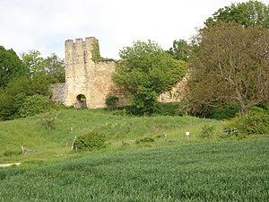
 Montchenu Castle |
||
Montchenu is a French municipality with 579 inhabitants (at January 1, 2017) in the department of Drôme in the region Auvergne Rhône-Alpes ; it belongs to the arrondissement of Valence and the canton of Drôme des collines .
Neighboring municipalities of Montchenu are Tersanne , Bathernay , Saint-Christophe-et-le-Laris , Crépol and Margès .
Population development
| year | 1962 | 1968 | 1975 | 1982 | 1990 | 1999 | 2008 | 2016 |
| Residents | 399 | 455 | 386 | 381 | 389 | 456 | 564 | 581 |
Attractions
- Montchenu Castle
- Two towers from the 13th / 14th centuries Century in Saint-Mury
Web links
Commons : Montchenu - collection of images, videos and audio files
