Génissieux
| Génissieux | ||
|---|---|---|
|
|
||
| region | Auvergne-Rhône-Alpes | |
| Department | Drôme | |
| Arrondissement | Valence | |
| Canton | Romans-sur-Isere | |
| Community association | Valence Roman's agglo | |
| Coordinates | 45 ° 5 ' N , 5 ° 5' E | |
| height | 177-303 m | |
| surface | 8.93 km 2 | |
| Residents | 2,282 (January 1, 2017) | |
| Population density | 256 inhabitants / km 2 | |
| Post Code | 26750 | |
| INSEE code | 26139 | |
| Website | http://www.genissieux.fr/ | |
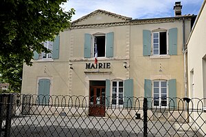
 Town hall (Mairie) of Génissieux |
||
Génissieux is a French commune with 2,282 inhabitants (as of January 1 2017) in the department of Drôme in the region Auvergne Rhône-Alpes ; it belongs to the arrondissement of Valence and the canton of Romans-sur-Isère (until 2015: canton of Romans-sur-Isère-2 ). The inhabitants are called Génissois .
geography
Génissieux is located about 23 kilometers northeast of Valence . The small river Savasse flows along the north-western edge of the municipality . Génissieux is surrounded by the neighboring communities of Geyssans in the north, Triors in the east and northeast, Saint-Paul-lès-Romans in the southeast, Romans-sur-Isère in the south and southwest, Mours-Saint-Eusèbe in the southwest and Peyrins in the west and northwest.
Population development
| year | 1911 | 1962 | 1968 | 1975 | 1982 | 1990 | 1999 | 2006 | 2016 |
|---|---|---|---|---|---|---|---|---|---|
| Residents | 609 | 589 | 655 | 765 | 1,125 | 1,584 | 1,826 | 2.002 | 2,183 |
Attractions
- Saint-Pierre church
- Giller Castle from the 16th century
- Génissieux castle from the 18th century
Web links
Commons : Génissieux - collection of images, videos and audio files
