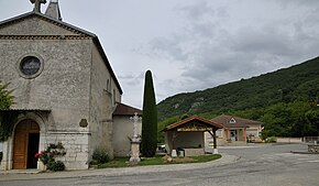
La Baume-d'Hostun
| La Baume-d'Hostun | ||
|---|---|---|
|
|
||
| region | Auvergne-Rhône-Alpes | |
| Department | Drôme | |
| Arrondissement | Valence | |
| Canton | Vercors-Monts du Matin | |
| Community association | Valence Roman's agglo | |
| Coordinates | 45 ° 3 ' N , 5 ° 14' E | |
| height | 148-760 m | |
| surface | 8.46 km 2 | |
| Residents | 571 (January 1, 2017) | |
| Population density | 67 inhabitants / km 2 | |
| Post Code | 26730 | |
| INSEE code | 26034 | |
| Website | www.la-baume-dhostun.fr | |
La Baume-d'Hostun is a French commune in the department of Drôme in the region Auvergne Rhône-Alpes .
geography
La Baume-d'Hostun is located in the northeast of the Drôme department, 17 kilometers east of Romans-sur-Isère and approx. 60 kilometers west of Grenoble (as the crow flies).
The 8.46 km² municipality covers part of the Isère valley and lies at the foot of the Vercors Mountains.
population
With 571 inhabitants (as of January 1, 2017), La Baume-d'Hostun is one of the smaller communities in the Drôme department.
| year | 1962 | 1968 | 1975 | 1982 | 1990 | 1999 | 2007 | 2017 |
|---|---|---|---|---|---|---|---|---|
| Residents | 112 | 241 | 262 | 250 | 324 | 364 | 469 | 571 |
Web links
Commons : La Baume-d'Hostun - collection of images, videos and audio files

