
Saint-Uze
| Saint-Uze | ||
|---|---|---|
.svg)
|
|
|
| region | Auvergne-Rhône-Alpes | |
| Department | Drôme | |
| Arrondissement | Valence | |
| Canton | Saint-Vallier | |
| Community association | Porte de DrômArdèche | |
| Coordinates | 45 ° 11 ′ N , 4 ° 52 ′ E | |
| height | 148-357 m | |
| surface | 10.1 km 2 | |
| Residents | 2,046 (January 1, 2017) | |
| Population density | 203 inhabitants / km 2 | |
| Post Code | 26240 | |
| INSEE code | 26332 | |
| Website | http://www.saintuze.fr/ | |

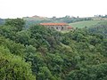
Saint-Uze is a French commune in the department of Drôme . Saint-Uze belongs to the arrondissement of Valence and the canton of Saint-Vallier . The community has 2,046 inhabitants (as of January 1, 2017).

geography
Saint-Uze is located about 46 kilometers southeast of Saint-Étienne between Lyon and Marseille . Saint-Uze is surrounded by the neighboring communities of Albon in the north, La Motte-de-Galaure in the east, Saint-Barthélemy-de-Vals in the south, Laveyron in the west and Beausemblant in the north-west.
Population development
| year | 1911 | 1962 | 1968 | 1975 | 1982 | 1990 | 1999 | 2006 | 2012 |
|---|---|---|---|---|---|---|---|---|---|
| Residents | 1,760 | 1,970 | 1,980 | 2,086 | 2.003 | 1,846 | 1,589 | 1,783 | 1,977 |
Attractions
- Saint-Eustache church
- Chapel of Sainte-Euphémie
- House of Ceramic Art
- Ruins of the Vals Castle
- Montaclard Castle

Saint-Eustache church
Saint-Euphémie Chapel


Web links
Commons : Saint-Uze - Collection of images, videos and audio files