
Northwest Territories
| coat of arms | flag |
|---|---|
 ( Details ) |
 ( Details ) |
| location | |
  |
|
| Basic data | |
| Official language | English (legal language) , French (legal language) , Chipewyan , Cree , Dogrib , Gwich'in , Inuinnaqtun , Inuktitut , Inuvialuktun , North- and South Slavey |
| Capital | Yellowknife |
| Biggest town | Yellowknife |
| surface | 1,143,793.86 km² (3rd) |
| Population (2016) | 41,786 (11.) |
| Population density | 0.04 inhabitants / km² |
| GDP in CAD (2006) | Total: 4.103 billion (11th) Per capita: 97,923 (1st) |
| Time zone | UTC −7 |
| ISO 3166-2 | CA-NT |
| Website | www.gov.nt.ca |
| politics | |
| Joined Confederation | July 15, 1870 |
| Commissioner | Tony Whitford |
| prime minister | Bob McLeod |
| Sit in the lower house | 1 |
| Seat in the Senate | 1 |
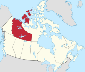
The Northwest Territories ( English Northwest Territories [ nɔɹθˌwɛst ˈtʰɛɹɪtʰɔɹiz ], French Territoires du Nord-Ouest [ tɛʁiˈtwaʁ dy nɔʁˈwɛst ]) are next to Yukon and Nunavut an area ( territory ) in Canada . In contrast to the provinces in the south, these three territories that make up the north of the state of Canada are directly subordinate to the Canadian federal government. The capital of the Northwest Territories is Yellowknife .
In 2016, 41,786 people lived in an area of 1,143,793.86 km². Of these, 20,635 were indigenous people, i.e. Inuit , Métis or First Nations , as the Indians are called in Canada. The latter are divided into 26 tribes with more than 17,000 members. The population, which in 2011 was 41,462 inhabitants and thus remained almost unchanged, mostly lives around the capital and at the confluence of the Mackenzie and the Beaufort Sea .
The climate is polar, especially in the north, flora and fauna are adapted to the short summers and the long winters, with the largest herds of caribou in America, and herds of musk ox in the north , being a defining factor.
The economy is largely based on the exploitation of raw materials. The fur trade no longer plays a significant role, although it was of considerable importance for the development of the area.
Originally, the Northwest Territories comprised most of Canada and its entire north. The Yukon Territory was part of the Northwest Territories until 1898, the provinces of Alberta and Saskatchewan until 1905, and parts of Manitoba until 1912. The area was reduced again with the establishment of the Nunavut Territory in 1999. The plural still used today for the administrative unit of Northwest Territories was factually overtaken by the establishment of the other two territorial administrative units.
geography
Expansion and structure
The Northwest Territories are bordered by the Yukon to the west, Nunavut to the east, British Columbia to the southwest , Alberta to the south, and Saskatchewan to the southeast. In the extreme southeast of the territory also comes on the quadrangle Four Corners to the province of Manitoba.
After the Great Lakes , here are the largest lakes in Canada, such as the Great Bear Lake with an area of 31,153 km² and the Great Slave Lake with 27,048 km². Between the by far largest lakes lies Lac la Martre, the third largest lake in the territory with 1776 km².
The largest drainage area is that of the Mackenzie in the west, which starts in the Great Slave Lake. Rivers like the Liard , which in turn receives the South Nahanni River , and the Peel River , which are only a small part of the territory, and the Keele River flow to it . To the east are numerous lakes, of which the group of four Kasba Lake (1,341 km²), MacKay Lake (1,061 km²), Aylmer Lake (847 km²) and Clinton-Colden Lake (737 km²) are among the largest. Hottah (918 km²), Selwyn (717 km²) and Wholdaia Lake (678 km²) join further to the east.

In the north, some islands of the Canadian Arctic Archipelago in the Arctic Ocean belong to the territory, such as Banks Island , Prince Patrick Island and parts of Victoria Island and Melville Island . The two largest lakes there are Aubry and Colville Lake .
At 2773 meters, the highest point is a nameless summit, unofficially called Mount Nirvana and located in the Mackenzie Mountains , which are also the highest mountain range. It also forms the border with the Yukon. The second highest mountain is Mount Sir James MacBrien, 26 km to the north, at 2762 m.
Geology and landscape
Liquid basalt was deposited almost 1.3 billion years ago in the area around the Coppermine River on an area of 170,000 km². Within less than five million years, basalt was deposited up to a height of 3.5 km. The Mackenzie Hotspot formed an extremely active magma area , later other volcanic hotspots arose in Nunavut as far as Ellesmere Island .
To the west, the Mackenzie Mountains form part of the northern Rocky Mountains . Along the western border of the territory, mountain ranges (ranges) such as the Tawu Range or the Backbone Range form sections of the Mackenzie Mountains. On its east side there are comparatively wooded river valleys, as well as in the south of the territory, where the capital Yellowknife is located at the confluence of the Yellowknife River in the north arm of the Great Slave Lake.

During the Cretaceous period , the lower lying areas east of the Mackenzie Mountains, which are now part of the Mackenzie drainage area, were covered by an estuary. To the east of the Mackenzie there are plateaus such as the Horn Plateau (838 m) or mountain ranges such as the Franklin Mountains (Cap Mountain, 1577 m), mountainous landscapes that are interspersed with numerous lakes even further east. To the east of the two large lakes of the territory there is a largely pathless lake landscape, through which the border to Nunavut runs northeast of the Great Bear Lake.
In the far north, the coast of the mainland stretches from the Mackenzie Estuary to the Amundsen Gulf , a region that is arctic and has little vegetation, and in which only the town of Paulatuk exists. In addition, several islands belong to the territory, such as part of Victoria Island , on the west coast of which is the settlement of Ulukhaktok , Banks Island , which rises to 750 m, or Prince Patrick Island . Geologically, the Arctic landscape is still very young. The area was completely covered with glaciers 20,000 years ago and only from around 8000 BC. From south to north it became increasingly ice-free.
Southwest of Fort Smith is the most important gypsum karst area in North America with numerous caves, sinkholes , sinkholes (the most famous being Pine Lake) and underground rivers. In Wood Buffalo National Park there are areas covered with salt crusts, the salt of which comes from the estuary located here, which once covered most of the territory.
climate
In the south of the territory the climate is subpolar, in the north arctic. In the so-called cryosphere there is prolonged frost up to permafrost . The summers are accordingly somewhat milder in the south, shorter and cooler in the north. In winter, temperatures below −40 ° C are not uncommon. The temperatures in Yellowknife between December 31, 1993 and January 19, 1994 were consistently below -37 ° C. Despite a very cold winter 2007/08, in which Yellowknife experienced −40 ° C for nine days, the winters of the last 25 years have been characterized by comparatively high temperatures. The lowest temperature ever recorded of −57.2 ° C was recorded in Fort Smith on December 26, 1917. The precipitation is low, but there was extensive precipitation around the capital on July 20, 2008 with heavy hail at temperatures of over 30 ° C. In the subarctic (Yellowknife) the average maximum temperature in January is -23 ° C and 21 ° C in July, in the Arctic zone it is -33 ° C and 10 ° C, respectively. In June there is 20 to 24 hours of daylight and up to 24 hours of darkness in December.
Flora and fauna

While the west and south of the territory are covered by forests that become lighter to the north, the east and north are beyond the tree line. The black spruce is often represented ; beyond the tree line, plants close to the ground dominate, such as opposed saxifrage (purple mountain saxifrage), the higher plant species growing to the north.
Seven large herds of caribou exist in the territory, numbering over half a million animals, the largest of which is the Qamanirjuaq herd in the east. Without them, settlement by the earliest inhabitants would hardly have been possible. The valley of the Thompsen River on Banks Island, on the other hand, is one of the most important habitats for musk oxen , which have been under protection in Canada since 1917. However, the local Inuit are allowed to kill a small number of animals each year. Their number is estimated at 50,000, and around 26,000 moose , at least 10,000 wolverines and 15,000 wolves live in the territory.
towns and places

By far the largest settlement chamber forms the Great Slave Lake with the upper Mackenzie. There is Yellowknife, the capital of the territory, and the largest town with 19,569 inhabitants. It is located on the Great Slave Lake, similar to the second largest city Hay River with 3,528 inhabitants. A little further south is Fort Smith, almost in Alberta. Also in the area of the Great Slave Lake is Behchokò with 1,874 inhabitants (including the inhabitants of the reserve), the former Rae-Edzo and the largest Dené settlement, as well as Fort Simpson and Fort Providence on the Mackenzie. Outside this large settlement chamber there is another in the mouth of the Mackenzie, where Inuvik , the third largest city, is, as well as Fort McPherson and Tsiigehtchic , the former Arctic Red River with 172 inhabitants.
The following table contains the ten largest municipalities in the territory (including all places that have the municipality status of City , Town or Village ), their region and municipality status, and their population figures from the respective censuses from Statistics Canada , the national statistical agency.
| local community | region | Community status |
population | ||||||
|---|---|---|---|---|---|---|---|---|---|
| 1991 | 1996 | 2001 | 2006 | 2011 | 2016 | ||||
| Deline | Sahtu | Charter community | 536 | 526 | 472 | 533 | |||
| Fort McPherson | Inuvik | Hamlet | 759 | 878 | 761 | 779 | 792 | 700 | |
| Fort Providence | South slave | Hamlet | 645 | 748 | 753 | 727 | 734 | 695 | |
| Fort Simpson | Dehcho | Village | 1,142 | 1,257 | 1,163 | 1,216 | 1,238 | 1,202 | |
| Fort Smith | South slave | Town | 2,480 | 2,441 | 2,185 | 2,364 | 2,496 | 2,542 | |
| Hay River | South slave | Town | 3,253 | 3,611 | 3,510 | 3,648 | 3,606 | 3,528 | |
| Inuvik | Inuvik | Town | 3,206 | 3,296 | 2,894 | 3,484 | 3,463 | 3,243 | |
| Norman Wells | Sahtu | Town | 627 | 798 | 666 | 761 | 727 | 778 | |
| Tuktoyaktuk | Inuvik | Hamlet | 918 | 943 | 930 | 870 | 854 | 898 | |
| Yellowknife | North slave | City | 15,179 | 17,275 | 16,541 | 18,700 | 19,234 | 19,569 | |
population
| Population development | |
|---|---|
| year | Residents |
| 1871 | 48,000 |
| 1891 | 98,967 |
| 1911 | 6,507 |
| 1931 | 9,316 |
| 1951 | 16.004 |
| 1961 | 22,998 |
| 1971 | 34,805 |
| 1981 | 45,740 |
| 1991 | 57,649 |
| 2001 | 37,560 |
| 2006 | 41,464 |
| 2011 | 41,462 |
| 2016 | 41,786 |
The early population figures are on the one hand unreliable, on the other hand they refer to the considerably larger area of the northwest territories of the 19th century. It was not until the 1911 census, after the Yukon, Alberta and Saskatchewan split off, that more accurate and comparable results were obtained. The same applies to the 1991 census and the split from Nunavut.
The First Nations and Inuit as well as Métis originally living here make up the absolute majority of the population, but around a fifth of the population describes themselves as Canadians , around half have European, mainly English, Scottish and Irish, but also French and German ancestors.
The Indian groups make up four Gwich'in First Nations in the Mackenzie area. The Teetl'it Zheh, or Fort McPherson, live on the Peel River and are the largest gwich'in group in the Northwest Territories. Their name means "people from the upper reaches". The second group are the Tsiigehtchic ("people of the plains") who live in the village of the same name . The Edhiitat Gwich'in ("Delta People") live in Aklavik on the Peel Channel in the MacKenzie Delta, as do the Nihtat Gwich'in ("Mixed Nations") who live in Inuvik on the East Channel.
The second large group is made up of the Chipewyan language speakers, especially Fort Resolution / Deninu Kue First Nation and Smiths Landing. Between 2006 and 2011 there was another stagnation in population growth, but the population growth in the other northern and inhospitable provinces of Nunavut and Yukon was very high with 11.6 and 8.3 percent respectively in just 5 years. The reason is not known and the Canadian Census Bureau expects growth again between 2011 and 2016.
According to the 2006 census, the following ten ethnic groups were the most common in the Northwest Territories (multiple answers were allowed):
- First Nations - 36.0%
- "Canadians" - 19.6%
- English - 16.6%
- Scots - 14.0%
- Irish - 12.0%
- Inuit - 11.2%
- French - 10.4%
- Germans - 8.1%
- Métis - 8.0%
- Ukrainians - 3.4%
26 First Nations are recognized in the territory, to which a total of around 17,000 people belonged in February 2009. The largest group with around 2,700 members are the Tli Cho between the Big Bear and the Slave Lake, which were formerly called the Dog Rib. Other recognized tribes with their registered relatives are, according to the Department of Indian Affairs and Northern Development :
|
|
history
Early history
The early history of the Northwest is dependent on the oral tradition of the indigenous people there and on archaeological sources (see History of the First Nations ). The density of finds is steadily increasing. In 2006, more than 6,000 archaeological sites were known, but they represent only a fraction of the existing sites.
Since 2002, like in the Yukon region, one type of source has proven to be particularly fruitful. This was created by the fact that caribou herds seek protection from the heat and insects in summer by settling on ice fields. In doing so, they left their own traces, mainly in the form of dung, but the hunters who followed them onto the ice also left numerous artefacts behind. As a result of global warming, these are increasingly thawing. Therefore, a research project was initiated in 2002 which, with the help of the Tulita First Nations Band and helicopters, was supposed to systematically record the tracks on the mountain edge. Objects up to 7000 years old came to light, which also consist of organic material, material that is only known from much more recent sites further south.
The earliest tangible tradition in the region in the north, however, is the Arctic Small Tool tradition , which, as the name suggests, left behind small tools dating back to between 2500 and 800 BC. And can be found from Alaska to Greenland . Its manifestations in northern Canada were Independence I and Pre-Dorset . It is believed that the ethnic groups from Asia around 2500 BC. Immigrated to the north of the Northwest Territories for the first time. It was followed by the Dorset culture until around 1000 AD (see Inuit culture ). Around 1000 groups moved south and east in the wake of global warming. In the so-called 2nd expansion , they penetrated as far as Hudson Bay . After 1300 the climate cooled down again, which made it increasingly difficult for people to survive. During the Little Ice Age between 1550 and 1850, with a brief thermal spike around 1800, the greater part of the extreme northwest was depopulated.
Fur trade and proselytizing
The fur trade had two roots in the Northwest Territories and the Yukon. Beavers , muskrats , mink , real martens and also lynxes were hunted by the inhabitants of the Mackenzie Basin and later by those of the delta. The trade associated with hunting expanded northwest from the 17th century, reaching the Arctic coasts in the 19th century. The second root was the hunt for the arctic fox . The first hunt was carried out by the Indians, the second by the Inuit.

Samuel Hearne traveled the polar regions from 1770 to 1772, starting from Fort Prince of Wales ( Churchill ) on Hudson Bay . He reached the Coppermine River and was the first to report on the Great Slave Lake . He described the Lake Wholdaia Chipewyan as successful caribou hunters, with whom the elders were well looked after, and whom he thought were particularly happy. The willingness with which many of them brought furs to Hudson Bay and thus made themselves slaves in Hearne's eyes is explained by his guide and protector Matonabbee with their pride in their work, which allowed them to give generously and to gain prestige . Matonabbee's father was an employee of Richard Norton at the Prince of Wales Fort around 1735, and after his father's death he and his Cree wife adopted his son.
In 1786, Fort Resolution (near the confluence of the Slave River in the Great Slave Lake) was the first trading post in the area of the later Northwest Territories. When Alexander Mackenzie was looking for access to the Pacific, Lac La Martre was the first trading post that enabled the Athapaskan tribes to trade directly with European fur trading companies. Until then, Cree and Chipewyan had acted as intermediaries. In addition, after 1700 Métis groups came from Saskatchewan who crossed the Methy Portage (see Portage ) and whose descendants are now known as Northern Métis .
At this early stage, a young woman played an important role. Thanadelthur was robbed by Cree at Great Slave Lake in 1713. These robbery parties had been armed with rifles and hunted slaves again and again since 1670. The rifles, in turn, often came from the Hudson's Bay Company (HBC) trading post , York Factory . Thanadelthur managed to escape to the fort in 1714, however, and the manager there, James Knight, immediately recognized the value of her information about fur hunters in the northwest. At his request, she led William Stewart and 150 Cree to the eastern arm of the Great Slave Lake and brokered peace between her people, the Chipewyan, and the Cree. In fact, the HBC established a new trading post at Churchill, Prince of Wales. Thanadelthur died, however, at the age of 17 in 1717. The peace made it possible for the Cree to have an undisturbed intermediate trade between the HBC and the tribes living in the northwest.
After the French were defeated by the British in 1760, several trading companies fought each other. The North West Company advanced north-west. Simon McTavish had connected nine small trading companies here. In 1786, the two rival companies of the North West Company under the leadership of Cuthbert Grant and Laurent Leroux of Gregory, Macleod and Company built separate forts. The companies united in 1787 built Old Fort Providence on Yellowknife Bay. But the principle of competing companies did not change, because now the Hudson's Bay Company competed with the combined North West Company. This state of affairs did not end until 1821 after the Pemmican War , when it was forcibly merged into a company that was now known as the Hudson's Bay Company and enjoyed a monopoly until 1870.
A trading post was not established on the Trout River until 1796 , but the post had to be abandoned three years later after Inuit had killed its builder Duncan Livingston. In 1801 the North West Company split and the XY Company was created. Nevertheless, in addition to short-lived trading posts, Fort of the Forks (1802 to 1811, later Fort Simpson), Fort Good Hope, Fort Norman and Fort Liard were founded . Nevertheless, the forts were relocated again and again, especially after the North West Company was taken over by HBC - also at the request of the delivering Indians. Ft. Simpson as the headquarters for the vast Mackenzie area. In 1827 alone, 4,800 beaver, 6,900 mink and 33,700 muskrat came to the HBC.
The fact that the wars between Dogrib and Yellowknives, which lasted around half a century, ended with a peace agreement after 1823 also contributed to the increase in yields . In October 1823, the Dogrib had avenged themselves for a defeat by killing 34 Yellowknife people, probably a fifth of the tribe. The peace treaty was celebrated at Mesa Lake.
Fort Liard and Fort Halkett were built on the upper Liard River . This was intended to bypass the Russian middlemen who dominated Alaska to the Kaska Indians when trading across the Pacific coastal areas on the way through the inland. In spite of the cultivation of potatoes and the like, the far-flung posts were dependent on the Indians' supply of food, especially meat. Three expeditions led by Captain John Franklin explored the areas between the central Arctic coast and the slave lake (1825-1827, 1836-1939, 1845).
By 1850 the distribution of trading posts was pretty much the same as it is today. The Indians continued to live nomadically, but especially in autumn and spring they increasingly lived near the trading posts. More and more traders gave the hunters credit - the bigger the prey in earlier years, the higher the credit could turn out to be. For the Indians it became a kind of recognition of their hunting skills to get the highest possible credit and thus debt. The beaver fur (madebeaver) became the only currency in the area. Its exchange value was clear: three mink, ten to fifteen muskrat, a full-grown lynx or six swans corresponded to a Madebeaver . A single knife cost two Madebeavers. The Indians received rifles, ammunition and powder, knives, traps, flour, tobacco, tea, cattle and rum for their furs. This too changed the structures of trade and power far into the north.
In 1847 the Oblate Missionary Alexandre-Antonin Taché came to Fort Chipewyan . The north-west diocese was established here, and the 27-year-old became its bishop. From this later diocese of Mackenzie (since 1967 suffragan of the Archdiocese of Grouard-McLennan ), more missionaries were sent north. In 1852 a mission station was established on the Great Slave Lake. When many Indians converted to Catholicism in the 1850s and the HBC helped out with food in years of hunger, the dependence on the trading posts grew. The epidemics brought in by Europeans, especially smallpox and measles , which killed numerous Indians, led to orphans being taken in. Vaccinations soon made the diseases less fatal. Other cultural changes helped increase British reliance on goods. The Indians usually buried their meat with hot stones and cooked it in this way, now iron pans were used for frying. The traditional techniques were lost.
The wafers initially stood in the way of Anglican competitors, but above all the numerous languages and the nomadism of the Indians, to which the wafers, however, adapted to Taché's instructions. In addition, the HBC was by no means ready to transport, supply and, if necessary, protect a large number of missionaries; few missionaries were able to follow the tribal migration cycles. Father Pierre-Henri Grollier moved north to Fort Simpson in 1858. In the same year the Anglican missionary James Hunter also arrived there. Grollier spoke Chipewyan and probably Slavey as well. The oblate Émile Petitot not only learned the languages, but also gained a certain fame through cultural observations. With the arrival of nuns from 1867, the focus shifted to schools. Nevertheless, the Oblates were not interested in settling down, let alone gaining a peasant life, which was not possible in the north anyway.
When HBC sold its trading territory to Canada in 1870, there were nine forts in the Northwest Territories: Good Hope, Liard, McPherson, Norman, Providence, Resolution, Simpson, Hay River, and Old Ft. Rae (until 1875).

The fur prices rose steadily, meanwhile silver fox skins were by far the most expensive furs. The furs were transported up the Mackenzie by boat, then by steamboat, from Edmonton (from 1890) the railroad continued to the consumption centers. The HBC was just one of several competing companies, including Hislop and Nagle in particular .
Although the first fur traders did not advance personally beyond the 60th parallel until 1894, events precipitated with the gold rush on the Klondike River . The fur animal populations fell noticeably, so that in 1906 and 1917 the Northwest Game Act was passed. Quiet times were introduced and everyone except the Indians had to acquire a license, the price of which was soon increased drastically. Still, the number of white trappers rose from 140 in 1920 to 500 six years later. At the same time, several animal populations, such as that of the mink, collapsed. The number of mink pelts captured fell from 21,205 (1923/24) to 3,630 (1927/28). In the 1920s and 1930s Lamson and Hubbard and Northern Traders Limited became HBC's fiercest competitors. But the global economic crisis let the prices collapse, only the HBC remained. Now only Indians and whites who already had a license were allowed to set traps. With that the era of trapping came to an end.
The territory


The Territory was created in June 1870 when the Hudson's Bay Company sold its rights to Rupert's Land and the Northwest Territory to the Federal Government of Canada. The area covered most of what is now Canada. In the years that followed, numerous border adjustments and splits took place.
On July 15, 1870, with the coming into force of the Manitoba Act, the province of Manitoba was founded, which at that time only comprised a small square area around the city of Winnipeg (enlarged in 1881 to a slightly larger rectangle that now forms the southern part of the province). The remaining Northwest Territories were co-administered from Winnipeg until 1905.
British Columbia , whichjoinedthe Canadian Confederation on July 20, 1871, had already been awarded those parts of the Northwest Territory in 1866 that were south of 60 ° N and west of 120 ° W, an area that made up most of the Stikine Territory included. On April 12, 1876, the Keewatin district was separated in the center of the territories, which was a separate administrative unit until 1905. In 1880 Great Britain ceded the British Arctic Territories to Canada. In 1882 and 1896, the remaining areas of the Northwest Territories were divided into the following districts:
- Alberta (southern Alberta, 1882)
- Assiniboia (southern Saskatchewan, 1882)
- Athabasca (northern Alberta and Saskatchewan, 1882)
- Franklin (the Canadian-Arctic archipelago with the Boothia and Melville peninsulas, 1895)
- Mackenzie (mainland NWT and western Nunavut, 1895)
- Saskatchewan (central Saskatchewan, 1882)
- Ungava (northern Québec, Labrador and islands in Hudson Bay)
- Yukon (present-day Yukon Territory)
In 1889 Ontario was enlarged westwards, in 1898 Québec moved its borders to the north. The Yukon Territory was also founded in 1898 in order to be able to cope better administratively with the consequences of the gold rush on the Klondike River.
In 1899, the government concluded one of the so-called Numbered Treaties with the Indians , in which they ceded their territories in exchange for securing their traditional way of life. This Treaty No. 8 only touched the southeast of what is now the Northwest Territories, but in 1921 Treaty No. 11 was signed, which included the rest of the territory.

On September 1, 1905, the new provinces of Alberta and Saskatchewan were founded. The first and only Prime Minister of the Northwest Territories was Sir Frederick Haultain . He lived since 1884 in Fort McLeod, which he represented in the Northwest Territories Council or in the Legislative Assembly of the Northwest Territories (from 1887), and worked as a prosecutor. On October 7, 1897, he was proposed as President of the Executive Council, or Premier, an office he held until 1905. He was an advocate of a province called Buffalo , which would include Alberta and Saskatchewan. But he could not become prime minister of one of the two provinces founded in 1905 because the leaders of the ruling Liberal Party rejected him.
In 1912 Manitoba, Ontario and Québec expanded their territory to the boundaries that are valid today, the latter extension was called Nouveau-Quebec. So only the districts of Mackenzie, Franklin (absorbed the rest of Ungava in 1920) and Keewatin remained. In 1925, the boundaries of the Northwest Territories were extended to the North Pole . From 1925 to 1999 the area of the Northwest Territories was 3,439,296 km² (roughly the size of India ). The remainder of the Northwest Territories had no representative in the Canadian House of Commons from 1907 to 1947 , after that only the Mackenzie District. The Inuit were only given the right to vote in 1953 and were represented in the federal parliament after the formation of a new constituency in 1962. In the course of the separation of the Nunavut Territory from the Northwest Territories on April 1, 1999, an official ideas competition was held to find a new name for the remaining area. After a satirizing initiative by students with the suggested name “Bob” attracted more and more attention, the competition was abandoned without result.
religion
In 2001, the proportion of Catholics was 45.7% of the population. The second largest Christian denomination was the Anglican Church with 14.9%, followed by the United Church (6.0%), Baptists and Lutherans with 1.8 and 1.1% respectively. The other Protestant groups make up over 5%, plus 65 Greek Orthodox and numerous other Christian groups, but with low membership numbers. Around 180 Muslims , 30 Jews , 155 Buddhists , 70 Hindus and 45 Sikhs joined them. 17.4% of the population stated no religion.
politics
The Northwest Territories officially by a Commissioner (Commissioner) rules, which is used by the Canadian Federal Government (prior to 1905 by a lieutenant governor ). From 1881, though, there also has its own Legislative Assembly (legislative assembly) , whose members are first determined were then selected from the 1951st Only since 1975 have all 19 members been elected by election. The chairman is the speaker. The assembly appoints a prime minister and a cabinet; However, there are no political parties. The majority of the members of the congregation are indigenous.
Since 1967, when Yellowknife became the capital, more and more responsibilities have been transferred from the Commissioner to the elected government, so this office is only of symbolic importance today. However, there are still disputes between the federal government and the government of the territories about the participation in the income from mineral resources.
According to the settlement structure, the administration is divided into two regions, the Fort Smith Region and the Inuvik Region. 47 incorporated places (municipalities) and 35 hamlets (hamlets), a total of around a hundred settlement points, are more or less strongly influenced by local traditions and political structures, which are often rooted in ethnic traditions. Indian reservations ( Indian reserves called) exist only at Hay River near Fort Smith. Since 1984, however, contracts have been concluded with the Inuvialuit of the Western Arctic, then in 1993 with the Tungavik Federation which separated Nunavut after a referendum in 1982 in 1999, and in 1994 with the Sahtu Dene and the Métis of the Mackenzietal.
Administrative division
Administratively, the territory is divided into the following regions:
environment

There are several protected areas around the Great Slave Lake in the south, such as the Mackenzie Bison Sanctuary on the west bank, the Slave River Reserve around the mouth of the river of the same name into the lake, to which the Wood Buffalo National Park connects to the southwest , Canada's largest national park. On both sides of the border with Yukon, in the north is the nature reserve of the Peel River Reserve , further to the south, the Nahanni National Park Reserve , which was expanded six times in 2009 and is a World Heritage Site. In addition, there is the small Norah Willis Michener Game Reserve on the Yukon border .
In the far north, already on the Beaufort Sea , is the Aulavik National Park on Banks Island , where numerous musk oxen live. The Tuktut-Nogait National Park (16,340 km²) was established on the mainland near the border to Nunavut, and the Reindeer Grazing Reserve near the border with the Yukon . It is located north and east of Inuvik and includes, in addition to Richards Island, the areas around Kugmallit Bay and Liverpool Bay and extends in the east to the Anderson River . Herds of caribou, especially Bluenose West and East as well as Cape Bathurst, are protected here. The latter was only recognized as a separate herd in 2000. However, their numbers are falling. In 1992 the Cape Bathurst herd had 17,500 animals, in 2006 only 1,800; Bluenose-West shrank from 98,900 to 18,000, Bluenose-East from 104,000 in 2000 to 66,200 in 2006.
Herds of caribou across Canada have been shrinking since the 1990s, including the Northwest Territories, which are home to seven of these huge herds of Barrenground Caribous . In the mid-1980s they probably comprised at least one million animals, and in the mid-1990s perhaps 1.3 million. The smaller herds, such as Cape Bathurst and Bluenose West , are shrinking particularly rapidly , but Porcupine and especially Bathurst are also declining sharply from the four large herds , while Beverly and Qamanirjuaq in the east (i.e. far from settlements), which in 1994 consisted of around 500,000 animals, have increased at least until the mid-1990s - further data are missing, however.
In the first years of gold mining at the Großer Bärensee from 1935 on, a process was used to separate gold and ore in which large amounts of arsenic (III) oxide dust were released. From 1951 to 1956 the amount of arsenic sank from 7.4 to 2.6 t per day, by 1959 to 52 kg. In total, the Giant Mine produced 237,000 t of this toxic substance during the 50 years of production (until 1999), which was stored underground. These bearings are washed out by groundwater, so that complex cleaning processes were necessary. Added to this are the disturbances in animal migration due to road construction and the increasing truck traffic. Research into these ecological pressures has a focus in Bremen .
economy
The economy of the Northwest Territories is based on the exploitation of natural resources. Trapping is only of minor economic importance (CAD 0.9 million in 1999), but there are still around 5,000 hunting licenses. The whale hunt no longer exists, the only significant fishery is that on the slave lake, where almost only white fish is caught. Commercial fishing is not permitted on the Slave Lake. Logging is only practiced in the Mackenzie valley.
Gold , uranium , lead , zinc , silver , copper , tungsten and diamonds have been mined in various mines, especially since the 1930s . In 2000, diamonds contributed $ 636 million, gold 56, and silver $ 0.25 million. In 1999, however, the largest gold mine, the Giant Mine, which had existed since 1935, had to close because the owner, the Royal Oak Company , was bankrupt. In addition, there are extensive reserves of crude oil (at Norman Wells) and natural gas in the Mackenzie Delta . While the oil flows to Alberta, the gas is shipped from Bent Horn on Cameron Island to Montreal. By 1986, all of Canada's tungsten production came from the territory. The mines employ a total of around 2000 people, which corresponds to around 15% of the jobs. Diamond mines in the Northwest Territories include the Ekati Diamond Mine , the Diavik Diamond Mine, and the Snap Lake Diamond Mine . The mines north of the city of Yellowknife are cut off from the outside world and connected to the American road network via the Tibbitt to Contwoyto Winter Road ice road for only two months a year . The documentary series Ice Road Truckers deals with this specialty.
Power producers are the Northwest Territories Power Corporation , which supplies 49 locations, and Northland Utilities Enterprises Ltd. the five places supplied. In 1994, 84% of the capacities were held by the former company. Around three quarters of the energy came from thermal sources, a quarter from hydropower, i.e. from power plants at Yellowknife, Snare (three power plants alone) and Taltson.
There is some agriculture in the south, but most of the food is imported, and low prices prevent local agriculture. Around half of the population works in the service sector, around a fifth in public administration. Because of its natural resources and relatively small population, the Northwest Territories have the highest gross domestic product per capita of any province or territory in Canada.
Tourism is of growing importance, although the region is not easily accessible. The national parks make a significant contribution to this, and they also create administrative offices. So is Wood Buffalo from Fort Smith , Nahanni of Fort Simpson and Aulavik from Sachs Harbor manages from.
After all, the art market is a major contributor to indigenous family incomes, such as Inuit prints and sculptures. Almost 50 cooperatives provide around 5,000 people with work and income. These cooperatives also maintain hotels, restaurants and shops.
traffic
There is still river shipping on the Mackenzie in which the Hay River and Tuktoyaktuk ports play a decisive role. Shipping along the coast is only possible for a few weeks in summer, ice breakers also operate there.
The inland ports are connected to the thin network of slopes via gravel roads. The Mackenzie and Yellowknife Highway connect the 2,200 km long road network of the territory via Hay River and Yellowknife with Alberta. The only way to Wood Buffalo National Park connects the Hay River with Fort Resolution and Fort Smith. The northern connection through the Mackenzietal extends to Wrigley north of Fort Simpson. The Liard Highway , opened in 1984, connects this place to the Alaska Highway via Fort Liard . The Dempster Highway connects the places of the Mackenziedeltas with Dawson in Yukon. Of particular importance are the winter roads, which are only passable in winter, and the frozen lakes, which are often the only external connection.
There are flights from Edmonton to airports in Mackenzietal and Resolute, from Montréal to the east and to Resolute, and from Winnipeg to Yellowknife, Rankin Inlet and Iqaluit, but nine out of ten flights go to and from Yellowknife. Places with more than 100 inhabitants have an airfield.
Culture
Linguistic diversity
There are eleven official languages in the Northwest Territories , more than in any of the other provinces and territories, with the two European languages predominant in the rest of Canada being joined by the Inuit and Indian languages. The latter belong to the group of the Athabaskan languages . The official languages are Chipewyan , Cree , English , French , then the language of the Gwich'in , Inuinnaqtun , Inuktitut , Inuvialuktun , North Slavey , South Slavey and Dogrib . Residents have the right to appeal to courts and government agencies in these languages. However, laws are only legally binding in the English and French versions. Laws and other documents are only translated if expressly requested.
Education and Research

The task of state-organized education and upbringing initially lay with missionaries and churches. Thirteen so-called residential schools were created in which the indigenous people should be made into Christians and the indigenous people should be "civilized" in accordance with the Gradual Civilization Act . For this purpose, the mostly nomadic or semi-nomadic groups were settled. The schools operated until the 1970s.
In 2000, there were 77 schools in the territory with 1,253 full-time teachers and 9,800 students. In 1962 that number was only 6,000. The curricula of the indigenous people, DeneKede and Inuuqatigiit, are essential for teaching cultures and languages.
In 1984 the Arctic College was established with a campus each in Fort Smith and Igaluit. Between 1987 and 1990 the local educational institutions were incorporated into the college system. In 1995 the Arctic College was split up, creating the Aurora College in the Western Arctic and the Nunavut Arctic College in the Eastern Arctic.
Museums, archives, libraries

The Prince of Wales Northern Heritage Center is both the territory's premier museum and archive and has its own library. As a branch of the Department of Education, Culture and Employment, it represents the cultures of the territory, collects and preserves the associated artifacts and displays them in-house and online. Plans to build such an institution took shape in 1971 and were approved by the government in 1972. In 1979 the center was inaugurated in the presence of the British heir to the throne and namesake. The collections include over 350,000 photographs, several thousand hours of sound and film recordings, and 9,000 books. There are also diaries and letters, maps, government files and numerous scientific publications and field reports from excavation campaigns.
The largest library with over 70,000 media is also located in the capital. The Yellowknife Public Library is part of the NWT Public Library Services . These include regional libraries in most parts of the territory, such as the Aklavik Community Library or the Fort McPherson Community Library in the northwest or the Zhahti Koe Community Library in Fort Providence , the Hay River Centennial Library or the Hay River Dene Reserve Community Library , which both are in Hay River , but form different focuses. There is also the Mary Kaeser Library in Fort Smith , which has magazine subscriptions with a regional focus, such as the Inuit Art Quarterly or the Arctic Bulletin .
Newspapers, radio, television
In addition to national newspapers, there are several weekly newspapers in the Northwest Territories with a regional focus. The Deh Choh Drum is a focal point in the south and, like some others, appears on the Internet. Fort Chipewyan, Alberta and Fort Smith are served by the Slave River Journal . There are also The Hub , Inuvik Drum , Tusaayaksat (Inuit, bi-monthly), the French newspaper L'Aquilon , News North , which appears twice a week in Yellowknife.
Today there are four local radio stations in the territory, in addition to the national offerings of the Canadian Broadcasting Corporation (CBC). In the 1950s, the first private radio station was set up, which began operations in Yellowknife and was not officially recognized by the CBC until 1958 (CFYK-AM (Radio One)). As with other stations, the CBC added a night program to the existing daily program in 1995. With CJCD-FM, a second station followed in the capital from 1979, headed by Charles A. Dent. In 2007, however, the Dent family sold the station to Vista Broadcast Group Inc. A third station, CKLB-FM, opened in 1985. It has a more multicultural programming.
The second radio station in the territory began broadcasting on November 22, 1960 in Inuvik . Further stations followed as a transmitter in Fort Norman (1969), Fort Good Hope (1973), Fort McPherson (1974), Cambridge Bay (1975), most recently in Tuktoyaktuk (2005). In 1990 the station in Inuvik broadcast its own program more than 40 hours per week, 15 of which were provided in the language of the Gwich'in and Inuvialuktun . A radio station was not established in Aklavik until 1986 .
Similar to radio stations, TV stations only exist in Inuvik and Yellowknife. CFYK-TV was created there in 1967, followed by CHAK-TV in Inuvik in 1968/69. The station in Yellowknife was the first television station in northern Canada and was created as part of the Frontier Coverage Package Program of the CBC.
Sports
Athletes from the Territory regularly compete in the Arctic Winter Games , alongside athletes from Nunavut and the Yukon, as well as Nunavik and northern Alberta . Athletes from Alaska and Greenland also take part in these games.
literature
- Tara Browner: Music of the First Nations. Tradition and Innovation in Native North America. University of Illois Press, Urbana IL 2009, ISBN 978-0-252-02221-0 , pp. 21-33: Chap. 2: Musical Expressions of the Dene. Doghrib Love and Land Songs.
Web links
- Government of the Northwest Territories (Engl.)
- Northwest Territories Tourism Germany
- NWT Archives
- Prince of Wales Northern Heritage Center
- Northwest Territories ( English, French ) In: The Canadian Encyclopedia .
- Lessons from the Land. Cultural Journey through the Northwest Territories (English, Doghrib, French)
Sources and Notes
- ^ Population and Dwelling Count Highlight Tables, 2016 Census. In: Statistics Canada . February 20, 2019, accessed on August 7, 2020 .
- ^ Canadian Mountain Encyclopedia
- ↑ Weather Facts and Trivia, CBC News, Nov. 11, 2000
- ↑ Canada's Top Ten Weather Stories for 2008. 9. The Coldest Place On Earth ( Memento from August 15, 2011 in the Internet Archive ) (English)
- ↑ A map of the Canadian forest can be found here .
- ^ Encyclopedia of Canadian Provinces :: Alberta to Nova Scotia. The Northwest Territories
- ^ Profile of Census Divisions and Subdivisions, 1996 Census. In: Statistics Canada . December 23, 2013, accessed September 15, 2019 .
- ↑ 2001 Community Profiles. In: Statistics Canada . February 1, 2007, accessed September 15, 2019 .
- ↑ 2006 Community Profiles. In: Statistics Canada . January 5, 2015, accessed September 15, 2019 .
- ^ Census Profile, 2011 Census. In: Statistics Canada . November 27, 2015, accessed September 15, 2019 .
- ^ Census Profile, 2016 Census. In: Statistics Canada . February 9, 2017, accessed September 15, 2019 .
- ↑ Statistics Canada - Population by selected ethnic origins, by province and territory ( Memento from June 21, 2008 in the Internet Archive )
- ↑ List of First Nations, North West Territories ( Memento from May 1, 2012 on WebCite ) with relatives numbers (February 2009)
- ↑ A map of the finds can be found here
- ^ Shelley Crouch: Archaeological Fieldwork in the Northwest Territories in 2006 .
- ↑ About Flew were doing in the middle Mackenzie Mountains between Norman Wells and the border of the Yukon, south to the sources of the South Nahanni River, north to those of the Arctic Red River.
- ↑ Hermann Parzinger: The children of Prometheus. A history of mankind before the invention of writing. CH Beck, Munich 2014, ISBN 978-3-406-66657-5 , pp. 561-563.
- ↑ General on the history of the fur trade, particularly the North West Company, in the northwest: The Fur Traders , McGill University, 2001
- ↑ Samuel Hearne . In: Dictionary of Canadian Biography . 24 volumes, 1966–2018. University of Toronto Press, Toronto ( English , French ).
- ^ Strother Roberts: The life and death of Matonabbee: fur trade and leadership among the Chipewyan, 1736–1782. Manitoba Historical Society 2007.
- ↑ Thanadelthur . In: Dictionary of Canadian Biography . 24 volumes, 1966–2018. University of Toronto Press, Toronto ( English , French ).
- ↑ This fort had to be abandoned after the death of four men in an extremely harsh winter in 1811. The search for the remains of the fort, led by the archaeologist Jean-Luc Pilon, did not find the fort, but numerous artefacts from the pre-European cultures are still being excavated there.
- ↑ Taché, Grollier . In: Dictionary of Canadian Biography . 24 volumes, 1966–2018. University of Toronto Press, Toronto ( English , French ).
- ↑ Kerry Margaret Abel: Drum Songs: Glimpses of Dene History. McGill-Queen's University Press 2005, p. 116 ff.
- ↑ Kerry Margaret Abel: Drum Songs: Glimpses of Dene History. McGill-Queen's University Press 2005, pp. 190 f.
- ↑ Gordon W. Smith, P. Whitney Lackenbauer (Ed.): A Historical and Legal Study of Sovereignty in the Canadian North: Terrestrial Sovereignty, 1870-1939. Northern Lights, November 2014, ISBN 978-1-55238-720-7 (including; web link to the publication , with the chapters as pdfs).
- ↑ A map of these contracts can be found here ( Memento from May 23, 2009 in the Internet Archive ) (atlas.nrcan.gc.ca), a description of the history of this contract by the Department of Indian Affairs and Northern Development can be found here (ainc -inac.gc.ca).
- ^ Name the residual Northwest Territories BOB! ( Memento from February 24, 2011 in the Internet Archive )
- ^ Statistics Canada
- ↑ Barren-ground Caribou Survey Results Released , September 8, 2006 ( Memento of November 19, 2006 in the Internet Archive ) (PDF; 28 kB).
- ↑ The project Mining-Caused Environmental Damage in the Canadian Borealis, funded by the German Research Foundation, using the example of the Great Slave Lake (Northwest Territories): yesterday - today - tomorrow ( Memento from June 1, 2009 in the Internet Archive ) works closely with Canadian Institutes together.
- ^ Northwest Territories Official Languages Act 1988 ( Memento of December 28, 2013 in the Internet Archive )
- ↑ Two existed in Aklavik (Immaculate Conception and All Saints), there were also schools in Coppermine, in Fort McPherson, Providence, Resolution, Smith, another two in Fort Simpson, two in Inuvik, one in Hay River and one in Whitehorse (after : Residential School Settlement. List of Residential Schools ). There are a total of 68 institutions that are eligible for reparation payments on the part of the institutions involved, cf. Decisions (PDF; 268 kB), lists all schools in Canada by provinces and territories.
- ↑ A search mask for the photo archive can be found here .
- ↑ Deh Choh Drum Online ( Memento from August 6, 2009 in the Internet Archive )
- ^ Newspapers in the Northwest Territories ( Memento of May 23, 2009 in the Internet Archive )
- ↑ Radio Station History, North West Territories, Inuvik ( Memento of August 11, 2010 in the Internet Archive ) (English)
Provinces: Alberta | British Columbia | Manitoba | Newfoundland and Labrador | New Brunswick | Nova Scotia | Ontario | Prince Edward Island | Québec | Saskatchewan
Territories: Northwest Territories | Nunavut | Yukon
Coordinates: 65 ° 1 ′ N , 117 ° 57 ′ W