
Sterkrade
|
|||
|---|---|---|---|
| coat of arms | map | ||

|

|
||
| Basic data | |||
| Area : | 42.14 km² | ||
| Residents : | 81,799 (December 31, 2017) | ||
| Population density : | 1,990 inhabitants / km² | ||
| Structure : |

|
||
| Postcodes : | 46119, 46145, 46147, 46149 | ||
| Telephone code : | +49 208 ... | ||
| Distribution of seats for the district council (2014) | |||
| SPD: 7 CDU: 6 GREENS: 2 BOB: 1 Left: 1 | |||

Sterkrade is a district of Oberhausen , which is divided into the districts of Alsfeld with Dunkelschlag , Barmingholten , Biefang , Buschhausen , Holten , Königshardt , Schmachtendorf with Waldhuck and Waldteich , Schwarze Heide with Weierheide , Sterkrade-Mitte, Tackenberg with Sterkrader Heide and Walsumermark with Brink and Neuköln is structured. It borders in the northwest on the city of Dinslaken ( Wesel district ), in the east on the independent city of Bottrop and the Oberhausen district of Osterfeld , in the south on the district of Alt-Oberhausen and in the west on the Duisburg district of Hamborn .
Sterkrade has the rank of a middle center . The attractiveness of its city center and the local retailers was initially reduced by the new construction of the Centr O in the Neue Mitte Oberhausen , but since the opening of the “Sterkrader Tor” shopping center in May 2007 it has become more popular again. The weekly market in Sterkrade is the largest market in Oberhausen.
The traditional Sterkrad Corpus Christi fair was at times the largest street fair in Europe.
history
Several archaeological findings show that the Sterkrad area was already settled in the early Middle Ages . The most important of these is a Franconian burial ground from the Merovingian era , which was found by chance during construction work in the Weseler Strasse / Oskarstrasse area in 1921 and made accessible through excavations in 1936. Gold coins found about 900 m away from the first half of the 6th century underline Sterkrad's early medieval beginnings, but do not seem to have any closer relationship with the burial ground.
The oldest written mention of the settlement dates from around 890 when they under the name "Starkinrotha" in Urbar the Will Abbey was performed. Other forms of name handed down from the Middle Ages are Sterkerotha , Stoerkenrotha , Starkerode or Starkenrade . The ending -rode or -rade refers to clearing as the starting point for settlement, but it is unclear whether the first half of the place name is supposed to testify to heavy clearing or a person named Starko - both hypotheses are still supported.


Up until the beginning of the 19th century, the history of Sterkrade was strongly influenced by the Sterkrade Monastery of the Cistercians , which was founded in 1240 as a branch of the Duissern Monastery , which in turn had emerged from the Cistercian Monastery of Saarn only a few years earlier . The sisters originally settled on Gut Defth (located in the Kirchhellen- Grafwald district of today's town of Bottrop), but must have moved to Sterkrade by spring 1255 at the latest. A document from Mechthild von Holten must be dated to this point in time , which gave the monastery the right of patronage over the Sterkrad church and gave it a mill and a fish pond. Further donations from Mechthild and her descendants secured the material basis of the monastery community and laid the foundation for extensive land ownership. A document from November 1266 mentions the place and monastery in one context for the first time: conventus sanctimonialium Cysterciensis ordinis in Starkerode . Monasterium de rivulo sancte Marie ("Kloster am Marienbächlein") is attested as a proper name of the monastery . The Sterkrad city coat of arms is derived from a personal seal of the abbess Anna Catharina von Nunum, called Dücker, who held office from 1674 to 1715. As a result of the Reichsdeputationshauptschluss of 1803, the monastery was abolished; the certificate of dissolution is dated July 15, 1809. The former monastery building subsequently became a residential building. In 1969, the last part of the former abbey, the east wing, built in 1701, was demolished without the state curator's knowledge .
Today's provost church of St. Clemens emerged from the former patron church of the monastery . The oldest Protestant church in the core of Sterkrade, which was purely Catholic until around 1800, is the Friedenskirche , consecrated in 1852 , which was relieved at the beginning of the 20th century by the opening of the Christ Church .

Originally Klevian Sterkrade belonged after 1815 to the mayor's office in Holten in the Dinslaken district , from September 27, 1823 to the Duisburg district , from December 8, 1873 to the Mülheim an der Ruhr district and from 1887 to the Ruhrort district . On April 1, 1886, Sterkrade became mayor with the four communities of Sterkrade, Stadt and Feldmark Holten , Amt Holten (Biefang) and Buschhausen . The mayor's office came to the Ruhrort district on April 20, 1887 and to the Dinslaken district on April 1, 1909. On April 20, 1909, the greater part of Buschhausen was incorporated into Sterkrade, and at the same time Oberhausen received the Grafenbusch with Oberhausen Castle . On March 17, 1913, Sterkrade received city rights , the Sterkrade mayor was divided into the town of Sterkrade and the mayor of Holten. As early as July 1, 1917, the Holten mayor's office, together with a large part of the Hiesfeld mayor's office - the towns of Barmingholten, Schmachtendorf and Walsumermark - was incorporated into the town of Sterkrade, which also became a district .
The town of Hamborn tried unsuccessfully in the 1920s under its mayor Hugo Rosendahl, who was born in Sterkrade, to merge the towns of Sterkrade, Dinslaken and Hamborn. There were plans to merge the cities of Duisburg, Oberhausen, Mülheim an der Ruhr , Dinslaken and the east of the Moers district to form the Ruhr estuary , which at that time would have had about a million inhabitants.
On August 1, 1929, however, Sterkrade was united with Osterfeld and (old) Oberhausen to form the new city of Oberhausen (Rhineland) in the course of the municipal reorganization in the Ruhr area . To the west, the new city of Duisburg-Hamborn was created , an amalgamation of the cities of Duisburg, Hamborn and the northern part of the Düsseldorf district.

In terms of industrial history, Sterkrade is closely connected to the Gutehoffnungshütte (GHH) and the Sterkrade colliery . The settlement and upswing of industry in the 19th century had a significant impact on population development. This effect was also reinforced by incorporations.
| year | Residents |
|---|---|
| 1808 | 457 |
| 1850 | 1.919 |
| 1900 | 15,264 |
| 1929 | 51.907 |
In the last few decades, as in the entire Ruhr area, the coal and steel industry has lost its role as a leading branch of the economy in Sterkrade . Most of the factory buildings have now disappeared from the cityscape, and a substantial part of the former GHH premises in the center of Sterkrad has been used for another purpose. Of the former large corporation, only part of the MAN Energy Solutions operations are essentially productive on site.
badges and flags
Blazon : Split in silver (white), fronted with three blue bars and at the back divided by a blue bar on which a black raven sits. The upper coat of arms consists of a red wall crown with 3 towers.
Meaning: It is a composite coat of arms; on the one hand the coat of arms of the 20th abbess Anna Catharina von Nunnum called Dücker, from 1674 to 1715 and on the other hand the coat of arms of the dynasty of the Hönnepel von Niederrhein, from which the mother of the abbess comes. Instead of a crest, a wall crown was placed on the coat of arms. Following a resolution by the Sterkrad city council, the city coat of arms was adopted on June 4, 1913. At the same time blue and white were chosen as the city colors.
Flag: Sterkrade carries a flag with the colors blue-white-blue in a ratio of 1: 8: 1 with the city coat of arms in the middle. It can also be hoisted as a banner.
Sterkrade as a city district
In terms of area, Sterkrade is the largest of the three Oberhausen districts. Of the approximately 77 km² of the urban area, 42.15 km² belong to Sterkrade. In terms of population, Sterkrade is in second place behind Alt-Oberhausen. Since the merger in 1929, when Oberhausen had 110,958 inhabitants and Sterkrade only 51,907, this gap has decreased significantly due to a "north migration" of the Oberhausen population that has been observed in recent decades. At the end of 2009 there were 91,725 people in Alt-Oberhausen and 83,021 in Sterkrade.
Social structure
From a socio-spatial perspective on the part of the city, Sterkrade is divided into the social spaces "Sterkrade Mitte" with the districts Buschhausen / Biefang, Sterkrade Mitte, Alsfeld, Tackenberg West as well as Schwarze Heide and "Sterkrade Nord" with Holten / Barmingholten, Schmachtendorf, Walsumermark and Königshardt. The north of Sterkrade scores better than the center of Sterkrades or the city of Oberhausen as a whole in terms of almost all indicators (such as the unemployment rate, transition rate to high school, use of educational assistance or the proportion of transfer recipients).
Politics and administration
The district administration office has been located in the so-called technical town hall, a former administration building of the Gutehoffnungshütte, together with other departments of the Oberhausen city administration. After the municipal elections in 2014, the Sterkrader district representation is composed as follows:
- SPD : seven seats,
- CDU : six seats,
- Alliance 90 / The Greens : two seats,
- Left list : a seat,
- Alliance of Oberhausen Citizens (BOB): one seat.
Made for state elections last Sterkrade together with the constituency Dinslaken 56: Oberhausen II - Wesel I .

City center with Neumarkt seen from the ferris wheel

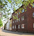
Bahnhofstrasse

Technical town hall

Sterkrade Monastery (new building)
Christinestr. 23, the geographical center of Oberhausen

.jpg)


Infrastructure
See article: Alter Postweg (Sterkrade)

Sterkrade has two train stations: Oberhausen-Sterkrade (opened in 1856) and Oberhausen-Holten (opened in 1886). Both are on the Oberhausen – Arnhem railway line . The Holten station is located between the northern Dinslaken station and the Sterkrade station. From Sterkrade there are connections in the direction of Oberhausen and Wesel. Every 20 minutes there is a regional train to Wesel or Duisburg / Krefeld. The Rheinexpress to Emmerich or Koblenz runs every hour.
Sterkrade is integrated into the public transport network of the city of Oberhausen . During the construction of the CentrO 1996 was public transport route Oberhausen , a completely new tram and bus lane from Oberhausen main station to station Sterkrade built. In addition to a number of bus lines, the tram from Mülheim an der Ruhr via Oberhausen Hbf. To Oberhausen-Sterkrade station will run on it. At the end of October 2004, this line was extended by an 800 m long section to Neumarkt, which can be used by public buses in the direction of the train station .
Sterkrade is connected to the A 516 city motorway via the Oberhausen-Sterkrade junction and to the A 3 to Cologne / Duisburg / Düsseldorf or Arnhem via the Oberhausen-Holten junction . The A 516 connects Sterkrade with the Oberhausen-Zentrum junction ( A 42 Kamp-Lintfort ↔ Dortmund ), where it then continues as the B 223 to the south of Oberhausen and Mülheim an der Ruhr . In the north, the A 516 leads to the Oberhausen motorway junction , where it changes to the A 3 to Arnhem and also has a connection to the A 2 in the direction of Hanover and Dortmund and via this to the A 31 to Nordhorn and Emden .
Attractions
- Sterkrade colliery
-
Provost Church of St. Clement , a hall from 1952 to 1953 after the previous building in the Second World War had been destroyed
- Image of grace Mother of good advice (painting from the 18th century, mentioned for the first time in 1738, based on a Passau image of the Virgin Mary, which in turn is based on a painting by Lucas Cranach the Elder (probably 1517))
- Mosaic of the risen Christ by Ludwig Baur
- Hagelkreuz (corner of Steinbrinkstraße / Postweg) originally built by the Rogez brothers called Lantermann in 1849 on the place of an older cross from 1812. Only a replica of the cross can be seen today after the body was stolen in 1993
- HOAG cycle path

Headframe Sterkrade Colliery 2008

Bell memorial at the train station
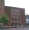
St. Clement's Church

Hail cross


Personalities


mayor
- Botho Franz Wolfgang von Trotha (1886–1905)
- Eugen zur Nieden, National Liberal Party (1906–1915)
Lord Mayor
- Otto Most , DVP (1916-1919)
- Wilhelm Heuser, Zentrum (1920–1929, 1930–1937 Lord Mayor of Oberhausen, from 1933 NSDAP )
Personalities of Sterkrades
- Wilhelm Lueg (1792–1864), director of the JHH, the forerunner of the Gutehoffnungshütte
- Wilhelm Hünermann (1900–1975), Catholic priest, biographer and writer, was a chaplain in Sterkrade.
- Wim Wenders (* 1945), internationally known film director, attended the modern-language Freiherr-vom-Stein grammar school in Sterkrade.
- Dieter Herzog (* 1946), footballer, started his career with the game association Sterkrade 06/07 .
Sons and daughters
- Wilhelm Trellenkamp (* 1826; † January 14, 1878 in Orsoy ), history painter from the Düsseldorf School
- Carl Lueg (born December 2, 1833; † May 5, 1905 in Düsseldorf ), 1st chairman of the Gutehoffnungshütte
- Heinrich Lueg (born September 14, 1840; † April 7, 1917 in Düsseldorf ), industrialist and politician
- Karl Heinrich Gisbert Gillhausen (born July 28, 1856 - † March 16, 1917 in Essen-Rüttenscheid ) civil engineer
.jpg)
- Felix Hollenberg (born December 15, 1868 - † April 28, 1945 Gomadingen ), painter and etcher
- Hugo Rosendahl , (born December 28, 1884 - † April 23, 1964 in Essen ), politician and mayor of Andernach , Hamborn , Koblenz and Essen
- Bernhard Kaes (born March 29, 1892 - † January 3, 1973) member of the state parliament
- Heinz Dungs (born December 21, 1898, † January 8, 1949 in Soviet custody) was a German theologian and pastor of the German Christians
- Karl Dungs (born January 19, 1901, † September 11, 1972 in Oberwesel ) was a German theologian , pastor of the German Christians and NSDAP member
- Martha Schneider-Bürger (born October 21, 1903; † September 25, 2001 in Gelnhausen ) first female German civil engineer
- Roland Rohn (born November 12, 1905; † June 11, 1971 in Zurich ) architect
- Maria Rentmeister (born January 27, 1905; † May 10, 1996 in Berlin ) resistance fighter against National Socialism
- Hans Haferkamp (born November 25, 1908 - † November 27, 1993) SPD politician .
- Karl Eugen Lehnkering (born March 23, 1915; † 1994) actor
- Josef Büscher (born March 10, 1918, † September 19, 1983 in Gelsenkirchen ) writer
- Klaus-Peter Kirchrath (born February 10, 1927) football coach
- Rolf Lamers (born July 8, 1927 - † October 17, 2016) athlete and Olympic participant in 1952
- Arnulf Zitelmann (born March 9, 1929) writer
- Heinz Georg Schmenk (* 1935) writer
- Theo Vennemann (born May 27, 1937) linguist and professor
- Klaus Lantermann , (born March 31, 1942) journalist, domestic chief of the Associated Press and political chief of the Berliner Morgenpost
- Ulf G. Stuberger (born September 5, 1949 - † October 4, 2015 in Pforzheim) journalist and book author
- Bernd Wegner (born October 1, 1949), historian
- Peter Kersken (* 1952), writer
- Wolfgang Neuhaus (born July 23, 1952) editor and translator
- Stefan Hartmann (born August 19, 1954), theologian and writer
- Holger Schmenk (born July 10, 1978) historian and author
- Julian Real (born December 22, 1989 in Königshardt ) water polo player
literature
- Elke Dißelbeck: The foundation of a medieval women's monastery Sterkrade / Oberhausen district . In: Das Münster am Hellweg 41 (1988), pp. 54–63
- Stephan Flechsig: The property of the Sterkrade monastery based on documentary tradition in the high and late Middle Ages . In: Origins and developments of the city of Oberhausen - sources and research on their history 2 (1992), pp. 87–126
- Heinz D. Janousek: History of the Cistercian abbey "Rivulus Sanctae Mariae" and the parish of St. Clemens Oberhausen-Sterkrade from its foundation to the beginning of the Reformation . In: Das Münster am Hellweg 30 (1977), pp. 125–164
- Wilhelm Mattler: The Sterkrader Cistercian Abbey and the Provost Church of St. Clemens . Koehn, Oberhausen 1994.
- Paul Neumann: The miraculous image of the mother of good advice in the provost church of St. Clemens in Oberhausen-Sterkrade. History and meaning of an old Marian pilgrimage image in the diocese of Essen. In: Das Münster am Hellweg 22 (1969), pp. 101–130
- Thomas Parent: The Ruhr area . DuMont Art Travel Guide, Cologne 1984, ISBN 3-7701-1368-3
- Günter von Roden: The Cistercian monasteries Saarn, Duissern, Sterkrade . (Germania Sacra, NF 18) DeGruyter, Berlin / New York 1984, ISBN 3-11-009831-8
- Frank Siegmund, Merovingian period on the Lower Rhine. (Rhenish excavations, vol. 34). Rheinland-Verlag, Cologne 1998, pp. 403-409
- Rudolf Stampfuss, The Franconian cemetery of Oberhausen-Sterkrade. In: Bonner Jahrbücher 143/144 (1938/39), pp. 238-254
- Michael Weier, Rainer Schlautmann (eds.): Discover Oberhausen , Essen 2001, ISBN 3-88474-893-9
Fiction representations
- Karl Grünberg : Brennende Ruhr , (1928), Verlag neue Leben, Berlin 1952. ISBN 3-88112-023-8 - In the foreword to the 1952 edition, Grünberg expressly mentions Sterkrade as a model for the city Swertrup.
- Markus Bötefür: Corpus Christi . KBV-Verlag, Hillesheim 2009. ISBN 978-3-940077-53-0 .
- Winand Herzog: restless. Historical novel from 1966 , office for reality design, Mönchengladbach 2017, ISBN 978-3-930509-66-9 .
- Peter Kersken: Death on the Ruhr . Emons Verlag, Cologne 2008, ISBN 978-3-89705-581-0 .
- Peter Kersken: In the shadow of the colliery . Emons Verlag, Cologne 2010, ISBN 978-3-89705-714-2 .
- Peter Kersken: Collieries die . Emons Verlag, Cologne 2011, ISBN 978-3-89705-866-8 .
- Peter Kersken: The search for the golden death . Emons Verlag, Cologne 2013, ISBN 978-3-95451-158-7 .
- Heinz Georg Schmenk: There's always a fool around . Henselowsky Boschmann Verlag, Bottrop 2007, ISBN 978-3-922750-73-4 .
Museums
Sterkrade is home to the private Sterkrad Radio Museum and the Zuckertüte confectionery museum , which is also private (which opened on September 24, 2014). The museum is currently closed due to the death of the founder.
Movie
- Chimney No. 4 with Romy Schneider (scenes were filmed in the Sterkrade indoor pool)
- Grenade production in Sterkrade , 1917, 26 minutes, silent, only as DVD copy, producer: Deutsche Lichtbild-Gesellschaft (DLG), location: Medienpädagogisches Zentrum Delmenhorst, 04221 - 992398
Individual evidence
- ↑ Figures. Retrieved November 15, 2018 .
- ↑ [1]
- ↑ Report by Rudolf Stampfuß , cf. Siegmund pp. 403-409.
- ^ W. Hagen, in: Bonner Jahrbücher 157 (1957), pp. 476–477, cf. Siegmund p. 403.
- ↑ Mattler p. 19.
- ↑ Janousek p. 126.
- ↑ See Dißelbeck pp. 54–63.
- ↑ For details: Flechsig pp. 87–126.
- ↑ by Roden, p. 151.
- ↑ Mattler p. 61ff.
- ↑ [2] Alfred and Ulrich Lindemann - coat of arms and flag description
- ↑ The population in Oberhausen on December 31, 2009 (PDF file; 9 kB)
- ↑ Social room map Oberhausen (PDF file; 2.60 MB)
- ↑ Results of the empirical social space analysis (ZEFIR) (PDF file; 122 kB)
- ↑ Tobias Fülbeck: Journey to the center of the city in Westdeutsche Allgemeine Zeitung from April 13, 2011
- ↑ a b Weier / Schlautmann p. 132.
- ↑ Parent p. 212.
- ↑ W.Mattler, M.Elm: In the footsteps of the Sterkrader miraculous image WAZ January 2, 2013
- ↑ Weier / Schlautmann p. 133 f.
- ↑ http://www.sterkrader-radio-museum.de/
- ↑ Weltmann, Stephanie: New Museum with Icing WAZ from August 15, 2013
- ↑ Yummy! A confectionery museum WAZ from September 25, 2014
- ^ Micke, Andrea: A sweet museum WAZ from October 9, 2014
- ↑ Christoph Strahl location Oberhausen in shift change journal for the history of Oberhausen; Edition 2/2011 p. 9f
Web links
- Alfred Lindemann - large collection of old pictures by Sterkrade
- Sterkrade colliery in the industrial monument foundation
- St. Clement's Church as a 3D model in SketchUp's 3D warehouse
- Tax office Oberhausen-Nord (Sterkrade) as a 3D model in SketchUp's 3D warehouse
- Technical town hall as a 3D model in SketchUp's 3D warehouse
Alsfeld | Alstaden | Alt-Oberhausen | Barmingholten | Bermensfeld | Biefang | Borbeck | Brink | Bricktorviertel | Buschhausen | Muffled | Darkfall | Eisenheim | Grafenbusch | Holten | Klosterhardt | Knappenviertel | Königshardt | Lirich | Marienviertel | Neuköln | New center | Osterfeld | Osterfeld-Heide | Rothebusch | Schlad | Schmachtendorf | Black heather | Stemmersberg | Sterkrade | Sterkrader Heide | Styrum | Tackenberg | But rather | Vonderort | Waldhuck | Forest pond | Walsumermark | Weierheide
Coordinates: 51 ° 31 ' N , 6 ° 51' E