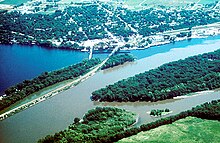
Washington County, Minnesota
![Washington County Courthouse, listed on NRHP No. 71000443 [1]](https://upload.wikimedia.org/wikipedia/commons/thumb/1/14/Wash_Co_Courthouse_2.JPG/298px-Wash_Co_Courthouse_2.JPG) Washington County Courthouse, listed on NRHP No. 71000443 |
|
| administration | |
|---|---|
| US state : | Minnesota |
| Administrative headquarters : | Stillwater |
| Address of the administrative headquarters: |
County Courthouse 14949 62nd Street N Stillwater, MN 55082-6132 |
| Foundation : | October 27, 1849 |
| Made up from: | St. Croix County |
| Area code : | 001 651 |
| Demographics | |
| Residents : | 238,136 (2010) |
| Population density : | 234.6 inhabitants / km 2 |
| geography | |
| Total area : | 1096 km² |
| Water surface : | 81 km² |
| map | |
| Website : www.co.washington.mn.us | |
The Washington County is a county in the US -amerikanischen State Minnesota . In 2010 , the county had 238,136 residents and a population density of 234.6 people per square kilometer. The county seat is Stillwater .
Washington County is part of the Minneapolis-Saint Paul metropolitan area .
geography
The county is located in southeast Minnesota and is separated from the neighboring state of Wisconsin to the east by the St. Croix River to its confluence with the Mississippi . It has an area of 1096 square kilometers, of which 81 square kilometers are water. The following neighboring counties border Washington County:
| Anoka County | Chisago County |
Polk County, Wisconsin |
| Ramsey County |

|
St. Croix County, Wisconsin |
| Dakota County |
Pierce County, Wisconsin |
history
Washington County was formed on October 27, 1849 from parts of St. Croix County, which now only exists in Wisconsin. It was named after George Washington (1732-1799), commander in chief of the Continental Army in the Revolutionary War (1775 to 1783) and first President of the United States (1789 to 1797).
One location in Washington County has the status of a National Historic Landmark , the St. Croix Boom Site . A total of 43 buildings and sites in the county are listed on the National Register of Historic Places (as of January 31, 2018).
Demographic data
| Population development | |||
|---|---|---|---|
| Census | Residents | ± in% | |
| 1850 | 1056 | - | |
| 1860 | 6123 | 479.8% | |
| 1870 | 11,809 | 92.9% | |
| 1880 | 19,563 | 65.7% | |
| 1890 | 25,992 | 32.9% | |
| 1900 | 27,808 | 7% | |
| 1910 | 26,013 | -6.5% | |
| 1920 | 23,761 | -8.7% | |
| 1930 | 24,753 | 4.2% | |
| 1940 | 26,430 | 6.8% | |
| 1950 | 34,544 | 30.7% | |
| 1960 | 52,432 | 51.8% | |
| 1970 | 83.003 | 58.3% | |
| 1980 | 113,571 | 36.8% | |
| 1990 | 145.896 | 28.5% | |
| 2000 | 201.130 | 37.9% | |
| 2010 | 238.136 | 18.4% | |
| Before 1900 1900–1990 2000 2010 | |||
According to the 2010 census , Washington County had 238,136 people in 87,446 households. The population density was 234.6 inhabitants per square kilometer. Statistically, there were 2.67 people in each of the 87,446 households.
The racial the population was composed of 88.5 percent white, 3.8 percent African American, 0.5 percent Native American, 5.1 percent Asian and other ethnic groups; 2.0 percent were descended from two or more races. Regardless of ethnicity, 3.5 percent of the population was Hispanic or Latino of any race.
26.1 percent of the population were under 18 years old, 62.9 percent were between 18 and 64 and 11.0 percent were 65 years or older. 50.5 percent of the population was female.
The median income for a household was 79,571 USD . The per capita income was $ 36,786. 5.7 percent of the population lived below the poverty line.
Washington County localities
1 - predominantly in Dakota County
2 - predominantly in Ramsey County
structure
Washington County is divided into six townships in addition to the 27 cities :
| Township | Population (2010) |
FIPS |
|---|---|---|
| Baytown Township | 1723 | 27-04132 |
| Denmark Township | 1737 | 27-15688 |
| Gray Cloud Island Township | 289 | 27-25982 |
| May Township | 2776 | 27-41120 |
| Stillwater Township | 2366 | 27-62842 |
| West Lakeland Township | 4046 | 27-69520 |
See also
Individual evidence
- ^ Extract from the National Register of Historic Places . Retrieved March 13, 2011
- ↑ GNIS-ID: 659526. Retrieved on February 22, 2011 (English).
- ↑ a b c U.S. Census Bureau, State & County QuickFacts - Washington County, MN Retrieved February 23, 2013
- ↑ a b National Association of Counties.Retrieved February 23, 2013
- ↑ Listing of National Historic Landmarks by State: Minnesota . National Park Service , accessed January 31, 2018.
- ↑ Search mask database in the National Register Information System. National Park Service , accessed January 31, 2018.
- ^ US Census Bureau _ Census of Population and Housing.Retrieved February 17, 2011
- ↑ Extract from Census.gov.Retrieved February 17, 2011
- ^ Census 2010 - Minnesota , Retrieved May 5, 2020
Web links
Coordinates: 45 ° 2 ′ N , 92 ° 53 ′ W


