Autobahn 4 (Switzerland)
| Autobahn 4 in Switzerland | ||||||||||||||||||||||||||||||||||||||||||||||||||||||||||||||||||||||||||||||||||||||||||||||||||||||||||||||||||||||||||||||||||||||||||||||||||||||||||||||||||||||||||||||||||||||||||||||||||||||||||||||||||||||||||||||||||||||||||||||||||||||||||||||||||||||||||||||||||||||||||||||||||||||||||||||||||||||||||||

|
||||||||||||||||||||||||||||||||||||||||||||||||||||||||||||||||||||||||||||||||||||||||||||||||||||||||||||||||||||||||||||||||||||||||||||||||||||||||||||||||||||||||||||||||||||||||||||||||||||||||||||||||||||||||||||||||||||||||||||||||||||||||||||||||||||||||||||||||||||||||||||||||||||||||||||||||||||||||||||
| |
||||||||||||||||||||||||||||||||||||||||||||||||||||||||||||||||||||||||||||||||||||||||||||||||||||||||||||||||||||||||||||||||||||||||||||||||||||||||||||||||||||||||||||||||||||||||||||||||||||||||||||||||||||||||||||||||||||||||||||||||||||||||||||||||||||||||||||||||||||||||||||||||||||||||||||||||||||||||||||
| map | ||||||||||||||||||||||||||||||||||||||||||||||||||||||||||||||||||||||||||||||||||||||||||||||||||||||||||||||||||||||||||||||||||||||||||||||||||||||||||||||||||||||||||||||||||||||||||||||||||||||||||||||||||||||||||||||||||||||||||||||||||||||||||||||||||||||||||||||||||||||||||||||||||||||||||||||||||||||||||||
| Basic data | ||||||||||||||||||||||||||||||||||||||||||||||||||||||||||||||||||||||||||||||||||||||||||||||||||||||||||||||||||||||||||||||||||||||||||||||||||||||||||||||||||||||||||||||||||||||||||||||||||||||||||||||||||||||||||||||||||||||||||||||||||||||||||||||||||||||||||||||||||||||||||||||||||||||||||||||||||||||||||||
| Operator: | Federal Roads Office | |||||||||||||||||||||||||||||||||||||||||||||||||||||||||||||||||||||||||||||||||||||||||||||||||||||||||||||||||||||||||||||||||||||||||||||||||||||||||||||||||||||||||||||||||||||||||||||||||||||||||||||||||||||||||||||||||||||||||||||||||||||||||||||||||||||||||||||||||||||||||||||||||||||||||||||||||||||||||||
| Start of the street: |
Thayngen ( 47 ° 44 ′ N , 8 ° 43 ′ E ) |
|||||||||||||||||||||||||||||||||||||||||||||||||||||||||||||||||||||||||||||||||||||||||||||||||||||||||||||||||||||||||||||||||||||||||||||||||||||||||||||||||||||||||||||||||||||||||||||||||||||||||||||||||||||||||||||||||||||||||||||||||||||||||||||||||||||||||||||||||||||||||||||||||||||||||||||||||||||||||||
| End of the road: |
Altdorf UR ( 46 ° 54 ′ N , 8 ° 37 ′ E ) |
|||||||||||||||||||||||||||||||||||||||||||||||||||||||||||||||||||||||||||||||||||||||||||||||||||||||||||||||||||||||||||||||||||||||||||||||||||||||||||||||||||||||||||||||||||||||||||||||||||||||||||||||||||||||||||||||||||||||||||||||||||||||||||||||||||||||||||||||||||||||||||||||||||||||||||||||||||||||||||
| Overall length: | approx. 165 km | |||||||||||||||||||||||||||||||||||||||||||||||||||||||||||||||||||||||||||||||||||||||||||||||||||||||||||||||||||||||||||||||||||||||||||||||||||||||||||||||||||||||||||||||||||||||||||||||||||||||||||||||||||||||||||||||||||||||||||||||||||||||||||||||||||||||||||||||||||||||||||||||||||||||||||||||||||||||||||
|
Canton : |
||||||||||||||||||||||||||||||||||||||||||||||||||||||||||||||||||||||||||||||||||||||||||||||||||||||||||||||||||||||||||||||||||||||||||||||||||||||||||||||||||||||||||||||||||||||||||||||||||||||||||||||||||||||||||||||||||||||||||||||||||||||||||||||||||||||||||||||||||||||||||||||||||||||||||||||||||||||||||||
|
Course of the road
|
||||||||||||||||||||||||||||||||||||||||||||||||||||||||||||||||||||||||||||||||||||||||||||||||||||||||||||||||||||||||||||||||||||||||||||||||||||||||||||||||||||||||||||||||||||||||||||||||||||||||||||||||||||||||||||||||||||||||||||||||||||||||||||||||||||||||||||||||||||||||||||||||||||||||||||||||||||||||||||
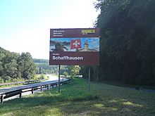
The Swiss Autobahn 4 or Autostrasse 4 is largely congruent with the Nationalstrasse 4 and runs for a total of 165 kilometers from the border crossing with Germany at Thayngen via Schaffhausen , Winterthur and Zurich to Altdorf UR .
Route


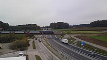
The A4 begins as a car road at the Thayngen border crossing on the border with Germany, crosses the Rhine at Schaffhausen with a cable-stayed bridge and leads from Flurlingen , through the Zurich wine region , as a so-called mini-car to Kleinandelfingen and on as a car road to Winterthur . Between Winterthur and Zurich , the A4 runs jointly with the highway developed A1 . From the Zurich East junction, the A4 and A1 run over the so-called Nordring to the Limmattal junction , from where the A4 and A3 have been running over the western bypass of Zurich since May 4, 2009; By May 2009 this section ended at the Birmensdorf motorway junction . From the south from the Blegi junction in the direction of Knonau, a section was approved in 1970, then built but not used. Only the rejection of the clover leaf initiative in April 1990 made a new project planning with a more environmentally friendly variant possible. On November 13, 2009, the section of the A4 was opened in the Knonauer Amt between the Zurich West and Blegi branches near Cham. At 4,680 meters, the Islisberg tunnel is the most important structure in this section of the route. From Blegi, the A4 runs to Schwyz and ends as a road after the Mositunnel near Brunnen .
The continuation is the Axenstrasse , which leads from Brunnen to Altdorf in the canton of Uri and, as a third-class national road, has the status of a main road . The Flüelen tunnel bypass, opened in 2005, is again designated as a motor road, but the connection to the A2 remained as a main road that is not free of intersections.
Expansion projects
Mini motorway Flurlingen – Kleinandelfingen
On October 20, 2006, the Federal Department of the Environment, Transport, Energy and Communication (DETEC) approved the implementation project for the expansion of the two-lane national road between Flurlingen and Kleinandelfingen into a four-lane mini-highway with separate directions. The expansion cost around 140 million Swiss francs . This took into account the large volume of traffic.
In the summer of 2007, construction work on the mini freeway could begin. The expanded section was released on October 22, 2010 in Kleinandelfingen with an opening party for the public. The mini freeway is signposted as a road.
Full expansion of the Kleinandelfingen branch in Winterthur North
According to a press release from the Federal Roads Office (FEDRO) (branch Winterthur), the expansion of the 8.6-kilometer, previously two-lane section from Kleinandelfingen to the Winterthur Nord junction into a four-lane motorway with separate directions (not a mini-freeway) is planned for the earliest from the end of 2022 to 2026. Planning started in 2010. The expected costs amount to 330 million francs (as of 2016). At the time, the expansion project was included by the Federal Council in its second PEB program message (February 26, 2014) in module 1 of removing bottlenecks in the national road network. Since 2018 this project has been included in the “2014 expansion step”. In a further step, the objection period was from February 1 to March 1, 2016. In 2019, the detailed project was developed, which is to be followed by the submission in 2020 .
Galgenbuck tunnel
In December 2019, the 1,138-meter-long Galgenbuck tunnel was opened as an extension of the Schaffhausen Süd A4 connection . It serves as a bypass of the community Neuhausen am Rheinfall as well as a direct connection of the Klettgau ( Hauptstrasse 13 / Hauptstrasse 14 ) with the A4 to Winterthur resp. to Germany. The main road 4 from the airport Zurich - Bülach for Schaffhausen is guided by the Galgenbuck tunnel. The tunnel is part of the national road network , but can be used without a motorway vignette.
Expansion of the Axenstrasse
According to the Federal Roads Office FEDRO, Axenstrasse is to be expanded in several stages between 2011 and 2025. Sisikon is relieved of through traffic by a 4.4 kilometer long tunnel. The 2.8 kilometer long Morschach Tunnel leads from Ingenbohl to Ort. The expansion will also provide better protection for the Axenstrasse from falling rocks and other natural forces.
City through Schaffhausen
In the medium term, the Fäsenstaub tunnel and the Schönenberg gallery, as well as the further course of the A4 between the Schaffhausen Herblingen and Schaffhausen Süd junctions on Schaffhausen's urban area, are to be expanded from currently two to four lanes, since according to forecasts, the city crossing will reach its capacity limit in the next few years becomes. The Fäsenstaub tunnel is to receive a second tube (Fäsenstaubtunnel II) and the Schönenberg Gallery is to be expanded to four lanes. Realization is expected from 2020. In autumn 2009, the federal government added the expansion of the Schaffhausen city passage to the list of projects with urgent planning needs.
The Fäsenstaub and Cholfirsttunnel no longer meet the current safety standards. From 2015, the ventilation will be adjusted in both tunnels and a parallel safety tunnel will be built.
Cholfirst tunnel and Rhine bridge
The construction of a second tube for the Cholfirst tunnel (Cholfirst tunnel II) and the expansion of the Rhine bridge to four lanes have been postponed for the time being in the new requirements plan of the Federal Department of Environment, Transport, Energy and Communications (DETEC). Realization is only possible from 2025 or 2030. The Rhine bridge and the Cholfirst tunnel will therefore remain three lanes for the foreseeable future.
Classification of the cantonal motor road J15 to the national road
At the federal level, a new version of the “Federal Decree on the National Road Network” of June 21, 1960 was drawn up under the title “Further Development of the National Road Network” (WEN). As part of the consultation, the Federal Council invited the cantons to comment in mid-2008.
The so-called "New Network Decision" provides for the adaptation of the road network in the canton of Schaffhausen to the real transit traffic flows. The national road 4, which ends at the Bargen border crossing, is not taken from any high-performance road on the German side, the transit traffic in the direction of Stuttgart is handled via the cantonal autostrasse J15 via the Thayngen border crossing , and there from the German federal road 34 , which leads to the federal motorway 81 . The J15 was therefore reclassified from the Mutzentäli junction to the Thayngen / Bietingen border crossing to a national road, while the N4 was classified as a cantonal road from the Mutzentäli junction to the Bargen / Neuhaus am Randen border crossing .
In its statement, the canton of Schaffhausen expressed its fundamental agreement with the project, and the Schaffhausen cantonal council unanimously adopted the statement on September 15, 2008 (69: 0 votes). Since the cantonal constitution also requires a referendum for comments in the event of the planned addition of a canton road to the national road network, this was held on November 30, 2008 and also confirmed with 88.9% yes-votes (23,974: 2,988 votes).
In comparison, the “New Network Resolution” is intended to shorten the national road network in the canton of Schaffhausen by around 7.2 kilometers. The cantonal road network eligible for compensation, however, would have been 19.8 kilometers longer due to the slightly longer course of the former N4 and the inclusion of Klettgaustrasse ( Hauptstrasse 13 ).
The decision was not implemented for the time being, as the people at the federal referendum on November 24, 2013 rejected the amendment to the federal law on the tax for the use of national roads (National Road Tax Act, NSAG) , which is why the A4 / N4 had started as before in Bargen - The bill was about the increase in the price of the motorway vignette, which should have financed the expansion of the national road network. By adopting the NAF in February 2017, the A4 / J15 swap took place on January 1, 2020.
The connections on the previous cantonal road J15 were included in the existing numbering system of the N4 / A4. From January 1, 2020, the course will be:
- Thayngen / Bietingen border crossing
- Thayngen (1)
- Kesslerloch (1a)
- Schaffhausen Herblingen (2)
- Mutzentäli branch (3)
Vignette requirement
The road between the border crossing at Thayngen and the Thayngen junction may be used without a vignette.
Web links
- Galgenbuck tunnel (FEDRO project website, Federal Roads Office)
- Galgenbuck tunnel implementation project (Federal Roads Office FEDRO)
- Expansion to four lanes Kleinandelfingen-Winterthur (Federal Roads Office FEDRO)
- Website for the Zurich west bypass (A3 / A4) with the Uetliberg tunnel (Construction Department of the Canton of Zurich)
- Expansion of the Zurich north bypass (Federal Roads Office FEDRO)
- Project website for the north bypass Zurich (A1 / A4)
- A4 New Axenstrasse
- Photo series A4 on Autobahnen.ch
- Photo series A4 on Autobahn-Bilder.de
- Important construction sites and projects on the national highways (Federal Roads Office FEDRO)
Individual evidence
- ↑ Autobahn in the Knonaueramt in the timetable view , article from September 25, 2009, updated on February 7, 2012
- ↑ ASTRA : full extension project page. Retrieved January 6, 2020 .
- ↑ ASTRA : Fact sheet: N04 / 08 Kleinandelfingen - Winterthur Nord branch, bottleneck removal. (PDF) Retrieved January 6, 2020 .
- ↑ Cholfirst tunnel website
- ↑ FEDRO website on NAF
- ↑ Schaffhauser Nachrichten of December 30, 2019: On Wednesday, streets will be swapped
- ^ Federal Customs Administration (EZV): Interactive map of the national roads subject to tax


