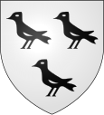
Ammerschwihr
| Ammerschwihr | ||
|---|---|---|

|
|
|
| region | Grand Est | |
| Department | Haut-Rhin | |
| Arrondissement | Colmar-Ribeauvillé | |
| Canton | Sainte-Marie-aux-Mines | |
| Community association | Vallée de Kaysersberg | |
| Coordinates | 48 ° 8 ' N , 7 ° 17' E | |
| height | 193-882 m | |
| surface | 19.66 km 2 | |
| Residents | 1,779 (January 1, 2017) | |
| Population density | 90 inhabitants / km 2 | |
| Post Code | 68770 | |
| INSEE code | 68005 | |
 View of Ammerschwihr |
||
Ammerschwihr (German Ammerschweier ) is a French commune with 1779 inhabitants (as of January 1, 2017) in the Haut-Rhin department in the Grand Est region (until 2015 Alsace ). She is a member of the Communauté de communes de la Vallée de Kaysersberg . The municipality is part of the Ballons des Vosges Regional Nature Park .
geography
The small Alsatian town of Ammerschwihr is located about nine kilometers northwest of Colmar on the western edge of the Upper Rhine Plain , on the eastern edge of the Vosges . A part of the pilgrimage and climatic health resort Trois-Épis (three ears of corn) lies on the territory of the municipality. This also includes the modern pilgrimage church of Notre-Dame-de-l'Annonciation .
history
Ammerschwihr was mentioned for the first time in 869 under the name Amarici Villare ( village of Amalrich ).
The village was elevated to a town in 1367 and fortified. It belonged to the front Austrian domination Landsberg in the 16th century Lazarus of Schwendi was that in 1568 by Emperor Maximilian II. Was elevated to the "Baron von Landsberg" (from 1572 "baron of Hohenlandenberg"). The town flourished under Lazarus. In 1634, during the Thirty Years War , the city was forced to place itself under the protection of the King of France. In 1648 he was given control of the place.
During the Second World War at the end of 1944, a large part of the buildings, which mainly originated from the 16th century, were destroyed in heavy fighting between German and American troops.
Ammerschwihr has belonged to the Lazarus-Schwendi-Städtebund, along with other Alsatian and German communities, since 1986 and is reminiscent of a particularly happy period in its history.
Population development
| year | 1962 | 1968 | 1975 | 1982 | 1990 | 1999 | 2007 | 2017 |
|---|---|---|---|---|---|---|---|---|
| Residents | 1341 | 1405 | 1448 | 1566 | 1869 | 1892 | 1913 | 1779 |
| Sources: Cassini and INSEE | ||||||||
economy
Viticulture plays a prominent role in Ammerschwihr . The single site Kaefferkopf has been an Alsace Grand Cru site since 2007 . Therefore, the place is also on the Alsace Wine Route .
Attractions
- The 16th century church of St. Martin has a steeple that was rebuilt in 1910 in neo-Gothic style.
- Some buildings from the medieval fortifications are still preserved: parts of the city wall, the upper gate , the citizen tower and the rogue tower ( Tour des fripons ) from the 16th century; this once served as a prison.
- German military cemetery in the Trois-Épis district
- The Château de Meywihr is a ruined castle from the 10th century. The castle is on private property and has been listed as a Monument historique by the French Ministry of Culture since 1965 .
Personalities
- Louis Dubois (1726–1766), master organ builder (active in Wissembourg , Saverne etc.)
- Jakob Ignatius Simonis (1831-1903); Catholic clergyman, superior of the Niederbronn sisters and member of the German Reichstag .
leisure
At Ammerschwihr there is an 18-hole golf course with an additional nine -hole course .
literature
- Le Patrimoine des Communes du Haut-Rhin. Flohic Editions, Volume 1, Paris 1998, ISBN 2-84234-036-1 , pp. 663-664.


