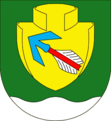
Novosedly u Strakonic
| Novosedly | ||||
|---|---|---|---|---|
|
||||
| Basic data | ||||
| State : |
|
|||
| Region : | Jihočeský kraj | |||
| District : | Strakonice | |||
| Area : | 844 ha | |||
| Geographic location : | 49 ° 16 ' N , 13 ° 48' E | |||
| Height: | 418 m nm | |||
| Residents : | 351 (Jan 1, 2019) | |||
| Postal code : | 387 11 | |||
| License plate : | C. | |||
| traffic | ||||
| Street: | Strašín - Katovice | |||
| Railway connection: | České Budějovice – Plzeň | |||
| Next international airport : | České Budějovice Airport | |||
| structure | ||||
| Status: | local community | |||
| Districts: | 1 | |||
| administration | ||||
| Mayor : | Jiří Janus (as of 2018) | |||
| Address: | Novosedly 6 387 16 Volenice |
|||
| Municipality number: | 551554 | |||
| Website : | www.novosedly.info | |||
Novosedly , until 1924 Nevosedy , (German Newosed ) is a municipality in the Czech Republic . It is located nine kilometers west of Strakonice in South Bohemia and belongs to the Okres Strakonice .
geography
Geographical location
Novosedly is located on the left bank of the Novosedelský creek in the foothills of the Bohemian Forest . To the northeast rises the Kněží hora (493 m), in the southeast the Homolka (490 m) and the Mladiny (600 m), south of the Makarovský vrch (575 m) and the Kůstrý vrch (584 m), in the southwest of the Vraní vrch ( 485 m), the Beranice (531 m) to the west and the Divoš (537 m) to the northwest. State road II / 172 between Strašín and Katovice runs through the village . The railway line České Budějovice – Plzeň runs north-east through the Otava valley , the Katovice railway station is a good two kilometers away near Liboč.
Community structure
No districts are designated for the municipality of Novosedly. The settlements Koclov ( Kotzlau ) and Sloučín ( Slautschin ) as well as the locality Na Hůrce belong to Novosedly . The corridors of the municipality are divided into the cadastral districts of Koclov, Novosedly u Strakonic and Sloučín.
Neighboring communities
Neighboring towns are Záleský, Horní Poříčí , Za Řekou, Dolní Poříčí and Pohodnice in the north, Liboc and Katovice in the Northeast, Střela, Virt and Pracejovice the east, Sloučín, Koclov and Drachkov the southeast, Stružský Mlyn, Makarov , Milčice, Kraselov and Dřetiny in South, Tažovická Lhota, Lipnice and Šebelovský Mlýn in the south-west, Štěchovice and Nové Dvory in the west and Kladruby , Ovčín, Svatá Trojice and Kozlov in the north-west.
history
The area on the edge of the central Otava valley was already populated in the early days. A Celtic gold coin treasure consisting of a rainbow bowl was found at Novosedly . In 1931 the archaeologist Bedřich Dubský discovered a Celtic barrow on the dirt road between Pracejovice and Sloučín.
The village probably originated as a settlement of gold seifners. Novosedly was first mentioned in writing in 1204 in a deed of donation by Ottokar I Přemysl to the St. George Monastery at Prague Castle , in which the king gave the Benedictine nuns income from several villages. The donation was confirmed papally in 1223. Later the Order of Malta acquired the village and added it to his rule Strakonitz .
In 1840, Newosed consisted of 48 houses with 307 residents. There was a mill in the village. The parish was Wolenitz . Until the middle of the 19th century, the village always remained subservient to Strakonitz.
After the abolition of patrimonial formed Nevosedy / Newosed 1850 with the districts Sloučín / Slautschin and Kozlov / Kotzlau a municipality in the district administration and the judicial district Strakonice. In 1885 a school house was inaugurated in Nevosedy . At the beginning of the 20th century, both districts broke away and formed the municipality of Koclov / Kotzlau . The community has been called Novosedly since 1924 . 1948 Koclov (with Sloučín) was incorporated again. The school was closed in 1975 and the children went to Volenice. With the beginning of the school year 1993/94, the two-class elementary school lessons were resumed in Novosedly.
Culture and sights
- Chapel in Novosedly
- Chapel in Koclov
- Chapel in Sloučín
- Wayside shrine on the road from Novosedly to Volenice
- Statue of St. John of Nepomuk at the bridge over the Novosedelský potok
Individual evidence
- ↑ Český statistický úřad - The population of the Czech municipalities as of January 1, 2019 (PDF; 0.8 MiB)
- ↑ Johann Gottfried Sommer : The Kingdom of Bohemia. Represented statistically and topographically. Volume 8: Prachiner Circle. Calve, Prague 1840, p. 126.


