Semoutiers-Montsaon
| Semoutiers-Montsaon | ||
|---|---|---|
|
|
||
| region | Grand Est | |
| Department | Haute-Marne | |
| Arrondissement | Chaumont | |
| Canton | Chaumont-3 | |
| Community association | Chaumont, Bassin Nogentais et Bassin de Bologne Vignory Froncles | |
| Coordinates | 48 ° 4 ' N , 5 ° 3' E | |
| height | 314-319 m | |
| surface | 27.4 km 2 | |
| Residents | 769 (January 1, 2017) | |
| Population density | 28 inhabitants / km 2 | |
| Post Code | 52000 | |
| INSEE code | 52469 | |
| Website | http://www.semoutiers.fr/index.htm | |
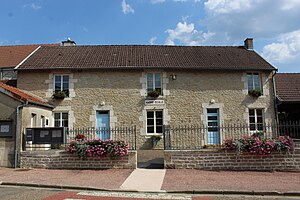
 Town hall (Mairie) of Semoutiers-Montsaon |
||
Semoutiers-Montsaon is a French commune with 769 inhabitants (as of January 1, 2017) in the Haute-Marne department in the Grand Est region (before 2016 Champagne-Ardenne ). It belongs to the Arrondissement of Chaumont and the canton of Chaumont-3 (until 2015 Chaumont-Sud ). The inhabitants are called Semonasteriens and Montsaonnais .
geography
Semoutiers-Montsaon is about six kilometers southwest of Chaumont city center . Semoutiers-Montsaon is surrounded by the neighboring communities of Buxières-lès-Villiers in the north, Villiers-le-Sec in the north and north-east, Chaumont in the east, Richebourg in the south, Blessonville in the west and Bricon in the north-west.
The Chaumont-Semoutiers airfield is located in the municipality . The A5 autoroute leads through the southern municipal area .
history
In 1973 the municipalities of Semoutiers and Montsaon were merged.
Population development
| year | 1962 | 1968 | 1975 | 1982 | 1990 | 1999 | 2006 | 2011 | 2016 |
| Residents | 169 | 303 | 286 | 413 | 572 | 558 | 864 | 913 | 783 |
| Source: Cassini and INSEE | |||||||||
Attractions
- Remains of a Roman marching band
- Saint-Pierre-ès-Liens church from the 17th century
- Saint Didier Church in Montsaon from the 16th century
- Semoutiers Castle


