Droga krajowa 42
| Droga krajowa 42 in Poland | |

|
|
| Basic data | |
| Operator: |
|
| Start of the street: | 51 ° 3 ' N , 17 ° 45' E |
| End of street: | 50 ° 59 ' N , 21 ° 15' E |
| Overall length: | 274 km |
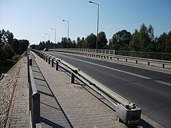
| Bridge over the Warta in Dzialoszyn | |
The Droga krajowa 42 (DK42) is a country road in Poland . It branches off in Kamienna near Namysłów (Namslau) from DK39 to the east, runs via Wołczyn (Konstadt) and Kluczbork (Kreuzburg OS), where DK11 is crossed, from here parallel with DK45 to Praszka (Praschkau), from it separates again here, then crosses the DK43 , crosses the Warta in Działoszyn and continues via Pajęczno and Radomsko , before which the future A1 Autostrada ( European route 75 ) is crossed. In Radomsko the road crosses the DK91 . The further course leads via Przedbórz with crossing the Pilica and crossing the Czarna Konecka near Ruda Maleniecka to the junction with the DK74 . The road then reaches Końskie and then Stąporków , Skarżysko-Kamienna , Wąchock , Starachowice and ends in Rudnik on DK9 ( European route 371 ).
The length of the road is around 274 kilometers.
Important towns along the way
Opole Voivodeship (województwo opolskie) :
Silesian Voivodeship (województwo śląskie) Łódź Voivodeship (województwo łódzkie) :
Świętokrzyskie Voivodeship (województwo świętokrzyskie) :
See also
Web links
- GDDKiA website (Polish)
- Website of the Drogi Zaufania program (Polish)
