Droga krajowa 65
| Droga krajowa 65 in Poland | |||||||||||||||||||||||||||||||||||||||||||||||||||||||||||||||||||||||||||||||||||||||||||||||||||||||||||||||||||||||||

|
|||||||||||||||||||||||||||||||||||||||||||||||||||||||||||||||||||||||||||||||||||||||||||||||||||||||||||||||||||||||||
| Basic data | |||||||||||||||||||||||||||||||||||||||||||||||||||||||||||||||||||||||||||||||||||||||||||||||||||||||||||||||||||||||||
| Operator: |
|
||||||||||||||||||||||||||||||||||||||||||||||||||||||||||||||||||||||||||||||||||||||||||||||||||||||||||||||||||||||||
| Overall length: | 224 km | ||||||||||||||||||||||||||||||||||||||||||||||||||||||||||||||||||||||||||||||||||||||||||||||||||||||||||||||||||||||||
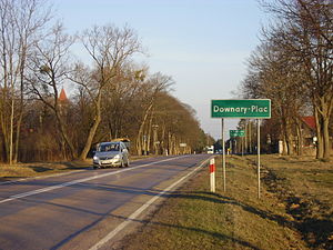
| The DK65 in Downary-Plac | |||||||||||||||||||||||||||||||||||||||||||||||||||||||||||||||||||||||||||||||||||||||||||||||||||||||||||||||||||||||||
|
Course of the road
|
|||||||||||||||||||||||||||||||||||||||||||||||||||||||||||||||||||||||||||||||||||||||||||||||||||||||||||||||||||||||||
The Droga krajowa 65 (DK65) is a Polish national road . It runs in a north-south direction from the Polish-Russian border at Gołdap to the Polish-Belarusian border at Bobrowniki through the Warmian-Masurian and Podlachian Voivodeships over a length of about 224 km. On the section from the Russian-Polish border to Prostki , DK 65 runs on the route of the former German Reichsstrasse 132 .
history
Origins
This road connects regions with completely different historical affiliations and routes with completely different origins. The northern section of the route used to belong to East Prussia and was known as Reichsstrasse 132 until 1945 . The southern section of the route belonged to the territory of the Second Polish Republic between 1921 and 1939 .
The road between Insterburg and Lyck was built in 1850.
The road from Białystok to the historic Polish-Lithuanian state border near Gródek was declared a state road (droga państwowa) by the Polish Road Act of December 10, 1920 . After the Treaty of Riga in the spring of 1921, this state road was extended via Wolkowysk to Baranowitschi .
Previous routes and names
In 1985 the Polish road network was reorganized. The previous state roads (droga państwowa) were renamed and renumbered as state roads (droga krajowa) . Since 1986 there have been three state roads on the route of today's DK 65:
- the DK 66 of Białystok according Bobrowniki
- the DK 657 of Elk about Gołdap to the border
- the DK 669 of Białystok Elk.
In 2003 the numbering of the road network was changed so that all state roads were marked with two-digit numbers and all provincial roads with three-digit numbers. At that time the three above-mentioned streets were merged to form DK 65.
Locations along the way
Warmian-Masurian Voivodeship (województwo warmińsko-mazurskie) :
- 0 km: Gołdap-Gusew border crossing point (Russian regional road 27A-011 from Gussew (Gumbinnen) )
- 3 km: Gołdap (Goldap) - junction with DW 650 and DW 651
- 7 km: Jabramowo (Abrahamsruh)
- 9 km: Kozaki (Kosaken / Rappenhöh)
- 12 km: Regiele (Regellen / Glaubitz)
- 16 km: Pogorzel (Pogorzellen / Hegelingen)
- 19 km: Kowale Oleckie (Kowahlen / Reimannswalde) - crossing with the DW 652
- 21 km: Daniele (Danielle / Kleinreimannswalde)
- 30 km: Sedranki (Sea tendrils)
- 35 km: Olecko (Treuburg) - junction with the DW 653 and DW 655
- 36 km: Zielonówek ( Green Mountain )
- 44 km: Ślepie (Schlepien / Schlöppen)
- 46 km: Gąski (Gonsken / Herzogskirchen)
- 50 km: Przytuły (Przytullen / Lake Peace)
- 56 km: Straduny (Stradaunen)
- 57 km: Oracze (Oratzen / Szameyten / Wittenwalde)
- 59 km: Konieczki (Elisenthal)
- 62 km: Ełk (Lyck) - junction with DK16 and DW 656
- 72 km: Nowa Wieś Ełcka (Neuendorf) - junction with the DW 667
- 74 km: Zdunki (Sdunken / Ulrichfelde)
- 76 km: Niedźwiedzkie (Niedzwetzken / Wiesengrund)
- 82 km: Prostki (Prostken)
- 84 km: Bogusze
Podlaskie Voivodeship (województwo podlaskie) :
- 88 km: Grajewo - junction with DK61
- 113 km: Osowiec-Twierdza - junction with the DW 668 and DW 670
- 126 km: Mońki
- 139 km: Knyszyn
- 161 km: Białystok - junction with DK8 and DK19
- 202 km: Grodek
- 218 km: Bobrowniki
- 224 km: Poland / Belarus border crossing point
Web links
Footnotes
- ↑ Law of December 10, 1920 on the Construction and Maintenance of Public Roads in Poland. Dz.U. 1921 no. 6 poz. 32.
- ^ Law of June 23, 1921 on the extension of the state road network. Dz.U. 1921 no. 63 poz. 387.
- ↑ Resolution No. 192 of the Council of Ministers of December 2, 1985 on the selection of state roads. MP 1986 no. 3 poz. 16.
- ↑ Northern East Prussia. Road map 1: 200000. Kaliningradskaja oblast , Höfer-Verlag, Dietzenbach, 2012
