Droga krajowa 3
| Droga krajowa 3 in Poland | |||||||||||||||||||||||||||||||||||||||||||||||||||||||||||||||||||||||||||||||||||||||||||||||||||||||||||||||||||||||||||||||||||||||||||||||||||||||||||||||||||||||||||||||||||||||||||||||||||||||||||||||||||||||||||||||||||||||||||||||||||||||||||||

|
|||||||||||||||||||||||||||||||||||||||||||||||||||||||||||||||||||||||||||||||||||||||||||||||||||||||||||||||||||||||||||||||||||||||||||||||||||||||||||||||||||||||||||||||||||||||||||||||||||||||||||||||||||||||||||||||||||||||||||||||||||||||||||||
| |
|||||||||||||||||||||||||||||||||||||||||||||||||||||||||||||||||||||||||||||||||||||||||||||||||||||||||||||||||||||||||||||||||||||||||||||||||||||||||||||||||||||||||||||||||||||||||||||||||||||||||||||||||||||||||||||||||||||||||||||||||||||||||||||
| map | |||||||||||||||||||||||||||||||||||||||||||||||||||||||||||||||||||||||||||||||||||||||||||||||||||||||||||||||||||||||||||||||||||||||||||||||||||||||||||||||||||||||||||||||||||||||||||||||||||||||||||||||||||||||||||||||||||||||||||||||||||||||||||||
| Basic data | |||||||||||||||||||||||||||||||||||||||||||||||||||||||||||||||||||||||||||||||||||||||||||||||||||||||||||||||||||||||||||||||||||||||||||||||||||||||||||||||||||||||||||||||||||||||||||||||||||||||||||||||||||||||||||||||||||||||||||||||||||||||||||||
| Operator: |
|
||||||||||||||||||||||||||||||||||||||||||||||||||||||||||||||||||||||||||||||||||||||||||||||||||||||||||||||||||||||||||||||||||||||||||||||||||||||||||||||||||||||||||||||||||||||||||||||||||||||||||||||||||||||||||||||||||||||||||||||||||||||||||||
| Start of the street: |
Świnoujście ( 53 ° 54 ′ N , 14 ° 16 ′ E ) |
||||||||||||||||||||||||||||||||||||||||||||||||||||||||||||||||||||||||||||||||||||||||||||||||||||||||||||||||||||||||||||||||||||||||||||||||||||||||||||||||||||||||||||||||||||||||||||||||||||||||||||||||||||||||||||||||||||||||||||||||||||||||||||
| End of street: |
Jakuszyce ( 50 ° 48 ′ N , 15 ° 26 ′ E ) |
||||||||||||||||||||||||||||||||||||||||||||||||||||||||||||||||||||||||||||||||||||||||||||||||||||||||||||||||||||||||||||||||||||||||||||||||||||||||||||||||||||||||||||||||||||||||||||||||||||||||||||||||||||||||||||||||||||||||||||||||||||||||||||
| Overall length: | 129 km | ||||||||||||||||||||||||||||||||||||||||||||||||||||||||||||||||||||||||||||||||||||||||||||||||||||||||||||||||||||||||||||||||||||||||||||||||||||||||||||||||||||||||||||||||||||||||||||||||||||||||||||||||||||||||||||||||||||||||||||||||||||||||||||
| Development condition: | see below | ||||||||||||||||||||||||||||||||||||||||||||||||||||||||||||||||||||||||||||||||||||||||||||||||||||||||||||||||||||||||||||||||||||||||||||||||||||||||||||||||||||||||||||||||||||||||||||||||||||||||||||||||||||||||||||||||||||||||||||||||||||||||||||
| The road at Jakuszyce towards Świnoujście | |||||||||||||||||||||||||||||||||||||||||||||||||||||||||||||||||||||||||||||||||||||||||||||||||||||||||||||||||||||||||||||||||||||||||||||||||||||||||||||||||||||||||||||||||||||||||||||||||||||||||||||||||||||||||||||||||||||||||||||||||||||||||||||
|
Course of the road
|
|||||||||||||||||||||||||||||||||||||||||||||||||||||||||||||||||||||||||||||||||||||||||||||||||||||||||||||||||||||||||||||||||||||||||||||||||||||||||||||||||||||||||||||||||||||||||||||||||||||||||||||||||||||||||||||||||||||||||||||||||||||||||||||
The National Road 3 (short DK3 , Polish for National Road 3 'or, country road 3') is a country road in Poland . It currently leads on four sections from Świnoujście (Swinoujscie) to the Czech border near Jakuszyce and represents an important north-south axis in Polish road traffic . The total length is 129 kilometers. The first section from Świnoujście to Troszyn is 33 km, the second from Ostromice to Miękowo 21 km, the third from Kaźmierzów to Lubków 12 km and the fourth from Bolków to Jakuszyce 63 km. In its original route as a continuous north-south axis, the state road has now been replaced on some sections by the S3 expressway . Once the expressway is completed, it will disappear from the road network.
history
The state road follows the former Reichsstraße 111 from Świnoujście to Goleniów , which had its starting point in Gützkow (south of Greifswald ) and led over the island of Usedom to Swinoujscie and on to Gollnow . Between Buchholz / Hohenkrug near Stettin (today Szczecin-Płonia / Struga) via Pyritz ( Pyrzyce ) to Rehnitz (Renice) near Soldin (Myślibórz) the road ran along the route of the former Reichsstraße 112 , which then went to Küstrin (Kostrzyn nad Odrą), Frankfurt (Oder) and Forst (Lausitz) led.
With the reorganization of the Polish road network in 1985, the state road became the former state roads T16 (section Świnoujście − Goleniów − Szczecin), E14 (sections Szczecin − Gorzów Wlkp. − Międzyrzecz − Zielona Góra − Nowa Sól and Jelenia Góra − Jakuszyce) and 42 (section Polkowice − Lubin). With the realization of the S3 expressway , which runs largely parallel to the state road , the old route of the state road has been broken down into municipal roads. This happened in 2006/2007 in Gorzów Wlkp. and Międzyrzecz, 2011 between Szczecin and Gorzów Wlkp., 2012 between Troszyn and Ostromice, 2013 between Międzyrzecz and Sulechów and 2014 between Gorzów Wlkp. and Międzyrzecz. Some sections of the future S3 are currently designated as Landesstraße 3. This applies to the bypasses of Międzyzdroje, Wolin and Międzyrzecz as well as partly to the two-lane route between Zielona Góra and Nowa Sól, which is to be rededicated as an expressway after the construction of a second lane.
Traffic safety
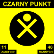
The road has two black dots (Polish: czarne dot ; singular czarny dot ). These are places where accidents occur particularly frequently. You are near Szczecin and Otyń . The black dots were set up in 1998. As early as 2003, no new signs were set up due to a lack of driver attention. In contrast to this, the Drogi Zaufania (“Trust Roads”) program was developed by the GDDKiA . As part of this program, various traffic safety measures were taken from 2008 onwards at places with an increased risk of accidents along the state road. The plan is to convert intersections and pedestrian crossings, and to build sidewalks and crash barriers.
State of development
The development of state road 3 is structured as follows:
| section | Stripes | Dividing strip |
|---|---|---|
|
Świnoujście - |
2 | No |
|
|
2 | No |
|
|
4th | Yes |
|
|
2 | No |
| Jelenia Góra urban area | 4th | Yes |
| Jelenia Góra - Jakuszyce (PL / CZ) | 2 | No |
Important places along the route
See also
Web links
- GDDKiA website (Polish)
- Website of the Drogi Zaufania program (Polish)
Footnotes
- ↑ Route of state road 3 from Świnoujście to Troszyn on maps.google.de (accessed October 17, 2019)
- ↑ Route of state road 3 from Ostromice to Miękowo on maps.google.de (accessed October 17, 2019)
- ↑ Route of state road 3 from Kaźmierzów to Lubków on maps.google.de (accessed October 17, 2019)
- ↑ Route of state road 3 from Bolków to Jakuszyce on maps.google.de (accessed October 17, 2019)
- ↑ Resolution No. 192 of the Council of Ministers of December 2, 1985 on the selection of state roads. MP 1986 no. 3 poz. 16.
- ↑ Krajowej Rady Bezpieczeństwa Ruchu Drogowego, Czarne punkty ( Memento from December 30, 2013 in the Internet Archive ) (PDF file; 925 kB; Polish)
- ↑ Drogi w programie: Droga krajowa nr 3 ( Memento from September 10, 2014 in the Internet Archive ) (Polish)


