Droga krajowa 60
| Droga krajowa 60 in Poland | |

|
|
| Basic data | |
| Operator: |
|
| Start of the street: | 52 ° 5 ' N , 19 ° 10' E |
| End of street: | 52 ° 48 ' N , 21 ° 52' E |
| Overall length: | 244 km |
| The DK60 in Gostynin | |
The Droga krajowa 60 (DK60) is a country road in Poland .
course
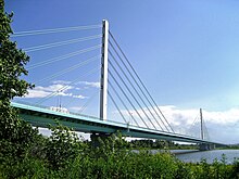
The road begins in Topola-Królewska about 2 kilometers north of Łęczyca on the DK91 and initially runs in a north-northeast direction via Kutno , where the DK2 is crossed, via the Sójki junction of the A1 autostrada to the Vistula , which reaches the town of Płock and joins with the Droga krajowa 62 is traversed on the bridge must Solidarności. The road continues through the center of Płock and from there to the northeast via Drobin (crossing with the DK10 ), Raciąż , Glinojeck (crossing with the planned Droga ekspresowa S7 on the route of the DK7 ), crosses the river Wkra (German name in the upper reaches : Neide) and further to the east reaches Ciechanów , where the DK50 ends when coming from the south . The DK57 crosses in Maków Mazowiecki and the DK61 in Różan . The DK60 now continues in an east-southeast direction to Ostrów Mazowiecka , where it ends at Droga ekspresowa S8 ( European route 67 ).
The length of the road is around 244 kilometers.
Important towns along the way
Łódź Voivodeship (województwo łódzkie) :
Masovian Voivodeship (województwo mazowieckie) :
See also
Web links
- GDDKiA website (Polish)
- Website of the Drogi Zaufania program (Polish)


