
Wensin
| coat of arms | Germany map | |
|---|---|---|

|
Coordinates: 53 ° 59 ′ N , 10 ° 25 ′ E |
|
| Basic data | ||
| State : | Schleswig-Holstein | |
| Circle : | Segeberg | |
| Office : | Trave land | |
| Height : | 28 m above sea level NHN | |
| Area : | 20.17 km 2 | |
| Residents: | 831 (Dec. 31, 2019) | |
| Population density : | 41 inhabitants per km 2 | |
| Postal code : | 23827 | |
| Area code : | 04559 | |
| License plate : | SE | |
| Community key : | 01 0 60 097 | |
| Office administration address: | Waldemar-von-Mohl-Strasse 10 23795 Bad Segeberg |
|
| Website : | ||
| Mayor : | Jörg Buthmann ( CDU ) | |
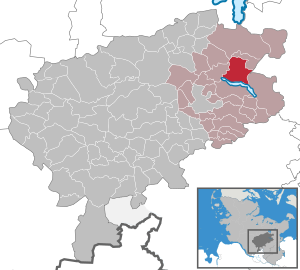
| Location of the municipality of Wensin in the Segeberg district | ||
  |
||

Wensin is a municipality on the shores of Lake Warder in the Segeberg district in Schleswig-Holstein . In addition to the Wensin estate, the village of Garbek also belongs to the municipality of Wensin.
Geography and traffic
Wensin is on the federal highway 432 Bad Segeberg - Scharbeutz .

history
The region has been inhabited since the Neolithic Age, and there are several barrows in Wensin .
coat of arms
Blazon : "In green a lowered golden oblique wave bar, accompanied above by a golden Dutch windmill, below by a golden stone grave consisting of three bearing stones and a cover plate."
Associations and community facilities
societies
In the municipality of Wensin there is the TuS Garbek sports club founded in 1949, the Wensin-Garbek volunteer fire brigade founded in 1937, the children's support group, founded in 1967 the Passopp nature conservation association, founded in 1996 as part of the citizens' initiative against the settlement of a hazardous waste dump in the municipality; the senior citizens club and the Segeberg golf club with an 18-hole course between the districts of Wensin and Garbek.
Community facilities
There is the day care center "de lütt Kinnerstuv" in the old school, next door in the same building since 2017 the Garbek police station and the house of the community for events of all kinds. Currently (February 2018) the cooperative residential park for barrier-free or supervised is under construction Living.
care
The Garbeker Bergladen offers a comprehensive basic supply.
Volksbank Eutin has an ATM in the former Raiffeisen building in Garbek.
Fiber optic internet is available in Garbek.
Attractions
The list of cultural monuments in Wensin includes the cultural monuments entered in the list of monuments of Schleswig-Holstein.
Good Wensin
The manor house on Gut Wensin , a double-roofed house , was built in 1642 for Joachim Brockdorff. Along with Gut Jersbek , it is one of the oldest mansions in Schleswig-Holstein that have been preserved almost unchanged. It is located directly on the Wardersee, surrounded by a park. Worth mentioning here are an avenue of linden trees from the 18th century, the rococo portal and the cavalier's house from 1727. A small part of the property is now used as a golf course (almost 100 hectares). The estate is privately owned and is not open to the public.
Sons and daughters (selection)
- August Schwerdtfeger (1816–1889), manor owner and member of the Prussian manor house
literature
- A. von Butlar, MM Meyer: Historical gardens in Schleswig-Holstein. - Verlag Boysen & Co., Heide 1998
- Hubertus Neuschäffer: Castles and mansions in South Holstein. - Verlag Weidlich, Würzburg 1984, ISBN 3-8035-1238-7
Web links
Individual evidence
- ↑ North Statistics Office - Population of the municipalities in Schleswig-Holstein 4th quarter 2019 (XLSX file) (update based on the 2011 census) ( help on this ).
- ↑ Schleswig-Holstein topography. Vol. 10: Timmaspe - Ziethen . 1st edition Flying-Kiwi-Verl. Junge, Flensburg 2008, ISBN 978-3-926055-92-7 , p. 213 ( dnb.de [accessed on August 9, 2020]).
- ↑ Schleswig-Holstein's municipal coat of arms
- ^ TuS Garbek: TuS Garbek was founded. In: Club homepage. Retrieved February 16, 2018 .
- ↑ Basses Blatt: Year of foundation of the children's support group. Retrieved February 16, 2018 .
- ↑ Passopp: Year of the statutes creating. Retrieved February 16, 2018 .
- ↑ Inauguration of the new police station. Press portal, accessed on February 16, 2018 .
Alveslohe | Armstedt | Bad Bramstedt | Bad Segeberg | Bahrenhof | Bark | Bebensee | Bimöhlen | Blunk | Boostedt | Bornhöved | Borstel | Bühnsdorf | Daldorf | Damsdorf | Dreggers | Ellerau | Fahrenkrug | Föhrden-Barl | Fredesdorf | Fuhlendorf | Geschendorf | Glasau | Gönnebek | Groß Kummerfeld | Gross Niendorf | Groß Rönnau | Great Aspen | Hagen | Hardebek | Hartenholm | Hasenkrug | Rabbit Moor | Heidmoor | Heidmühlen | Henstedt-Ulzburg | Hitzhusen | Högersdorf | Hüttblek | Itzstedt | Kaltenkirchen | Kattendorf | Kayhude | Kisdorf | Klein Gladebrugge | Klein Rönnau | Krems II | Kükels | Latendorf | Leezen | Lentföhrden | Mönkloh | Mözen | Near | Negro Bay | Take | Neuengörs | Neversdorf | Norderstedt | Use | Oering | Oersdorf | Pronstorf | Rickling | Rohlstorf | Schackendorf | Sheer | Schmalensee | Narrow field | Schwissel | Seedorf | Seth | Sievershütten | Stipsdorf | Stocksee | Strukdorf | Struvenhütten | Stuvenborn | Sülfeld | Tarbek | Tensfeld | Fields of death | Trappenkamp | Travenhorst | Traventhal | Wahlstedt | Wakendorf I | Wakendorf II | Weddelbrook | Weede | Wensin | Westerrade | Wiemersdorf | Winsen | Wittenborn
Non-parish area in the Segeberg
forest district of Buchholz