Jindřichov u Hranic
| Jindřichov | ||||
|---|---|---|---|---|
|
||||
| Basic data | ||||
| State : |
|
|||
| Region : | Olomoucký kraj | |||
| District : | Přerov | |||
| Area : | 1644 ha | |||
| Geographic location : | 49 ° 39 ' N , 17 ° 45' E | |||
| Height: | 418 m nm | |||
| Residents : | 461 (Jan. 1, 2019) | |||
| Postal code : | 753 01 | |||
| License plate : | M. | |||
| traffic | ||||
| Street: | Střítež nad Ludinou - Odry | |||
| structure | ||||
| Status: | local community | |||
| Districts: | 1 | |||
| administration | ||||
| Mayor : | Jaromír Blaha (as of 2008) | |||
| Address: | Jindřichov 19 753 01 Hranice 1 |
|||
| Municipality number: | 513873 | |||
| Website : | www.obec-jindrichov.cz | |||
Jindřichov (German Heinrichswald ) is a municipality in the Czech Republic . It is located twelve kilometers north of Hranice and belongs to the Okres Přerov .
geography
Jindřichov is located in the south of the Oder Mountains . The Waldhufendorf extends over a length of three kilometers along the Luha stream . To the north rises the hill Varta ( Heinrichswalder Berg , 590 m).
Neighboring towns are Spálov in the north, Dobešov in the northeast, Veselí in the east, Nejdek in the southeast, Střítež nad Ludinou in the south, Partutovice in the southwest and Hilbrovice and Heltínov in the northwest.
history
The village emerged at the transition between the 12th and 13th centuries in the course of the colonization of the areas north and northeast of Hranice by the Benedictine Abbey of Rajhrad . The place was according to tradition after his locator Heinrich, a Köhler, who with his brothers Bartholomew and Dobesch the villages Partutovice and Dobešov are said to have founded when Henry forest designated. Another legend gives a local bailiff named Heinrich as the patron saint; previously the village is said to have been called Dlouhá Ves (Langendorf).
The first documentary mention comes from 1499.
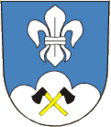
After the abolition of patrimonial Jindřichov / Heinrichswald became an independent municipality in the district administration of Mährisch Weißkirchen in 1850. According to the Munich Agreement , the community was added to the German Reich on October 1, 1938, together with the villages of Střítež nad Ludinou / Ohrnsdorf, Partutovice / Bartelsdorf, Luboměř / Laudmer, Spálov / Sponau and Heltínov / Scherzdorf, which were also mostly inhabited by Czechs . After negotiations, Jindřichov, as well as Partutovice and Střítež nad Ludinou, was returned to Czechoslovakia on November 21, 1938. In the course of the territorial reform of 1960 and the dissolution of the Okres Hranice, Jindřichov was assigned to the Okres Přerov on January 1, 1961 . Jindřichov has had a coat of arms and a banner since 1995.
Community structure
No districts are shown for the municipality of Jindřichov.
Attractions
- Church of the Assumption, built in 1752 in place of a church dedicated to St. Church of St. John the Baptist
- Rectory, built in 1802, today the seat of the municipal office
- Chapel of St. Theresia
- Chapel of St. Wenceslaus
- baroque statue of St. John of Nepomuk, built in 1802

