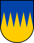
Špičky
| Špičky | ||||
|---|---|---|---|---|
|
||||
| Basic data | ||||
| State : |
|
|||
| Region : | Olomoucký kraj | |||
| District : | Přerov | |||
| Area : | 703 ha | |||
| Geographic location : | 49 ° 33 ' N , 17 ° 48' E | |||
| Height: | 347 m nm | |||
| Residents : | 287 (Jan. 1, 2019) | |||
| Postal code : | 753 66 | |||
| License plate : | M. | |||
| traffic | ||||
| Street: | Černotín - Jeseník nad Odrou | |||
| Railway connection: | Hranice na Moravě – Vsetín | |||
| structure | ||||
| Status: | local community | |||
| Districts: | 1 | |||
| administration | ||||
| Mayor : | Vladimír Zamazal (as of 2010) | |||
| Address: | Špičky 56 753 66 Hustopeče nad Bečvou |
|||
| Municipality number: | 570061 | |||
| Website : | www.obec-spicky.eu | |||
Špičky (German Speitsch ) is a municipality in the Czech Republic . It is four kilometers east of Hranice and belongs to the Okres Přerov .
geography
Špičky is located on the right side above the Bečva valley on the southern crest of Vysoká Stráž (372 m). The hill Hůrka (337 m) rises to the west. To the northwest is the main watershed of the Moravian Gate . South in the Bečva valley is the state road 35 / E 442 from Hranice to Valašské Meziříčí and the Hranice na Moravě – Vsetín railway , where the Špičky railway station is located in Kačena .
Neighboring towns are Kunčice in the north, Polom and Heřmanice in the northeast, Hranické Loučky in the east, Milotice nad Bečvou in the southeast, Kačena and Kamenec in the south, Černotín and Hluzov in the southwest and Hranice in the west.
history
The place on the important European trade connection of the Amber Road is one of the oldest in Moravia. According to tradition, the apostles Cyril and Methodius consecrated a small Christian church on the site of the pagan temple during the Christianization of Greater Moravia in the 9th century, which is said to be the second oldest in Moravia after the one at Modrá .
In a deed of ownership from the Diocese of Olomouc from 1132, there is an unnamed settlement north of Kelč , which is believed to be Špičky. The deed of donation from Duke Friedrich von Olmütz over the rule of Hranice to the Benedictine monastery Raigern from the year 1169, in which Stpicki is clearly documented for the first time, has proven to be a later forgery to underpin the claims of the Benedictines in the course of the property disputes with the Premonstratensian monastery Hradisko . In 1201 Ottokar I. Přemysl allocated the area to the Hradisko monastery, and the dispute between the two orders was settled in 1222 when the Raigern abbot Dluhomil waived the payment claims against the Premonstratensians. In 1270, Bishop Bruno von Schauenburg left the festival (munitium) Sahov to Vladiken Eberhard. The wooden fortress on the Dvořisko square, together with the parish church of the Virgin Mary consecrated by Bishop Bruno around 1270, formed the center of the Spiczk settlement .
In the 16th century the lords of Žerotín became the owners of Špičky. After the death of Bernhard the Elder in 1531, Bernhard the Younger from Žerotín, in 1539 Wilhelm and Přemek from Žerotín and two years later Charles from Žerotín on Hustopeče followed . During this time the Reformation started and the church received an evangelical pastor. At the beginning of the Thirty Years' War Johann Amos Comenius preached on his trip to Fulnek in Špičky. After the battle of White Mountain , the Žerotín family lost their feudal rights. Recatholization began in 1627. In 1642 imperial troops, retreating from the Swedes, devastated the village; in the process they destroyed the Sáhov fortress.
In 1771 the Catholic parish Špičky was renewed. In 1798 a wooden bell tower was added to the parish church of Simon and Judas. This was replaced by the White Tower in 1832. After the abolition of patrimonial Špičky / Speitsch became an independent municipality in the district administration of Mährisch Weißkirchen in 1850. From 1881 the municipality was named Štipky . In 1900 Štipky had 379 inhabitants and consisted of 79 houses. Since 1924 the municipality name has been Špičky . In the 1950s, the old Speitsch mill in Kačena, a historic water mill on the Bečva, was demolished. In the course of the territorial reform of 1960 and the dissolution of the Okres Hranice, the municipality was assigned to the Okres Přerov on January 1, 1961 . Hranické Loučky was incorporated in 1964. In 1976 it was incorporated into Hustopeče nad Bečvou . On January 1, 1992, the municipality Špičky was created again.
Community structure
No districts are shown for the municipality of Špičky. The settlement of Kačena belongs to Špičky.
Attractions
- Parish Church of St. Simon and Juda, the building surrounded by an old quarry stone churchyard wall with a sandstone atonement cross from around 1600 was built in place of a wooden chapel around 1270 as the parish church of the Virgin Mary. In 1577 it was rebuilt in the Renaissance style. In 1771 the Catholic parish was rebuilt and the church was consecrated to the apostles Simon and Jude. The White Church Tower was added between 1831 and 1832. The church received its current neo-Gothic shape during the renovation between 1899 and 1901. It was declared a cultural monument. Inside the church is the renaissance style burial place of Katharina Potstatzky von Prusinowitz from 1577.
- Christ cross

