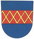
Kojetín
| Kojetín | ||||
|---|---|---|---|---|
|
||||
| Basic data | ||||
| State : |
|
|||
| Region : | Olomoucký kraj | |||
| District : | Přerov | |||
| Area : | 3103 ha | |||
| Geographic location : | 49 ° 21 ' N , 17 ° 18' E | |||
| Height: | 200 m nm | |||
| Residents : | 6,103 (Jan 1, 2019) | |||
| Postal code : | 750 02 - 752 01 | |||
| traffic | ||||
| Street: | Prostějov - Kroměříž | |||
| Railway connection: |
Brno – Přerov Kojetín – Český Těšín Kojetín – Tovačov |
|||
| structure | ||||
| Status: | city | |||
| Districts: | 3 | |||
| administration | ||||
| Mayor : | Mojmír Haupt (as of 2007) | |||
| Address: | Masarykovo náměstí 20 752 01 Kojetín |
|||
| Municipality number: | 514055 | |||
| Website : | www.kojetin.cz | |||
Kojetín (German Kojetein , older also Kogetein ) is a city in the Czech Republic . It is located nine kilometers northwest of Kroměříž in the Hanna and belongs to the Okres Přerov .
geography
Kojetín is located on the right bank of the March and north of the Haná not far from its confluence. State roads 435 from Olomouc and 367 from Prostějov to Kroměříž lead through Kojetín . The town lies on the railway lines between Vyškov and Přerov and between Kroměříž and Tovačov , with passenger traffic on the Kojetín - Tovačov section being suspended on the latter. The D 1 motorway runs south of the city .
Neighboring towns are Uhřičice in the north, Záříčí in the northeast, Chropyně in the east, Bezměrov in the southeast, Popůvky in the south, Křenovice in the southwest, Měrovice nad Hanou and Hruška in the west and Tvorovice in the northwest.
history
The first written mention of the village Kojetín took place in 1233 by Přemysl of Moravia . In the second half of the 13th century, Bavarian settlers expanded the street village into a market, which Ottokar II Přemysl left to the diocese of Prague . In 1290 Kojetín was raised to the status of a city with Olomouc law and received city fortifications.
During the Hussite Wars, Jiří von Sternberg acquired Kojetín in 1415 as a pledge. At the beginning of the 16th century, Wilhelm II of Pernstein became the owner of Kojetín. Since then, Jews have settled in the city and by 1885 the Jewish community had grown to 700 members. On December 20, 1720, the pledge fell back to the diocese of Prague and in 1725 Archbishop Franz Ferdinand von Kuenburg sold the Kojetín rule.
The new town hall was built in 1829 and a year later a new rectory. Since the 15th century the number of the German population had declined sharply and in 1880 there were 4888 people in Kojetein, of whom 259 were Germans.
In 1864 the railway from Prerau to Brno was inaugurated and in 1895 the line from Kojetein to Mährisch Ostrau followed . Due to the favorable traffic situation, Kojetein developed into a transshipment point for the agricultural products of the Hanna. The Jewish community was wiped out during World War II.
In 1995 a fire destroyed parts of the west side of the market next to the town hall.
Local division
The town of Kojetín consists of the districts Kojetín I - Město, Kojetín II - Popůvky and Kojetín III - Kovalovice.
Attractions
- Baroque Church of the Assumption of Mary on Comeniusplatz, built at the end of the 17th century in place of a previous Gothic building
- Plague column on the market square, built in 1704/05 by Johannes Kulhan
- Jewish Cemetery
- synagogue
- town hall
- Statues of St. Wenceslas and St. Anna
sons and daughters of the town
- Franz Anton Sebastini (around 1724–1789), baroque painter and fresco artist
- Beda Dudík (1815–1890), priest and historian
- Alexander Niklitschek (1892–1953), Austrian author

