Les croûtes
| Les croûtes | ||
|---|---|---|
|
|
||
| region | Grand Est | |
| Department | Aube | |
| Arrondissement | Troyes | |
| Canton | Aix-en-Othe | |
| Community association | Chaourçois et du Val d'Armance | |
| Coordinates | 48 ° 0 ′ N , 3 ° 52 ′ E | |
| height | 109-155 m | |
| surface | 7.11 km 2 | |
| Residents | 97 (January 1, 2017) | |
| Population density | 14 inhabitants / km 2 | |
| Post Code | 10130 | |
| INSEE code | 10118 | |
| Website | http://mairie-des-croutes.e-monsite.com/ | |
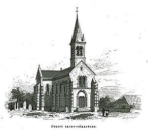
 Drawing of the Saint-Sébastien church |
||
Les Croûtes is a French commune with 97 inhabitants (as of January 1, 2017) in the Aube department in the Grand Est region (before 2016 Champagne-Ardenne ). It belongs to the canton of Aix-en-Othe (until 2015 Ervy-le-Châtel ) in the Troyes arrondissement .
geography
Les Croûtes is about 39 kilometers southwest of Troyes . Neighboring communities are Soumaintrain in the north and north-west, Courtaoult in the north, Chessy-les-Prés in the north-east, Flogny-la-Chapelle in the south and east, Percey in the south-west and Butteaux in the west and south-west.
Population development
| year | 1962 | 1968 | 1975 | 1982 | 1990 | 1999 | 2006 | 2011 | 2016 |
|---|---|---|---|---|---|---|---|---|---|
| Residents | 148 | 134 | 138 | 114 | 114 | 113 | 105 | 101 | 100 |
| Source: Cassini and INSEE | |||||||||
Attractions
- Saint-Sébastien church
Web links
Commons : Les Croûtes - Collection of images, videos and audio files
