List of waters in the Eichsfeld
This list contains the most important bodies of water in the Eichsfeld . Due to the location of the Eichsfeld on the Elbe-Weser watershed , there are no major rivers here, only the Werra forms the border between the Eichsfeld and the Hessian Werra-Meißner district in the west . In return, numerous smaller and larger springs, especially at the layers of shell limestone and red sandstone, form a highly branched stream and river system, which has shaped today's landscape. In the Eichsfeld there are only a few natural lakes and a few retention basins, small ponds were often created for fish farming and to provide fire fighting water in the villages and monasteries.
The information relates to the administrative border of the Eichsfeld in 1802 with the end of the Kurmainzer rule and the taking over by the Kingdom of Prussia .
Flowing waters
swell
Below is a selection of sources in the Eichsfeld.
| Surname | location | particularities | photo |
|---|---|---|---|
| Rhume spring | northeast of Rhumspringe on the boundary to neighboring Pöhlde | Karst spring with an average of 2000 l spring discharge per second |

|
| Leash source | in the urban area of Leinefelde | on the edge of the Worbiser trench consisting of several sources, the beginning of the Leine-Heide-Radweg |

|
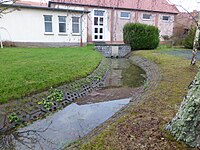
| Wipper spring | in the urban area of Worbis | Consists of several sources on the edge of the Worbiser Graben |
|
| Hollow springs | on the western outskirts of Worbis | Consists of several sources on the edge of the Worbiser Graben |

|
| Unstrut source | west of Kefferhausen | Beginning of the Unstrut cycle path |

|
| Klingenberg source | between Lindau and Bilshausen |

|
Streams and rivers
The following list contains a selection of rivers, sorted according to the length of their course in the Eichsfeld.
Legend:
Country code : Hessen = HE; Lower Saxony = NI; Thuringia = TH
Catchment areas : E = Elbe ; W = Weser
| River ( EZG ) |
length | of which in the Eic |
source | muzzle | Tributaries in the Eichsfeld |
Places on the river in Eichsfeld |
image |
|---|---|---|---|---|---|---|---|
| Leash (W) |
281 km
|
37.8 km
|
in Leinefelde (TH) | to the Aller near Schwarmstedt (NI) |
Etzelsbach , Geislede , Beber , Lutter , Rustebach | Leinefelde , Heiligenstadt , Uder , Arenshausen |

|
| Hallow (W) |
27.6 km
|
27.6 km
|
in Worbis (TH) | in the rooms near Gieboldehausen (NI) |
Nisse , Muse, Nathe , Suhle | Teistungen , Duderstadt , Obernfeld , Gieboldehausen |

|
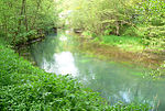
| Rhume (W) |
48.0 km
|
{{{1}}}
|
in Rotenberg near Rhumspringe (NI) |
on the leash near Northeim (NI) |
Eller , Hahle | Rhumspringe , Gieboldehausen , Lindau |
|
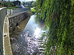
| Without (E) |
14.0 km
|
14.0 km
|
in Dün near Kallmerode (TH) | in the Wipper near Gernrode (TH) |
Ahlenbach , Laubach | Lower Orschel |
|
| Nathe (W) |
{{{1}}}
|
{{{1}}}
|
near Neuendorf (TH) | to the Hahle near Obernfeld (NI) |
Rocker | Nesselröden , Westerode | |
| Geislede (W) |
13.5 km
|
13.5 km
|
Upper Eichsfeld / Dün near Kreuzebra (TH) |
on the leash in Heilbad Heiligenstadt (Th) |
Horse stream | Geisleden , Heiligenstadt |

|
| Frieda (W) |
18.4 km
|
{{{1}}}
|
in the Upper Eichsfeld near Struth (TH) |
in the Werra near Frieda (HE) |
Lazy Bach, Lutter , Rosoppe , Rode | Lengenfeld under the stone , Geismar |

|
| Rocker (E) |
92.6 km
|
{{{1}}}
|
in the Ohm Mountains in Worbis (TH) |
in the Unstrut near Oldisleben (TH) |
Bode , without | Worbis , Bernterode |

|
| Lutter (Frieda) (W) |
12.1 km
|
12.1 km
|
in the Upper Eichsfeld near Effelder (TH) |
to Frieda near Geismar (TH) |
Steingraben, Neunbörner, Wolfenthalsbach | Großbartloff |

|
| Rosoppe (W) |
11.3 km
|
11.3 km
|
in the Upper Eichsfeld near Flinsberg (TH) |
to Frieda near Geismar (TH) |
Schlossbach, Krombach | Martinfeld , Ershausen |

|
| Walse (W) |
11.3 km
|
11.3 km
|
in the Upper Eichsfeld near Mackenrode (TH) |
to the Werra in Wahlhausen (TH) |
Rotenbach, Hollbach | Mackenrode , Wahlhausen |

|
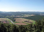
| Werra (W) |
292 km
|
{{{1}}}
|
in the Thuringian Forest near Masserberg (TH) |
in the Weser in Hann. Münden (NI) |
Walse , Siesterbach | Wahlhausen , Werleshausen |
|
| Ellerbach (W) |
{{{1}}}
|
{{{1}}}
|
west of Krebeck (NI) | into the wallow at Gieboldehausen (NI) |
Retlake | Krebeck , Wollbrandshausen | |
| Rode (W) |
9.3 km
|
9.3 km
|
in the Upper Eichsfeld near Schwobfeld (TH) |
to Frieda near Geismar (TH) |
Hesselbach, Hühnerbach | Armor , Sickerode | |
| Eller (W) |
9.3 km
|
9.3 km
|
with the Geröder spring arm near Gerode (TH) | in the Rhume near Rüdershausen (NI) |
Jütze, Soolbach | Weißenborn-Lüderode , Hilkerode | |
| Beber (leash) (W) |
{{{1}}}
|
{{{1}}}
|
near Günterode (TH) | on the leash at Uder (Th) |
Rothenbach | Mengelrode , Rengelrode | |
| Rustebach (W) |
{{{1}}}
|
{{{1}}}
|
near Freienhagen (TH) | on the leash in Arenshausen (Th) |
Eulenbach | Rustenfelde | |
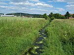
| Bode (E) |
20.7 km
|
{{{1}}}
|
in the Ohm Mountains near Holungen (TH) |
in the Wipper near Bleicherode (TH) |
no | Bischofferode |
|
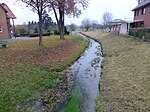
| Wallow (W) |
{{{1}}}
|
{{{1}}}
|
at the Göttingen Forest near Mackenrode (NI) | in the Hahle near Gieboldehausen (NI) |
Aue , Ellerbach | Seulingen , Germershausen , Gieboldehausen |
|
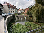
| Unstrut (E) |
192 km
|
{{{1}}}
|
in the Upper Eichsfeld near Kefferhausen (TH) |
in the Saale in Naumburg (ST) |
Helbe , Wipper , Helme , Luhne | Dingelstädt , Zella |
|
| Lutter (top line) (W) |
{{{1}}}
|
{{{1}}}
|
in the Upper Eichsfeld near Lutter (TH) |
on the leash in Uder (Th) |
Grießbach | Lutter , Uder | |
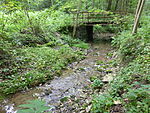
| Luhne (E) |
{{{1}}}
|
{{{1}}}
|
near Küllstedt (TH) | in the Unstrut near Ammern (TH) |
Pour | Bickenriede |
|
| Heldrabach (W) |
11.1 km
|
{{{1}}}
|
in the Upper Eichsfeld near Diedorf (TH) |
in the Werra near Heldra (HE) |
no | Turning houses |

|
| Helbe (E) |
56.6 km
|
{{{1}}}
|
with the right source arm (Steingraben) on the Dün from the direction of Beberstedt (TH) | in the Unstrut near Weißensee (TH) |
no | no | |
| Lempertsbach (W) |
9 km
|
{{{1}}}
|
in the Upper Eichsfeld near Heyerode (TH) |
in the Werra near Mihla (TH) |
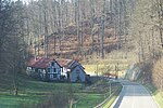
no | Heyerode |
|
| Helmets (E) |
81 km
|
{{{1}}}
|
between Stöckey and Bischofferode (TH) | in the Unstrut near Artern (TH) |
no | no |
water falls
| waterfall | Waters | place | region | description | Height in m | image |
|---|---|---|---|---|---|---|
| Lutter waterfall | Lutter | at Großbartloff | Upper Eichsfeld | several steps over tufa in a small forest notch | 10 | |
| Geislede waterfall | Geislede | in Heilbad Heiligenstadt an der Scheuche | Upper Leinetal | created by partial diversion of the Geislede | 7th |
Standing waters
Lakes and ponds
The list below contains a number of small ponds , lakes and ponds . An exception in terms of size is the Seeburger See , which is also called the eye of the Eichsfeldes . Several other small bodies of standing water have disappeared over the centuries as a result of landscape changes and drainage. For example, on some historical maps from the 17th and 18th centuries, in the headwaters of the Unstrut, there is a small lake whose location is no longer known today.
| Surname | location | Emergence | Hydrographic description | Inflow / outflow | Use / specialty | photo |
|---|---|---|---|---|---|---|
| Seeburg lake | in the Golden Mark between Seeburg and Bernshausen | Sinkhole lake after leaching of the underground salt store | Area: 86.5 ha
Depth: max. 3.5 m |
Aue | Largest lake in the Eichsfeld, nature reserve, recreation area |

|
| Lutteranger (Luttersee) | in the Golden Mark between Seeburg and Wollbrandshausen | Sinkhole lake after leaching of the underground salt store | In the 19th century, drainage by means of a tunnel, renaturation of the lake in 1989 | |||
| Seeanger (Westersee) | in the Goldenen Mark northwest of Seeburg | Sinkhole lake after leaching of the underground salt store | Area: 5 ha (up to 50 ha in case of flooding) | Aue | after draining, renaturation of the Seeanger since 2000 by relocating the floodplain | |
| Thiershäuser ponds | in the Unterreichsfeld north of Renshausen | Area: 3.5 ha | Renshäuser Bach | Nature reserve, fishing waters |

|
|
| Waxedter lake | Eichsfelder Höhe east of waxedt | Pour | ||||
| Marienthaltich | west of Neustadt | Knickbach | ||||
| Ox swamp | Ohm mountains north of Kirchohmfeld | none | ||||
| Spanier See (court lake) | Eichsfelder Höhe west of Büttstedt | Sinkhole waters | none | Renaturation 2005 | ||
| Harbachteich | north of Wingerode | Harbach | ||||
| Pond on the round meadow | Eichsfelder Höhe north of waxedt | System as a camouflage pit on a former military site | none |
Dams
Below are the dams and retention basins in the Eichsfeld.
| Surname | Dammed river |
Volume (million m³ ) |
Height of the barrier structure ( m ) |
place | Year of commissioning |
photo |
|---|---|---|---|---|---|---|
| Bffekt dam | Without | 1.2 | 10.7 | Leinefelde |

|
|
| Ahlenbach Deuna dam | Ahlenbach | 0.35 | 9.3 | Deuna |
|
|
| Teistungen reservoir Glockengraben | Reese, bell moat | 0.3 | 7.35 | Performance |

|
|
| Mengelrode flood retention basin | Beber , usually not stowed | 0.11 | 10.05 | Mengelrode |
|
|
| Wingerode dam | Rittersbach | 0.03 | 6.85 | Wingerode |
|
|
| Mühlfeld Hauröden dam | Hauröder Bach | 0.03 | 5.50 | Hauroden |
|
|
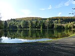
| Reifenstein reservoir | Moat | Kleinbartloff |
|
|
literature
- Kurt Porkert: Notable springs along the Elbe-Weser watershed within or not far from the Lower Eichsfeld. In: Eichsfeld-Jahrbuch (EJb) 23 (2015), pp. 375–416
- Kurt Porkert: Remarkable sources along the Elbe-Weser watershed within or not far from the upper area. In: EJb 24 (2016), pp. 341-360
- Kurt Porkert: Characteristics and potential opportunities of the Elbe-Weser watershed in Eichsfeld. In: EJb 22 (2014), pp. 379–386
- Kurt Porkert: Disappeared, preserved and newly created still waters in the Obereichsfeld. In: Eichsfelder Heimatzeitschrift 58th volume 2014, pages 398–401
- Kurt Porkert: Mysterious fountains and bodies of water in the Eichsfeld and neighboring areas. Mecke Publishing and Printing, Duderstadt 2018
- P. Buerschaper: The Luttersee near Bernshausen. A cultural-historical consideration. In: Die Goldene Mark Verlag Mecke Duderstadt, 14th year (1963) pp. 56–59
See also
Web links
- Thuringian State Institute for Environment and Geology , on tlug-jena.de
- Natura2000-Station Antje Ehrle: "Optimization of tufa springs on the Muschelkalkplatten in western and northern Thuringia , accessed on March 16, 2020
Individual evidence
- ↑ Map of the rivers of Thuringia from 10 km² catchment area ( TLUG ; PDF; 1.23 MB)
- ↑ Kurt Porkert: Disappeared, preserved and newly created still waters in the Obereichsfeld. Eichsfelder Heimatzeitschrift 58th volume 2014, pages 398–401
- ↑ [1] Seeanger on Karstwanderweg.de
- ↑ [2] Reservoir register of the TLVwA pdf
- ↑ [3] Reservoir register of the TLVwA pdf


