List of streets and squares in Graal-Müritz
The list of streets and squares in Graal-Müritz describes the street system of the seaside spa Graal-Müritz in the Rostock district in Mecklenburg-Western Pomerania .
Legend
The following table gives an overview of the existing streets and squares in the municipality as well as some related information. In detail these are:
- Name / location : current name of the street or square. The location (geoposition) indicates roughly the middle of the street or the square
- Street names that are no longer valid are in italics. set
- Length / dimensions : rounded length of the street or dimensions of the square in meters. The latter are given in the form a × b for rectangular systems or a × b × c for triangular systems with a as the longest edge. The addition 'in the village' indicates the length of the road within the municipality of Lubmin, provided it runs through several municipalities
- Name origin : origin of the name
- Notes : further information on local institutions, the history of the street or historical names
- Image : Image of the street or an adjacent object
Overview of streets and squares
| Surname | Length / dimensions (in meters) |
Origin of name | Remarks | image |
|---|---|---|---|---|
|
Alexandrastrasse
( Location ) |
440 | Alexandra of Hanover and Cumberland , the last Grand Duchess of Mecklenburg-Schwerin . Her husband Friedrich Franz IV donated among other things the financial means for the construction of the Lukaskirche . | Alexandrastrasse runs parallel to Kurstrasse and ends at Berliner Strasse. |

|
| On the embankment
( Location ) |
65 | after the adjacent railway line, which is served by the Mecklenburg Spa Railway , among others | The path connects the Koppelweg with the Black Path. The Koppelweg stop is located here . |

|
| At the Erlengrund
( Location ) |
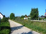
540 | Alder , a plant genus in the family of the Birch Family | The path extends the street An der Jugendherberge at the level of the Teichweg in an easterly direction. Here is one of the two terminal stops of the Mecklenburg Spa Railway. The path is south of this railway line; from here there is a connection to the street An der Büdnerei . |
|
| At the radio tower
( Location ) |
65 | after the radio tower located here for cellular and data radio | The street ends from Rostocker Straße in a southerly direction as a dead end . | |
| At the Sonnenhof
( Location ) |
80 | after a Sonnenhof sanatorium of the Jewish owner Julius Salinger located here. He was expelled in 1936 for treating children free of charge. | The street ends from Rostocker Straße in a southerly direction as a dead end. |

|
| At the Tannenhof
( Location ) |
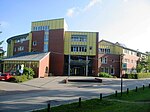
180 | to the adjacent Tannenhof Children's Clinic | The road connects the Hufenweg with the Strandstraße. Here is the Verkehrswacht Graal-Müritz e. V. as well as the eponymous children's clinic Tannenhof . It goes back to a children's hospital founded by Carl von Mettenheimer . The personal physician of the Mecklenburg Duke discovered the healing climate of the community in 1877 and founded the first children's hospital in the Baltic Sea in 1884. |
|
| At the water tower
( Location ) |
880 | Water tower , description of an operation building of the water supply, a high-level tank for storage of ( drinking ) water has | The path connects Lindenweg / corner Friedhofsweg with Bahnhofstraße / corner Birkenallee. The municipality's water tower, which gives the street its name, is located here. It was completed in 1913 and supplied the community with drinking water until 1988. Its storage capacity was 150 m³. In connection with the sewer system built in 1930, the previously used draw wells became superfluous. Baumeister was the later honorary citizen of the community Wilhelm Tiehl . The 32 meter high tower has been privately owned since 2005 and is a listed building . | |
| At the Büdnerei
( Location ) |
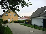
70 | Büdnerei , old fisherman's house | Coming from Lange Straße, the street ends as a dead end. This is where the Budō Kyokai Graal-Müritz e. V. |
|
| At the youth hostel
( Location ) |
700 | Youth hostel , colloquially for an inexpensive, simple hostel | The street runs in a west-east direction parallel to Bahnhofstraße and ends at Kiefernweg. The Anglerverband Ostseestrand Graal-Müritz e. V. |

|
| At the lock
( Location ) |
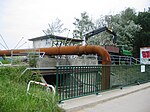
65 | after the sluice on the river ditch with a new pumping station to improve inland flood protection. The client was the Lower Warnow Coast Water and Soil Association . | The path is an extension of the Buchenweg in a westerly direction. It leads to the river ditch and continues behind the lock as a riverside road. This street provides access to an allotment garden. |
|
| August-Bebel-Strasse
( Location ) |
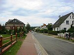
410 | Ferdinand August Bebel (1840–1913), co-founder of the organized social democratic labor movement in Germany | August-Bebel-Straße connects Lindenweg with Langen Straße. One of the two medical centers in the community is located here. The house with number 23 is the seat of the Graal-Müritz e. V. , while the Association for the Promotion of Art and Art Education is located in number 7 . |
|
|
Bathing path
( Location ) |
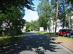
150 | Bath , bathing in warm or cold water, which primarily serves to cleanse, but also to promote health and well-being. | The bathing path connects the street Zur Seebrücke with the Nachtigallenweg and the Buchenkampweg. On the corner of the street Zur Seebrücke there is a bust in memory of Rosa Luxemburg , whose name the street Zur Seebrücke bore until 1993. |
|
| Bahnhofstrasse
( Location ) |
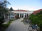
560 | after the railway line running here, which the community u. a connects to Rostock main station | The street connects the Lange Straße with the Birkenallee. The only day care center Kinderland and the only post office in the community are located here. To the right of the building is a sports hall. In house 17D there is the association for the development and maintenance of the church ensemble Graal-Müritz e. V. |
|
| Bahnhofsweg
( Location ) |
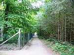
65 | after the railway line running here, which connects the community with Rostock main station. The path leads directly to a stop on the line. | The Bahnhofsweg connects Rostocker Strasse with Parkstrasse. A junction to the west connects the path via Karl-Rettich-Weg with Schillerstraße. |
|
| Barsbüttler Ring
( Location ) |
175 | to the partnership community Barsbüttel, Stormarn district in Schleswig-Holstein | The Barsbüttler Ring branches off from the street An der Jugendherberge in the south and runs in a ring until it meets this street again. The street Klünersholz branches off to the northeast . |

|
| Berlin street
( Location ) |
265 | Berlin , capital and seat of government of the Federal Republic of Germany | Berliner Strasse connects Kurstrasse with Alexanderstrasse. A nursing home and rehabilitation center is located on the corner property on Alexandrastrasse . |

|
| Amber Trail
( Location ) |
115 | Amber , colloquially for a clear to opaque, mostly yellowish fossil resin of various origins and origins | The Bernsteinweg branches off from the Muschelweg and ends in a dead end. The street name is also used for a street south of it. It too ends in a dead end. |

|
| Birch avenue
( Location ) |
500 | after the first birch planting | The Birkenallee connects Bahnhofsstraße with Ribnitzer Straße and is part of Landstraße 22. The Warnower Water and Wastewater Association has its headquarters here. |

|
| Bridge path
( Location ) |
65 | by the bridge across the river current trench leads | The Brückenweg extends the Heuweg into the Fischerweg and leads over the Stromgraben. This river is dammed in a basin north of the bridge path and drained into the Baltic Sea via a lock. |

|
| Buchenkampweg
( Location ) |
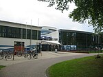
370 | The Buchenkampweg is the extension of the bathing path and leads to the Muschelweg. The Wirtschaftliche Vereinigung e. Is located in the building at number 6 on the way . V. Graal-Müritz and a leisure and recreation center, the Aquadrom (built between 2002 and 2004). The Martin-Andersen-Nexö pioneer camp used to be located here . |
|
|
| Buchenweg
( Location ) |
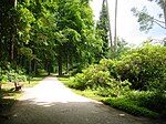
65 | Beeches , the only genus of plants of the subfamily Fagoideae within the beech family | The Buchenweg is the northern end of the Rhododendron Park and connects the Parkstraße with the An der Schleuse path . The park was laid out between 1951 and 1961 by the horticultural architect Friedrich-Karl Evert and, along with the park in Westerstede in Lower Saxony, is one of the largest of its kind in Germany. |
|
| Groyne path
( Location ) |
95 | Groyne wall or dam-like structure for coastal protection | The path leaves Mittelweg in an easterly direction and ends in a dead end. |

|
|
Doctor Bach Way
( Location ) |
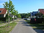
145 | Wilhelm Bach, practicing doctor in Graal-Müritz since 1933, who died of typhus on February 12, 1945 , after having assisted many people in a quarantine camp in Graal-Müritz after the Second World War . | The Doktor-Bach-Weg connects the Birkenallee with the Kiefernweg. |
|
| Doktor-Bernateck-Strasse
( Location ) |
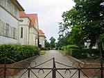
65 | Friedrich Bernateck (1923–1999) completed training as a specialist in Berlin. After receiving his doctorate in 1950, he was medical director and chief physician of the Richard Aßmann clinic and the Tannenhof children's sanatorium from 1959 to 1985 . Bernateck worked as a lecturer at the University of Greifswald and the medical universities of applied sciences in Berlin and Rostock. | The street connects Berliner Straße in the north with Rostocker Straße in the south. It is located on the sanatorium grounds and is closed to public traffic. The BVG acquired the building land and built a spa and recreation facility here from 1925 to 1928 with its own gardening and cattle ranch for its employees. 25 years later, on September 9, 1951, the complex became the Richard Assmann sanatorium . In 1956 it was assigned to the FDGB and in 1962 to the state health system. |
|
| Doctor Liver Street
( Location ) |
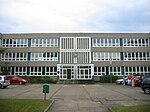
400 | Doktor-Leber-Straße connects Lindenweg with Langen Straße. Here is a special educational support center by the sea , which was founded on September 1st, 1954. The local association for the promotion of learning disabled people is located at number 8 . V. of the Graal-Müritz special needs school . |
|
|
| Doctor Mettenheimer Way
( Location ) |
160 | Carl von Mettenheimer , State Medical Officer ; Founder of the first children's hospital in Tannenhof on the Baltic Sea in Müritz. | The Doktor-Mettenheimer-Weg runs between the Doktor-Bach-Weg and the Schulweg, parallel to the Doktor-Sedl-Weg. The house with the number 11 is the seat of the association for philately . |

|
| Doktor-Sedl-Weg
( Location ) |
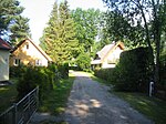
195 | Karl-Georg Sedl (* 1917), was expelled from Czechoslovakia in 1945 after studying medicine at the German Charles University in Prague and after working as an assistant doctor at the district hospital in Chomutov . Sedl worked as a senior doctor in the quarantine camp in Graal-Müritz and from 1946 to 1990 as a general practitioner in the community. | The Doktor-Sedl-Weg runs north of the Doktor-Mettenheimer-Weg and also connects the Doktor-Bach-Weg with the way to school. |
|
| Dune path
( Location ) |
200 | Dune , elevation made of sand that is blown and deposited by the wind . | The dune path runs parallel to the coast and houses a music shell, a covered building where concerts take place. To the west there is a swimming pool that is part of a hotel complex. The path begins on the road to the pier and ends at the Felsenburgweg / corner of the beach promenade. |

|
|
Erich-Kästner-Weg
( ) |
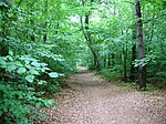
65 | Emil Erich Kästner (1899–1974), German writer , screenwriter and writer of texts for cabaret , who spent his summer holidays here in 1914. | The Erich-Kästner-Weg runs from the beach road in a southerly direction to the Hans-Fallada-Weg. |
|
| Erlenweg
( Location ) |
65 | Alder , a plant genus in the family of the Birch Family | The Erlenweg runs from the junction of Friedhofsweg and Lindenweg in a northerly direction to the street Zur Seebrücke . |

|
| Harvest path
( Location ) |
25th | Harvesting , bringing in agricultural crops and fruits | The harvest path branches off at Weidenweg and ends in a dead end. |

|
| Owl Way
( Location ) |
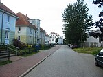
220 | Owls , a species of bird | The Eulenweg branches off to the west from the street Zur Eselswiese and ends in a dead end in the south. |
|
|
F.-K.-Evert-Weg
( Location ) |
65 | Friedrich-Karl Evert , horticultural architect from Rostock , who created the Graal-Müritz rhododendron park | The path crosses the Rhododendron Park parallel to the Buchenweg and is north of the concert pavilion. |

|
| Felsenburgweg
( Location ) |
65 | The path runs from the beach through the forest towards Doktor-Leber-Straße. Another path of the same name also leads from the beach to August-Bebel-Straße. |

|
|
| Fischerweg
( Location ) |
65 | Fisherman , a person who practices fishing | The Fischerweg represents the south-eastern border of the rhododendron park. It runs parallel to the park road. Here is a poetry book , which was inaugurated on June 3, 2011 on the occasion of the 50th anniversary of the Rhododendron Park. The spa administration offers readings on Wednesdays under this tree. Laypeople are also encouraged to use the site for literary purposes. | |
| Flounder Trail
( Location ) |
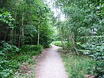
65 | Flounder , flatfish that is native to the coastal waters of Europe | The flounder path runs from the beach through the forest past the sports field and ends at Doktor-Leber-Straße. |
|
| Trout Trail
( Location ) |
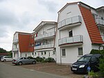
100 | Trout , a species of fish from the genus Salmo in the salmon fish family (Salmonidae) | Like the groyne path, the path branches off from Mittelweg in an easterly direction and ends in a dead end. |
|
| Franz Kafka Way
( Location ) |
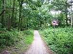
65 | Franz Kafka (1883–1924), German-speaking writer , who spent his summer vacation in 1923 in the then still independent community of Müritz-Ost | The Franz-Kafka-Weg runs parallel to the beach road from the beach towards Köhlerwiese. |
|
| Friedensstrasse
( Location ) |
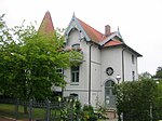
180 | Peace , wholesome state of stillness or calm | The Friedensstrasse connects the Fritz-Reuter-Strasse with the Lindenweg. The house with number 5 (formerly "Charlotte") is a listed building. |
|
| Friedhofsweg
( Location ) |
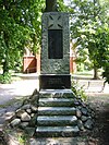
560 | here is the community cemetery | The Friedhofsweg extends the Lindenweg to the intersection of Ribnitzer Straße / Zur Seebrücke. Here you will also find the community cemetery, a war memorial from the First World War and a memorial stone for Martin Luther (who, however, never visited the community). | |
| Fritz-Reuter-Strasse
( Location ) |
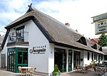
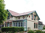
340 | Fritz Reuter (1810–1874), important German poet and writer of the Low German language | Fritz-Reuter-Straße connects Parkstraße with Onkel-Bräsing-Straße and is the location of the bath library , the former "Ithaka House". The building from 1905/1906 was acquired by Rudolf Presber , who spent the summers here from 1921 to 1928. His novel "Ithaka" comes from this time. On the occasion of his 60th birthday, he was given honorary citizenship of the community. The novelist Herbert Nachbar lived with his family in the Ithaka house from 1963 to 1969 . The building with number 8 (“Castle Mona”), number 13 (“Weidmannsruh”) and number 15 (Hotel “Cecilie”) are under monument protection. The Villa Elise , built in 1907, was converted into the German people's recreation home (Devo children's home) Haus Frohsinn from 1920 . In 1952 the district hospital used the building for people suffering from bone tuberculosis . In 1994 it was canceled. In its place there is now a Lindenhof nursing home . |
|
|
Goose path
( Location ) |
95 | Geese , a subfamily of ducks | The Gänseweg branches off to the west from Doktor-Leber-Straße and creates a direct connection to August-Bebel-Straße. |

|
| gardenstreet
( Location ) |
260 | to the allotment gardens adjoining here | The street branches off from Rostocker Straße in a south-easterly direction and ends in a dead end. There are some allotments here. |

|
| Gorse path
( Location ) |
35 | Broom , a plant genus of Schmetterlingsblütler | The path branches off in a northerly direction from the street Zur Koppenheide and ends at the street An der Jugendherberge . |

|
| Graal overland route
( Location ) |
2,050 | Graal, part of the municipality of Graal-Müritz | The Graaler Landweg branches off to the west from the L 22 at the level of the Birkenallee into the forest and after about 2 km at the Ribnitzer Straße also meets the L 22. From here there is a footpath to the Gelbensande hunting lodge . |

|
| Green meadow
( Location ) |
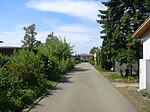
770 | after the green meadow holiday complex built here | The road lies between Hufenweg and Grünem Winkel and runs in a ring with a crossing in the central axis. |
|
| Green angle
( Location ) |
400 | after the bungalow settlement Grüner Winkel built here | As an extension of the beach road, the road initially runs in a southerly direction and then joins the Pappelweg at an acute angle. |

|
|
Rose hip path
( Location ) |
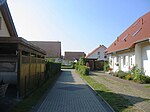
55 | Rose hips , non-toxic fruits of various types of roses , especially the dog rose | The path branches off from the street An der Jugendherberge in a southerly direction and ends in a dead end. |
|
| Hanning-Schuldt-Weg
( Location ) |
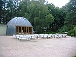
50 | Johann (Hanning) Schuldt (1909–2000), Graal citizen since 1928, who has rendered services to the community in many ways. Schuldt had been deputy mayor since 1970 and campaigned for the expansion of the campsite, the road network and the construction of the rhododendron park. In his retirement from 1979 he dealt with the local history of the place and became an honorary citizen of the community in 1995. | The path is in the Rhododendron Park. It begins on Zarnesweg at Kurstraße and ends at the concert pavilion. There it continues as F.-K.-Evert-Weg to Parkstrasse. |
|
| Hans Fallada Way
( Location ) |
50 | Pseudonym of Rudolf Wilhelm Friedrich Ditzen (1893–1947), one of the most famous German authors of the 20th century. Fallada lived in the parish from 1906 to 1909. | The Hans-Fallada-Weg connects the Erich-Kästner-Weg with the Graaler Landweg. It crosses the cycle path to Klein-Müritz and Ribnitzer Straße. |

|
| Hedge path
( Location ) |
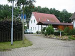
20th | Hedge , linear growth of dense, strongly branched shrubs | The street branches off from the street Zur Koppenheide in a southerly direction and ends as a private street and dead end. |
|
| Blueberry trail
( Location ) |
300 | Blueberry , species in the heather family | The path runs in a U-shape from the street Zur Koppenweide . In the house with the number 1 is the Mandolin Orchestra Graal-Müritz e. V. is at home. |

|
| Hay path
( Location ) |
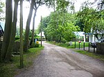
1,450 | Hay , dried aboveground biomass from grassland plants ( grasses , herbs , legumes ) | The hay path runs from the forest aisle to the riverside road and crosses the Rostock Heath . |
|
| Elder path
( Location ) |
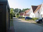
85 | Elder , a genus of plants in the musk herb family | The Elderweg branches off in a southerly direction from the street Zur Koppenheide and ends in a dead end. |
|
| Hufenweg
( Location ) |
540 | Hoof , horn structure , which encloses the tip of the toe in unpaired hoofs | The Hufenweg branches off from the Am Tannenhof street , runs in a north-westerly direction and ends at the beach. |

|
|
Karl-Lühnsdorf-Weg
( Location ) |
344 | The path connects Rostocker Strasse with Schillerstrasse. |

|
|
| Karl-Radich-Weg
( Location ) |
263 | Karl Lorenz Rettich (1841–1904), landscape painter, who from 1896 lived in a villa and studio he built here. | The path runs at a right angle to Karl-Lühnsdorf-Weg and connects Parkstrasse with Schillerstrasse. |

|
| Kastanienallee
( Location ) |
430 | Horse chestnuts , a genus of plants in the soap tree family | Kastanienallee connects Waldstrasse to the south with Langen Strasse and, along with August-Bebel-Strasse, is the location of the community's second medical center. The Pniel parish hall and the Evangelical St. Luke Church from 1908 are also located here . |

|
| Hangover
( Location ) |
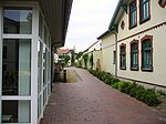
50 | Low German term for a narrow path that only wide enough for a hangover is | The narrow path connects Kurstraße with Fritz-Reuter-Straße. A care facility of the Arbeiter-Samariter-Bund is located here . |
|
| Lapwing path
( Location ) |
135 | Lapwing , species of bird in the plover family | The Kiebitzweg runs in a westerly direction from the Kastanienallee and turns into the Eulenweg at the intersection Lerchenweg / Zur Eselswiese. |

|
| Pine path
( Location ) |
410 | to the pine forest adjacent to the east | The Kiefernweg begins at the corner of Bahnhofstrasse / Birkenallee in a southerly direction and forms the southern end of the Graal district. |

|
| Kirchsteig
( Location ) |
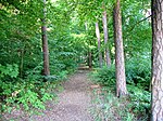
50 | to the nearby Lukaskirche and the Church of St. Ursula | The Kirchsteig runs from Birkenallee in a north-easterly direction and ends at Ribnitzer Straße. This connection takes you from the Evangelical St. Luke Church to the Catholic Church of St. Ursula . It is also listed as the Kirchsteigweg on street signs in the community . |
|
| Klünnersholz
( Location ) |
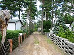
50 | after the adjacent Klünnersholz meadow of the same name | The path leaves the street An der Jugendherberge in a northerly direction and ends in a dead end. |
|
| Paddock
( Location ) |
460 | Paddock , a fenced-in piece of pastureland for horses | The Koppelweg leaves Lange Straße in a southerly direction and meets the Am Bahndamm street . Here is the stop of the same name on the railway line from Graal-Müritz to Rostock . |

|
| Crab Path
( Location ) |
140 | Crabs , largest disorder of the order decapod crabs | The Krabbenweg connects the Ribnitzer Straße with the Muschelweg. It opens up a settlement area made up of single-family houses and holiday apartments. |

|
| Kurstrasse
( Location ) |
580 | Cure , a " rehabilitation measure " for prevention in case of (weakened) health or to support recovery from illnesses and diseases | Kurstrasse begins in the northwest at the junction to Parkstrasse and joins in the southeast into Lange Strasse and the corner of Rostocker Strasse. It was once called Lange Strasse , then Adolf-Hitler-Strasse and, at the time of the GDR, Ernst-Thälmann-Strasse . A comprehensive redesign took place in 1994/1995. As part of an urban development measure, Kurstrasse was redesigned as a traffic-calmed business zone and should be upgraded in the process.
In the street is the only bank in the community, the Ostsee-Sparkasse, the Heidesanatorium , an institution of the Arbeiter-Samariter-Bund for mother-child cures as well as some listed buildings (number 5 - Giesela office building, no.22 , no. 25 - Grahl residential and commercial building , number 26 - bakery, number 38 - Aurum house , number 39 - Hotel Alexandrine ). The poet Ida Heincke lived in the Villa Flora from 1890 . |
  
|
|
Long street
( Location ) |
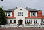
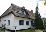
520 | after its original expansion as the longest street in the municipality in the 19th century | Lange Straße is part of Landesstraße 22 and connects Rostocker Straße with Bahnhofsstraße. This is where the Graal-Müritz train station is located, as well as the voluntary fire brigade from 1876 in the building number 8. The buildings number 4 (Haus Daheim ), 11, 16 and 22 / 22a as well as 26 (former Büdnereien) are listed. The family of the writer Hans Fallada lived from 1906 to 1906 in a Büdnerhaus built in 1753. The house is no longer preserved; rather, there is now a new building at number 33. |
|
| Lerchenweg
( Location ) |
50 | Larks , species-rich family in the order of passerine birds | The Lerchenweg branches off from the Kiebitzweg in a northerly direction, runs in a U-shape and joins the Zur Eselswiese street further west . There is a youth club in house number 24 . |

|
| Lindenweg
( Location ) |
890 | Linden , a genus of plants in the subfamily of the linden family | The Lindenweg delimits the Graal-Müritz forest to the south. It will be extended from Friedhofsweg at the level of the street “Am Wasserturm”. There is a rehabilitation clinic and a sports field with a youth center in Lindenweg . The place is used by the TSV 1926 Graal sports club, among others . The house number 2 Min Hüsing is a listed building. |

|
| Dandelion path
( Location ) |
230 | Dandelion , a plant of the sunflower family | The Löwenzahnweg runs parallel to the southern Wiesenstrasse. It is bordered by the Kiefernweg and the Zur Koppenheide path and is one of the paths and roads that demarcate Graal-Müritz towards the south from the agricultural fields. |

|
|
Max-Hölz-Strasse
( Location ) |
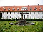
50 | Max Hoelz (1889–1933), German communist | Max-Hölz-Straße connects Rostocker Straße with Karl-Rettich-Weg. It is part of the clinic sanatorium, which also includes the “Bear Fountain”. There is a culture center southwest of the path . However, this is not the building from the 1920s. This was destroyed by fire in 1971; a new building was inaugurated in March 1974. |
|
| middle way
( Location ) |
725 | Center point , geometric object | The Mittelweg runs from Ribnitzer Strasse at a right angle to the Baltic Sea. It connects the streets Buhnenweg, Forellenweg, Möwenweg and Seesternweg, laid out at right angles, to Ribnitzer Straße. It thus serves as an access route to a new settlement area with single-family houses and holiday apartments. |

|
| Seagull path
( Location ) |
175 | Gulls , a family of birds within the order of the plover-like | The Möwenweg leaves the Krabbenweg at a right angle in a north-easterly direction and meets the Mittelweg there. |

|
| Mühlenweg
( Location ) |
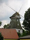
65 | after standing here gallery Dutch windmill | The Mühlenweg leads from Langen Straße in a southerly direction and ends as a dead end. Here is a gallery Dutch windmill from 1852, in which grain was ground until the 1950s. It is a two-storey, octagonal brick building with a trunk and a half-timbered hood. It has been used as a residential building since the 1960s. It served, among others, Lyonel Feininger as a motif.
In 1997 the new fire station was built on the site . |
|
| Shell Way
( Location ) |
560 | Clams , a class of mollusks | The Muschelweg extends the Friedhofsweg in a north-easterly direction. Together with the Krabbenweg, it opens up a settlement area consisting of homes and holiday apartments. |

|
|
Nightingale Path
( Location ) |
410 | Nightingale , a bird art from the order of the passerines | The path leads from the street Zur Seebrücke to the beach and is crossed by the bathing path and the Buchenkamp path. |
|
| Northern meadow road
( Location ) |
190 | Meadows , agricultural grassland that border on the south of the settlement area | The Nördliche Wiesenstraße branches off from the Zur Koppenheide street and leads to the Kiefernweg. The southern meadow road runs parallel to this. |

|
|
Onkel-Bräsig-Strasse
( Location ) |
50 | Fictional character by the Mecklenburg writer Fritz Reuter | The road branches off from Kurstraße in a north-westerly direction and ends at Richard-Wossidlo-Straße. |

|
| Baltic ring
( Location ) |
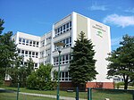
1,180 | Baltic Sea , European inland sea | The Ostseering branches off in a cross shape from Kastanienallee into several street branches. At the eastern end there is the Ostsee- Grundschule and the Greenhouse-School together with the friends' association, a general education school in private ownership with a high school level. Within the Ostseerring there is also a residential area Ostseering , which was built between 1975 and 1979. This resulted in a prefabricated housing estate with 461 apartments, a sports hall, a department store and a school, the Herbert Warnke polytechnic , which is now used as a secondary and elementary school. |
|
|
Poplar Path
( Location ) |
510 | Poplars , a genus of plants in the willow family | The path runs in a fan shape between several branches of the beach road and opens up the cottage settlement Pappelweg and Grüner Winkel . |

|
| Parkstrasse
( Location ) |
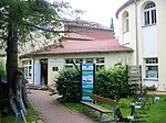
370 | Park , a larger green area designed according to the rules of garden art , which is used for beautification and relaxation | Parkstrasse crosses Kurstrasse in a north-easterly direction. At the end of the street there is the local history museum (number 21) and a nursing home "Strandperle". The “Wenden” house (number 1), the Waldhotel from 1894 (number 5) and the nursing home (number 19) are listed as historical monuments. Robert Musil spent the summer in the Waldhotel - it is the oldest hotel in the Graal area - from 1906 to 1908 when he wrote his novel "The Man Without Qualities". Walter Kempowski and his family spent the summer in the guesthouse "Waldperle" (number 9) from 1890 . Kurt Tucholsky spent his summer in today's local history museum in 1920 - probably on his honeymoon with his wife Else Weil. The museum has a permanent exhibition entitled “From the fishing village to the seaside spa”. The first period describes the founding period from 1328 to 1880, the second the time of the community in the Third Reich . The last section deals with the development of Graal-Müritz since 1945. There is also a gallery by the painter Joachim Weyrich . In 1896, the painter Karl Rettich built an Art Nouveau house at the southwest end of the street and spent there with his sister Auguste from April to October. |
|
| Philosophers' Way
( Location ) |
50 | Philosopher , a person who strives to find answers to the questions of philosophy | The path runs from the sports field past a youth center to the rhododendron park. It begins on Waldstrasse and ends on Zur Seebrücke . |

|
| Mushroom trail
( Location ) |
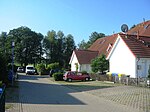
60 | Fungi , eukaryotic organisms whose cells contain mitochondria and a cell skeleton | The path runs south from the street Zur Koppenheide and ends in a dead end. |
|
| Poet Path
( Location ) |
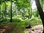
50 | Poet , author of poetry or poems | The Poetenweg begins in the middle of the Kirchsteige and leads to the Graaler Landweg. |
|
|
Ribnitzer Strasse
( Location ) |
3,900 | Ribnitz , a district of Ribnitz-Damgarten , was an independent border town in Mecklenburg until 1950 | The street is the extension of Birkenallee with Müritzer Straße and thus part of Landstraße 22. This is where the Catholic Church of St. Ursula of the community is located. The interior was designed by the sculptor Paul Brandenburg . The municipal administration has been located in house number 21 since May 1998 . The first hotel in the municipality, Haus Anastasia , was once located here . The police station is in house number 3 and the youth and social welfare organization Region Rostock gGmbH is in house number 11 . The sports club TSV Graal-Müritz from 1926 e. V. is at home. The building with number 7 (a kiosk) is a listed building, as is the hotel with number 13 ( Elfriede ), as well as the former Büdnereien in numbers 29, 47, 49, 55 and 57. The children's health clinic Tannenhof as well as the main building and the The Möwe , Sturmeck , Seeblick houses are, as is the park and memorial stone for Carl von Mettenheimer, a registered monument. The Graal-Müritz children's sanatorium “Friedrich Franz Hospiz” was built in 1883/1884 on the initiative of the personal physician of the Mecklenburg Grand Duke Carl von Mettenheimer at number 59. In 1935 it was renamed “Tannenhof”. Here Ruth Kraft wrote the novel “Stundete Liebe”, in which the children's sanatorium is used as the setting. The art historian Werner Timm grew up in house number 49 . In 2009 a plaque was unveiled on his parents' house. The coastal forest holiday park adjoining to the south is already on the territory of the neighboring municipality of Gelbensande . |
  
|
| Richard-Wossidlo-Strasse
( Location ) |
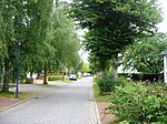
400 | Richard Wossidlo (1859–1939), Nestor of Mecklenburg Folklore , as co-founder of German-speaking folklore and important field researcher in European ethnology | The street connects Friedensstrasse with Doktor-Leber-Strasse. In the house with the number 2 the friends of the home history e. V. as well as the painting and drawing circle Graal-Müritz . |
|
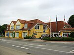
| Rostocker Strasse
( Location ) |
1,120 | Rostock , north German Hanseatic city on the Baltic Sea | The street is the extension of the Torfbrücke with Langen Straße and also part of Landstraße 22. The rehabilitation center with House 1 (main building), House 2 (Kurmittelhaus), House 3 (cardiological clinic), House 4 (residential building), residential buildings , Guardhouse are a listed building. Here there is a park with a bear fountain, a memorial stone and a portrait bust of the SPD - Reichstag deputy Richard Assmann . The tourist office "Haus des Gastes" from 1997 is located in the building at number 3 ; in building number 3 the Kurpark- und Wirtschaftshof.
The connection between Rostocker Straße and the neighboring community of Rövershagen was called Chausseestraße in the 19th century and was completed in 1906 as far as Graal. A memorial stone in front of the local history museum reminds of this work. |
  |
| Rudolf-Presber-Weg
( Location ) |
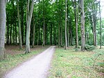
50 | Rudolf Presber (1868–1935), German writer , playwright and screenwriter , who bought the "Ithaka House" in Fritz-Reuter-Straße in 1921 and worked there during the summer months | The path leads from Felsenburgweg to Parkstraße. |
|
|
Sachsenweg
( ) |
50 | Free State of Saxony , Land in the east of the Federal Republic of Germany | The Sachsenweg begins on Kiefernweg and ends in a north-easterly direction in a dead end. |

|
| Schiller Street
( Location ) |
230 | Johann Christoph Friedrich von Schiller (1759–1805) German-speaking poet , philosopher and historian | The street connects the Karl-Rettich-Weg with the Alexanderstraße. |

|
| way to school
( Location ) |
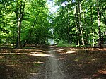
50 | after the school located here in the 19th century (at the level of the former Büdnerei VI on Chausseestrasse) | The path begins on Kiefernweg, crosses Poetenweg and ends at Ribnitzer Straße. It enables a connection from Müritz to Graal without having to use the busy Ribnitzer Straße. |
|
| Schwanenberg
( Location ) |
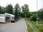
230 | The Schwanenberg leaves Rostocker Straße in a southerly direction and ends in a cul-de-sac that serves as the entrance to the Rostock-Torfbrücke train station. The SSC Schach -Sport-Club Graal-Müritz e. V. is in house number 6. |
|
|
| Black way
( Location ) |
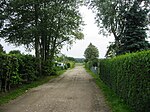
195 | The Black Path is the direct connection from the Weidenweg to the Am Bahndamm path . There are some allotments here. |
|
|
| Pier forecourt
( Location ) |
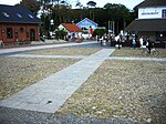
40 × 30 | promenade | The square is at the end of the street Zur Seebrücke and offers access to the new pier built in 1993. It was laid out in the course of urban development measures from September 1994 to November 1995 and was one of the main requirements for the community to be recognized as a seaside spa. This is where the former DLRG rescue center is located , which is now used as an ice cream parlor. The square is divided into four fields, which were divided into four so-called "artificial fields" paved with field stones by a four-row limestone pavement. They point to a dune passage west of the pier, which was not yet realized in September 2012. The place is not officially dedicated . |
|
| Seesternweg
( Location ) |
100 | Starfish , a class of Eleutherozoa within the echinoderm tribe | The Seesternweg leaves the Muschelweg in an easterly direction and meets the Mittelweg there. |

|
| Promenade
( Location ) |
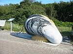
2,800 | Promenade , term for a walk or - mostly for strollers - a spacious area | The beach promenade begins in the west at the boat mooring and ends at the height of the Hufenweg. Here it runs as a dune path - and thus as part of the Baltic Sea coast route (D2) - towards Müritz. On the promenade there are nine oversized models of the fauna and flora of the Baltic Sea, such as a mussel . They belong to a series of great flora and fauna and are part of a project Experience Nature - Graal Müritz . The models were set up on the promenade in 2012 together with an explanatory text board.
The promenade was built in 1909 and symbolically anticipated the merger of the then still separate communities. From 1995 to 2001 a total of 2,800 meters were laid with red-colored concrete rectangular paving. 560 meters of this was created on a newly constructed storm surge protection dike. |
 |
| Beach road
( Location ) |
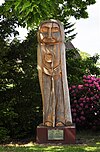
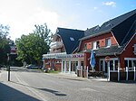
1,070 | Beach , a flat coastal or shoreline made of sand or rubble | Strandstraße branches off from Ribnitzer Straße in a northerly direction and ends at the Baltic Sea beach. Here is a facility of the Arbeiter-Samariter-Bund Meeresbriese , in which mother-child cures are offered. In the street there is a memorial stone for the 100th anniversary of the Wars of Liberation 1819–1913, which is a listed building. Next to it is a wooden sculpture showing Clare of Assisi , founder of the Order of the Poor Clares . The Poor Clare Monastery in Ribnitz is considered to be the founder of Graal and Müritz. Franz Kafka spent his last vacation in the Glückauf house (number 6), where he met Dora Diamant , who at the time was a young employee in the home. The path that runs parallel to the beach road bears his name in his memory. The von Kafka family lived in house number 12 in the Glückauf house . A new building is located here today. Erich Kästner spent the summer of 1914 with his mother and cousin in Villa Martha at number 16 . In his book "When I was a little boy" he describes his experiences in Graal-Müritz. In 1935 the book “Emil and the Three Twins” was also written here. |
|
| Southern meadow road
( Location ) |
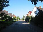
220 | Meadow , agricultural grassland | The Südliche Wiesenstraße branches off from the Zur Koppenheide street and leads to the Kiefernweg. The Nördliche Wiesenstrasse runs parallel to this. |
|
|
Pond path
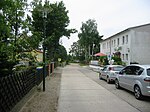
( Location ) |
85 | Pond , an artificially created still water of moderate depth with at least one inlet and one outlet, without the formation of a stable temperature stratification | Teichweg is the southern extension of Kastanienallee from Langen Strasse and Bahnhofstrasse. The path ends as a dead end at a pond. |
|
| Torfbrücker Weg
( Location ) |
270 | after the neighboring district of the same name in Rostock, the peat bridge | The Torfbrücker Weg branches off from Rostocker Straße and ends at the intersection with Bahnhofsweg / corner of Karl-Lühnsdorf Weg. | |
|
Embankment
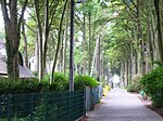
( Location ) |
550 | Shore , the area of land immediately adjacent to a body of water | The shore road runs parallel to the coastline and is the extension of the road An der Schleuse in a westerly direction. |
|
|
Vollrath-Kirsch-Weg
( Location ) |
50 | Hans Vollrath Kirsch , German writer and student of the painter Carl Rettich . He had to go to a concentration camp for six weeks because he recommended to a tour group in Graal-Müritz when visiting the Rostock Heath in the 1930s that they no longer differentiate between roe deer and stag, but rather call it “red deer”. | The path runs from the beach to the Lindenweg. |

|
|
Forest road
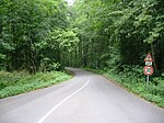
( Location ) |
720 | The road runs through the mixed forest that predominates here . | Waldstraße branches off at the intersection of Lindenweg, Kastanienallee and Friedhofsweg in a northerly direction and ends in a circular loop at a conference hotel. |
|
| Pasture path
( Location ) |
300 | Willows , a genus of plants from the willow family | The Weidenweg branches off from the Schwarzen Weg and runs in steps in the direction of the Lange Straße. At the end of the pasture path there is an allotment garden. |

|
| Wendenweg
( ) |
50 | Wenden , refers to the western Slavs who settled large parts of northern and eastern Germany from the 7th century onwards | The Wendenweg runs parallel to Ribnitzer Straße and is located south of the petrol station. The path enables a connection from the Krabbenweg to the Am Tannenhof street , bypassing Ribnitzer Straße. |

|
| Wiedortschneise
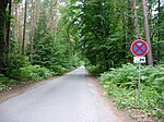
( Location ) |
1,670 | The Wiedortschneise branches off at the corner of Torfbrücke and Rostocker Straße in a north-westerly direction and ends at the Baltic Sea. Here is the Baltic Sea Camp and Holiday Park Rostocker Heide . |
|
|
|
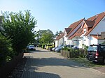
Zapfenweg
( Location ) |
100 | Cones , spiked female inflorescence and the resulting seed stand of coniferous plants that develop from it through lignification | The path begins on the street Zur Koppenweide and ends as a dead end. |
|
| Zarnesweg
( Location ) |
410 | The Zarnesweg leads from Rostocker Straße over Kurstraße through the forest to the dog beach. |

|
|
| To the Eselswiese
( Location ) |
210 | The street connects Lerchenweg with Langen Straße. |

|
|
| To the Koppenheide
( Location ) |
760 | The street Zur Koppenheide runs parallel to the street An der Jugendherberge , turns north at the level of the Nördliche Wiesenstraße and meets this street. In number 66 is the association of house and landowners e. V. resident. |

|
|
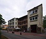
| To the pier
( Location ) |
670 | Pier , building on wooden or concrete piles, which the bank a coast into the sea or into an inland lake is built out | The street runs from the corner of Friedhofsweg and Ribnitzer Straße towards Seebrücke. This is where the local group of People's Solidarity is based, which maintains a senior citizens' club and a meeting place. The building was built in 1894 as a souvenir shop by Wilhelm Bartelmann and was converted from 1983 to 1989 into the People's Solidarity Club. The houses with number 1, number 4 (former post office), number 8 (Haus Ina ), number 14 (Haus Elisabeth ), number 16 (Haus Buchengarten ), number 22 (Pension Klaus Störtebeker ), number 28 (beach hotel) and number 42 (former sea rescue station) are under monument protection. Until 1993 the street was called "Rosa-Luxemburg-Straße". As a memento, there is a stele with the bust of Luxembourg on the corner of Zum Badeweg . Before 1996, the town hall of the municipality was also located here (today in Ribnitzer Straße) in a former Miramare guesthouse (today Elmsfeuer house ). |
|
Web links
- List of monuments of the Bad Doberan district Website of the Rostock district, (PDF; 656 kB), accessed on June 24, 2012.
Individual evidence
- ↑ Joachim Puttkamer: Baltic Sea Spa Graal-Müritz - pearl on the sea. 1st edition. Geiger-Verlag, Horb am Neckar 2006.
- ↑ a b c Tourismus- und KurGmbH Graal-Müritz: Graal-Müritz: The Baltic Sea Spa with Tradition AZ | 2012–2013 (Flyer)
- ↑ a b c Tourismus und KurGmbH: List of hosts 2012
- ↑ a b c Ursula Dannenberger u. a .: Graal-Müritz. 1st edition. Königstein / Ts 1994, ISBN 3-928275-36-4 .
- ↑ a b c d e f g Tourismus- und KurGmbH Graal-Müritz: In the footsteps of writers in Graal-Müritz, districts of Müritz and Müritz-Ost (Flyer)
- ↑ Dieter Borbe: Mutiny and shipwreck in the Edelweiss house - view into a missing Graal-Müritz building . In: Windflüchter. Issue 163, p. 8 of June 3, 2012.
- ↑ Bernd Kuntze: Experience nature - Graal Müritz . In: Windflüchter. Issue 163, pp. 1 and 2 from June 3, 2012.
literature
- Ostseeheilbad Graal-Müritz - pearl by the sea . 1st edition. Geiger Verlag, Horb am Neckar 2005, ISBN 3-86595-005-1 , p. 96 .
- Municipality of Graal-Müritz, building authority and society for urban renewal and local development Mecklenburg mbH (GSOM), trustee redevelopment agency of the municipality of Graal-Müritz: Graal-Müritz: Urban renewal and urban development in the course of time . 1st edition. Norbert Böttcher, Berlin 2003, p. 48 .
- Ursula Dannenberger u. a .: Graal-Müritz . 1st edition. Ruth Gerig, Königstein / Ts 1994, ISBN 3-928275-36-4 , p. 48 .


