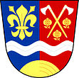
Pocinovice
| Pocinovice | ||||
|---|---|---|---|---|
|
||||
| Basic data | ||||
| State : |
|
|||
| Region : | Plzeňský kraj | |||
| District : | Domažlice | |||
| Area : | 2460.5902 ha | |||
| Geographic location : | 49 ° 20 ' N , 13 ° 8' E | |||
| Height: | 448 m nm | |||
| Residents : | 592 (Jan. 1, 2019) | |||
| Postal code : | 345 09 | |||
| License plate : | P | |||
| traffic | ||||
| Street: | Kdyně - Nýrsko | |||
| Railway connection: | Janovice nad Úhlavou – Domažlice | |||
| structure | ||||
| Status: | local community | |||
| Districts: | 2 | |||
| administration | ||||
| Mayor : | František Rada (as of 2014) | |||
| Address: | Pocinovice 72 345 09 Pocinovice |
|||
| Municipality number: | 554120 | |||
| Website : | www.pocinovice.cz | |||
Pocinovice (German Putzeried ) is a municipality in the Czech Republic . It is located six kilometers north of Nýrsko and belongs to the Okres Domažlice .
geography
Pocinovice is located in the valley of the Andělice brook in the Neugedein furrow. To the north rises the Hora (566 m), in the northeast the Podhoří (624 m), in the east the Hůrka (535 m), southeast the Úborská hůrka (542 m), in the southwest the Orlovická hora (723 m) and the Jezvinec ( 739 m) and to the west the Havranice (665 m), the Holý vrch (606 m) and the Malá křížová (585 m). The Janovice nad Úhlavou – Domažlice railway and the state road II / 192 between Nové Chalupy and Nýrsko run through the village .
Neighboring towns are Libkov and Dobrá Voda in the north, U Červenků, V Háji, Nová Víska, Draha, Na Ovčině, Dlažov and Miletice in the north-east, Běhařov and U Špátů in the east, Úborsko, Koblince and Stříbrný Mlýn in the south-east, Nové Pocinovice U manasu, U Nadvesného, U Cihlářů and Hadrava in the south, U Sekadlů, U Kalců, U Vítků and U Krocarů in the southwest, Orlovice, U Havelků and Výrov the west and U Čížků, U Veseláků, U Blahníků, Chodská Lhota , Loučim and Maškův Mlýn in the northwest.
history
The first documentary mention of Pocinovice was on March 16, 1325 in the Chodenprivileg of Johann von Luxemburg as one of the eleven privileged Chodendörfer. The village at the foot of the Gewintzywald was the easternmost and at the same time the largest of the Chodendörfer.
The church was built in 1805–1806.
After the abolition of patrimonial formed Pocinovice / plaster Ried in 1850 with the hamlet Silberberg / Orlovice a municipality in the judicial district Neugedein. From 1868 the municipality belonged to the Taus district . The name form Pocinovice has been in use since the beginning of the 20th century. In 1927 the community had 1216 inhabitants. The district of Silberberg was added to the German Reich after the Munich Agreement and belonged to the district of Markt Eisenstein from 1939 to 1945 . In 2012 there were 548 people living in the community.
Community structure
The municipality Pocinovice consists of the districts and cadastral districts Orlovice ( Silberberg ) and Pocinovice ( Putzeried ). Basic settlement units are Nové Pocinovice ( Neu Putzeried ), Orlovice and Pocinovice. To Pocinovice also includes the monolayer Dobrá Voda, Stříbrný Mlýn, U Červenků, U Cihlářů, U Čížků, U Havelků, U Kalců, U Korala, U Krocarů, U Marka, U manasu, U Matoušků, U Michálků, U Nadvesného, U Sekadlů , U Veseláků and U Vítků as well as a part of the settlement Výrov.
Attractions
- Church of St. Anna on the village square, built 1805–1806
- The pilgrimage chapel of the Blessed Virgin Mary in Sorrows in Dobrá Voda. A Way of the Cross leads north from Pocinovice to it. At the old Chod pilgrimage site there was originally a wooden chapel, which burned down in 1908. Today's walled pilgrimage chapel was built in its place.
- Homesteads No. 47 and 123
Individual evidence
- ↑ http://www.uir.cz/obec/554120/Pocinovice
- ↑ Český statistický úřad - The population of the Czech municipalities as of January 1, 2019 (PDF; 7.4 MiB)
- ↑ http://www.uir.cz/casti-obce-obec/554120/Obec-Pocinovice
- ↑ http://www.uir.cz/katastralni-uzemi-obec/554120/Obec-Pocinovice
- ↑ http://www.uir.cz/zsj-obec/554120/Obec-Pocinovice


