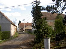
Ždánov
| Ždánov | ||||
|---|---|---|---|---|
|
||||
| Basic data | ||||
| State : |
|
|||
| Region : | Plzeňský kraj | |||
| District : | Domažlice | |||
| Area : | 337.1209 ha | |||
| Geographic location : | 49 ° 28 ' N , 12 ° 51' E | |||
| Height: | 432 m nm | |||
| Residents : | 158 (Jan 1, 2019) | |||
| Postal code : | 344 01 | |||
| License plate : | P | |||
| traffic | ||||
| Street: | Domažlice - Poběžovice | |||
| structure | ||||
| Status: | local community | |||
| Districts: | 1 | |||
| administration | ||||
| Mayor : | Jiří Kopecký (as of 2014) | |||
| Address: | Ždánov 49 344 01 Domažlice |
|||
| Municipality number: | 554472 | |||
| Website : | www.zdanov.cz | |||
Ždánov (German Tannawa ) is a municipality in the Czech Republic . It is located six kilometers northwest of Domažlice and belongs to the Okres Domažlice .
geography
Ždánov is located in the valley of a small tributary to the Černý potok in the Chodská pahorkatina. The Veský rybník pond is located in the village. To the north rise the Pařezovský vrch ( Parisauberg , 485 m) and the Červený vrch ( Rother Berg , 498 m) and in the south the Hrádek ( Spitzberg , 585 m). The road I / 26 runs east of the village between Horšovský Týn and Furth in the forest .
Neighboring towns are Otov , Ohnišťovice and Meclov in the north, Březí, Němčice and Bozdíš in the north-east, Luženice and Luženičky in the east, Draženov and Petrovice in the south-east, Dobrá Voda, Újezd , Pila, Trhanov and Nový Hamr in the south, Dlouhý Menčov and Díly in the southwest, Červený Mlýn, Postřekov and Mlýnec in the west and Podhamří, Papírna, Nový Kramolín , Nový Pařezov and Starý Pařezov in the northwest.
history
The village was first mentioned in writing around 1420 as part of the Stockau monastery . Later the village fell into desolation and was repopulated in 1579. The village was parish after Schüttwa . In 1684 the early Baroque chapel of Blessed Koloman was consecrated in Hrůbek on the burial site of the beatified Augustinian hermit Koloman, who had lived in Tannawa. In 1730 the Augustinian hermits of Stockau had a small castle with a farmyard built in Tannawa. In the course of the Jopsephinic reforms , the Stockau monastery was closed in 1787 and the chapel was left to its own devices. In 1814 Franz Joseph Mayer founded a porcelain factory in Tannawa Castle.
After the abolition of patrimonial formed Tannawa / Ždanov 1850 a municipality in the Klatovy district and judicial district Taus. The community of Trasenau had the desert chapel of Blessed Koloman restored in 1860, and it was consecrated again on October 14, 1860. From 1868 the municipality belonged to the Taus district . By 1880, the brand was in Tannawa porcelain Tannava produced. The Czech name has been Zdanov t since the beginning of the 20th century . Žďanov used. The current form of the name Ždánov was introduced in 1924. In 1930 there were 275 people living in Tannawa.
After the Munich Agreement , the municipality was added to the German Reich and until 1945 belonged to the district of Bischofteinitz . In 1939 Tannawa had 274 inhabitants.
After the end of World War II, most of the Germans were expelled and the Czechs settled. The castle then served as the seat of the Local National Committee (MNV).
In 1958 the chapel of Blessed Koloman was declared a monument. After the roof of the chapel burned down in June 1961, the otherwise intact monument was not rebuilt, but torn down in 1963. In 1980 the chapel was removed from the list of monuments. Between 1985 and 1990 Ždánov belonged to Draženov as a district .
Community structure
No districts are identified for the municipality of Ždánov. To Ždánov belong the locality Hrůbek and one-layer Červený Mlýn ( Rothmühle ).
Attractions
- Ždánov Castle, built in 1730 as a summer residence for guests of the Stockau Monastery, the dilapidated building is for sale
- Statue of St. Augustine from 1763, in front of the main building of the monastery courtyard
- Postřekovské rybníky nature reserve, west of the village
Individual evidence
- ↑ http://www.uir.cz/obec/554472/Zdanov
- ↑ Český statistický úřad - The population of the Czech municipalities as of January 1, 2019 (PDF; 7.4 MiB)
- ^ Michael Rademacher: German administrative history from the unification of the empire in 1871 to the reunification in 1990. District Bischofteinitz. (Online material for the dissertation, Osnabrück 2006).


